Fishes Allegheny Reservoir
Reservoir · Allegheny National Forest · Pennsylvania
Allegheny Reservoir Fishing Guides
Kinzua to everyone who fishes it: a long, deep reservoir inside the Allegheny National Forest, cold enough for trout and wild enough to feel like a northern lake.
Map of the Allegheny Reservoir
35 numbered points: 8 access points, 16 campsites, 6 parks and conservation areas, 2 agency offices, 2 hazards, 1 USGS gauge. Tap a marker for details. Reviewed Sep 21, 2026.
- Access / boat ramp (8)
- Campsite (16)
- Park / conservation area (6)
- Agency / conservation office (2)
- Dam / hazard (2)
- USGS gauge (1)
Map data © OpenStreetMap contributors. Points are curated from OpenStreetMap and state agency sources; confirm access and hours before you go.
Print it. Bag it. Bring it.Phones die, screens crack, and most of this water has no signal. Print this map, fold it into a zip-top bag or dry bag with your license, and you have a backup your electronics can’t give you. Every marker is numbered so you can say exactly where you are.
Open the printable mapAll 35 points on this map
| # | Point | Type | Lat, Lon | Notes |
|---|---|---|---|---|
| 1 | Kinzua Dam U.S. Army Corps of Engineers | Dam / hazard | 41.83974, -79.00249 | The dam that forms the reservoir and the start of this clockwise shoreline list. The Allegheny below it is a separate tailwater fishery and is not on this sheet. |
| 2 | USGS 03012520 - Allegheny Reservoir at Kinzua Dam Live pool elevation and outflow | USGS gauge | 41.83812, -79.00254 | Check the pool before towing a boat: ramps on this reservoir are affected by winter drawdown. |
| 3 | Hooks Brook Boat Access Campground Allegheny National Forest - boat access only | Campsite | 41.96214, -78.94309 | Boat-in campground on the west bank of the upper reservoir. No road reaches it. |
| 4 | Onoville Marina Park Cattaraugus County, New York | Access / boat ramp | 42.02783, -78.96680 | County marina park on the New York arm: launch ramp, docks, and east and west camping areas on the same ground. |
| 5 | Highbanks Camping Area New York side, above Onoville | Campsite | 42.05456, -78.90055 | Campground on the New York portion of the reservoir. |
| 6 | Allegany State Park Boat Launch NYS OPRHP - Quaker Bridge area | Access / boat ramp | 42.05818, -78.88077 | State park launch at the head of the reservoir near Quaker Bridge. Rules on this water are shared between Pennsylvania, New York and the Seneca Nation. |
| 7 | Quaker Run Dam Head of the Quaker Run arm | Dam / hazard | 42.05224, -78.87685 | Low dam at the head of the Quaker Run arm. Quaker Lake above it is a separate water with its own canoe launch and is not covered here. |
| 8 | Willow Bay Campground Allegheny National Forest - SR 346 | Campsite | 41.98658, -78.91016 | Drive-in campground at Willow Bay, the reservoir's main east-side base, fifteen miles west of Bradford. |
| 9 | Willow Bay Boat Launch Allegheny National Forest - four lanes | Access / boat ramp | 41.98889, -78.91750 | Four-lane concrete launch with a 130-foot courtesy dock and parking for about 120 rigs, open around the clock. Coordinate published by the Forest Service; it falls 0.1 km from the mapped shoreline. |
| 10 | Boat ramp above Hooks Brook (unnamed in OSM) East side of the main channel | Access / boat ramp | 41.99159, -78.93569 | A mapped ramp and courtesy dock near the New York line, carrying no name in OSM. The Forest Service names a Webbs Ferry launch on this reach but puts it on the WEST bank; the shoreline walk puts this one on the east, so it is left unnamed. |
| 11 | Willow Bay Recreation Area Allegheny National Forest - SR 346 | Park / conservation area | 41.97256, -78.91754 | Day-use ground on the south shore of Willow Bay. |
| 12 | Tracy Run Campsites Allegheny National Forest - boat or trail access | Campsite | 41.95979, -78.92166 | Primitive shoreline sites at Tracy Run, below the Tracy Ridge trail system. |
| 13 | Johnnycake Run Campsite Allegheny National Forest - boat or trail access | Campsite | 41.92880, -78.92140 | Primitive shoreline campsite at Johnnycake Run. |
| 14 | Handsome Lake Boat Access Campground Allegheny National Forest - boat access only | Campsite | 41.92232, -78.93041 | Boat-in campground on the east bank north of Sugar Bay, the larger of the pair with Hopewell. |
| 15 | Hopewell Boat Access Campground Allegheny National Forest - boat access only | Campsite | 41.91252, -78.93279 | Boat-in campground on the east bank just north of Sugar Bay. |
| 16 | Nelson Run Campsites Allegheny National Forest - boat or trail access | Campsite | 41.89961, -78.90028 | Two numbered primitive sites about twenty metres apart on the east bank at Nelson Run, mapped here as one site. |
| 17 | Fishing Hole Campsite Allegheny National Forest - boat or trail access | Campsite | 41.88489, -78.88081 | Primitive shoreline campsite on the east bank below Sugar Run. |
| 18 | Old State Road Campground Allegheny National Forest | Campsite | 41.86813, -78.95441 | Small drive-in campground on the shore above the marina. |
| 19 | Kinzua Wolf Run Marina Wolf Run Bay, PA 59 - concession marina | Access / boat ramp | 41.85580, -78.94779 | The reservoir's only full-service marina: launch ramp, courtesy docks, slips, rentals and the only lakeside store on the water. Just east of the Morrison Bridge, across PA 59 from Kinzua Beach. |
| 20 | Kinzua Beach Picnic Area Allegheny National Forest - PA 59 | Park / conservation area | 41.85334, -78.95539 | Swimming beach and picnic area opposite the marina, with bathhouse and shelter. The Forest Service lists no boat ramp here. |
| 21 | Morrison Boat Access Campground Allegheny National Forest - boat access only | Campsite | 41.82143, -78.92729 | Boat-in campground on Morrison Bay, east bank across from Elijah Run. |
| 22 | Chappel Bay Campsite Allegheny National Forest - boat or trail access | Campsite | 41.81028, -78.90385 | Primitive shoreline campsite on Chappel Bay. |
| 23 | Briggs Run Campsite Allegheny National Forest - boat or trail access | Campsite | 41.81061, -78.88592 | Primitive shoreline campsite at the mouth of Briggs Run, east side of the Kinzua Arm. |
| 24 | Duncle Corners Fishing Area Allegheny National Forest - SR 321 | Park / conservation area | 41.79562, -78.91198 | Bank-fishing area on the Kinzua Arm. |
| 25 | Red Bridge Recreation Area Allegheny National Forest - SR 321 | Campsite | 41.77782, -78.88680 | Drive-in campground at the head of the Kinzua Arm, about ten miles north of Kane. |
| 26 | Red Bridge Bank Fishing Area Allegheny National Forest | Park / conservation area | 41.77506, -78.88253 | Signed bank-fishing frontage beside the Red Bridge campground. The Forest Service lists no boat ramp at Red Bridge. |
| 27 | Bigrock Overflow Area Allegheny National Forest | Park / conservation area | 41.77506, -78.87809 | Overflow parking and day-use ground at the top of the Kinzua Arm. |
| 28 | Kiasutha Boat Launch Allegheny National Forest - two lanes | Access / boat ramp | 41.78055, -78.89206 | Two-lane plank ramp with a 130-foot courtesy dock. Placed on the mapped slipway beside the mapped dock rather than on the campground centroid. |
| 29 | Kiasutha Recreation Area Allegheny National Forest | Campsite | 41.78234, -78.89993 | Drive-in campground and day-use area on the upper Kinzua Arm off the Longhouse Byway. Check status before travelling - the Forest Service has recently flagged this site as closed. |
| 30 | Elijah Run Boat Launch Allegheny National Forest - Kinzua Arm | Access / boat ramp | 41.81917, -78.94622 | Large, popular launch on the west bank of the Kinzua Arm, on the Longhouse National Scenic Byway. |
| 31 | Dewdrop Recreation Area Allegheny National Forest - Kinzua Bay | Campsite | 41.83188, -78.95986 | Drive-in campground on the Kinzua Bay shoreline off the Longhouse Byway. |
| 32 | Dew Drop Boat Ramp Allegheny National Forest - campers only | Access / boat ramp | 41.83497, -78.95645 | One-lane concrete ramp inside Dewdrop Recreation Area. The Forest Service restricts it to registered campground users, reserves the trailer parking for campers and says it is not suitable for large boats. |
| 33 | Kinzua Point Information Center Allegheny National Forest | Agency / conservation office | 41.85947, -78.96356 | Seasonal Forest Service information point on the Longhouse Byway - maps, pool levels and campground status. |
| 34 | Jakes Rock Picnic Area Allegheny National Forest | Park / conservation area | 41.84707, -78.98171 | Clifftop picnic area and overlook above the dam pool. |
| 35 | Allegheny National Fish Hatchery U.S. Fish and Wildlife Service | Agency / conservation office | 41.84201, -79.00609 | Federal hatchery on the west bank immediately below the dam. Visitor parking and a self-guided walk; not an access to the reservoir. |
Guides on the Allegheny Reservoir
Claimed profiles take booking requests. Unclaimed profiles are built from public records so the river is never empty; the guide can claim or remove one any time.
Order on this page: premium and outfitter plans first (labelled Premium placement), then claimed free profiles, then unclaimed — one published price, no bidding for position. How placement works
About the Allegheny Reservoir
The Allegheny Reservoir, which almost everyone calls Kinzua, sits behind Kinzua Dam in the Allegheny National Forest and reaches north into New York. It is long, deep and steep-sided, surrounded by public forest rather than houses, and it feels far more like a northern Canadian shield lake than anything else in Pennsylvania.
The depth and the cold give it an unusual species list for the state. Walleye are the main target and are fished hard in spring and autumn. Smallmouth bass on the rock are excellent and under-appreciated. Muskellunge and northern pike are both present, and the deep cold water supports brown trout that most anglers never see.
Because so much of the shoreline is national forest, access is a mix of good developed ramps and long stretches of undeveloped bank reachable on foot. That makes it one of the better big waters in the state for anglers without a boat, and an excellent place to combine fishing with camping.
Kinzua also has a tailwater below the dam that is a fishery in its own right. Cold water drawn from depth keeps the upper Allegheny below Warren cool through the summer, and that stretch supports trout and smallmouth in a river that would otherwise be too warm for one of them.
The New York end of the reservoir is fished under New York regulations, so anyone running north should know where the line is and what changes at it.
The gauge below reports pool elevation. Kinzua is a flood-control reservoir with a real seasonal drawdown, and on water this steep the practical effect is on ramp usability and on how far fish have shifted along the contour rather than on how much cover is flooded.
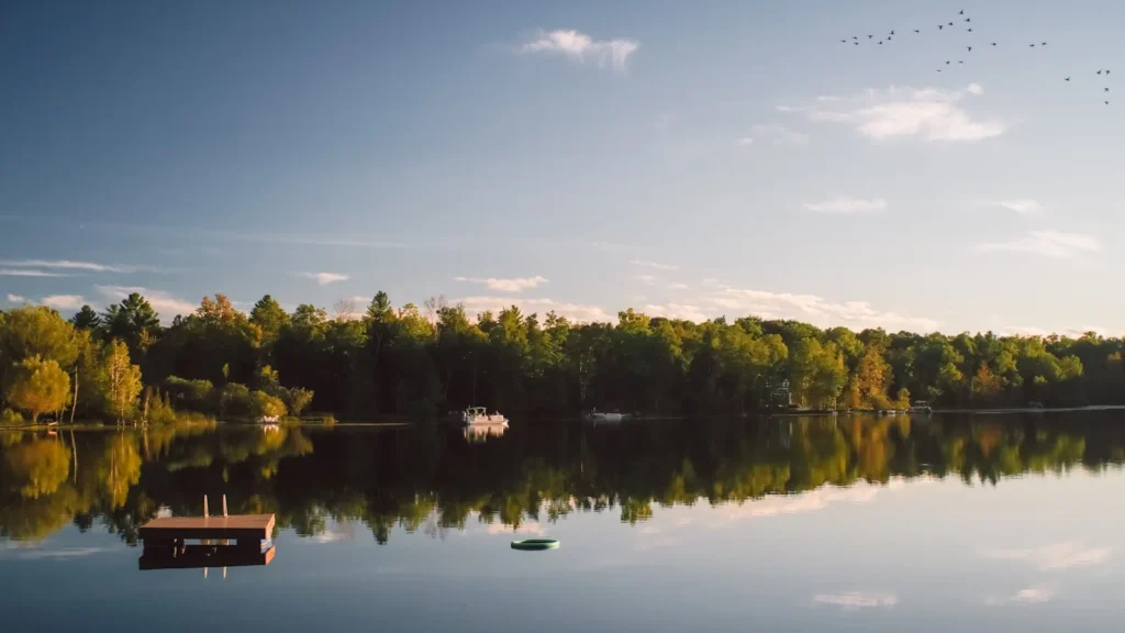
This water needs a real photo
The photo at the top of this page is not Allegheny Reservoir.
It is a regional stand-in, honestly captioned but generic — we will not put a name to a river we cannot prove. Send us a photograph you took here and it replaces the stand-in, with your credit on it.
Pioneer badgeUnclaimed
Add a photo of this water
Landscape, not fish — the water itself. Reviewed by hand before it appears. The first one published here earns the Pioneer badge.
Pool right now
1,313.94ft NAVD88
- 24 hours-0.84 ft ↓ falling
- For the dateA little above normal for the date
Reading taken 1h ago at USGS 03012520, Allegheny Reservoir near Warren, PA. Elevation is the surface of the lake above the survey datum, not depth. Source.
Fished this water? Add a photo
Reviewed by hand before it appears. Pick the water, not the spot — we never publish exact locations.
Access
Kinzua Beach and Kiasutha: Forest Service ramps and day-use areas.
Willow Bay: northern access near the New York line.
Elijah Run and Roper Hollow: quieter Forest Service ramps.
Dewdrop and Red Bridge: campgrounds with lake access.
Kinzua Dam area near Warren: bank access and the tailwater below.
Allegheny National Forest surrounds the lake, so shoreline access is extensive.
Note: the northern end is in New York and its regulations apply there.
Seasons
Winter: cold and quiet, with ice fishing in the sheltered arms in a hard winter.
Spring: the walleye run and the best fishing of the year.
Summer: smallmouth on the rock, deep walleye, and comfortable camping weather.
Fall: feeding walleye and muskellunge, and the forest at its best.
From the water
No logged trips yet. Be the first to put this water on your map.
Log this water
Fished it or cleaned it? Log in or create a free account to log a trip with photos and earn the waterway badge.
Questions
What species can you catch on the Allegheny Reservoir?
Anglers target Black Crappie, Brown Trout, Channel Catfish, Muskellunge, Northern Pike, Smallmouth Bass, Walleye on the Allegheny Reservoir in Pennsylvania.
Are there fishing guides on the Allegheny Reservoir?
GuidedFloats lists 1 guide and outfitters on the Allegheny Reservoir. Claimed profiles accept booking requests; unclaimed profiles are built from public records and link to the business.
Where can you access the Allegheny Reservoir?
Kinzua Beach and Kiasutha: Forest Service ramps and day-use areas. Willow Bay: northern access near the New York line. Elijah Run and Roper Hollow: quieter Forest Service ramps. Dewdrop and Red Bridge: campgrounds with lake access. Kinzua Dam area near Warren: bank access and the tailwater below. Allegheny National Forest surrounds the lake, so shoreline access is extensive. Note: the northern end is in New York and its regulations apply there.
When is the best time to fish the Allegheny Reservoir?
Winter: cold and quiet, with ice fishing in the sheltered arms in a hard winter. Spring: the walleye run and the best fishing of the year. Summer: smallmouth on the rock, deep walleye, and comfortable camping weather. Fall: feeding walleye and muskellunge, and the forest at its best.
Where are the fishing regulations for the Allegheny Reservoir?
Regulations change by season and section. Read the current rules on the Pennsylvania agency site: https://www.pa.gov/agencies/fishandboat/fishing/regulations