Fishes Tulpehocken Creek
Tailwater · Berks County · Pennsylvania
Tulpehocken Creek Fishing Guides
Pennsylvania's best-known suburban tailwater — cold bottom releases from Blue Marsh Lake hold wild-acting brown trout right outside Reading.
Map of the Tulpehocken Creek
24 numbered points: 4 access points, 10 bridges, 3 parks and conservation areas, 2 regulation section limits, 4 hazards, 1 USGS gauge. Tap a marker for details. Reviewed Sep 16, 2026.
- Access / boat ramp (4)
- Bridge crossing (10)
- Park / conservation area (3)
- Regulation section limit (2)
- Dam / hazard (4)
- USGS gauge (1)
Map data © OpenStreetMap contributors. Points are curated from OpenStreetMap and state agency sources; confirm access and hours before you go.
Print it. Bag it. Bring it.Phones die, screens crack, and most of this water has no signal. Print this map, fold it into a zip-top bag or dry bag with your license, and you have a backup your electronics can’t give you. Every marker is numbered so you can say exactly where you are.
Open the printable mapAll 24 points on this map
| # | Point | Type | Lat, Lon | Notes |
|---|---|---|---|---|
| 1 | Marion Township Park Marion Township, Berks County | Park / conservation area | 40.37921, -76.23189 | Township park on the bank near the head of the mapped reach, 0.24 km off the creek. |
| 2 | Main Street bridge, Womelsdorf Borough street crossing | Bridge crossing | 40.37332, -76.21843 | |
| 3 | Mill Spring Park Womelsdorf | Park / conservation area | 40.37033, -76.19438 | Bank park 0.10 km off the creek, just upstream of the Conrad Weiser Parkway crossing. |
| 4 | Conrad Weiser Parkway bridge US 422 | Bridge crossing | 40.37139, -76.19297 | The main highway crossing of the upper creek. |
| 5 | Old Charming Forge Dam Low-head dam | Dam / hazard | 40.38732, -76.17134 | On the centreline; GNIS 1208952. A second OSM object of the same name sits 0.4 km upstream on the same structure. |
| 6 | Charming Forge Road bridge T-road crossing | Bridge crossing | 40.39065, -76.17189 | |
| 7 | Kricks Mill Road bridge Township road crossing | Bridge crossing | 40.41329, -76.17126 | |
| 8 | Sundays Mill Dam Low-head dam | Dam / hazard | 40.41615, -76.16780 | On the centreline; GNIS 1208989. |
| 9 | Station Road bridge Township road crossing | Bridge crossing | 40.41986, -76.16413 | |
| 10 | North Heidelberg Road bridge Secondary road, above Blue Marsh | Bridge crossing | 40.42525, -76.11237 | Last road crossing before the creek enters the Blue Marsh Lake pool. |
| 11 | Kayak Launch, Blue Marsh Lake Blue Marsh Lake, upper pool | Access / boat ramp | 40.41953, -76.10533 | OSM carries no operator name for this slipway; it is the upper-pool launch on the north shore. |
| 12 | Sheidy Boat Launch Blue Marsh Lake (USACE) | Access / boat ramp | 40.41181, -76.08823 | Slipway on the upper arm of the lake, 0.04 km off the chained centreline. |
| 13 | Church Road bridge Township road over the lake arm | Bridge crossing | 40.40583, -76.08047 | |
| 14 | Blue Marsh Lake National Recreation Area US Army Corps of Engineers | Park / conservation area | 40.38595, -76.04608 | The federal recreation area surrounding the lake; day-use areas, trails and the launches below sit inside it. |
| 15 | State Hill Boat Launch Blue Marsh Lake (USACE) | Access / boat ramp | 40.37021, -76.04458 | South-shore launch, 0.28 km off the chained centreline. |
| 16 | Dry Brooks Boat Launch Blue Marsh Lake (USACE) | Access / boat ramp | 40.38497, -76.03339 | Launch inside the Dry Brooks day-use area, the closest ramp to the dam. |
| 17 | Blue Marsh Dam USACE, NID PA00921 | Dam / hazard | 40.37941, -76.03159 | The dam that makes the tailwater below. Everything downstream of here fishes cold through the summer. |
| 18 | Delayed Harvest Artificial Lures Only - upper limit PFBC special-regulation reach, Berks County | Regulation section limit | 40.37757, -76.03139 | Published upper limit is the first deflector below Blue Marsh Dam. Placed by walking PFBC's published 3.79 miles up the centreline from the T-921 covered bridge; it lands 0.24 km below the dam. Rules on the PFBC page. |
| 19 | USGS 01470960 Tulpehocken Creek near Reading USGS streamgage | USGS gauge | 40.37057, -76.02519 | The gauge the tailwater is read on; 0.04 km off the chained centreline. |
| 20 | Rebers Bridge Road bridge Tailwater, Union Canal Trail parking | Bridge crossing | 40.37316, -76.00819 | One of the two usual parking-and-walk-in points on the Delayed Harvest water. |
| 21 | Papermill Road bridge Tailwater, Union Canal Trail parking | Bridge crossing | 40.36611, -75.99450 | The lower of the two usual walk-in points above the covered bridge. |
| 22 | Wertz's Red Bridge (T-921 covered bridge) Covered bridge, Union Canal Trail | Bridge crossing | 40.36904, -75.97907 | The covered bridge PFBC names as the downstream limit of the Delayed Harvest reach. |
| 23 | Delayed Harvest Artificial Lures Only - lower limit PFBC special-regulation reach, Berks County | Regulation section limit | 40.36886, -75.97927 | Published lower limit: the T-921 covered bridge. Stocked trout water continues from here to the mouth. Rules on the PFBC page. |
| 24 | Tulpehocken Dam Low-head dam, Reading | Dam / hazard | 40.34633, -75.95212 | On the last reach above the Schuylkill confluence. |
Guides on the Tulpehocken Creek
Claimed profiles take booking requests. Unclaimed profiles are built from public records so the river is never empty; the guide can claim or remove one any time.
About the Tulpehocken Creek
Tulpehocken Creek below Blue Marsh Lake is the tailwater that made year-round trout fishing possible in southeastern Pennsylvania. The Army Corps flood-control dam at Blue Marsh releases from depth, and that cold bottom water carries roughly four miles of creek down through Berks County to the Schuylkill River at Reading at temperatures a freestone stream at this latitude could never hold in August. The USGS station at the damsite reports discharge, stage and water temperature, and because releases here change with flood-control needs, the gauge is the first thing anyone checks.
Brown trout dominate, with rainbow trout mixed in, and the population combines stocked fish with holdovers that have been in the creek long enough to behave like wild fish — selective, structure-oriented and hard to fool in the flat water. The Tulpehocken is famous among Pennsylvania fly anglers for its sulphur hatch in late spring and for prolific midge and caddis activity that keeps fish looking up much of the year. Smallmouth bass, rock bass and white suckers share the lower reach as the water warms toward the Schuylkill.
The creek is managed under Pennsylvania’s Delayed Harvest Artificial Lures Only rules for the primary tailwater section, which keeps fish in the system and supports the technical, small-fly fishing the water is known for. It is walk-and-wade throughout, with a paved rail-trail running the length of the tailwater that makes it one of the most accessible trout streams in the state. That accessibility also means real pressure, especially on weekends.
Access is excellent. Blue Marsh Lake’s recreation areas cover the top of the reach, and the Tulpehocken Creek Trail and Berks County park land follow it down to Reading with parking at multiple points. A Pennsylvania fishing license plus a trout permit is required, and the Fish and Boat Commission link below carries the current Delayed Harvest season dates and tackle rules for this specific section, which differ from the statewide regulations.
This water needs a real photo
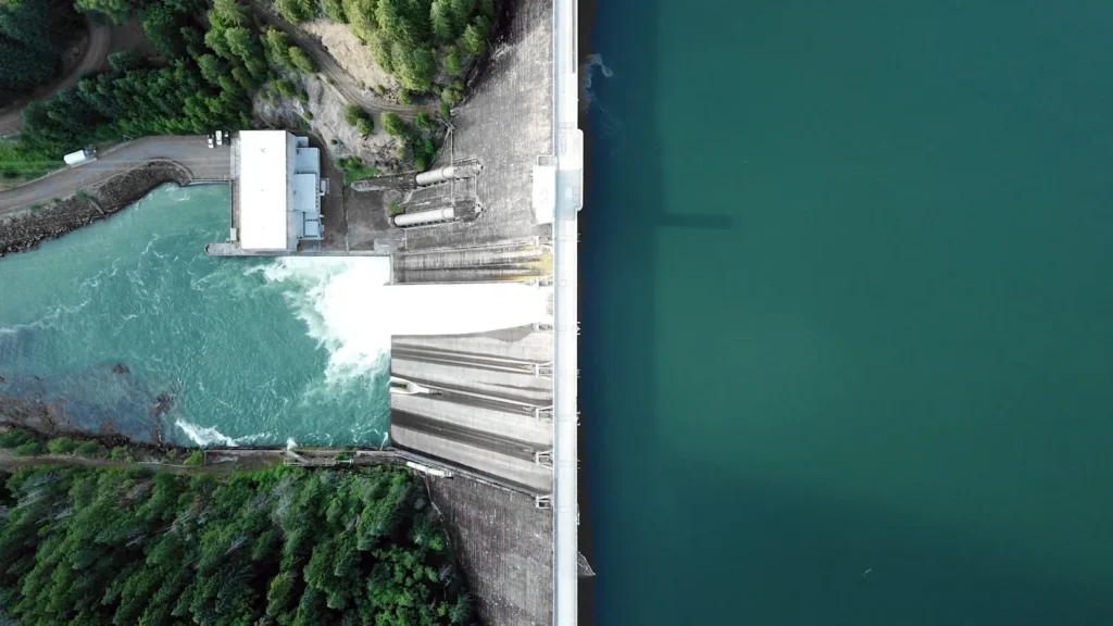
The photo at the top of this page is not Tulpehocken Creek.
It is a regional stand-in, honestly captioned but generic — we will not put a name to a river we cannot prove. Send us a photograph you took here and it replaces the stand-in, with your credit on it.
Pioneer badgeUnclaimed
Add a photo of this water
Landscape, not fish — the water itself. Reviewed by hand before it appears. The first one published here earns the Pioneer badge.
Fished this water? Add a photo
Reviewed by hand before it appears. Pick the water, not the spot — we never publish exact locations.
Access
Blue Marsh Lake damsite — the top of the tailwater at the USGS gauge.
Rebers Bridge Road — the classic mid-tailwater access with parking on both banks.
Paper Mill Road — access to the upper Delayed Harvest water.
Tulpehocken Creek Trail parking areas — trail access the full length of the reach.
Red Bridge / Palisades area — lower tailwater access toward Reading.
Gring's Mill Recreation Area — county park access with facilities and parking.
Schuylkill River confluence at Reading — bottom-end access where the trout water ends.
Seasons
Spring: heavy releases early, then the sulphur hatch from mid-May into June — the signature weeks.
Summer: cold releases keep the tailwater fishing when nearby freestone streams are shut down.
Fall: falling flows, brown trout coloring up and moving, and excellent streamer and terrestrial fishing.
Winter: midge fishing on the flats, open water most of the season, and the lightest pressure of the year.
From the water
No logged trips yet. Be the first to put this water on your map.
Log this water
Fished it or cleaned it? Log in or create a free account to log a trip with photos and earn the waterway badge.
Questions
What is the current flow on the Tulpehocken Creek?
As of Oct 21, 11:15 pm, the USGS gauge Tulpehocken Cr at Blue Marsh Damsite near Reading reads 228 cfs, with water temperature 60.8 F. Conditions update every 15 minutes.
What species can you catch on the Tulpehocken Creek?
Anglers target Brown Trout, Rainbow Trout, Rock Bass, Smallmouth Bass, White Sucker on the Tulpehocken Creek in Pennsylvania.
Are there fishing guides on the Tulpehocken Creek?
GuidedFloats lists 1 guide and outfitters on the Tulpehocken Creek. Claimed profiles accept booking requests; unclaimed profiles are built from public records and link to the business.
Where can you access the Tulpehocken Creek?
Blue Marsh Lake damsite — the top of the tailwater at the USGS gauge. Rebers Bridge Road — the classic mid-tailwater access with parking on both banks. Paper Mill Road — access to the upper Delayed Harvest water. Tulpehocken Creek Trail parking areas — trail access the full length of the reach. Red Bridge / Palisades area — lower tailwater access toward Reading. Gring's Mill Recreation Area — county park access with facilities and parking. Schuylkill River confluence at Reading — bottom-end access where the trout water ends.
When is the best time to fish the Tulpehocken Creek?
Spring: heavy releases early, then the sulphur hatch from mid-May into June — the signature weeks. Summer: cold releases keep the tailwater fishing when nearby freestone streams are shut down. Fall: falling flows, brown trout coloring up and moving, and excellent streamer and terrestrial fishing. Winter: midge fishing on the flats, open water most of the season, and the lightest pressure of the year.
Where are the fishing regulations for the Tulpehocken Creek?
Regulations change by season and section. Read the current rules on the Pennsylvania agency site: https://www.pa.gov/agencies/fishandboat/fishing/regulations