Westfield River Fishing Guides
Massachusetts' first National Wild and Scenic river — three mountain branches off the Berkshires joining above Westfield and running to the Connecticut.
Map of the Westfield River
57 numbered points: 13 access points, 24 bridges, 13 parks and conservation areas, 1 regulation section limit, 5 hazards, 1 USGS gauge. Tap a marker for details. Reviewed Sep 26, 2026.
- Access / boat ramp (13)
- Bridge crossing (24)
- Park / conservation area (13)
- Regulation section limit (1)
- Dam / hazard (5)
- USGS gauge (1)
Print it. Bag it. Bring it.Phones die, screens crack, and most of this water has no signal. Print this map, fold it into a zip-top bag or dry bag with your license, and you have a backup your electronics can’t give you. Every marker is numbered so you can say exactly where you are.
Open the printable mapAll 57 points on this map
| # | Point | Type | Lat, Lon | Notes |
|---|---|---|---|---|
| 1 | Main Road bridge MA 8A and MA 116 | Bridge crossing | 42.56849, -73.03146 | Highest mapped crossing on the chained centreline, close to the East Branch headwaters. |
| 2 | Haskins Road bridge Town road crossing | Bridge crossing | 42.56705, -73.02962 | |
| 3 | River Road bridge Town road crossing | Bridge crossing | 42.55955, -73.02155 | First of three River Road crossings on the upper East Branch; they are numbered in order on this sheet. |
| 4 | River Road bridge Town road crossing | Bridge crossing | 42.53323, -73.01439 | Second River Road crossing. |
| 5 | River Road bridge Town road crossing | Bridge crossing | 42.51424, -72.99225 | Third River Road crossing. |
| 6 | Westfield River Access - River Road (upper) MassWildlife, off River Road | Access / boat ramp | 42.50454, -72.98792 | One of ten MassWildlife parcels on this reach all named Westfield River Access in OSM; named here from the nearest mapped road, about 160 m away. |
| 7 | Westfield River Access - River Road (lower) MassWildlife, off River Road | Access / boat ramp | 42.49667, -72.98166 | Nearest mapped road about 170 m away; a further parcel 340 m downstream on the same road is not shown separately. |
| 8 | Westfield River Access - Savoy Road MassWildlife, off Savoy Road | Access / boat ramp | 42.49254, -72.97930 | Nearest mapped road about 60 m away; a second Savoy Road parcel 260 m away is not shown separately. |
| 9 | West Main Street bridge Town road crossing | Bridge crossing | 42.49271, -72.97362 | |
| 10 | Bridge Road bridge Town road crossing | Bridge crossing | 42.48982, -72.96692 | |
| 11 | Deer Hill State Reservation DCR Division of State Parks and Recreation | Park / conservation area | 42.49633, -72.96181 | |
| 12 | Berkshire Trail bridge MA 9 | Bridge crossing | 42.48896, -72.96343 | Upper of two MA 9 crossings. |
| 13 | Berkshire Trail bridge MA 9 | Bridge crossing | 42.48231, -72.93250 | Lower MA 9 crossing; OSM maps it as two adjoining spans about 200 m apart and they are shown here as one point. |
| 14 | Plainfield Road bridge Secondary road | Bridge crossing | 42.46339, -72.89649 | |
| 15 | Pettingill Field Town of Cummington | Park / conservation area | 42.45886, -72.88862 | A town field on the riverbank rather than a formal launch. |
| 16 | Marine Corps League Highway bridge MA 9 and MA 112 | Bridge crossing | 42.45592, -72.88473 | |
| 17 | Cummington Wildlife Management Area MassWildlife | Park / conservation area | 42.45624, -72.88480 | A second polygon of the same management area 250 m away is not shown separately. |
| 18 | Gilbert A. Bliss State Forest DCR Division of State Parks and Recreation | Park / conservation area | 42.45055, -72.87779 | Mapped as two polygons on this reach; one point is shown. |
| 19 | Westfield River Access - Berkshire Trail MassWildlife, off MA 9 | Access / boat ramp | 42.44113, -72.86847 | Parcel edge about 17 m from MA 9 and 60 m from the centreline. |
| 20 | Westfield River Access - Main Road MassWildlife, off MA 143 | Access / boat ramp | 42.40752, -72.87129 | Pin is the parcel centroid rather than a marked pull-off; the nearest mapped road is about 520 m away. |
| 21 | Main Road bridge MA 143 | Bridge crossing | 42.40343, -72.87644 | Crossing by the Chesterfield Gorge reach. |
| 22 | Ireland Street bridge Town road crossing | Bridge crossing | 42.40085, -72.87629 | |
| 23 | Westfield River Access - Ireland Street MassWildlife, off Ireland Street | Access / boat ramp | 42.39694, -72.87392 | Nearest mapped road about 130 m away, just above the Chesterfield Gorge reach. |
| 24 | Westfield River Catch and Release Area: Chesterfield and Huntington Chesterfield Gorge Reservation, Trustees of Reservations | Regulation section limit | 42.39233, -72.87347 | A separately regulated reach of the East Branch. Upper limit the Chesterfield Gorge parking lot, Chesterfield; lower limit the gate north of the Corps of Engineers basin parking lot at Knightville, Huntington. |
| 25 | Knightville Dam US Army Corps of Engineers flood-control dam | Dam / hazard | 42.29062, -72.86159 | Also the downstream limit of the catch and release reach above: the gate north of the Corps basin parking lot at Knightville, which is not itself mapped. |
| 26 | Worthington Road bridge MA 112 | Bridge crossing | 42.28302, -72.86868 | First of three MA 112 crossings; numbered in order on this sheet. |
| 27 | C.M. Gardner State Park DCR Division of State Parks and Recreation | Park / conservation area | 42.26873, -72.86511 | |
| 28 | Worthington Road bridge MA 112 | Bridge crossing | 42.24948, -72.86728 | Second MA 112 crossing. |
| 29 | Worthington Road bridge MA 112 | Bridge crossing | 42.24502, -72.86960 | Third MA 112 crossing. |
| 30 | Pettis Field Town of Huntington | Park / conservation area | 42.23388, -72.87451 | |
| 31 | Crescent Mills Dam | Dam / hazard | 42.22149, -72.85914 | |
| 32 | Main Street bridge Town road crossing | Bridge crossing | 42.19015, -72.84991 | |
| 33 | Westfield River Paper Company Dam | Dam / hazard | 42.18726, -72.85060 | |
| 34 | Town Park Town of Russell | Park / conservation area | 42.18716, -72.85203 | OSM maps five polygons named Town Park on this reach; one point is shown. |
| 35 | Riverside fishing access off US 20 Off Westfield Road (US 20) | Access / boat ramp | 42.18072, -72.84442 | Tagged in OSM as a fishing spot with no name; named here from the nearest road, about 40 m away. |
| 36 | Strathmore Park | Park / conservation area | 42.17486, -72.83225 | |
| 37 | Woronoco Mills Dam Three weir ways mapped as one complex | Dam / hazard | 42.16540, -72.82883 | OSM maps a north, a middle and a south weir here; one point is shown. The Valley View Avenue and Woronoco Road crossings are within about 130 m. |
| 38 | Riverside fishing access off US 20 Off Westfield Road (US 20) | Access / boat ramp | 42.15779, -72.81439 | Unnamed in OSM; nearest road about 75 m away. |
| 39 | Massachusetts Turnpike bridge I 90 | Bridge crossing | 42.15673, -72.81389 | Two carriageways mapped as separate ways and shown here as one crossing. |
| 40 | Tekoa Park City of Westfield | Park / conservation area | 42.15308, -72.81515 | Mapped as three polygons; one point is shown. |
| 41 | Riverside fishing access off US 20 Off Russell Road (US 20) | Access / boat ramp | 42.14582, -72.80947 | Unnamed in OSM; nearest road about 120 m away. |
| 42 | Westfield River Access - Russell Road (upper) MassWildlife, off US 20 | Access / boat ramp | 42.14181, -72.80730 | Parcel sits on the centreline, about 33 m from US 20; a further parcel 690 m upstream on the same road is not shown separately. |
| 43 | Riverside fishing access off US 20 Off Russell Road (US 20) | Access / boat ramp | 42.13560, -72.79666 | Unnamed in OSM; nearest road about 160 m away. |
| 44 | Westfield River Access - Russell Road (lower) MassWildlife, off US 20 | Access / boat ramp | 42.13146, -72.77722 | On the centreline; nearest mapped road about 420 m away. |
| 45 | Westfield River Access - Pochassic Road MassWildlife, off Pochassic Road | Access / boat ramp | 42.13251, -72.77181 | Nearest mapped road about 215 m away. |
| 46 | Westfield River Esplanade Riverwalk | Park / conservation area | 42.12896, -72.74814 | |
| 47 | Elm Street bridge US 202 and MA 10 | Bridge crossing | 42.12888, -72.74620 | Paired with the Union Avenue span about 60 m downstream; the two are one crossing and ship as one point. |
| 48 | Half Mile Falls Park | Park / conservation area | 42.12944, -72.74551 | |
| 49 | East Main Street bridge US 20 | Bridge crossing | 42.11665, -72.73356 | Upper of two US 20 crossings in the lower river. |
| 50 | East Main Street bridge US 20 | Bridge crossing | 42.11241, -72.71717 | Lower US 20 crossing. |
| 51 | USGS gauge 01183500 - Westfield River near Westfield US Geological Survey streamgauge | USGS gauge | 42.10676, -72.69898 | Live stage and discharge for the river. Coordinate taken from the site roster. |
| 52 | Westfield Road bridge Secondary road | Bridge crossing | 42.10846, -72.68410 | |
| 53 | Mittineague Park Town of West Springfield | Park / conservation area | 42.09512, -72.65893 | |
| 54 | Strathmore Paper Company Dam | Dam / hazard | 42.09912, -72.64769 | |
| 55 | Bridge Street bridge Secondary road | Bridge crossing | 42.09911, -72.63613 | The Front Street span sits about 65 m away and is the same crossing. |
| 56 | Suffield Street bridge MA 147 | Bridge crossing | 42.08988, -72.62692 | Mapped as three adjoining ways, including one named Memorial Avenue; shown here as one crossing. |
| 57 | Pynchon Point City of Agawam | Park / conservation area | 42.08262, -72.58654 | Park at the confluence with the Connecticut River, at the foot of the sheet. |
Guides on the Westfield River
Claimed profiles take booking requests. Unclaimed profiles are built from public records so the river is never empty; the guide can claim or remove one any time.
No guides listed yet
Guide or outfit this water? Create your profile. Listing is free, the commission is 10% or 7% with a premium profile, and premium profiles list first on this water.
About the Westfield River
The Westfield River drains the eastern slope of the Berkshires through three branches — the East, Middle and West — that join above the city of Westfield before the main stem runs east to the Connecticut River at Agawam. It was the first river in Massachusetts designated National Wild and Scenic, and the upper branches run through steep, forested gorge country with pocket water, plunge pools and boulder gardens. The USGS gauge near Westfield covers the main stem below the confluence and reports discharge and stage.
The river fishes as two distinct systems. The upper branches are cold-water trout habitat, holding wild brook trout in the headwaters and a mix of stocked and holdover brown and rainbow trout through the gorge reaches — the East Branch through Chesterfield Gorge is the best known of these. The main stem below Westfield warms and turns into a solid smallmouth bass river, with largemouth in the slower stretches, fallfish throughout, northern pike in the lower backwaters, and an American shad run that pushes up from the Connecticut River in late spring.
Guided work here is mostly walk-and-wade on the branches and light-tackle or paddle-based on the main stem. The East Branch is also a nationally known whitewater run in the spring, so early-season anglers share the water with paddlers during high releases and snowmelt. Because the branches are freestone and steep, they rise and drop fast; the gauge is the difference between a wadeable morning and a blown-out one.
Access is very good, with state forest and Trustees of Reservations land covering long stretches of the upper branches, plus town and state access along the main stem. Massachusetts requires a freshwater fishing license, and the state link below carries current trout stocking, catch-and-release reaches and seasonal rules. Several sections of the East Branch carry specific artificial-lures or catch-and-release designations that differ from the statewide regulations.
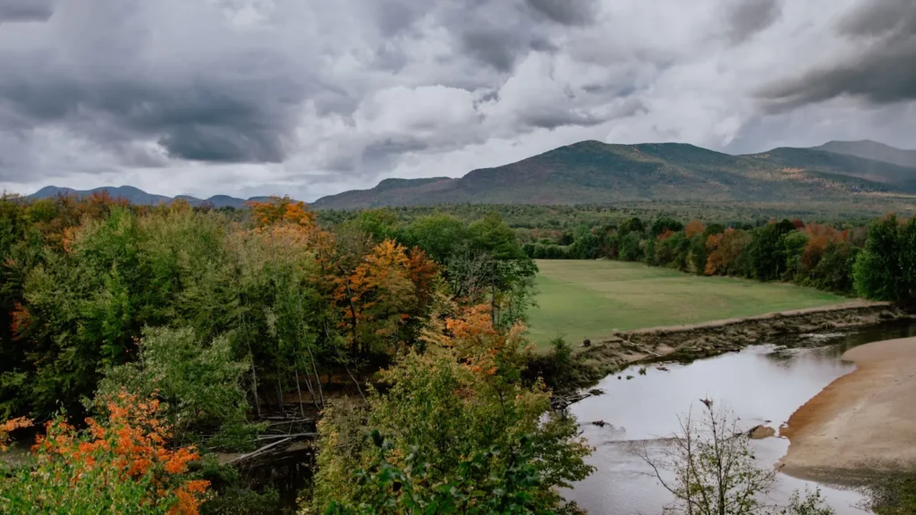
This water needs a real photo
The photo at the top of this page is not Westfield River.
It is a regional stand-in, honestly captioned but generic — we will not put a name to a river we cannot prove. Send us a photograph you took here and it replaces the stand-in, with your credit on it.
Add a photo of this water
Landscape, not fish — the water itself. Reviewed by hand before it appears. The first one published here earns the Pioneer badge.
Fished this water? Add a photo
Reviewed by hand before it appears. Pick the water, not the spot — we never publish exact locations.
Access
Westfield main-stem access near the USGS gauge — bank and wade access below the confluence.
Chesterfield Gorge (Trustees of Reservations) — the signature East Branch walk-in trout access.
Knightville Dam area — Middle Branch access with parking and trails.
Huntington town access — West Branch access along Route 112.
Chester and Becket area pull-offs — upper West Branch roadside wade access.
Robinson State Park, Agawam — lower main-stem bank and paddle access.
Connecticut River confluence at Agawam — bottom-end access for shad and smallmouth.
Seasons
Spring: snowmelt and whitewater flows early, trout stocking through April, and the shad run in late May.
Summer: low clear branches for wild trout, and steady smallmouth fishing on the warmer main stem.
Fall: cooling water brings trout back on the feed and gives the best smallmouth fishing of the year.
Winter: limited to the main stem and open pocket water; most guided activity pauses.
From the water
No logged trips yet. Be the first to put this water on your map.
Log this water
Fished it or cleaned it? Log in or create a free account to log a trip with photos and earn the waterway badge.
Questions
What is the current flow on the Westfield River?
As of Nov 2, 7:15 am, the USGS gauge WESTFIELD RIVER NEAR WESTFIELD, MA reads 233 cfs. Conditions update every 15 minutes.
What species can you catch on the Westfield River?
Anglers target American Shad, Brook Trout, Brown Trout, Fallfish, Largemouth Bass, Northern Pike, Rainbow Trout, Smallmouth Bass on the Westfield River in Massachusetts.
Where can you access the Westfield River?
Westfield main-stem access near the USGS gauge — bank and wade access below the confluence. Chesterfield Gorge (Trustees of Reservations) — the signature East Branch walk-in trout access. Knightville Dam area — Middle Branch access with parking and trails. Huntington town access — West Branch access along Route 112. Chester and Becket area pull-offs — upper West Branch roadside wade access. Robinson State Park, Agawam — lower main-stem bank and paddle access. Connecticut River confluence at Agawam — bottom-end access for shad and smallmouth.
When is the best time to fish the Westfield River?
Spring: snowmelt and whitewater flows early, trout stocking through April, and the shad run in late May. Summer: low clear branches for wild trout, and steady smallmouth fishing on the warmer main stem. Fall: cooling water brings trout back on the feed and gives the best smallmouth fishing of the year. Winter: limited to the main stem and open pocket water; most guided activity pauses.
Where are the fishing regulations for the Westfield River?
Regulations change by season and section. Read the current rules on the Massachusetts agency site: https://www.mass.gov/info-details/freshwater-fishing-regulations