Cedar River Fishing Guides
Eastern Iowa's best smallmouth and walleye river, running from Minnesota through Waverly, Waterloo and Cedar Rapids on a rock and gravel bed with good float access the whole way.
Map of the Cedar River
44 numbered points: 6 access points, 2 campsites, 13 bridges, 19 parks and conservation areas, 1 USGS gauge, 3 points of interest. Tap a marker for details. Reviewed Oct 23, 2026.
- Access / boat ramp (6)
- Campsite (2)
- Bridge crossing (13)
- Park / conservation area (19)
- USGS gauge (1)
- Point of interest (3)
Print it. Bag it. Bring it.Phones die, screens crack, and most of this water has no signal. Print this map, fold it into a zip-top bag or dry bag with your license, and you have a backup your electronics can’t give you. Every marker is numbered so you can say exactly where you are.
Open the printable mapAll 44 points on this map
| # | Point | Type | Lat, Lon | Notes |
|---|---|---|---|---|
| 1 | Cedar River Access Area La Porte City | Access / boat ramp | 42.32579, -92.14564 | County access at the McFarlane Park cluster; first mapped access on this reach. |
| 2 | Mt. Auburn Boat Launch Mt. Auburn | Access / boat ramp | 42.29557, -92.05925 | Concrete ramp. |
| 3 | Milroy Access Area Benton County | Access / boat ramp | 42.18368, -92.00722 | Bank access above Vinton. |
| 4 | Hoefle Dulin Access Benton County | Access / boat ramp | 42.16418, -91.97853 | Ramp at Hoefle-Dulin Recreation Area. |
| 5 | Wildcat Bluff Access Benton County | Access / boat ramp | 42.19022, -91.88277 | Ramp below Wildcat Bluff. |
| 6 | Ellis Harbor Cedar Rapids | Access / boat ramp | 42.00366, -91.69315 | Boat harbour and ramp at Ellis Park. |
| 7 | McFarlane County Park Campground La Porte City | Campsite | 42.32184, -92.14841 | Benton County campground at the access. |
| 8 | Palisades-Kepler State Park Campground Mount Vernon | Campsite | 41.90797, -91.50973 | State park campground above the dam. |
| 9 | Five-in-One Dam Cedar Rapids | Point of interest | 41.97873, -91.67261 | Low-head dam through downtown; portage. |
| 10 | Cedar Rapids Milldam Cedar Rapids | Point of interest | 41.94433, -91.63022 | Weir below the city. |
| 11 | Palisades-Kepler Dam Palisades-Kepler State Park | Point of interest | 41.90131, -91.50704 | Weir at the state park. |
| 12 | Cedar Island Wildlife Management Area Iowa DNR | Park / conservation area | 42.30272, -92.12656 | Public bottomland on river left. |
| 13 | Spring Creek Flats Iowa DNR | Park / conservation area | 42.31596, -92.11174 | Wildlife area on the east bank. |
| 14 | Winegar Lake - Tobin Area Iowa DNR | Park / conservation area | 42.29207, -92.04621 | Oxbow and wildlife area. |
| 15 | Cedar Bend Park Vinton | Park / conservation area | 42.17415, -92.01634 | Riverside city park at Vinton. |
| 16 | Cumberland's Recreation Area Benton County | Park / conservation area | 42.18174, -92.01862 | County conservation area. |
| 17 | County Care Facility Wildlife Area Benton County | Park / conservation area | 42.15752, -91.99142 | County wildlife area. |
| 18 | Butterfield Island Wildlife Area Benton County | Park / conservation area | 42.16778, -91.97613 | Island wildlife area. |
| 19 | Benton City Fry Recreation Area Benton County | Park / conservation area | 42.16167, -91.91840 | County recreation area. |
| 20 | North Cedar Natural Area Linn County | Park / conservation area | 42.16016, -91.80098 | County natural area. |
| 21 | Goose Pond Natural Area Linn County | Park / conservation area | 42.14560, -91.80221 | Backwater natural area. |
| 22 | Wickiup Hill Natural Area Linn County | Park / conservation area | 42.09424, -91.76691 | Learning centre and natural area. |
| 23 | Chain Lakes Natural Area Linn County | Park / conservation area | 42.04947, -91.77460 | Chain Lakes backwaters. |
| 24 | Rock Island Botanical Preserve Linn County | Park / conservation area | 42.03077, -91.73817 | Sand prairie preserve. |
| 25 | Seminole Valley Park Cedar Rapids | Park / conservation area | 42.00534, -91.73013 | Large riverside park. |
| 26 | Riverfront Park Cedar Rapids | Park / conservation area | 41.97763, -91.67195 | Downtown riverfront, river right. |
| 27 | Prairie Park Cedar Rapids | Park / conservation area | 41.95292, -91.63078 | Prairie Park Fishery. |
| 28 | Winnebago Park Cedar Rapids | Park / conservation area | 41.94430, -91.62096 | Riverside natural area. |
| 29 | Palisades-Kepler State Park Mount Vernon | Park / conservation area | 41.90969, -91.50500 | Limestone bluffs; the marquee stop on this reach. |
| 30 | Palisades-Dows Preserve Linn County | Park / conservation area | 41.90226, -91.51667 | Preserve below the state park. |
| 31 | Cedar Valley Nature Trail bridge La Porte City | Bridge crossing | 42.31555, -92.13391 | Rail-trail crossing. |
| 32 | 22nd Avenue bridge Mt. Auburn | Bridge crossing | 42.29352, -92.05930 | |
| 33 | 24th Avenue Drive bridge Vinton | Bridge crossing | 42.17091, -92.02372 | |
| 34 | 32nd Avenue bridge Benton County | Bridge crossing | 42.18677, -91.87235 | |
| 35 | Blairs Ferry Road bridge Palo | Bridge crossing | 42.06922, -91.78497 | |
| 36 | Chain Lakes Bridge Linn County | Bridge crossing | 42.05022, -91.77554 | Footbridge at the natural area. |
| 37 | IA 100 bridge Cedar Rapids | Bridge crossing | 42.02789, -91.74092 | |
| 38 | Edgewood Road bridge Cedar Rapids | Bridge crossing | 42.01145, -91.70511 | |
| 39 | 1st Avenue Bridge Cedar Rapids | Bridge crossing | 41.97725, -91.67155 | Downtown; above the Five-in-One dam. |
| 40 | 3rd Avenue Bridge Cedar Rapids | Bridge crossing | 41.97582, -91.66914 | |
| 41 | 8th Avenue bridge Cedar Rapids | Bridge crossing | 41.97167, -91.66486 | |
| 42 | 16th Avenue bridge Cedar Rapids | Bridge crossing | 41.96649, -91.65944 | |
| 43 | Lincoln Freeway bridge Linn County | Bridge crossing | 41.92615, -91.55057 | |
| 44 | USGS 05464500 Cedar River at Cedar Rapids USGS streamgauge | USGS gauge | 41.97190, -91.66710 | Live stage and discharge. |
Guides on the Cedar River
Claimed profiles take booking requests. Unclaimed profiles are built from public records so the river is never empty; the guide can claim or remove one any time.
No guides listed yet
Guide or outfit this water? Create your profile. Listing is free, the commission is 10% or 7% with a premium profile, and premium profiles list first on this water.
About the Cedar River
The Cedar River enters Iowa from southern Minnesota and runs southeast through Charles City, Waverly, Waterloo, Vinton and Cedar Rapids before joining the Iowa River near Columbus Junction. It is one of the few large Iowa rivers with a genuinely rocky bed – limestone ledge, cobble and gravel through much of its middle reach – and that geology is why it fishes so much better than the sand-bottomed rivers of the western half of the state. Low-head dams through the towns break the river into segments, and several have been modified or removed in recent years, improving both passage and paddling safety.
Smallmouth bass are the headline. The reach from Charles City down through Waverly and Waterloo is legitimately good smallmouth water by any regional standard, with fish holding on every rock ledge and current break. Walleye are abundant and are the reason a large share of local anglers are on the water at all, concentrated below the dams in spring and spread through the deeper runs the rest of the year. Channel catfish are everywhere and heavily fished, flathead catfish reach substantial size in the deeper holes, and northern pike hold in the backwaters and slower side channels.
Access is easy and public. City parks, county conservation board areas and state access points are spaced closely enough that float segments of five to ten miles are simple to plan, and the river is well suited to canoes, kayaks and small jon boats. The Cedar Valley Nature Trail parallels a long stretch and opens up bank access. The Cedar Rapids gauge reads discharge and stage and is the standard reference for the lower river; its water temperature series has not reported since 2012, so temperature is not available here.
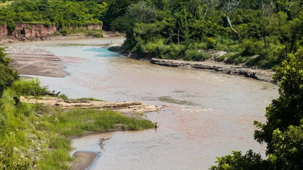
This water needs a real photo
The photo at the top of this page is not Cedar River.
It is a regional stand-in, honestly captioned but generic — we will not put a name to a river we cannot prove. Send us a photograph you took here and it replaces the stand-in, with your credit on it.
Add a photo of this water
Landscape, not fish — the water itself. Reviewed by hand before it appears. The first one published here earns the Pioneer badge.
Fished this water? Add a photo
Reviewed by hand before it appears. Pick the water, not the spot — we never publish exact locations.
Access
Cedar Rapids - city park and boat ramp access near the gauge, serving the lower river through and below town.
Waterloo and Cedar Falls - multiple ramps and park accesses, and the closest good smallmouth water to the metro area.
Waverly - the usual put-in for the upper float segments where the rock structure is best.
Vinton and Palo county conservation areas break the middle river into manageable single-day floats.
The Cedar Valley Nature Trail parallels much of the river between Waterloo and Evansdale and gives long stretches of bank access.
Low-head dams remain in several towns and are genuinely dangerous - portage well upstream and do not attempt to run them.
Farmland dominates the banks between access points; use the public landings rather than crossing fields.
Seasons
Spring: high and stained from snowmelt into May, with the walleye run below the dams the main event once the river drops.
Summer: prime smallmouth season. Low clear water over the rock reaches, good topwater fishing, and comfortable float conditions.
Fall: cooling water brings the biggest smallmouth and walleye of the year, and September and October are the best float months on the river.
Winter: the river ices over and the fishery effectively stops. Some tailwater fishing below the dams continues on mild spells.
From the water
No logged trips yet. Be the first to put this water on your map.
Log this water
Fished it or cleaned it? Log in or create a free account to log a trip with photos and earn the waterway badge.
Questions
What is the current flow on the Cedar River?
As of Nov 2, 7:00 am, the USGS gauge Cedar River at Cedar Rapids, IA reads 5,360 cfs. Conditions update every 15 minutes.
What species can you catch on the Cedar River?
Anglers target Channel Catfish, Flathead Catfish, Northern Pike, Smallmouth Bass, Walleye on the Cedar River in Iowa.
Where can you access the Cedar River?
Cedar Rapids - city park and boat ramp access near the gauge, serving the lower river through and below town. Waterloo and Cedar Falls - multiple ramps and park accesses, and the closest good smallmouth water to the metro area. Waverly - the usual put-in for the upper float segments where the rock structure is best. Vinton and Palo county conservation areas break the middle river into manageable single-day floats. The Cedar Valley Nature Trail parallels much of the river between Waterloo and Evansdale and gives long stretches of bank access. Low-head dams remain in several towns and are genuin...
When is the best time to fish the Cedar River?
Spring: high and stained from snowmelt into May, with the walleye run below the dams the main event once the river drops. Summer: prime smallmouth season. Low clear water over the rock reaches, good topwater fishing, and comfortable float conditions. Fall: cooling water brings the biggest smallmouth and walleye of the year, and September and October are the best float months on the river. Winter: the river ices over and the fishery effectively stops. Some tailwater fishing below the dams continues on mild spells.
Where are the fishing regulations for the Cedar River?
Regulations change by season and section. Read the current rules on the Iowa agency site: https://www.iowadnr.gov/things-do/fishing/regulations-laws