Connecticut River Fishing Guides
New England's largest river running the length of the Pioneer Valley, with a nationally significant shad run and strong smallmouth and northern pike fishing.
Map of the Connecticut River
68 numbered points: 17 access points, 3 campsites, 18 bridges, 22 parks and conservation areas, 2 agency offices, 5 hazards, 1 USGS gauge. Tap a marker for details. Reviewed Sep 26, 2026.
- Access / boat ramp (17)
- Campsite (3)
- Bridge crossing (18)
- Park / conservation area (22)
- Agency / conservation office (2)
- Dam / hazard (5)
- USGS gauge (1)
Print it. Bag it. Bring it.Phones die, screens crack, and most of this water has no signal. Print this map, fold it into a zip-top bag or dry bag with your license, and you have a backup your electronics can’t give you. Every marker is numbered so you can say exactly where you are.
Open the printable mapAll 68 points on this map
| # | Point | Type | Lat, Lon | Notes |
|---|---|---|---|---|
| 1 | Connecticut River Boat Launch - Northfield Mass DCR | Access / boat ramp | 42.71557, -72.45260 | State concrete ramp at the head of the Massachusetts river, reached from Pauchaug Ramp Road. MassGIS records one lane, about 32 trailer spaces and a shallow draft. |
| 2 | New England Central Railroad bridge Palmer Subdivision | Bridge crossing | 42.70618, -72.45913 | The only rail crossing on the upper Massachusetts reach. |
| 3 | King Phillip's Hill | Park / conservation area | 42.68497, -72.47691 | Conservation land on the right bank below Northfield. |
| 4 | Northfield Mountain Riverview Picnic Area | Park / conservation area | 42.61442, -72.47842 | Picnic area above Barton Cove, run with the Northfield Mountain pumped-storage station. |
| 5 | French King Bridge (MA 2) MassDOT | Bridge crossing | 42.59773, -72.49675 | Cantilever highway bridge over the French King gorge; the two MA 2 carriageway ways 60 m away are folded in here. |
| 6 | Cabot Camp Access Northfield | Access / boat ramp | 42.59641, -72.49678 | Canoe and kayak access point on the right bank, tagged in OSM as a waterway access point rather than a ramp. |
| 7 | Barton Cove Campground FirstLight Power | Campsite | 42.60302, -72.53720 | Riverside campground on Barton Cove, the impoundment above Turners Falls Dam. |
| 8 | Gill Boat Launch - Barton Cove Mass DCR | Access / boat ramp | 42.60759, -72.54178 | Two-lane state concrete ramp on Barton Cove with about 45 trailer spaces; the main launch above Turners Falls Dam. |
| 9 | Unity Park Turners Falls | Park / conservation area | 42.60642, -72.55179 | Riverside town park at Turners Falls. |
| 10 | Turners Falls Canal Headgates | Dam / hazard | 42.61039, -72.55397 | Head of the power canal. The river above here is Barton Cove. |
| 11 | Connecticut River Greenway State Park - Turners Falls Mass DCR | Park / conservation area | 42.60995, -72.55521 | DCR's linear greenway along the river. OSM carries it as about two dozen separate polygons under one name; three are shipped, one per reach. |
| 12 | Turners Falls Dam | Dam / hazard | 42.61101, -72.55160 | Main-stem dam. Portage the whole Turners Falls complex; the bypass reach below it can run very low. |
| 13 | Gill-Montague Bridge | Bridge crossing | 42.61148, -72.55188 | |
| 14 | Turners Falls Road / Fifth Street | Bridge crossing | 42.60945, -72.56178 | Two adjoining OSM ways 60 m apart, condensed to one crossing. |
| 15 | Turners Falls Number 1 Dam | Dam / hazard | 42.60561, -72.56441 | Second dam in the Turners Falls complex. |
| 16 | Rocky Mountain Conservation Land | Park / conservation area | 42.59825, -72.58409 | Conservation land on the right bank at Montague. |
| 17 | USGS S.O. Conte Anadromous Fish Research Center US Geological Survey | Agency / conservation office | 42.59144, -72.58019 | Federal anadromous-fish research station beside the Turners Falls canal; three OSM polygons condensed to one. |
| 18 | Cabot Station Power Plant Dam FirstLight Power | Dam / hazard | 42.58785, -72.57886 | Powerhouse dam at the foot of the canal. An unnamed dam way 100 m off is part of the same structure. |
| 19 | Montague City Road | Bridge crossing | 42.58052, -72.57960 | |
| 20 | FirstLight Hydro portage access FirstLight Power | Access / boat ramp | 42.57966, -72.57646 | Marked portage access around the Turners Falls canal and dam complex. |
| 21 | Canalside Rail Trail | Bridge crossing | 42.57949, -72.57479 | Former railroad bridge, now the Canalside Rail Trail crossing. |
| 22 | USGS streamgauge - Connecticut River at Montague City USGS | USGS gauge | 42.58022, -72.57450 | The flow reference for the whole Massachusetts river. Read it before you go; this river is big water and the Turners Falls releases move it. |
| 23 | Berkshire and Eastern Railroad bridge - Montague | Bridge crossing | 42.56237, -72.55615 | Two rail ways 1 m apart, the Freight Main Line and the Montague Industrial Track, condensed to one crossing. |
| 24 | Bitzer State Fish Hatchery Mass DFW | Agency / conservation office | 42.55979, -72.54915 | State trout hatchery on Hatchery Brook above the river; three OSM polygons condensed to one. |
| 25 | Hatchery Brook Primitive Campsite Appalachian Mountain Club | Campsite | 42.55689, -72.55435 | Primitive riverside campsite on the AMC's Connecticut River paddlers' trail. |
| 26 | Connecticut River Access - upper Sunderland parcel | Access / boat ramp | 42.53820, -72.56193 | State access parcel. OSM carries the name Connecticut River Access on several separate parcels along this river; this is the upper of two about 800 m apart. |
| 27 | Connecticut River Access - lower Sunderland parcel | Access / boat ramp | 42.53114, -72.56537 | Lower of the two same-named access parcels above Sunderland. |
| 28 | Third Island Unit US Fish and Wildlife Service | Park / conservation area | 42.52223, -72.56673 | Silvio O. Conte National Fish and Wildlife Refuge unit on an island in the river. |
| 29 | Mount Sugarloaf State Reservation Mass DCR | Park / conservation area | 42.47965, -72.58683 | State reservation on the bluff above the river at Sunderland. 0.80 km off the water, kept because it is a state unit on this corridor. |
| 30 | Sunderland Boat Launch Town of Sunderland | Access / boat ramp | 42.46769, -72.58331 | Town concrete ramp. MassGIS records about eight trailer and six car spaces, with overflow parking at the library, town hall and School Street. |
| 31 | Sunderland Road (MA 116) | Bridge crossing | 42.46784, -72.58567 | |
| 32 | Whately Oaks Primitive Campsite Appalachian Mountain Club | Campsite | 42.45861, -72.59053 | Primitive riverside campsite on the AMC paddlers' trail. |
| 33 | Connecticut River Greenway State Park - Hatfield Mass DCR | Park / conservation area | 42.39964, -72.58127 | Second of the three greenway points, in the Hatfield reach. |
| 34 | Hatfield Boat Launch Mass DCR | Access / boat ramp | 42.39400, -72.59006 | State gravel ramp. MassGIS records one lane and about eight trailer spaces. |
| 35 | Connecticut River Access - North Hadley | Access / boat ramp | 42.38122, -72.59253 | Named state access parcel on the left bank at North Hadley. |
| 36 | River Access - Hadley | Access / boat ramp | 42.35512, -72.58742 | Named access parcel on the left bank above the MA 9 crossing. |
| 37 | Alexandra Dawson Conservation Area Town of Hadley | Park / conservation area | 42.34922, -72.59607 | Conservation area on the left bank with its own parking off the river road. |
| 38 | Elwell State Park Mass DCR | Park / conservation area | 42.33936, -72.62449 | Riverside state park at Northampton beside the rail-trail bridge. |
| 39 | Norwottuck Rail Trail Bridge | Bridge crossing | 42.33658, -72.61952 | Former railroad bridge carrying the Norwottuck Rail Trail across the river. |
| 40 | Russell Street (MA 9) | Bridge crossing | 42.33699, -72.61716 | |
| 41 | Rainbow Beach Natural Heritage Area | Park / conservation area | 42.32365, -72.58923 | Natural heritage area on the left bank at Hadley. |
| 42 | Sheperds Island | Park / conservation area | 42.31683, -72.59439 | Protected island in the river below Hadley. |
| 43 | Mill River Division US Fish and Wildlife Service | Park / conservation area | 42.29932, -72.61596 | Conte National Fish and Wildlife Refuge unit at the Mill River confluence. |
| 44 | Oxbow Boat Launch - Easthampton Mass DCR | Access / boat ramp | 42.28842, -72.61830 | State concrete ramp on the Oxbow. MassGIS records one lane and about 32 trailer spaces. |
| 45 | Brunelles Marina ramp | Access / boat ramp | 42.26307, -72.60112 | Marina ramp above Holyoke Dam, tagged in OSM as customer access. |
| 46 | Holyoke Canoe Club | Park / conservation area | 42.26435, -72.60521 | Canoe club grounds on the right bank above Holyoke Dam. The club's two swimming pools are not shipped. |
| 47 | Dinosaur Footprints Trustees of Reservations | Park / conservation area | 42.24223, -72.62293 | Reservation on the right bank at Holyoke, with the Jurassic trackway on the riverbed ledge. |
| 48 | South Hadley Canal Park | Park / conservation area | 42.22250, -72.60894 | Riverside park on the canal at South Hadley Falls. |
| 49 | Purple Heart Drive (US 202) | Bridge crossing | 42.21697, -72.60720 | Two adjoining OSM ways condensed to one crossing. |
| 50 | Holyoke Dam Holyoke Gas & Electric | Dam / hazard | 42.21364, -72.60277 | Major main-stem dam with a fish lift. Four numbered overflow dams and two unnamed dam ways within 400 m are parts of the same complex and are folded in here. |
| 51 | Chicopee Boat Launch - Syrek Street Mass DCR | Access / boat ramp | 42.21058, -72.59100 | State concrete ramp reached from Syrek Street. MassGIS records one lane and about ten trailer spaces. |
| 52 | Willimansett Bridge (MA 116 / MA 141) | Bridge crossing | 42.19555, -72.60173 | Road bridge. The rail trestle 100 m downstream is a separate crossing. |
| 53 | Willimansett Railroad Bridge Berkshire and Eastern Railroad | Bridge crossing | 42.19549, -72.60073 | |
| 54 | Connecticut River Access - West Springfield | Access / boat ramp | 42.15987, -72.62996 | Named access parcel on the right bank; two adjoining OSM polygons condensed to one. |
| 55 | Massachusetts Turnpike (I-90) | Bridge crossing | 42.15406, -72.62744 | Two carriageways condensed to one crossing. |
| 56 | Chicopee Boat Launch - Melina Street Mass DCR | Access / boat ramp | 42.15321, -72.62569 | State concrete ramp reached from Melina Street. MassGIS records one lane and about 40 trailer spaces - the largest launch on the lower river. |
| 57 | Land Along Connecticut R. West Springfield | Park / conservation area | 42.13212, -72.61848 | One of three identically-named riverbank conservation parcels in West Springfield, condensed here. |
| 58 | Connecticut River Access Park Springfield | Access / boat ramp | 42.11034, -72.61340 | City access and park on the right bank above the North End Bridge. |
| 59 | North End Bridge (US 20) | Bridge crossing | 42.10881, -72.61408 | |
| 60 | North Riverfront Park Springfield | Park / conservation area | 42.10817, -72.60999 | |
| 61 | Berkshire Subdivision railroad bridge - Springfield CSX Transportation | Bridge crossing | 42.10164, -72.59921 | Two adjoining rail ways condensed to one crossing. |
| 62 | Memorial Bridge | Bridge crossing | 42.09918, -72.59485 | Two adjoining carriageways condensed to one crossing. |
| 63 | Riverfront Park City of Springfield | Park / conservation area | 42.09702, -72.58948 | Springfield's riverfront park on the left bank. |
| 64 | Pynchon Point Access Town of Agawam | Access / boat ramp | 42.08346, -72.58594 | Town access point at the Westfield River confluence; the adjoining Pynchon Point park polygon is the same place. |
| 65 | South End Bridge (US 5) | Bridge crossing | 42.08170, -72.58294 | Two carriageways condensed to one crossing. |
| 66 | Springfield Yacht and Canoe Club | Park / conservation area | 42.07991, -72.58574 | Club grounds on the right bank at Agawam. OSM spells the name Sprigfield; corrected here. |
| 67 | Connecticut River Greenway State Park - Agawam Mass DCR | Park / conservation area | 42.06297, -72.59205 | Third of the three greenway points, in the Agawam and Longmeadow reach. |
| 68 | Floodplain Conservation Area Town of Longmeadow Conservation Commission | Park / conservation area | 42.05580, -72.59699 | Seven identically-named Longmeadow floodplain parcels run down the last few miles to the Connecticut state line; one is shipped. |
Guides on the Connecticut River
Claimed profiles take booking requests. Unclaimed profiles are built from public records so the river is never empty; the guide can claim or remove one any time.
No guides listed yet
Guide or outfit this water? Create your profile. Listing is free, the commission is 10% or 7% with a premium profile, and premium profiles list first on this water.
About the Connecticut River
The Connecticut River runs four hundred and ten miles from the Canadian border to Long Island Sound, and the Massachusetts reach through the Pioneer Valley is the widest and most productive water on its course. The USGS gauge at Montague City watches roughly seventy-eight hundred and sixty square miles, capturing nearly all of New Hampshire and Vermont’s contribution above it. It reports discharge and stage and carries no active temperature series at this site, so flow is the practical planning number.
The river here alternates between broad flat impoundments and short lively reaches. Turners Falls dam and the Holyoke dam break the Massachusetts stretch into distinct pools, and the water below Turners Falls runs faster and rockier than anything above it. Both dams carry fish passage, and the Holyoke fish lift is the reason this river matters nationally: the American shad run through it is one of the largest on the Atlantic coast, with hundreds of thousands of fish counted in a strong spring.
Beyond shad, the fishery is deep and year-round. Smallmouth bass hold on every rock ledge and current seam, largemouth fill the coves and backwaters, and northern pike in the oxbows and weedy flats reach genuinely large sizes. Walleye, channel catfish, yellow and white perch are all common, and sea-run striped bass push up into the lower Massachusetts reach in some years.
Guided activity here is a mix of bass boat trips, spring shad fishing below the dams, and a substantial paddling trade using the Connecticut River Paddlers’ Trail. Dam releases affect levels below both structures, and spring runoff can push the river hard through the valley. The Massachusetts reach is also the most accessible part of the whole river, with public ramps in nearly every valley town and a continuous corridor of conservation land along both banks.
This water needs a real photo
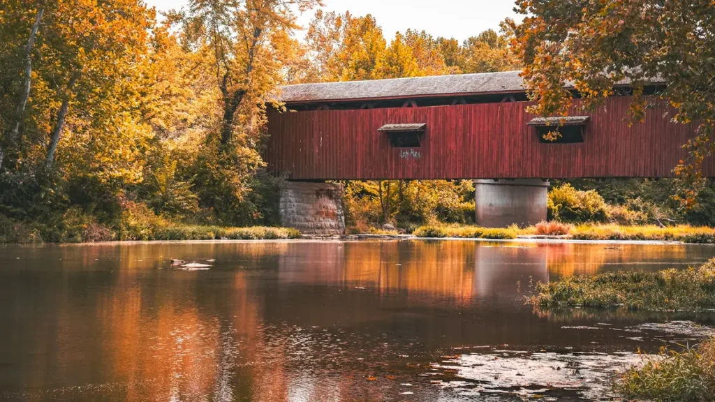
The photo at the top of this page is not Connecticut River.
It is a regional stand-in, honestly captioned but generic — we will not put a name to a river we cannot prove. Send us a photograph you took here and it replaces the stand-in, with your credit on it.
Add a photo of this water
Landscape, not fish — the water itself. Reviewed by hand before it appears. The first one published here earns the Pioneer badge.
Fished this water? Add a photo
Reviewed by hand before it appears. Pick the water, not the spot — we never publish exact locations.
Access
Montague City gauge and the Turners Falls area - the flow reference and fast water below the dam.
Barton Cove, Gill - boat ramp, camping and protected paddling water.
Holyoke dam and fish lift - the shad-run viewing site and heavy spring fishing pressure.
Oxbow at Easthampton - backwater and prime northern pike habitat.
Northampton and Hadley boat ramps - central valley launches for the flat water.
Deerfield River confluence - tributary mouth and a productive current seam.
Sunderland and Route 116 bridge access - middle-valley bank and boat access.
Seasons
Spring: high water and the American shad run through the Holyoke lift; the year's signature fishing.
Summer: settled flows and the core smallmouth, largemouth and paddling season.
Fall: cooling water, strong bass and pike fishing and the best clarity of the year.
Winter: cold and high after thaws; ice on the backwaters and limited open-water fishing.
From the water
No logged trips yet. Be the first to put this water on your map.
Log this water
Fished it or cleaned it? Log in or create a free account to log a trip with photos and earn the waterway badge.
Questions
What is the current flow on the Connecticut River?
As of Nov 2, 7:15 am, the USGS gauge CONNECTICUT RIVER AT MONTAGUE CITY, MA reads 2,060 cfs. Conditions update every 15 minutes.
What species can you catch on the Connecticut River?
Anglers target American Shad, Channel Catfish, Fallfish, Largemouth Bass, Northern Pike, Smallmouth Bass, Striped Bass, Walleye, White Perch, Yellow Perch on the Connecticut River in Massachusetts.
Where can you access the Connecticut River?
Montague City gauge and the Turners Falls area - the flow reference and fast water below the dam. Barton Cove, Gill - boat ramp, camping and protected paddling water. Holyoke dam and fish lift - the shad-run viewing site and heavy spring fishing pressure. Oxbow at Easthampton - backwater and prime northern pike habitat. Northampton and Hadley boat ramps - central valley launches for the flat water. Deerfield River confluence - tributary mouth and a productive current seam. Sunderland and Route 116 bridge access - middle-valley bank and boat access.
When is the best time to fish the Connecticut River?
Spring: high water and the American shad run through the Holyoke lift; the year's signature fishing. Summer: settled flows and the core smallmouth, largemouth and paddling season. Fall: cooling water, strong bass and pike fishing and the best clarity of the year. Winter: cold and high after thaws; ice on the backwaters and limited open-water fishing.
Where are the fishing regulations for the Connecticut River?
Regulations change by season and section. Read the current rules on the Massachusetts agency site: https://www.mass.gov/freshwater-fishing-regulations