Fishes Big Spring Creek
Spring creek · Central Montana, Fergus County, the Judith Basin below Lewistown at the foot of the Big Snowy Mountains · Montana
Big Spring Creek Fishing Guides
A central Montana limestone spring creek rising from one of the largest freshwater springs in the state, running cold and weedy through the Judith Basin below Lewistown with wild rainbow and brown trout.
Map of the Big Spring Creek
28 numbered points: 7 access points, 1 bait & fly shop, 10 bridges, 5 parks and conservation areas, 2 agency offices, 1 hazard, 1 spring, 1 USGS gauge. Tap a marker for details. Reviewed Sep 23, 2026.
- Access / boat ramp (7)
- Bait, tackle & fly shop (1)
- Bridge crossing (10)
- Park / conservation area (5)
- Agency / conservation office (2)
- Dam / hazard (1)
- Spring (1)
- USGS gauge (1)
Map data © OpenStreetMap contributors. Points are curated from OpenStreetMap and state agency sources; confirm access and hours before you go.
Print it. Bag it. Bring it.Phones die, screens crack, and most of this water has no signal. Print this map, fold it into a zip-top bag or dry bag with your license, and you have a backup your electronics can’t give you. Every marker is numbered so you can say exactly where you are.
Open the printable mapAll 28 points on this map
| # | Point | Type | Lat, Lon | Notes |
|---|---|---|---|---|
| 1 | Big Spring Source of Big Spring Creek - Lewistown's water supply | Spring | 47.00250, -109.34357 | One of the largest freshwater springs in the United States. The creek starts here at about 1,269 m and runs roughly 60 km north-west to the Judith River; the whole fishery below this point is spring-fed and fishes year round. |
| 2 | Fish Hatchery Road First crossing below the spring | Bridge crossing | 47.00815, -109.34987 | Upstream of the state hatchery, about 1.3 km down from the spring. |
| 3 | Hatchery Montana FWP fishing access site | Access / boat ramp | 47.00765, -109.35074 | The uppermost FWP site on the creek, at the Big Springs trout hatchery about 5 miles south of Lewistown on Big Spring Creek Road (MT 466), bearing right at the Y onto Fish Hatchery Road. Wade access - this is not a float stream. |
| 4 | Dill Lane | Bridge crossing | 47.01633, -109.35479 | Road crossing about 3.2 km below the spring. |
| 5 | Fish Hatchery Road Second Fish Hatchery Road crossing | Bridge crossing | 47.02204, -109.36166 | The road crosses the creek twice; this is the lower of the two, about 4.3 km below the spring. |
| 6 | Spring Creek Montana FWP fishing access site | Access / boat ramp | 47.02936, -109.38066 | About 3 miles south of Lewistown on Upper Spring Creek Road (MT 238). FWP's own site name is just 'Spring Creek' - it is on Big Spring Creek. |
| 7 | Swan Lane | Bridge crossing | 47.03323, -109.38590 | Road crossing about 9.6 km below the spring, upstream of Lewistown. |
| 8 | Foxfarm Road | Bridge crossing | 47.03384, -109.39067 | Road crossing about 10.2 km below the spring. |
| 9 | Green Bridge Named bridge on the upper creek | Bridge crossing | 47.03332, -109.39479 | About 10.7 km below the spring, just upstream of the Brewery Flats reach. |
| 10 | Brewery Flats Montana FWP fishing access site | Access / boat ramp | 47.04711, -109.41233 | 1 mile south of Lewistown on Upper Spring Creek Road (MT 238). The reach here was re-meandered in a well-known stream restoration project and is the most walked water on the creek. |
| 11 | Jaycees Park Lewistown city park | Park / conservation area | 47.05037, -109.42301 | Creekside park on the south edge of town, at the foot of the Brewery Flats reach. |
| 12 | Charles M. Russell National Wildlife Refuge Refuge headquarters, Lewistown | Agency / conservation office | 47.05144, -109.44232 | USFWS office about 1.6 km west of the creek; the refuge itself is on the Missouri, not on this creek. |
| 13 | Frank Day Park Lewistown city park | Park / conservation area | 47.05797, -109.41836 | On the creek where it enters town, next to the Lewistown trail system. |
| 14 | Bureau of Land Management - Lewistown Field Office BLM field office, north-east Lewistown | Agency / conservation office | 47.07080, -109.40067 | About 1.6 km from the creek. The field office covers the surrounding public land, not the creek itself. |
| 15 | Weir in Lewistown Unnamed in OSM | Dam / hazard | 47.05982, -109.41606 | A weir on the creek inside Lewistown, beside the trail system. It is mapped with no name and no operator - read it on the ground before wading through it. |
| 16 | Lewistown Trail System footbridge Pedestrian crossing | Bridge crossing | 47.05978, -109.41647 | Trail bridge next to the weir; the town trail follows the creek from here north. |
| 17 | Sport Center Sporting goods, Lewistown | Bait, tackle & fly shop | 47.06558, -109.42470 | Sells fishing tackle; the shop's own site carries a fishing department. OSM name is 'Sport Center'; the business trades as The Sport Center. About 100 m from the creek in the middle of town. |
| 18 | Hawthorne Park Lewistown city park | Park / conservation area | 47.06886, -109.42963 | |
| 19 | Mill Ditch Park Lewistown city park | Park / conservation area | 47.06880, -109.42257 | Right on the bank, about 60 m off the water. |
| 20 | East Main Street US 87 business route through Lewistown | Bridge crossing | 47.06853, -109.42144 | The main crossing in the middle of town. |
| 21 | Lazy KB Montana FWP fishing access site | Access / boat ramp | 47.07390, -109.42728 | On the edge of the Lewistown city limits off US 191. |
| 22 | Kendall Road | Bridge crossing | 47.07500, -109.42900 | Crossing at the north edge of town, just below the Lazy KB site. |
| 23 | Judith Park Lewistown city park | Park / conservation area | 47.07386, -109.43129 | |
| 24 | Carroll Trail Montana FWP fishing access site | Access / boat ramp | 47.08176, -109.44549 | 1 mile north of Lewistown on Joyland Road. |
| 25 | USGS 06111800 - Big Spring Cr at R&B Trading Post nr Lewistown Live flow and gauge height | USGS gauge | 47.08783, -109.45750 | The creek's only USGS gauge, at the Reed & Bowles (R&B) Trading Post site. Coordinates are the USGS station record. |
| 26 | Joyland Road | Bridge crossing | 47.09306, -109.46087 | Crossing just below the gauge and the Reed & Bowles site. |
| 27 | Reed & Bowles Montana FWP fishing access site | Access / boat ramp | 47.09463, -109.46530 | 2 miles north of Lewistown on Joyland Road, at the historic Reed and Bowles trading post the USGS gauge is named for. |
| 28 | Hruska Montana FWP fishing access site | Access / boat ramp | 47.11126, -109.50574 | The lowest FWP site on the creek - 6 miles north-west of Lewistown off Hanover Road (MT 426) on Scott Crossing Road. Below here the creek runs about 28 km of mostly private ground to the Judith River. |
Guides on the Big Spring Creek
Claimed profiles take booking requests. Unclaimed profiles are built from public records so the river is never empty; the guide can claim or remove one any time.
About the Big Spring Creek
Big Spring Creek rises a few miles south of Lewistown from a limestone spring that discharges a remarkable and remarkably steady volume of cold water, and it runs north through the Judith Basin to meet the Judith River. It is the genuine article as spring creeks go. The water emerges at close to a constant temperature year round, and that single fact shapes the fishery more than anything else about the drainage.
What a spring source buys an angler is stability. Flow varies far less here than on a snowmelt river, the creek does not blow out with spring runoff the way the nearby freestone streams do, and it stays cold through the hottest weeks of a central Montana summer and open through much of the winter. That constancy produces dense aquatic vegetation, enormous numbers of scuds, sowbugs and midges, and trout that grow quickly on them.
The creek fishes like a spring creek rather than a mountain stream. It is weedy, comparatively flat and often clear enough that trout see an angler well before the angler sees the trout. Presentation matters more than fly selection through much of the year, and fishing small imitations on light tippet to visible fish is the normal approach. Wild rainbow and brown trout are the mainstays, brook trout appear particularly in the upper reaches, and mountain whitefish are abundant and often take a nymph intended for something else.
Lewistown sits astride the creek, and a good deal of the water near town is accessible and locally popular. Below town the creek runs through ranch country where access requires attention to Montana’s stream access rules.
The city maintains a trout hatchery at the spring itself, which is worth a visit, and the volume pouring out of the hillside there explains the creek’s character better than any description can.
This water needs a real photo
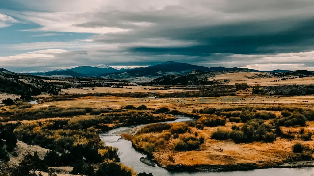
The photo at the top of this page is not Big Spring Creek.
It is a regional stand-in, honestly captioned but generic — we will not put a name to a river we cannot prove. Send us a photograph you took here and it replaces the stand-in, with your credit on it.
Pioneer badgeUnclaimed
Add a photo of this water
Landscape, not fish — the water itself. Reviewed by hand before it appears. The first one published here earns the Pioneer badge.
Fished this water? Add a photo
Reviewed by hand before it appears. Pick the water, not the spot — we never publish exact locations.
Access
Lewistown - the town on the creek, with lodging, fuel, tackle and fly shop support.
Big Spring Creek Trout Hatchery - the state hatchery at the spring source south of town.
Brewery Flats - a restored reach with public access and walk in fishing near Lewistown.
Machler and Ackley fishing access sites - state access points along the drainage.
Judith River - the river the creek joins north of Lewistown.
Big Snowy Mountains - the range south of town, source of the limestone aquifer.
Crystal Lake - a small mountain lake in the Big Snowies for a change of pace.
Seasons
Spring: the creek stays fishable while freestone rivers blow out, with midges and early mayflies.
Summer: weed growth peaks, terrestrial fishing is strong and cold spring water keeps trout active.
Fall: brown trout colour up and move to spawn, and the creek fishes very well in cooling weather.
Winter: much of the creek stays open and ice free, and midge fishing continues on milder days.
From the water
No logged trips yet. Be the first to put this water on your map.
Log this water
Fished it or cleaned it? Log in or create a free account to log a trip with photos and earn the waterway badge.
Questions
What is the current flow on the Big Spring Creek?
As of Oct 18, 5:30 pm, the USGS gauge Big Spring Cr at R&B Trading Post nr Lewistown MT reads 152 cfs. Conditions update every 15 minutes.
What species can you catch on the Big Spring Creek?
Anglers target Brook Trout, Brown Trout, Mountain Whitefish, Rainbow Trout, Westslope Cutthroat Trout, White Sucker on the Big Spring Creek in Montana.
Are there fishing guides on the Big Spring Creek?
GuidedFloats lists 1 guide and outfitters on the Big Spring Creek. Claimed profiles accept booking requests; unclaimed profiles are built from public records and link to the business.
Where can you access the Big Spring Creek?
Lewistown - the town on the creek, with lodging, fuel, tackle and fly shop support. Big Spring Creek Trout Hatchery - the state hatchery at the spring source south of town. Brewery Flats - a restored reach with public access and walk in fishing near Lewistown. Machler and Ackley fishing access sites - state access points along the drainage. Judith River - the river the creek joins north of Lewistown. Big Snowy Mountains - the range south of town, source of the limestone aquifer. Crystal Lake - a small mountain lake in the Big Snowies for a change of pace.
When is the best time to fish the Big Spring Creek?
Spring: the creek stays fishable while freestone rivers blow out, with midges and early mayflies. Summer: weed growth peaks, terrestrial fishing is strong and cold spring water keeps trout active. Fall: brown trout colour up and move to spawn, and the creek fishes very well in cooling weather. Winter: much of the creek stays open and ice free, and midge fishing continues on milder days.
Where are the fishing regulations for the Big Spring Creek?
Regulations change by season and section. Read the current rules on the Montana agency site: https://fwp.mt.gov/fish/regulations