Pemigewasset River Fishing Guides
The White Mountains river running out of Franconia Notch through Woodstock, Campton and Plymouth, a freestone trout stream up top and a smallmouth river down low.
Map of the Pemigewasset River
52 numbered points: 15 access points, 5 campsites, 11 bridges, 12 parks and conservation areas, 3 regulation section limits, 4 hazards, 1 spring, 1 USGS gauge. Tap a marker for details. Reviewed Sep 25, 2026.
- Access / boat ramp (15)
- Campsite (5)
- Bridge crossing (11)
- Park / conservation area (12)
- Regulation section limit (3)
- Dam / hazard (4)
- Spring (1)
- USGS gauge (1)
Print it. Bag it. Bring it.Phones die, screens crack, and most of this water has no signal. Print this map, fold it into a zip-top bag or dry bag with your license, and you have a backup your electronics can’t give you. Every marker is numbered so you can say exactly where you are.
Open the printable mapAll 52 points on this map
| # | Point | Type | Lat, Lon | Notes |
|---|---|---|---|---|
| 1 | Lafayette Campground Franconia Notch State Park | Campsite | 44.14274, -71.68460 | |
| 2 | Franconia Notch State Park NH State Parks | Park / conservation area | 44.14207, -71.68901 | |
| 3 | Sentinel Pine Covered Bridge Flume Gorge | Bridge crossing | 44.10435, -71.67793 | |
| 4 | Flume Covered Bridge Flume Gorge | Bridge crossing | 44.09931, -71.67704 | |
| 5 | Country Bumpkins Campground North Woodstock | Campsite | 44.05419, -71.68832 | |
| 6 | Clark’s covered railroad bridge White Mountain Central Railroad | Bridge crossing | 44.05152, -71.68776 | |
| 7 | Fay Wayside Picnic Area NH Division of Forests and Lands | Park / conservation area | 44.04204, -71.68665 | |
| 8 | Fay State Forest NH Division of Forests and Lands | Park / conservation area | 44.03591, -71.68591 | |
| 9 | Cascade Park Woodstock | Park / conservation area | 44.03209, -71.68609 | |
| 10 | NH 112 bridge, North Woodstock Kancamagus Highway | Bridge crossing | 44.02995, -71.68491 | |
| 11 | Soldiers Park Town of Woodstock | Park / conservation area | 44.02986, -71.68576 | |
| 12 | Woodstock Family Park Access Town of Woodstock - cartop | Access / boat ramp | 44.02594, -71.68374 | |
| 13 | US 3 bridge, Woodstock Main Street | Bridge crossing | 44.02579, -71.68502 | |
| 14 | NH 175 bridge, Woodstock Eastside Road | Bridge crossing | 44.02202, -71.68203 | |
| 15 | Staple Rock Park Woodstock | Park / conservation area | 43.97543, -71.67840 | |
| 16 | River access, Woodstock Cartop; picnic area across NH 175 | Access / boat ramp | 43.97530, -71.68020 | |
| 17 | Waterest Campground Woodstock | Campsite | 43.96914, -71.67860 | |
| 18 | Lincoln / Woodstock KOA Holiday | Campsite | 43.96134, -71.67527 | |
| 19 | Robins Nest Access Point Cartop, asphalt; by the LCIP Ballou property | Access / boat ramp | 43.91733, -71.68374 | |
| 20 | Pemi River Campground Thornton | Campsite | 43.87008, -71.66428 | |
| 21 | NH 49 bridge, Campton Campton Village Road | Bridge crossing | 43.84814, -71.66033 | |
| 22 | Blair Bridge Covered bridge, Campton | Bridge crossing | 43.81033, -71.66573 | |
| 23 | Blair Bridge Access Cartop | Access / boat ramp | 43.81025, -71.66609 | |
| 24 | Blair Woodland Natural Area Campton Conservation Commission | Park / conservation area | 43.80686, -71.66954 | |
| 25 | Livermore Falls Ledge drop and gorge - scout or portage | Dam / hazard | 43.78510, -71.66704 | |
| 26 | Livermore Falls State Forest NH Division of Forests and Lands | Park / conservation area | 43.78400, -71.66894 | |
| 27 | Livermore Falls walk-in NH Fish & Game - walk-in | Access / boat ramp | 43.78210, -71.66570 | |
| 28 | NH 175A bridge, Plymouth Capt. Douglas A. DiCenzo Bridge | Bridge crossing | 43.75995, -71.68611 | |
| 29 | USGS gauge 01076500 - Pemigewasset River at Plymouth Live flow and stage | USGS gauge | 43.75924, -71.68563 | |
| 30 | Pemigewasset River Cartop Access NH Fish & Game - concrete cartop ramp | Access / boat ramp | 43.75710, -71.68572 | |
| 31 | Riverside Park, Plymouth Town of Plymouth | Park / conservation area | 43.75673, -71.68596 | |
| 32 | Pemi Oxbow Preserve Squam Lakes Conservation Society | Park / conservation area | 43.74876, -71.67365 | |
| 33 | Crystal Spring Holderness | Spring | 43.74404, -71.68014 | |
| 34 | Church Hill Wildlife Management Area NH Fish & Game | Park / conservation area | 43.73107, -71.65189 | |
| 35 | Sawhegenet Falls Recreation Area Town of Bridgewater - residents only | Park / conservation area | 43.68386, -71.65051 | |
| 36 | Mooney Clark Landing NH Fish & Game - concrete-plank ramp | Access / boat ramp | 43.60732, -71.66345 | |
| 37 | NH 104 bridge, Bristol | Bridge crossing | 43.60651, -71.66273 | |
| 38 | Bristol special-rule section NH Fish & Game - upstream limit at the NH 104 bridge | Regulation section limit | 43.60651, -71.66273 | Section runs from the NH 104 bridge downstream to Ayers Island Dam. Boundary only; see NH Fish and Game for the rules. |
| 39 | Ayers Island Hydro upstream access Cartop / portage | Access / boat ramp | 43.59903, -71.71771 | |
| 40 | Ayers Island Dam Bristol - portage | Dam / hazard | 43.59786, -71.71780 | |
| 41 | Bristol to Franklin special-rule section NH Fish & Game - anchored on Ayers Island Dam | Regulation section limit | 43.59786, -71.71780 | Section runs from 300 ft below Ayers Island Dam downstream to the Eastman Falls Dam in Franklin. Boundary only. |
| 42 | Ayers Island Hydro downstream access Cartop / portage | Access / boat ramp | 43.59634, -71.71886 | |
| 43 | Pemigewasset River Access, New Hampton NH DOT - cartop | Access / boat ramp | 43.59060, -71.73100 | |
| 44 | Coolidge Woods Cartop Facility II US Army Corps of Engineers - cartop | Access / boat ramp | 43.58560, -71.72350 | |
| 45 | Coolidge Woods Cartop Facility US Army Corps of Engineers - cartop | Access / boat ramp | 43.57980, -71.71610 | |
| 46 | Shaw Cove Boat Launch US Army Corps of Engineers - gravel ramp | Access / boat ramp | 43.49920, -71.66620 | |
| 47 | Franklin Falls Dam US Army Corps of Engineers flood-control dam | Dam / hazard | 43.46842, -71.65958 | |
| 48 | Franklin Public Boat Ramp City of Franklin - paved trailer ramp | Access / boat ramp | 43.45010, -71.65523 | |
| 49 | Eastman Falls Dam Franklin - Central Rivers Power | Dam / hazard | 43.44711, -71.65781 | |
| 50 | Franklin special-rule section NH Fish & Game - anchored on Eastman Falls Dam | Regulation section limit | 43.44711, -71.65781 | Section runs from 150 ft below Eastman Falls Dam downstream to the confluence with the Winnipesaukee River. Boundary only. |
| 51 | Eastman Falls Hydro Station Cartop Access Cartop | Access / boat ramp | 43.44623, -71.66003 | |
| 52 | US 3 bridge, Franklin Central Street | Bridge crossing | 43.44165, -71.65735 |
Guides on the Pemigewasset River
Claimed profiles take booking requests. Unclaimed profiles are built from public records so the river is never empty; the guide can claim or remove one any time.
No guides listed yet
Guide or outfit this water? Create your profile. Listing is free, the commission is 10% or 7% with a premium profile, and premium profiles list first on this water.
About the Pemigewasset River
The Pemigewasset starts at Profile Lake in Franconia Notch and runs south along Interstate 93 through North Woodstock, Thornton, Campton and Plymouth to the Winnipesaukee confluence at Franklin, where it becomes the Merrimack. It is the main drainage of the western White Mountains, and it collects a remarkable set of tributaries on the way: the East Branch out of the Pemigewasset Wilderness, the Mad River, Baker River and Smith River, each a fishery in its own right.
The upper river above Woodstock is cold freestone brook trout water in a spectacular notch. Through the middle river brown and rainbow trout are stocked and hold over in the deeper pools and the shaded reaches, and the East Branch and the smaller tributaries hold wild brook trout in the backcountry. Below Plymouth the river widens and warms and smallmouth bass take over, giving the lower reaches a genuinely good summer bass fishery. Landlocked salmon are present in the lowest reaches near Franklin.
The Plymouth gauge reads the middle river and it is entirely weather-driven. Spring melt off the White Mountains makes the river big, cold and fast, and it is not wadeable at peak. It drops quickly once melt is over, and June is typically ideal. A summer thunderstorm in the notch can double the flow for a day. By August the river runs low, warm and clear in the middle reaches and the trout fishing moves to the tributaries and the early hours.
Lincoln, North Woodstock, Campton and Plymouth are the base towns, with easy interstate access, and the tributary streams are what reward a second day.
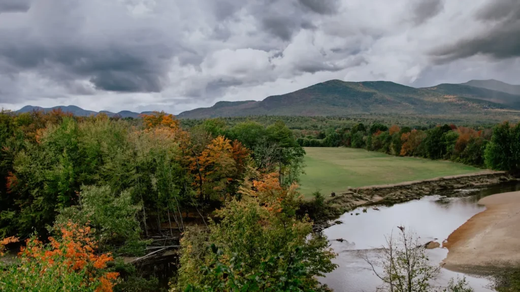
This water needs a real photo
The photo at the top of this page is not Pemigewasset River.
It is a regional stand-in, honestly captioned but generic — we will not put a name to a river we cannot prove. Send us a photograph you took here and it replaces the stand-in, with your credit on it.
Add a photo of this water
Landscape, not fish — the water itself. Reviewed by hand before it appears. The first one published here earns the Pioneer badge.
Fished this water? Add a photo
Reviewed by hand before it appears. Pick the water, not the spot — we never publish exact locations.
Access
Franconia Notch State Park: the headwaters and the coldest water.
North Woodstock and the East Branch confluence: upper river access.
Thornton and Campton: roadside pullouts along Route 175 and Route 3.
Livermore Falls: a well-known reach with parking above Plymouth.
Plymouth: town access at the gauge and the Baker River confluence.
Bristol and Ashland: lower river and smallmouth water.
Mad River, Baker River and Smith River: tributary trout fisheries.
Seasons
April and May: heavy snowmelt, high and cold; streamers or wait it out.
June: the best month, dropping clear water and strong hatches.
July and August: low and warm on the main stem; fish the tributaries or the upper notch.
September and October: cooling water, fall trout and excellent smallmouth below Plymouth.
From the water
No logged trips yet. Be the first to put this water on your map.
Log this water
Fished it or cleaned it? Log in or create a free account to log a trip with photos and earn the waterway badge.
Questions
What is the current flow on the Pemigewasset River?
As of Oct 19, 3:30 am, the USGS gauge PEMIGEWASSET RIVER AT PLYMOUTH, NH reads 512 cfs, the 43rd percentile for this date. Conditions update every 15 minutes.
What species can you catch on the Pemigewasset River?
Anglers target Brook Trout, Brown Trout, Landlocked Atlantic Salmon, Rainbow Trout, Smallmouth Bass on the Pemigewasset River in New Hampshire.
Where can you access the Pemigewasset River?
Franconia Notch State Park: the headwaters and the coldest water. North Woodstock and the East Branch confluence: upper river access. Thornton and Campton: roadside pullouts along Route 175 and Route 3. Livermore Falls: a well-known reach with parking above Plymouth. Plymouth: town access at the gauge and the Baker River confluence. Bristol and Ashland: lower river and smallmouth water. Mad River, Baker River and Smith River: tributary trout fisheries.
When is the best time to fish the Pemigewasset River?
April and May: heavy snowmelt, high and cold; streamers or wait it out. June: the best month, dropping clear water and strong hatches. July and August: low and warm on the main stem; fish the tributaries or the upper notch. September and October: cooling water, fall trout and excellent smallmouth below Plymouth.
Where are the fishing regulations for the Pemigewasset River?
Regulations change by season and section. Read the current rules on the New Hampshire agency site: https://www.wildlife.nh.gov/laws-and-rules