Hatchet Creek Fishing Guides
A clear piedmont shoal creek in Coosa County, paddled and waded for Coosa redeye bass over bedrock ledges and gravel runs.
Guides on the Hatchet Creek
Claimed profiles take booking requests. Unclaimed profiles are built from public records so the river is never empty; the guide can claim or remove one any time.
No guides listed yet
Guide or outfit this water? Create your profile. Listing is free, the commission is 10% or 7% with a premium profile, and premium profiles list first on this water.
About the Hatchet Creek
Hatchet Creek runs southwest through Coosa County in the Alabama piedmont, past Rockford and down to the Coosa River at the head of Lake Mitchell. It is one of the best examples left of a piedmont shoal creek: clear water over granite and gneiss bedrock, long gravel runs broken by ledge shoals, and hardwood and pine right down to the bank. The creek is small enough to wade in a great deal of its length and shallow enough that a kayak or a canoe is the only sensible boat, which keeps the pressure light and the character intact.
The fish worth coming for is the redeye bass. The Coosa basin redeye is a piedmont specialty, a small, brilliantly marked black bass that lives in exactly this kind of shoal water and takes a popper or a small streamer with more aggression than its size suggests. Hatchet Creek is one of the streams Alabama anglers name when they talk about redeye fishing. Smallmouth, spotted and largemouth bass are present as well, mixed by reach, and longear and redbreast sunfish fill the pockets behind every ledge. Channel catfish hold in the deeper pools. The fishing is a wading and paddling proposition, done with light gear and short accurate casts to the seams and pocket water, and it rewards covering ground rather than sitting on one hole.
The gauge below Rockford is the flow to check, and it is worth being clear that the name is not a dam reference. Rockford is a town, so despite the word below in the station name this is a free-flowing piedmont creek and not a tailwater, and nothing upstream is regulating it. That means it responds directly to rain: a summer thunderstorm can put it up and off-color within hours and it clears again quickly, while a dry spell leaves the shoals too bony to float and drops the creek to a series of connected pools. No temperature sensor publishes here.
This water needs a real photo
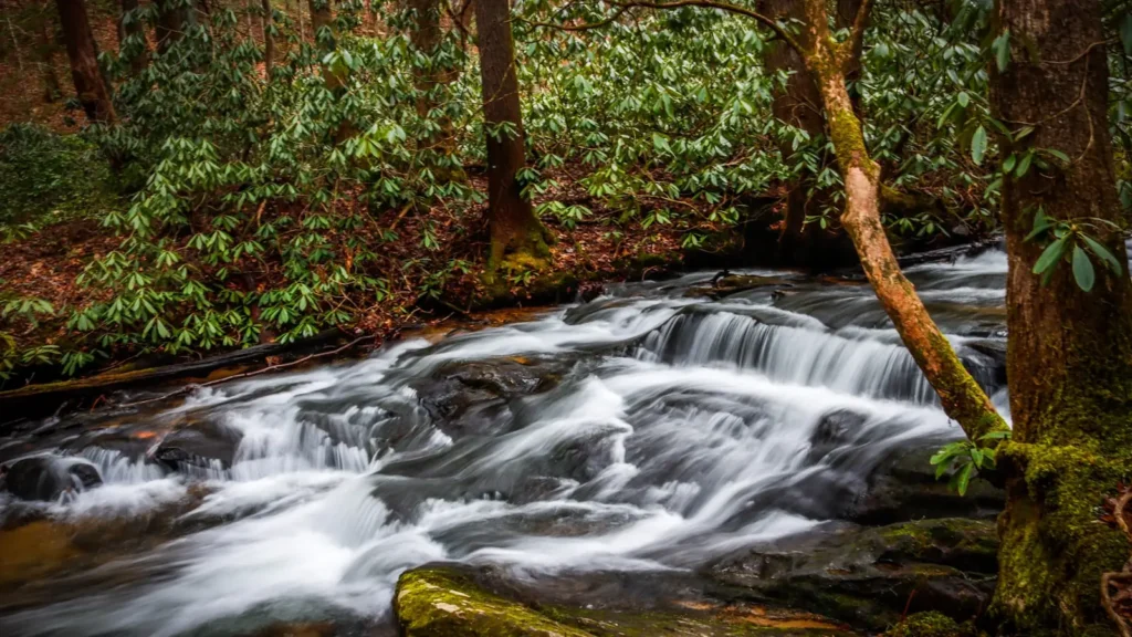
The photo at the top of this page is not Hatchet Creek.
It is a regional stand-in, honestly captioned but generic — we will not put a name to a river we cannot prove. Send us a photograph you took here and it replaces the stand-in, with your credit on it.
Add a photo of this water
Landscape, not fish — the water itself. Reviewed by hand before it appears. The first one published here earns the Pioneer badge.
Fished this water? Add a photo
Reviewed by hand before it appears. Pick the water, not the spot — we never publish exact locations.
Access
Rockford area bridge crossing - the closest public access to the gauge.
County Road 29 crossing - a common kayak put-in on the middle creek.
Hatchet Creek at Highway 231 - roadside bank and wading access.
Swayback Bridge Trail area - walk-in access to the lower creek.
Coosa River confluence at Lake Mitchell - boat access to the creek mouth.
County Road 56 crossing - upper creek access with roadside parking.
Weogufka State Forest roads - dispersed walk-in access to the upper drainage.
Seasons
Spring: the best flows of the year and aggressive redeye and sunfish once the water clears.
Summer: low and clear, ideal for wading, with early morning topwater the highlight.
Fall: excellent fishing in comfortable weather with very little traffic on the creek.
Winter: cold and slow, with fish stacked in the deeper pools between the shoals.
From the water
No logged trips yet. Be the first to put this water on your map.
Log this water
Fished it or cleaned it? Log in or create a free account to log a trip with photos and earn the waterway badge.
Questions
What is the current flow on the Hatchet Creek?
As of Sep 17, 5:45 am, the USGS gauge HATCHET CREEK BELOW ROCKFORD AL reads 45 cfs. Conditions update every 15 minutes.
What species can you catch on the Hatchet Creek?
Anglers target Bluegill, Channel Catfish, Largemouth Bass, Longear Sunfish, Redbreast Sunfish, Redeye Bass, Smallmouth Bass, Spotted Bass, Warmouth on the Hatchet Creek in Alabama.
Where can you access the Hatchet Creek?
Rockford area bridge crossing - the closest public access to the gauge. County Road 29 crossing - a common kayak put-in on the middle creek. Hatchet Creek at Highway 231 - roadside bank and wading access. Swayback Bridge Trail area - walk-in access to the lower creek. Coosa River confluence at Lake Mitchell - boat access to the creek mouth. County Road 56 crossing - upper creek access with roadside parking. Weogufka State Forest roads - dispersed walk-in access to the upper drainage.
When is the best time to fish the Hatchet Creek?
Spring: the best flows of the year and aggressive redeye and sunfish once the water clears. Summer: low and clear, ideal for wading, with early morning topwater the highlight. Fall: excellent fishing in comfortable weather with very little traffic on the creek. Winter: cold and slow, with fish stacked in the deeper pools between the shoals.
Where are the fishing regulations for the Hatchet Creek?
Regulations change by season and section. Read the current rules on the Alabama agency site: https://www.outdooralabama.com/fishing/freshwater-fishing-creel-and-size-limits