South Fork Eel River Fishing Guides
The redwood-corridor steelhead river, running north past Leggett and through Humboldt Redwoods with a winter run that lives or dies on the rain.
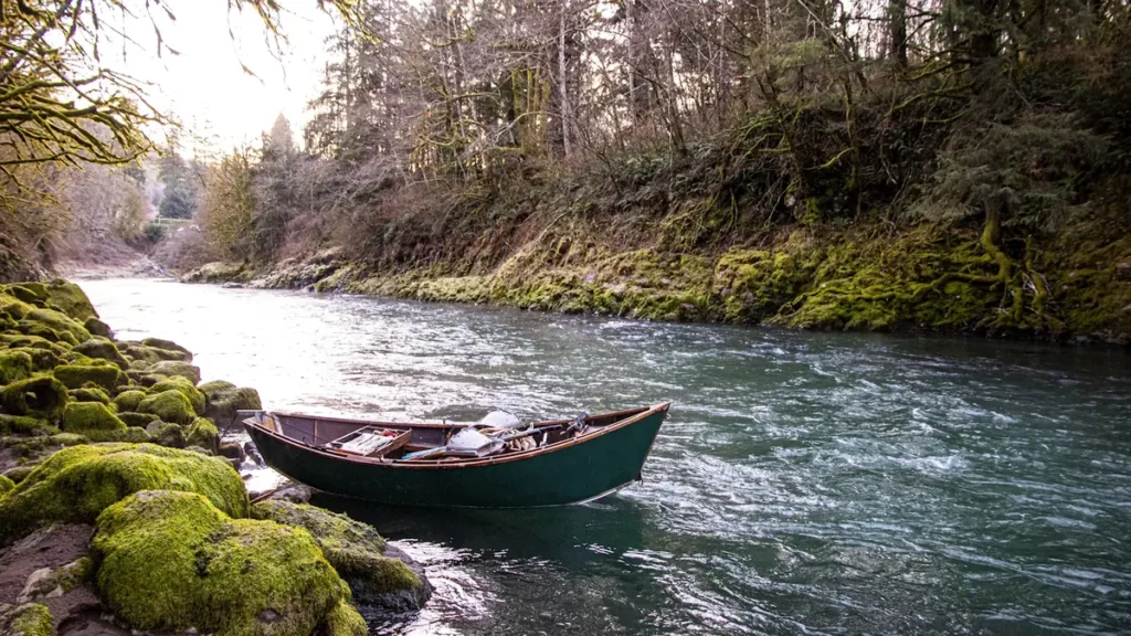
Guides on the South Fork Eel River
Claimed profiles take booking requests. Unclaimed profiles are built from public records so the river is never empty; the guide can claim or remove one any time.
No guides listed yet
Guide or outfit this water? Create your profile. Listing is free, the commission is 10% or 7% with a premium profile, and premium profiles list first on this water.
About the South Fork Eel River
The South Fork Eel runs through some of the most photographed country in California and much of its length is shadowed by old growth redwood. It flows north rather than south, gathering from the coast range above Leggett and running down past Garberville and through Humboldt Redwoods State Park to meet the main stem at Dyerville. The gauge at Leggett sits near the top of the reach that matters to anglers, and the river below it is a classic coastal winter steelhead stream.
Everything here depends on rain. The South Fork is unregulated, with no dam to hold water back, so it runs low, clear and warm through the dry season and transforms the moment the winter storms arrive. Steelhead enter on the freshets, and the fishery is a matter of timing the window between a river too high and muddy to fish and one that has dropped back into shape. Anglers who live nearby fish it on days’ notice. Visitors who book far ahead take their chances with the weather.
The runs are a serious conservation story rather than a footnote. Coho are listed and fully protected, chinook numbers are a fraction of historical levels, and the winter steelhead run, while still the backbone of the sport fishery, is closely watched. The Eel basin has dealt with sediment from historic logging, water diversion and, more recently, heavy unregulated water draw in the headwaters. Management has tightened accordingly.
Anglers need to understand California’s low-flow closure system before planning a trip here. The state closes coastal rivers to fishing when flows drop below set thresholds, and the determination changes through the season, so it must be checked close to the day rather than assumed. Gear restrictions and hatchery retention rules also apply. The upside is a river that runs through redwoods, sees moderate pressure and fishes beautifully when conditions line up.
This water needs a real photo
The photo at the top of this page is not South Fork Eel River.
It is a regional stand-in, honestly captioned but generic — we will not put a name to a river we cannot prove. Send us a photograph you took here and it replaces the stand-in, with your credit on it.
Add a photo of this water
Landscape, not fish — the water itself. Reviewed by hand before it appears. The first one published here earns the Pioneer badge.
Fished this water? Add a photo
Reviewed by hand before it appears. Pick the water, not the spot — we never publish exact locations.
Access
Leggett - the gauge reach and access at the top of the fishable water.
Standish-Hickey State Recreation Area - developed access and campground near Leggett.
Richardson Grove State Park - redwood corridor access on the middle river.
Benbow - the standard access near Garberville.
Garberville area river access - bank access on the middle reach.
Humboldt Redwoods State Park, Weott - lower river access through the old growth.
Dyerville - the confluence with the main stem Eel and the bottom of the reach.
Seasons
Spring: the tail of the winter run, dropping flows and closures arriving as the river falls.
Summer: low warm water, largely closed to fishing and best treated as a swimming season.
Fall: the first rains bring the earliest fish, but the river is usually still too low.
Winter: the season, entirely governed by storm timing and the low-flow closure status.
From the water
No logged trips yet. Be the first to put this water on your map.
Log this water
Fished it or cleaned it? Log in or create a free account to log a trip with photos and earn the waterway badge.
Questions
What is the current flow on the South Fork Eel River?
As of Sep 17, 5:30 am, the USGS gauge SF EEL R A LEGGETT CA reads 20 cfs. Conditions update every 15 minutes.
What species can you catch on the South Fork Eel River?
Anglers target American Shad, Chinook Salmon, Coho Salmon, Sacramento Pikeminnow, Sacramento Sucker, Steelhead on the South Fork Eel River in California.
Where can you access the South Fork Eel River?
Leggett - the gauge reach and access at the top of the fishable water. Standish-Hickey State Recreation Area - developed access and campground near Leggett. Richardson Grove State Park - redwood corridor access on the middle river. Benbow - the standard access near Garberville. Garberville area river access - bank access on the middle reach. Humboldt Redwoods State Park, Weott - lower river access through the old growth. Dyerville - the confluence with the main stem Eel and the bottom of the reach.
When is the best time to fish the South Fork Eel River?
Spring: the tail of the winter run, dropping flows and closures arriving as the river falls. Summer: low warm water, largely closed to fishing and best treated as a swimming season. Fall: the first rains bring the earliest fish, but the river is usually still too low. Winter: the season, entirely governed by storm timing and the low-flow closure status.
Where are the fishing regulations for the South Fork Eel River?
Regulations change by season and section. Read the current rules on the California agency site: https://wildlife.ca.gov/Regulations