Cedar River Fishing Guides and Conditions, Iowa
Eastern Iowa's best smallmouth and walleye river, running from Minnesota through Waverly, Waterloo and Cedar Rapids on a rock and gravel bed with good float access the whole way.
Guides on the Cedar River
Claimed profiles take booking requests. Unclaimed profiles are built from public records so the river is never empty; the guide can claim or remove one any time.
No guides listed yet
Guide or outfit this water? Create your profile. Listing is free, the commission is 10% or 7% with a premium profile, and premium profiles list first on this water.
About the Cedar River
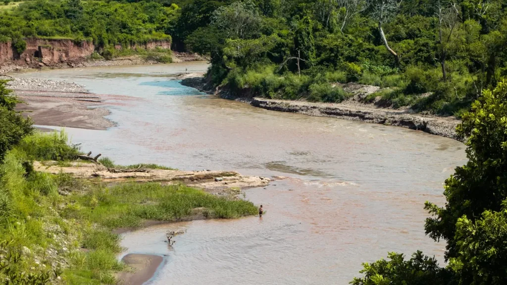
The Cedar River enters Iowa from southern Minnesota and runs southeast through Charles City, Waverly, Waterloo, Vinton and Cedar Rapids before joining the Iowa River near Columbus Junction. It is one of the few large Iowa rivers with a genuinely rocky bed – limestone ledge, cobble and gravel through much of its middle reach – and that geology is why it fishes so much better than the sand-bottomed rivers of the western half of the state. Low-head dams through the towns break the river into segments, and several have been modified or removed in recent years, improving both passage and paddling safety.
Smallmouth bass are the headline. The reach from Charles City down through Waverly and Waterloo is legitimately good smallmouth water by any regional standard, with fish holding on every rock ledge and current break. Walleye are abundant and are the reason a large share of local anglers are on the water at all, concentrated below the dams in spring and spread through the deeper runs the rest of the year. Channel catfish are everywhere and heavily fished, flathead catfish reach substantial size in the deeper holes, and northern pike hold in the backwaters and slower side channels.
Access is easy and public. City parks, county conservation board areas and state access points are spaced closely enough that float segments of five to ten miles are simple to plan, and the river is well suited to canoes, kayaks and small jon boats. The Cedar Valley Nature Trail parallels a long stretch and opens up bank access. The Cedar Rapids gauge reads discharge and stage and is the standard reference for the lower river; its water temperature series has not reported since 2012, so temperature is not available here.
Fished this water? Add a photo
Reviewed by hand before it appears. Pick the water, not the spot — we never publish exact locations.
Access
Cedar Rapids - city park and boat ramp access near the gauge, serving the lower river through and below town.
Waterloo and Cedar Falls - multiple ramps and park accesses, and the closest good smallmouth water to the metro area.
Waverly - the usual put-in for the upper float segments where the rock structure is best.
Vinton and Palo county conservation areas break the middle river into manageable single-day floats.
The Cedar Valley Nature Trail parallels much of the river between Waterloo and Evansdale and gives long stretches of bank access.
Low-head dams remain in several towns and are genuinely dangerous - portage well upstream and do not attempt to run them.
Farmland dominates the banks between access points; use the public landings rather than crossing fields.
Seasons
Spring: high and stained from snowmelt into May, with the walleye run below the dams the main event once the river drops.
Summer: prime smallmouth season. Low clear water over the rock reaches, good topwater fishing, and comfortable float conditions.
Fall: cooling water brings the biggest smallmouth and walleye of the year, and September and October are the best float months on the river.
Winter: the river ices over and the fishery effectively stops. Some tailwater fishing below the dams continues on mild spells.
From the water
No logged trips yet. Be the first to put this water on your map.
Log this water
Fished it or cleaned it? Log in or create a free account to log a trip with photos and earn the waterway badge.
Questions
What is the current flow on the Cedar River?
As of Sep 6, 2:00 am, the USGS gauge Cedar River at Cedar Rapids, IA reads 2,670 cfs. Conditions update every 15 minutes.
What species can you catch on the Cedar River?
Anglers target Channel Catfish, Flathead Catfish, Northern Pike, Smallmouth Bass, Walleye on the Cedar River in Iowa.
Where can you access the Cedar River?
Cedar Rapids - city park and boat ramp access near the gauge, serving the lower river through and below town. Waterloo and Cedar Falls - multiple ramps and park accesses, and the closest good smallmouth water to the metro area. Waverly - the usual put-in for the upper float segments where the rock structure is best. Vinton and Palo county conservation areas break the middle river into manageable single-day floats. The Cedar Valley Nature Trail parallels much of the river between Waterloo and Evansdale and gives long stretches of bank access. Low-head dams remain in several towns and are genuin...
When is the best time to fish the Cedar River?
Spring: high and stained from snowmelt into May, with the walleye run below the dams the main event once the river drops. Summer: prime smallmouth season. Low clear water over the rock reaches, good topwater fishing, and comfortable float conditions. Fall: cooling water brings the biggest smallmouth and walleye of the year, and September and October are the best float months on the river. Winter: the river ices over and the fishery effectively stops. Some tailwater fishing below the dams continues on mild spells.
Where are the fishing regulations for the Cedar River?
Regulations change by season and section. Read the current rules on the Iowa agency site: https://www.iowadnr.gov/Fishing/Fishing-Licenses-Laws