Maquoketa River Fishing Guides
Eastern Iowa's limestone-bluff smallmouth river, running from the Delaware County forks down through Maquoketa to the Mississippi.
Map of the Maquoketa River
36 numbered points: 12 access points, 2 campsites, 9 bridges, 8 parks and conservation areas, 1 regulation section limit, 1 USGS gauge, 3 points of interest. Tap a marker for details. Reviewed Oct 23, 2026.
- Access / boat ramp (12)
- Campsite (2)
- Bridge crossing (9)
- Park / conservation area (8)
- Regulation section limit (1)
- USGS gauge (1)
- Point of interest (3)
Print it. Bag it. Bring it.Phones die, screens crack, and most of this water has no signal. Print this map, fold it into a zip-top bag or dry bag with your license, and you have a backup your electronics can’t give you. Every marker is numbered so you can say exactly where you are.
Open the printable mapAll 36 points on this map
| # | Point | Type | Lat, Lon | Notes |
|---|---|---|---|---|
| 1 | Monticello City Park Monticello | Park / conservation area | 42.24213, -91.18507 | City park on the river at Monticello. |
| 2 | State Highway 38 IA 38, Monticello | Bridge crossing | 42.26007, -91.19265 | Highway crossing above the Mon-Maq Dam. |
| 3 | North Main Street US 151 Business, Monticello | Bridge crossing | 42.24386, -91.17972 | Town crossing at Monticello. |
| 4 | Mon-Maq Dam Monticello | Point of interest | 42.24474, -91.17208 | Dam at Monticello; the walk-in canoe landing is immediately below it. |
| 5 | Mon-Maq Dam Walk-in Canoe Landing Monticello | Access / boat ramp | 42.24589, -91.17057 | Walk-in canoe landing at the Mon-Maq Dam. |
| 6 | US 151 US 151, below Monticello | Bridge crossing | 42.24585, -91.16460 | Highway crossing below the dam. |
| 7 | Pictured Rocks Boat Landing Jones County | Access / boat ramp | 42.20638, -91.10289 | Boat landing at Pictured Rocks, the limestone bluff reach below Monticello. |
| 8 | Indian Bluffs Wildlife Management Area Iowa DNR | Park / conservation area | 42.21183, -91.07789 | DNR wildlife area on the bluffs above the river. |
| 9 | Eby's Mill Wildlife Area Iowa DNR | Park / conservation area | 42.20303, -91.03922 | Wildlife area at the old Eby's Mill site. |
| 10 | Eby's Mill Road Eby's Mill | Bridge crossing | 42.19822, -91.05740 | County crossing at Eby's Mill. |
| 11 | State Highway 136 IA 136 | Bridge crossing | 42.20332, -91.00488 | Highway crossing on the middle river. |
| 12 | Temple Hill Road Temple Hill | Bridge crossing | 42.18567, -90.97728 | County crossing in the long reach above Canton. |
| 13 | Canton Canoe Access Canton | Access / boat ramp | 42.16256, -90.89357 | County canoe access at Canton. |
| 14 | Buzzard Ridge Wildlife Area Jackson County Conservation | Park / conservation area | 42.15226, -90.87714 | County wildlife area on the river near Baldwin. |
| 15 | Buzzard Ridge Campground Jackson County Conservation | Campsite | 42.14697, -90.87838 | Riverside campground inside the Buzzard Ridge area. |
| 16 | Millertown Canoe Access Millertown | Access / boat ramp | 42.12443, -90.85844 | Canoe access at the Millertown crossing. |
| 17 | Pine Valley Nature Area Jackson County Conservation | Park / conservation area | 42.13330, -90.84968 | County nature area on the slope above the river. |
| 18 | Royertown Canoe Access Jackson County Conservation | Access / boat ramp | 42.12041, -90.82977 | County canoe access at Royertown. |
| 19 | Chenelworth Canoe Access Jackson County Conservation | Access / boat ramp | 42.10961, -90.79702 | County canoe access at Chenelworth. |
| 20 | Frazier Wildlife Area Jackson County Conservation | Park / conservation area | 42.10854, -90.79262 | County wildlife area beside the Chenelworth access. |
| 21 | Morehead Canoe Access Jackson County | Access / boat ramp | 42.09037, -90.79657 | Canoe access at the 74th Street crossing. |
| 22 | Joinerville Park Jackson County Conservation | Campsite | 42.08117, -90.75194 | County park with river frontage and camping by permit. |
| 23 | Lakehurst Dam North American Hydro | Point of interest | 42.07011, -90.69788 | Hydro dam on the river above Maquoketa. |
| 24 | US 61 US 61, Maquoketa | Bridge crossing | 42.07560, -90.68244 | Highway crossing at Maquoketa. |
| 25 | Hurstville Marsh Observation Deck Hurstville | Point of interest | 42.09022, -90.67882 | Boardwalk and observation deck over the Hurstville marsh beside the river. |
| 26 | Hurstville Lime Kilns Jackson County Conservation | Park / conservation area | 42.09655, -90.68304 | County historic site at the restored lime kilns on the Hurstville reach. |
| 27 | Hurstville Road Hurstville Road, Maquoketa | Bridge crossing | 42.07748, -90.66652 | Town crossing below the US 61 bridge. |
| 28 | Bridgeport Canoe Access Bridgeport | Access / boat ramp | 42.08504, -90.63138 | Canoe access at Bridgeport, below Maquoketa. |
| 29 | Ansel Briggs Highway Bridgeport | Bridge crossing | 42.08378, -90.63258 | Highway crossing at the Bridgeport access. |
| 30 | Richardson Timber Preserve Jackson County Conservation | Park / conservation area | 42.09230, -90.53084 | County timber preserve on the lower river. |
| 31 | Iron Bridge Canoe Access Jackson County Conservation | Access / boat ramp | 42.10141, -90.51871 | County canoe access at the Iron Bridge crossing. |
| 32 | Spragueville Access Spragueville | Access / boat ramp | 42.08055, -90.43581 | County access at the 387th Avenue crossing. |
| 33 | Damon Canoe Access Damon | Access / boat ramp | 42.11829, -90.39454 | Canoe access at the 435th Avenue crossing on the lower river. |
| 34 | Maquoketa River Hwy 52 Access Jackson County Conservation | Access / boat ramp | 42.15990, -90.33819 | The last access on the river, at the Great River Road crossing above the Mississippi. |
| 35 | USGS 05418500 Maquoketa River near Maquoketa Primary flow reference | USGS gauge | 42.08335, -90.63292 | |
| 36 | Maquoketa River (below Monticello) Below Monticello down to the Mississippi | Regulation section limit | 42.24368, -91.17324 | Iowa DNR manages the river below Monticello as a single section of about eighty miles, running down to the Mississippi. |
Guides on the Maquoketa River
Claimed profiles take booking requests. Unclaimed profiles are built from public records so the river is never empty; the guide can claim or remove one any time.
No guides listed yet
Guide or outfit this water? Create your profile. Listing is free, the commission is 10% or 7% with a premium profile, and premium profiles list first on this water.
About the Maquoketa River
The Maquoketa River drains a broad piece of eastern Iowa, forming from the North Fork and the main stem in Delaware and Dubuque counties and running southeast past Monticello and Maquoketa to the Mississippi River near Green Island. The lower half cuts through limestone bluff country on the edge of the Driftless region, throwing long gravel riffles, rock ledges and deep outside bends. The USGS gauge near Maquoketa reports discharge and stage, and on a river this responsive to rainfall, flow is the whole trip-planning story.
Smallmouth bass are the marquee fish and the reason most guided trips run here. The rock ledges and gravel riffles below Maquoketa hold good numbers and respectable size, and the fishery has benefited from Iowa’s protected-slot management on several eastern rivers. Walleye run the deeper holes and are strongest in spring and fall, northern pike hold in the slower backwaters, and channel and flathead catfish are abundant throughout. Freshwater drum, black crappie and bluegill round out the lower reaches toward the Mississippi bottoms.
The river fishes best as a float. Canoes, kayaks and small jon boats work the bridge-to-bridge reaches, with anglers wading gravel bars and casting tubes, jerkbaits and topwater to the rock. The upper river above Monticello is narrower and more of a paddle trip; the lower river below Maquoketa opens up and takes a motor. Backbone State Park on the upper river adds a trout element from stocked reaches, though the main-stem fishery is squarely warmwater.
Access is good, with county and state accesses at most bridge crossings and formal river access points maintained through the Maquoketa corridor. Iowa fishing licenses are required, and the Iowa DNR link below carries current statewide limits along with the specific smallmouth bass slot rules that apply to designated eastern Iowa river reaches — worth confirming before keeping any fish here.
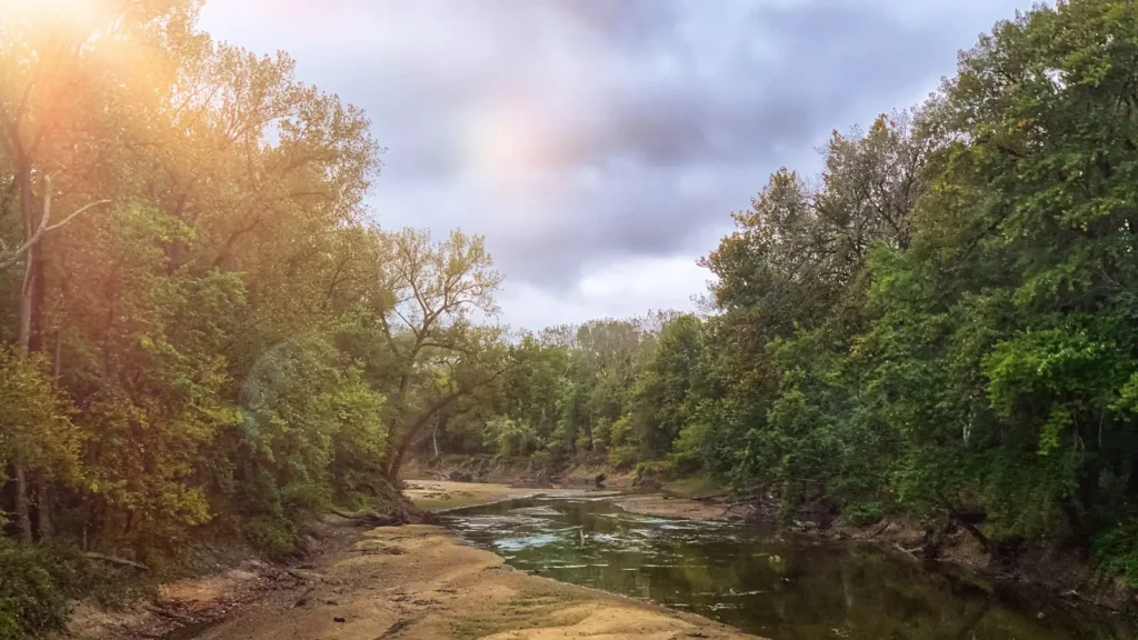
This water needs a real photo
The photo at the top of this page is not Maquoketa River.
It is a regional stand-in, honestly captioned but generic — we will not put a name to a river we cannot prove. Send us a photograph you took here and it replaces the stand-in, with your credit on it.
Add a photo of this water
Landscape, not fish — the water itself. Reviewed by hand before it appears. The first one published here earns the Pioneer badge.
Fished this water? Add a photo
Reviewed by hand before it appears. Pick the water, not the spot — we never publish exact locations.
Access
Maquoketa city river access — the main put-in near the USGS gauge.
Monticello area accesses — upper-river paddle put-ins on the main stem.
Joinerville and Canton bridge crossings — mid-river wade and float access.
Backbone State Park — upper river access with trout-stocked reaches nearby.
Hurstville area county access — north-side access above the town of Maquoketa.
Green Island Wildlife Area — lower river and Mississippi bottoms access.
Bellevue area Mississippi landings — take-out for full lower-river floats.
Seasons
Spring: high water early, then strong walleye and pre-spawn smallmouth fishing as flows drop in May.
Summer: low clear water, wade-and-float smallmouth fishing, topwater at dawn and dusk.
Fall: the best smallmouth fishing of the year as fish feed heavily ahead of winter.
Winter: limited float activity; walleye and catfish in the deep holes for the few who go.
From the water
No logged trips yet. Be the first to put this water on your map.
Log this water
Fished it or cleaned it? Log in or create a free account to log a trip with photos and earn the waterway badge.
Questions
What is the current flow on the Maquoketa River?
As of Nov 2, 6:15 am, the USGS gauge Maquoketa River near Maquoketa, IA reads 1,320 cfs. Conditions update every 15 minutes.
What species can you catch on the Maquoketa River?
Anglers target Black Crappie, Bluegill, Channel Catfish, Flathead Catfish, Freshwater Drum, Northern Pike, Smallmouth Bass, Walleye on the Maquoketa River in Iowa.
Where can you access the Maquoketa River?
Maquoketa city river access — the main put-in near the USGS gauge. Monticello area accesses — upper-river paddle put-ins on the main stem. Joinerville and Canton bridge crossings — mid-river wade and float access. Backbone State Park — upper river access with trout-stocked reaches nearby. Hurstville area county access — north-side access above the town of Maquoketa. Green Island Wildlife Area — lower river and Mississippi bottoms access. Bellevue area Mississippi landings — take-out for full lower-river floats.
When is the best time to fish the Maquoketa River?
Spring: high water early, then strong walleye and pre-spawn smallmouth fishing as flows drop in May. Summer: low clear water, wade-and-float smallmouth fishing, topwater at dawn and dusk. Fall: the best smallmouth fishing of the year as fish feed heavily ahead of winter. Winter: limited float activity; walleye and catfish in the deep holes for the few who go.
Where are the fishing regulations for the Maquoketa River?
Regulations change by season and section. Read the current rules on the Iowa agency site: https://www.iowadnr.gov/things-do/fishing/regulations-laws