Contoocook River Fishing Guides
A southern New Hampshire river that runs north from the Monadnock highlands to the Merrimack, stocked with trout above Peterborough and holding smallmouth through the lower valley.
Map of the Contoocook River
58 numbered points: 19 access points, 1 bait & fly shop, 10 bridges, 12 parks and conservation areas, 3 regulation section limits, 12 hazards, 1 USGS gauge. Tap a marker for details. Reviewed Sep 25, 2026.
- Access / boat ramp (19)
- Bait, tackle & fly shop (1)
- Bridge crossing (10)
- Park / conservation area (12)
- Regulation section limit (3)
- Dam / hazard (12)
- USGS gauge (1)
Print it. Bag it. Bring it.Phones die, screens crack, and most of this water has no signal. Print this map, fold it into a zip-top bag or dry bag with your license, and you have a backup your electronics can’t give you. Every marker is numbered so you can say exactly where you are.
Open the printable mapAll 58 points on this map
| # | Point | Type | Lat, Lon | Notes |
|---|---|---|---|---|
| 1 | Contoocook Lake Dam Jaffrey - head of the river | Dam / hazard | 42.80133, -72.02717 | |
| 2 | Rindge to Henniker special-rule section NH Fish & Game - upstream limit at Contoocook Lake | Regulation section limit | 42.80133, -72.02717 | Section runs from Contoocook Lake downstream to the area marked with signs and wire in West Henniker. Boundary only; see NH Fish and Game for the rules. |
| 3 | Carey Park Town of Jaffrey | Park / conservation area | 42.80198, -72.02670 | |
| 4 | Nutting Road bridge, Jaffrey | Bridge crossing | 42.82280, -72.01892 | |
| 5 | Cheshire Pond Dam Jaffrey | Dam / hazard | 42.81701, -72.00843 | |
| 6 | US 202 bridge, Jaffrey Peterborough Street / US 202 | Bridge crossing | 42.81661, -72.00588 | |
| 7 | Sharon Road bridge, Peterborough | Bridge crossing | 42.85269, -71.96382 | |
| 8 | Noone Mills Dam Peterborough | Dam / hazard | 42.85976, -71.96134 | |
| 9 | USGS gauge 01082000 - Contoocook River at Peterborough Live flow and stage | USGS gauge | 42.86258, -71.95925 | |
| 10 | US 202 / NH 101 bridge, Peterborough Wilton Road | Bridge crossing | 42.86898, -71.94954 | |
| 11 | Depot Park Peterborough village | Park / conservation area | 42.87606, -71.94902 | |
| 12 | Main Street bridge, Peterborough | Bridge crossing | 42.87747, -71.94836 | |
| 13 | North Village Dam Peterborough | Dam / hazard | 42.89923, -71.93946 | |
| 14 | Shieling Forest NH Division of Forests and Lands | Park / conservation area | 42.89315, -71.93318 | |
| 15 | Wetlands Mitigation Facility access NH DOT - cartop, Peterborough | Access / boat ramp | 42.90020, -71.93740 | |
| 16 | Peterborough Common Pathway access Town of Peterborough - cartop | Access / boat ramp | 42.92420, -71.94500 | Follow the Common Pathway through the tunnel under US 202. |
| 17 | Powdermill Pond Access Facility NH Fish & Game - concrete trailer ramp | Access / boat ramp | 42.95580, -71.93630 | |
| 18 | Hancock-Greenfield Covered Bridge Forest Road | Bridge crossing | 42.95675, -71.93485 | |
| 19 | Powder Mill Pond Hand-Carry Boat Launch Monadnock Paper Mills - cartop | Access / boat ramp | 42.98950, -71.93450 | |
| 20 | Powder Mill Pond Dam Bennington | Dam / hazard | 42.99268, -71.92411 | |
| 21 | Monadnock Power Station Dam Bennington | Dam / hazard | 42.99991, -71.92600 | |
| 22 | Paper Mill Dam Bennington | Dam / hazard | 43.00578, -71.92673 | |
| 23 | Contoocook River Access, Bennington Monadnock Paper Mills - cartop | Access / boat ramp | 43.00610, -71.93060 | |
| 24 | Depot Street bridge, Antrim | Bridge crossing | 43.02598, -71.92839 | |
| 25 | McCabe Forest Society for the Protection of NH Forests | Park / conservation area | 43.03822, -71.93064 | |
| 26 | NH 149 bridge, Hillsborough Bridge Street | Bridge crossing | 43.11341, -71.89417 | |
| 27 | Riverwalk, Hillsborough Town of Hillsborough | Park / conservation area | 43.11396, -71.88919 | |
| 28 | Grimes Park Boat Launch Town of Hillsborough - cartop | Access / boat ramp | 43.11443, -71.88549 | |
| 29 | Morse Sporting Goods Hillsborough - tackle and licences | Bait, tackle & fly shop | 43.14005, -71.87208 | |
| 30 | Whitewater Section Access Town of Henniker - cartop | Access / boat ramp | 43.14425, -71.87021 | |
| 31 | Town Conservation Area, Henniker Town of Henniker - shorebank | Park / conservation area | 43.14680, -71.86050 | |
| 32 | Contoocook River Access land NH Fish & Game | Park / conservation area | 43.15132, -71.86515 | |
| 33 | West Henniker Contoocook River Access Town of Henniker - cartop | Access / boat ramp | 43.16796, -71.84180 | |
| 34 | Contoocook Valley Paper Company Dam The former paper mill dam in West Henniker | Dam / hazard | 43.16950, -71.84311 | |
| 35 | Henniker special-rule section NH Fish & Game - anchored on the former paper mill dam | Regulation section limit | 43.16950, -71.84311 | Section runs from 2,500 ft above the former paper mill dam in West Henniker, marked by signs and wire, upstream one mile to a point marked by signs and wire. Boundary only. |
| 36 | Azalea Park Town of Henniker | Park / conservation area | 43.17817, -71.82411 | |
| 37 | NH 114 bridge, Henniker Bridge Street | Bridge crossing | 43.17876, -71.82198 | |
| 38 | Contoocook River Access Boat Launch US Army Corps of Engineers - cartop | Access / boat ramp | 43.17351, -71.81656 | |
| 39 | River Road Boat Launch US Army Corps of Engineers - concrete-plank ramp | Access / boat ramp | 43.16638, -71.77160 | |
| 40 | Ames State Forest NH Division of Forests and Lands | Park / conservation area | 43.17231, -71.76213 | |
| 41 | Hopkinton Dam US Army Corps of Engineers flood-control dam | Dam / hazard | 43.18859, -71.74761 | |
| 42 | Elm Brook boat launch US Army Corps of Engineers | Access / boat ramp | 43.19292, -71.74036 | |
| 43 | Elm Brook Park US Army Corps of Engineers | Park / conservation area | 43.18824, -71.73585 | |
| 44 | Contoocook Village Dam Hopkinton | Dam / hazard | 43.22243, -71.71548 | |
| 45 | Cedar Street Boat Launch Town of Hopkinton - cartop | Access / boat ramp | 43.22206, -71.71532 | |
| 46 | Contoocook Railroad Bridge Covered railroad bridge, Hopkinton | Bridge crossing | 43.22308, -71.71389 | |
| 47 | Riverway Park Canoe/Kayak Launch Town of Hopkinton - cartop | Access / boat ramp | 43.22320, -71.71293 | |
| 48 | Bohanan Farm boat access Town of Hopkinton - cartop | Access / boat ramp | 43.23485, -71.69153 | |
| 49 | Mast Yard State Forest NH Division of Forests and Lands | Park / conservation area | 43.24075, -71.66302 | |
| 50 | Lehtinen Park North City of Concord - walk-in / shore fishing | Access / boat ramp | 43.25140, -71.64810 | |
| 51 | Lehtinen Park / Broad Cove water access City of Concord - walk-in / cartop | Access / boat ramp | 43.23331, -71.64784 | |
| 52 | Jim Hill Riverwalk City of Concord - walk-in / shore fishing | Access / boat ramp | 43.23970, -71.63930 | |
| 53 | Rolfe Canal Public Boat Ramp City of Concord - concrete trailer ramp | Access / boat ramp | 43.26646, -71.61389 | Varying current below the dam; keep craft under control. |
| 54 | Edward H York Dam Penacook | Dam / hazard | 43.26924, -71.61305 | |
| 55 | Penacook Riverside Park City of Concord | Park / conservation area | 43.28074, -71.60163 | |
| 56 | Penacook Upper Falls Dam Briar-Hydro Associates | Dam / hazard | 43.28281, -71.60120 | |
| 57 | Penacook Street Boat Ramp Gravel trailer ramp; connects to the Merrimack | Access / boat ramp | 43.28620, -71.59090 | |
| 58 | Henniker to Concord special-rule section NH Fish & Game - downstream limit at the Merrimack | Regulation section limit | 43.28685, -71.58907 | Section runs from 2,500 ft above the former paper mill dam in West Henniker downstream to the confluence with the Merrimack River. Boundary only. |
Guides on the Contoocook River
Claimed profiles take booking requests. Unclaimed profiles are built from public records so the river is never empty; the guide can claim or remove one any time.
No guides listed yet
Guide or outfit this water? Create your profile. Listing is free, the commission is 10% or 7% with a premium profile, and premium profiles list first on this water.
About the Contoocook River
The Contoocook is one of the few New England rivers that runs north, rising in the highlands south of Jaffrey and working up past Peterborough, Hillsborough and Henniker to meet the Merrimack at Penacook. The USGS gauge at Peterborough reads the upper river, the section that gets fished hardest for trout, and reports discharge and stage without a current water temperature series. On a river this size the stage reading is often the more useful number, because a foot of difference changes which runs are wadeable.
The upper Contoocook and its feeder brooks fish as classic southern New Hampshire trout water. New Hampshire Fish and Game stocks brook, brown and rainbow trout through the spring, and there are wild brook trout in the colder tributaries coming off the Monadnock highlands. The river runs over cobble and ledge here, alternating short riffles with dark pools under hemlock, and it fishes well with a short rod and a wading staff. Below Hillsborough the character changes as the river widens and slows through a chain of impoundments and long flat reaches, and smallmouth bass, largemouth, chain pickerel and yellow perch take over.
Most guided work in this part of New Hampshire is wade-based fly fishing on the upper river and its tributaries, sold as half-day and full-day trips out of Peterborough, Keene and Concord. The lower river below Henniker sees paddlecraft traffic, and a canoe or kayak float fishing for smallmouth through the summer flats is a legitimate and underused way to fish it. Public access is generally good, with town landings, state boat accesses and a long run of conservation land frontage.
Timing is straightforward. Spring stocking and cool water make April through early June the productive trout window; by mid-July the upper river warms and low flow concentrates fish into the deepest pools, at which point the smallmouth fishing downstream is the better trip. September and October bring the trout back on the feed as water cools. New Hampshire licenses are required and the regulations linked below carry the current stocking schedule, seasons and limits.
This water needs a real photo
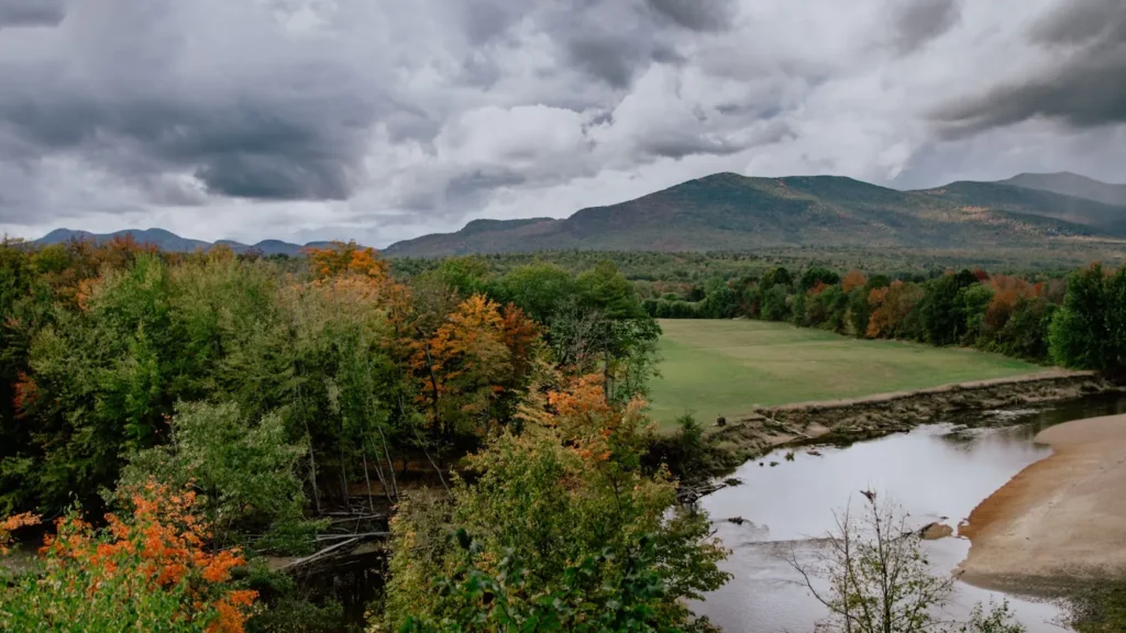
The photo at the top of this page is not Contoocook River.
It is a regional stand-in, honestly captioned but generic — we will not put a name to a river we cannot prove. Send us a photograph you took here and it replaces the stand-in, with your credit on it.
Add a photo of this water
Landscape, not fish — the water itself. Reviewed by hand before it appears. The first one published here earns the Pioneer badge.
Fished this water? Add a photo
Reviewed by hand before it appears. Pick the water, not the spot — we never publish exact locations.
Access
Peterborough town access at the USGS gauge - the upper-river flow reference and easy wade access.
Noone Falls and Peterborough village pullouts - short walk-in access to the ledge water.
Bennington and Antrim river accesses - middle-river wading and canoe launch points.
Hillsborough town access - the transition point from trout water to warmwater river.
Henniker river accesses - lower-river hand launch for smallmouth floats.
Contoocook village landing in Hopkinton - trailer and hand launch on the lower flats.
Jaffrey and Rindge headwater brooks - wild brook trout wading on the tributaries.
Seasons
Spring: stocking runs through April and May and the upper river fishes best of the year as flows drop off snowmelt.
Summer: the upper river warms and drops; fish the tributary mouths early or float the lower river for smallmouth.
Fall: cooling water in late September and October brings holdover trout back into the runs.
Winter: mostly closed or iced on the flats, with limited open-water access on the upper river.
From the water
No logged trips yet. Be the first to put this water on your map.
Log this water
Fished it or cleaned it? Log in or create a free account to log a trip with photos and earn the waterway badge.
Questions
What is the current flow on the Contoocook River?
As of Nov 2, 7:30 am, the USGS gauge CONTOOCOOK RIVER AT PETERBOROUGH, NH reads 30 cfs. Conditions update every 15 minutes.
What species can you catch on the Contoocook River?
Anglers target Brook Trout, Brown Trout, Chain Pickerel, Fallfish, Largemouth Bass, Rainbow Trout, Smallmouth Bass, Yellow Perch on the Contoocook River in New Hampshire.
Where can you access the Contoocook River?
Peterborough town access at the USGS gauge - the upper-river flow reference and easy wade access. Noone Falls and Peterborough village pullouts - short walk-in access to the ledge water. Bennington and Antrim river accesses - middle-river wading and canoe launch points. Hillsborough town access - the transition point from trout water to warmwater river. Henniker river accesses - lower-river hand launch for smallmouth floats. Contoocook village landing in Hopkinton - trailer and hand launch on the lower flats. Jaffrey and Rindge headwater brooks - wild brook trout wading on the tributaries.
When is the best time to fish the Contoocook River?
Spring: stocking runs through April and May and the upper river fishes best of the year as flows drop off snowmelt. Summer: the upper river warms and drops; fish the tributary mouths early or float the lower river for smallmouth. Fall: cooling water in late September and October brings holdover trout back into the runs. Winter: mostly closed or iced on the flats, with limited open-water access on the upper river.
Where are the fishing regulations for the Contoocook River?
Regulations change by season and section. Read the current rules on the New Hampshire agency site: https://www.wildlife.nh.gov/laws-and-rules