Smith River Fishing Guides
California's last major undammed river, a jade-green coastal freestone in the redwoods that produces the largest wild winter steelhead in the state.
Guides on the Smith River
Claimed profiles take booking requests. Unclaimed profiles are built from public records so the river is never empty; the guide can claim or remove one any time.
About the Smith River
The Smith is the largest completely undammed river left in California, and that single fact explains most of what a visitor will notice about it. There is no reservoir upstream to store sediment, no release schedule to smooth the hydrograph, and no summer augmentation. The river rises and falls entirely on rainfall, drains six hundred and fourteen square miles of steep, largely protected country in the Six Rivers National Forest, and clears faster after a storm than almost any river of its size anywhere. The gauge near Crescent City reports discharge and stage but carries no live water temperature series, so flow is the number that governs planning here.
What the Smith is known for is wild winter steelhead, and specifically large ones. The river has a long-standing reputation for producing fish in the high teens and twenties, all of them wild, in a season that runs from roughly late December through March. Fall chinook precede them, entering on the first serious rains of autumn and providing a heavy, short, weather-dependent fishery. Coho are present and fully protected. Coastal cutthroat occupy the lower river and the tidewater reach.
Guided fishing is overwhelmingly done from drift boats, and the reason is the water itself. The Smith runs through bedrock gorge and boulder gardens with limited bank access between formal put-ins, and the classic day is a float on one of the three forks or the mainstem. Because the river drops so quickly, guides watch the gauge hour by hour and will move an entire trip upstream or downstream overnight.
The practical rule is that the Smith is unfishable at high water and superb two days later. Learning to read the falling limb of the hydrograph, rather than booking a fixed date, is how people fish this river well.
This water needs a real photo
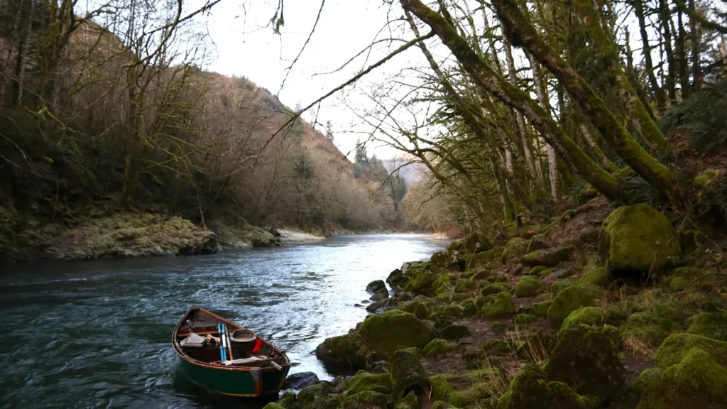
The photo at the top of this page is not Smith River.
It is a regional stand-in, honestly captioned but generic — we will not put a name to a river we cannot prove. Send us a photograph you took here and it replaces the stand-in, with your credit on it.
Add a photo of this water
Landscape, not fish — the water itself. Reviewed by hand before it appears. The first one published here earns the Pioneer badge.
Fished this water? Add a photo
Reviewed by hand before it appears. Pick the water, not the spot — we never publish exact locations.
Access
Jedediah Smith Redwoods State Park - mainstem access, campground and the most photographed water on the river.
Hiouchi and the Highway 199 corridor - roadside pullouts and the standard mainstem put-ins.
Middle Fork at Patrick Creek - upper drift water in the national forest.
South Fork Road - access to the largest and most remote of the three forks.
North Fork near Gasquet - steep bedrock water that clears first after a storm.
Ruby Van Deventer County Park - lower river bank access and a takeout.
Tidewater below Highway 101 near Crescent City - cutthroat and fresh-run fish at the estuary.
Seasons
Spring: late wild steelhead through March, then the river quiets and turns very low and clear.
Summer: minimal fishing, warm and low; the river is used mostly for swimming and redwood tourism.
Fall: the first rains bring chinook into the lower river and the season effectively restarts.
Winter: the main event, with large wild steelhead and a river that swings from blown out to perfect in two days.
From the water
No logged trips yet. Be the first to put this water on your map.
Log this water
Fished it or cleaned it? Log in or create a free account to log a trip with photos and earn the waterway badge.
Questions
What is the current flow on the Smith River?
As of Oct 22, 6:45 am, the USGS gauge SMITH R NR CRESCENT CITY CA reads 197 cfs. Conditions update every 15 minutes.
What species can you catch on the Smith River?
Anglers target Chinook Salmon, Coastal Cutthroat Trout, Coho Salmon, Rainbow Trout, Steelhead on the Smith River in California.
Are there fishing guides on the Smith River?
GuidedFloats lists 3 guides and outfitters on the Smith River. Claimed profiles accept booking requests; unclaimed profiles are built from public records and link to the business.
Where can you access the Smith River?
Jedediah Smith Redwoods State Park - mainstem access, campground and the most photographed water on the river. Hiouchi and the Highway 199 corridor - roadside pullouts and the standard mainstem put-ins. Middle Fork at Patrick Creek - upper drift water in the national forest. South Fork Road - access to the largest and most remote of the three forks. North Fork near Gasquet - steep bedrock water that clears first after a storm. Ruby Van Deventer County Park - lower river bank access and a takeout. Tidewater below Highway 101 near Crescent City - cutthroat and fresh-run fish at the estuary.
When is the best time to fish the Smith River?
Spring: late wild steelhead through March, then the river quiets and turns very low and clear. Summer: minimal fishing, warm and low; the river is used mostly for swimming and redwood tourism. Fall: the first rains bring chinook into the lower river and the season effectively restarts. Winter: the main event, with large wild steelhead and a river that swings from blown out to perfect in two days.
Where are the fishing regulations for the Smith River?
Regulations change by season and section. Read the current rules on the California agency site: https://wildlife.ca.gov/Fishing/Inland/Regulations