Fishes Blanco River
River · Hays and Blanco counties in the eastern Texas Hill Country, between Wimberley, Kyle and San Marcos · Texas
Blanco River Fishing Guides
A short, spring-fed Hill Country river through Wimberley and Kyle that offers some of the most accessible Guadalupe bass wade fishing anywhere in Texas.
Map of the Blanco River
30 numbered points: 4 campsites, 1 outfitter, 16 bridges, 4 parks and conservation areas, 4 hazards, 1 USGS gauge. Tap a marker for details. Reviewed Oct 21, 2026.
- Campsite (4)
- Outfitter / canoe rental (1)
- Bridge crossing (16)
- Park / conservation area (4)
- Dam / hazard (4)
- USGS gauge (1)
Map data © OpenStreetMap contributors. Points are curated from OpenStreetMap and state agency sources; confirm access and hours before you go.
Print it. Bag it. Bring it.Phones die, screens crack, and most of this water has no signal. Print this map, fold it into a zip-top bag or dry bag with your license, and you have a backup your electronics can’t give you. Every marker is numbered so you can say exactly where you are.
Open the printable mapAll 30 points on this map
| # | Point | Type | Lat, Lon | Notes |
|---|---|---|---|---|
| 1 | Crabapple Road bridge CR 104, upper Blanco | Bridge crossing | 30.10212, -98.51191 | First public crossing on the upper river. Everything above here is private ranchland with no mapped access. |
| 2 | Wayne Smith Dam Above Blanco | Dam / hazard | 30.09993, -98.44327 | Weir above town. Portage. |
| 3 | Blanco City Dam Number 1 Blanco | Dam / hazard | 30.09287, -98.43094 | The upper of the dams that pool the river through Blanco State Park. Portage. |
| 4 | Kendalia Road bridge CR 102 | Bridge crossing | 30.09263, -98.43048 | Crossing at the head of the park reach. |
| 5 | Park Road 23 low-water crossing PR 23, Blanco State Park | Bridge crossing | 30.09123, -98.42415 | Low-water crossing inside the park; impassable and dangerous when the river is up. |
| 6 | Blanco State Park Texas Parks and Wildlife Department | Park / conservation area | 30.09306, -98.42386 | TPWD park on both banks through town, the one reliably public stretch of the Blanco: camping, day use and the dam-pooled reach. Point placed on the park headquarters. Pole-and-line only in state-park waters. |
| 7 | South US Highway 281 bridge US 281 | Bridge crossing | 30.09210, -98.42295 | |
| 8 | Chandler Street bridge Loop 163 | Bridge crossing | 30.09642, -98.41822 | |
| 9 | Ranch Road 165 bridge RM 165 | Bridge crossing | 30.09109, -98.40175 | |
| 10 | Blanco Settlement RV Park Private RV park below Blanco | Campsite | 30.09107, -98.39799 | |
| 11 | Tejas Trail bridge CR 405 | Bridge crossing | 30.09009, -98.37760 | |
| 12 | River Oaks Riverfront RV Resort Private riverfront RV resort | Campsite | 30.10375, -98.33854 | |
| 13 | Fischer Store Road bridge CR 181 | Bridge crossing | 30.00057, -98.20009 | The classic upper put-in for the Blanco's Wimberley run, and the only mapped public touch point in a 38 km stretch of private river. |
| 14 | Wayside Drive bridge | Bridge crossing | 29.96734, -98.18962 | |
| 15 | Boy Scout Dam Above Wimberley | Dam / hazard | 29.95562, -98.16918 | Low dam. Portage. |
| 16 | Blanco River Outfitters Wimberley | Outfitter / canoe rental | 29.98618, -98.11066 | Outfitter on the river at Wimberley. Named in OSM with no shop tag, so treat the hours and the shuttle range as worth a phone call. |
| 17 | Green Acres RV Park Private RV park, Wimberley | Campsite | 29.98790, -98.11015 | |
| 18 | County Road 1492 bridge CR 1492 | Bridge crossing | 29.98482, -98.10944 | |
| 19 | River Road bridge Wimberley | Bridge crossing | 29.98915, -98.10571 | |
| 20 | Wimberley RV Park Private RV park | Campsite | 29.99764, -98.08932 | Mapped in OSM as Wimberley RV Park & Mini Storage. |
| 21 | USGS 08171290 Blanco River near Kyle Stage and discharge | USGS gauge | 30.00556, -97.95250 | The gauge this float reads off, at chainage 117 km. The Blanco is flashy and loses flow to the aquifer in dry spells - read it before driving out. |
| 22 | Randall W Vetter Park Hays County | Park / conservation area | 29.94201, -97.90297 | County park on the left bank above Five Mile Dam. |
| 23 | Five Mile Dam Park Hays County | Park / conservation area | 29.94219, -97.90103 | County park either side of Five Mile Dam, the best-known public access on the lower Blanco. |
| 24 | Five Mile Dam Hays County park reach | Dam / hazard | 29.94045, -97.90163 | Weir that pools the lower river through the county park. Portage; the pool above it is the swimming reach. |
| 25 | Union Pacific Austin Subdivision bridge Railroad crossing | Bridge crossing | 29.93730, -97.89556 | |
| 26 | Post Road bridge CR 140 | Bridge crossing | 29.93726, -97.89532 | Road crossing beside the railroad bridge. |
| 27 | Interstate 35 bridges I 35 / Purple Heart Trail | Bridge crossing | 29.91255, -97.89822 | Four decks cross within about 80 m here; one marker stands for the crossing. |
| 28 | Blanco Shoals Natural Area San Marcos Greenbelt Alliance | Park / conservation area | 29.90582, -97.89747 | Greenbelt natural area on the shoals reach below Interstate 35. |
| 29 | Union Pacific Lockhart Subdivision bridge Railroad crossing | Bridge crossing | 29.88496, -97.90645 | |
| 30 | Old Martindale Road bridge CR 295 | Bridge crossing | 29.87132, -97.91564 | Last mapped crossing above the San Marcos River confluence. |
Guides on the Blanco River
Claimed profiles take booking requests. Unclaimed profiles are built from public records so the river is never empty; the guide can claim or remove one any time.
Order on this page: premium and outfitter plans first (labelled Premium placement), then claimed free profiles, then unclaimed — one published price, no bidding for position. How placement works
About the Blanco River
The Blanco is a compact river with an outsized reputation. It rises in Kendall County, runs east past Blanco and Wimberley, and joins the San Marcos River below Kyle. The bed is the same hard limestone that defines the eastern Hill Country, and the river alternates between shaded cypress pools and shallow gravel runs the whole way. Spring input keeps parts of it flowing when nearby streams are dry, but the Blanco is genuinely flashy. It can go from a clear ankle-deep run to a destructive flood in hours, as it did memorably in 2015, and then settle back within days.
For anglers that flashiness is the thing to plan around rather than fear. Under normal flow this is one of the friendliest wade fisheries in Texas. Guadalupe bass hold in the current seams below every gravel bar, largemouth sit in the deeper cypress pools, and Rio Grande cichlid and redbreast sunfish are thick enough that a beginner will stay busy all morning. A three or four weight fly rod with small poppers and crayfish patterns covers almost everything. Ultralight spinning tackle works just as well and is what most local guides hand a first-timer.
The catch is access. Nearly all of the Blanco corridor is private land, and Texas law puts the streambed in public ownership while the banks around it are not. Practically, that means anglers fish from public crossings and parks and stay in the water. Blue Hole Regional Park in Wimberley and Five Mile Dam near Kyle are the two dependable public options, and guided trips often run on private leases arranged in advance. The gauge near Kyle is the flow to check before committing to a wade.
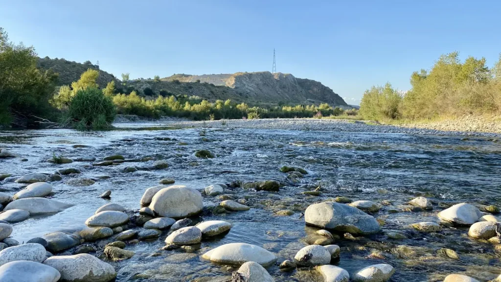
This water needs a real photo
The photo at the top of this page is not Blanco River.
It is a regional stand-in, honestly captioned but generic — we will not put a name to a river we cannot prove. Send us a photograph you took here and it replaces the stand-in, with your credit on it.
Pioneer badgeUnclaimed
Add a photo of this water
Landscape, not fish — the water itself. Reviewed by hand before it appears. The first one published here earns the Pioneer badge.
Fished this water? Add a photo
Reviewed by hand before it appears. Pick the water, not the spot — we never publish exact locations.
Access
Blue Hole Regional Park in Wimberley - the best-known public access, with cypress pools and a swimming reach.
Five Mile Dam Park near Kyle - county park with river frontage and reliable year-round water.
Ranch Road 12 crossing at Wimberley - roadside access to the wadable gravel runs above town.
Seven A Ranch and the Wimberley low-water crossings - limited public frontage, best at moderate flow.
Halifax Ranch gauge crossing near Kyle - the reference gauge site and nearby public streambed access.
Blanco State Park in Blanco - upper-river state park with bank fishing and a stocked winter trout reach.
San Marcos confluence below Kyle - the bottom of the river and a common kayak take-out.
Seasons
Spring: strongest flows of the year, excellent wading, and Guadalupe bass on the gravel runs.
Summer: warm and low, early mornings and the deeper cypress pools hold the fish worth chasing.
Fall: flows steady after autumn rain and the river fishes cleanly with very little pressure.
Winter: clear and cold, slow warmwater fishing, but Blanco State Park carries stocked trout upstream.
From the water
No logged trips yet. Be the first to put this water on your map.
Log this water
Fished it or cleaned it? Log in or create a free account to log a trip with photos and earn the waterway badge.
Questions
What is the current flow on the Blanco River?
As of Nov 2, 7:30 am, the USGS gauge Blanco Rv at Halifax Rch nr Kyle, TX reads 10 cfs. Conditions update every 15 minutes.
What species can you catch on the Blanco River?
Anglers target Bluegill, Channel Catfish, Guadalupe Bass, Largemouth Bass, Redbreast Sunfish, Rio Grande Cichlid on the Blanco River in Texas.
Are there fishing guides on the Blanco River?
GuidedFloats lists 1 guide and outfitters on the Blanco River. Claimed profiles accept booking requests; unclaimed profiles are built from public records and link to the business.
Where can you access the Blanco River?
Blue Hole Regional Park in Wimberley - the best-known public access, with cypress pools and a swimming reach. Five Mile Dam Park near Kyle - county park with river frontage and reliable year-round water. Ranch Road 12 crossing at Wimberley - roadside access to the wadable gravel runs above town. Seven A Ranch and the Wimberley low-water crossings - limited public frontage, best at moderate flow. Halifax Ranch gauge crossing near Kyle - the reference gauge site and nearby public streambed access. Blanco State Park in Blanco - upper-river state park with bank fishing and a stocked winter trout r...
When is the best time to fish the Blanco River?
Spring: strongest flows of the year, excellent wading, and Guadalupe bass on the gravel runs. Summer: warm and low, early mornings and the deeper cypress pools hold the fish worth chasing. Fall: flows steady after autumn rain and the river fishes cleanly with very little pressure. Winter: clear and cold, slow warmwater fishing, but Blanco State Park carries stocked trout upstream.
Where are the fishing regulations for the Blanco River?
Regulations change by season and section. Read the current rules on the Texas agency site: https://tpwd.texas.gov/regulations/outdoor-annual/fishing