Scott River Fishing Guides
A Klamath tributary out of Scott Valley whose lower canyon is a classic winter steelhead run, tightly regulated and entirely flow dependent.
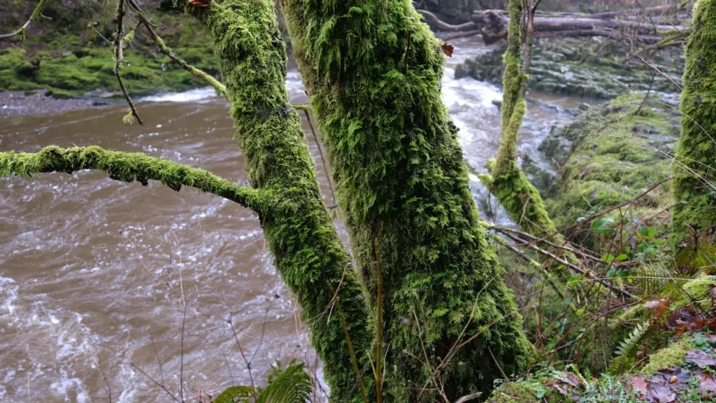
Guides on the Scott River
Claimed profiles take booking requests. Unclaimed profiles are built from public records so the river is never empty; the guide can claim or remove one any time.
No guides listed yet
Guide or outfit this water? Create your profile. Listing is free, the commission is 10% or 7% with a premium profile, and premium profiles list first on this water.
About the Scott River
The Scott River gathers in Scott Valley, a broad agricultural basin under the Marble Mountains in Siskiyou County, then turns north and cuts a granite canyon for its last twenty-odd miles to meet the Klamath at Scott Bar. Those two halves could hardly be less alike. The valley reach is a slow meadow river running between hay ground and irrigation diversions; the canyon below Fort Jones is a boulder-and-bedrock river with real gradient, deep green tailouts and the kind of holding water that winter steelhead use. Almost all of the angling reputation belongs to the canyon.
It is a steelhead river first. Winter fish enter from the Klamath when flows come up, and the run has always been weather-dependent rather than calendar-dependent, which is the single most important thing to understand about fishing here. Fall-run chinook use the lower river, and the Scott carries one of the more significant remaining coho populations in the Klamath basin, which is precisely why the regulations on this water are strict, specific and revised often. Resident rainbows hold through the canyon year-round. Anglers should read the current California regulations for this drainage before every trip rather than relying on last season’s memory, because closures, gear restrictions and low-flow shutdowns are all live possibilities here.
The gauge near Fort Jones sits at the head of the canyon and it is the whole planning tool. Summer and early fall flows drop very low, partly through natural recession and partly through valley irrigation demand, and the river can effectively close itself to fish passage. What steelhead anglers actually watch for is the winter freshet: a storm that lifts the gauge sharply and then drops it into a fishable window as the color clears. There is no temperature sensor at this site, so the trace answers whether fish can move and whether the river is wadeable, and nothing more.
This water needs a real photo
The photo at the top of this page is not Scott River.
It is a regional stand-in, honestly captioned but generic — we will not put a name to a river we cannot prove. Send us a photograph you took here and it replaces the stand-in, with your credit on it.
Add a photo of this water
Landscape, not fish — the water itself. Reviewed by hand before it appears. The first one published here earns the Pioneer badge.
Fished this water? Add a photo
Reviewed by hand before it appears. Pick the water, not the spot — we never publish exact locations.
Access
Scott River Road below Fort Jones - the main paved access following the canyon reach.
Scott Bar - the lowest access, near the confluence with the Klamath.
Jones Beach river access - a well-known walk-in run in the lower canyon.
Kelsey Creek confluence - roadside pullout access to good holding water.
Fort Jones highway crossing - the closest bank access to the gauge.
Callahan area crossings - upper valley access to the meadow reach.
Klamath National Forest pullouts along Scott River Road - dispersed walk-in access through the canyon.
Seasons
Spring: dropping snowmelt with resident rainbows fishing well once the river clears.
Summer: very low and warm, often restricted or closed, and not the season to plan a trip around.
Fall: chinook enter the lower river and the first steelhead arrive with autumn rain.
Winter: the main steelhead season, entirely dependent on catching the drop after a storm.
From the water
No logged trips yet. Be the first to put this water on your map.
Log this water
Fished it or cleaned it? Log in or create a free account to log a trip with photos and earn the waterway badge.
Questions
What is the current flow on the Scott River?
As of Sep 17, 6:30 am, the USGS gauge SCOTT R NR FORT JONES CA reads 8 cfs. Conditions update every 15 minutes.
What species can you catch on the Scott River?
Anglers target Brown Trout, Chinook Salmon, Coastal Cutthroat Trout, Coho Salmon, Rainbow Trout, Steelhead on the Scott River in California.
Where can you access the Scott River?
Scott River Road below Fort Jones - the main paved access following the canyon reach. Scott Bar - the lowest access, near the confluence with the Klamath. Jones Beach river access - a well-known walk-in run in the lower canyon. Kelsey Creek confluence - roadside pullout access to good holding water. Fort Jones highway crossing - the closest bank access to the gauge. Callahan area crossings - upper valley access to the meadow reach. Klamath National Forest pullouts along Scott River Road - dispersed walk-in access through the canyon.
When is the best time to fish the Scott River?
Spring: dropping snowmelt with resident rainbows fishing well once the river clears. Summer: very low and warm, often restricted or closed, and not the season to plan a trip around. Fall: chinook enter the lower river and the first steelhead arrive with autumn rain. Winter: the main steelhead season, entirely dependent on catching the drop after a storm.
Where are the fishing regulations for the Scott River?
Regulations change by season and section. Read the current rules on the California agency site: https://wildlife.ca.gov/Regulations