North Saluda River Fishing Guides
A cold escarpment tailwater below North Saluda Reservoir, holding trout through the summer in a part of the state that mostly cannot.
Guides on the North Saluda River
Claimed profiles take booking requests. Unclaimed profiles are built from public records so the river is never empty; the guide can claim or remove one any time.
No guides listed yet
Guide or outfit this water? Create your profile. Listing is free, the commission is 10% or 7% with a premium profile, and premium profiles list first on this water.
About the North Saluda River
The North Saluda River falls off the Blue Ridge escarpment in northern Greenville County and is impounded by North Saluda Reservoir, a Greenville water supply lake, before continuing south toward Slater-Marietta and its confluence with the main Saluda. The gauge sits immediately below the reservoir, and its station name records the arrangement plainly. What comes out of the dam is water drawn from a deep, cold mountain impoundment, and that is what makes this reach worth fishing.
South Carolina has very little water that holds trout through a full summer, and almost all of it is either high in the mountains or below a dam. This reach is the second kind. Release water stays cold enough well into the warm months to keep brown and rainbow trout alive and feeding below the dam, in a valley where the ambient streams would be too warm by July. Brook trout are present in the higher tributary water above the reservoir, and smallmouth bass appear downstream where the river warms toward the Saluda.
The gauge reports water temperature alongside stage and discharge, which on a tailwater is the number that actually decides the day. A release keeps the reach cold and the fish active; a long period without one lets the water below warm and the fishing fall off. Checking temperature and flow together before driving up is the standard practice on water like this and the record here supports it.
Access requires some care. The reservoir itself is a protected municipal watershed with restricted entry, so fishing here means the river below the dam and the public water downstream rather than the lake. Slater-Marietta is the nearest town, US 25 is the main approach from Greenville, and the surrounding escarpment holds several state parks and preserves that provide the practical parking and trail access for the area.
This water needs a real photo
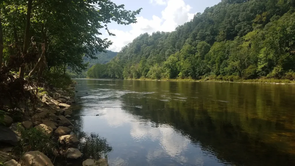
The photo at the top of this page is not North Saluda River.
It is a regional stand-in, honestly captioned but generic — we will not put a name to a river we cannot prove. Send us a photograph you took here and it replaces the stand-in, with your credit on it.
Add a photo of this water
Landscape, not fish — the water itself. Reviewed by hand before it appears. The first one published here earns the Pioneer badge.
Fished this water? Add a photo
Reviewed by hand before it appears. Pick the water, not the spot — we never publish exact locations.
Access
Slater-Marietta - the nearest town and the main approach to the tailwater reach.
Below North Saluda Dam - the gauge reach and the coldest water in the system.
US 25 corridor - the primary road approach north from Greenville.
Saluda River confluence - the downstream end where the fork joins the main river.
Jones Gap State Park - escarpment access on the neighboring Middle Saluda drainage.
Caesars Head State Park - high-country access above the reservoir watershed.
Travelers Rest - the nearest supply town south of the tailwater.
Seasons
Spring: consistent releases and cool water make this the most reliable season of the year.
Summer: the reach stays fishable on release water while nearby streams run too warm.
Fall: cooling air and steady flows bring the trout back on through October and November.
Winter: cold and quiet, with fishing possible whenever the reservoir is releasing.
From the water
No logged trips yet. Be the first to put this water on your map.
Log this water
Fished it or cleaned it? Log in or create a free account to log a trip with photos and earn the waterway badge.
Questions
What is the current flow on the North Saluda River?
As of Sep 17, 5:45 am, the USGS gauge N. SALUDA RIVER BL N. SALUDA RES. ABOVE SLATER, SC reads 6 cfs, with water temperature 56.5 F. Conditions update every 15 minutes.
What species can you catch on the North Saluda River?
Anglers target Brook Trout, Brown Trout, Rainbow Trout, Smallmouth Bass on the North Saluda River in South Carolina.
Where can you access the North Saluda River?
Slater-Marietta - the nearest town and the main approach to the tailwater reach. Below North Saluda Dam - the gauge reach and the coldest water in the system. US 25 corridor - the primary road approach north from Greenville. Saluda River confluence - the downstream end where the fork joins the main river. Jones Gap State Park - escarpment access on the neighboring Middle Saluda drainage. Caesars Head State Park - high-country access above the reservoir watershed. Travelers Rest - the nearest supply town south of the tailwater.
When is the best time to fish the North Saluda River?
Spring: consistent releases and cool water make this the most reliable season of the year. Summer: the reach stays fishable on release water while nearby streams run too warm. Fall: cooling air and steady flows bring the trout back on through October and November. Winter: cold and quiet, with fishing possible whenever the reservoir is releasing.
Where are the fishing regulations for the North Saluda River?
Regulations change by season and section. Read the current rules on the South Carolina agency site: https://www.dnr.sc.gov/regulations.html