Fishing Creek Fishing Guides
Big Fishing Creek, the Clinton County limestoner that holds Fisherman's Paradise and some of the most technical wild brown trout water in Pennsylvania.
Map of the Fishing Creek
30 numbered points: 1 access point, 15 bridges, 5 parks and conservation areas, 1 agency office, 4 regulation section limits, 1 hazard, 1 spring, 1 USGS gauge, 1 point of interest. Tap a marker for details. Reviewed Sep 18, 2026.
- Access / boat ramp (1)
- Bridge crossing (15)
- Park / conservation area (5)
- Agency / conservation office (1)
- Regulation section limit (4)
- Dam / hazard (1)
- Spring (1)
- USGS gauge (1)
- Point of interest (1)
Print it. Bag it. Bring it.Phones die, screens crack, and most of this water has no signal. Print this map, fold it into a zip-top bag or dry bag with your license, and you have a backup your electronics can’t give you. Every marker is numbered so you can say exactly where you are.
Open the printable mapAll 30 points on this map
| # | Point | Type | Lat, Lon | Notes |
|---|---|---|---|---|
| 1 | PA 880 bridge at Tylersville West Valley Road · top of the mapped reach | Bridge crossing | 40.99369, -77.41987 | Uppermost crossing on this sheet. The chained OSM centreline used for the numbering starts here, at the Tylersville hamlet; above it the creek is small headwater flow in Sugar Valley. |
| 2 | Summer Mountain Road bridge T349 · Fishing Creek Narrows | Bridge crossing | 40.98293, -77.46220 | The only public crossing inside the upper Narrows, where the creek leaves Sugar Valley through the gap in Nittany Mountain. Roadside parking is limited to the shoulder. |
| 3 | Catch and Release Artificial Lures Only section — upper limit PFBC Clinton County section 7 · river mile 18.79 | Regulation section limit | 40.98323, -77.47053 | Upper boundary of the PFBC special-regulation reach, about 5.25 miles long. It falls at the Vermeil Lane bridge, 0.03 km from the mapped limit. Boundary only — read the current PFBC summary for what applies. |
| 4 | USGS gauge 01548030 — Fishing Creek near Lamar Real-time stage and discharge | USGS gauge | 40.98047, -77.48278 | The gauge sits at the Narrows Road (SR 2002) bridge, inside the catch-and-release reach, so its reading is the one that matters for the whole Narrows. |
| 5 | Streamside fishing access (unnamed) Tagged in OSM as a fishing spot · Narrows reach | Access / boat ramp | 40.98759, -77.50001 | The only mapped streamside access in the six kilometres between the gauge and the lower Narrows Road bridge. Unnamed in OSM and not a PFBC access area, so treat it as a pull-off rather than a developed launch. |
| 6 | Narrows Road bridge (lower Narrows) Unnumbered township crossing | Bridge crossing | 40.99615, -77.52831 | Lower of the two Narrows Road crossings, where the gorge road returns to the creek above the fishery centre. |
| 7 | Weir below the Narrows Low head structure · unnamed in OSM | Dam / hazard | 40.99876, -77.52986 | A low weir across the full channel a third of a kilometre above the Northeast Fishery Center intake. Wade around it; it is not runnable. |
| 8 | Steel Spring Named limestone spring on the north bank | Spring | 41.00062, -77.53388 | One of the cold limestone springs along the Lamar reach that hold the creek temperature through summer. |
| 9 | Northeast Fishery Center U.S. Fish and Wildlife Service · Lamar | Agency / conservation office | 41.00253, -77.53438 | Federal hatchery and fish-health centre on the creek at Lamar; its raceways are the aquaculture ground you see from Furnace Road. |
| 10 | Catch and Release Artificial Lures Only section — lower limit PFBC Clinton County section 9 · river mile 13.54 | Regulation section limit | 41.00689, -77.53377 | Lower boundary of the same PFBC special-regulation reach, just above the Furnace Road bridge at Lamar. Boundary only. |
| 11 | Furnace Road bridge Lamar · below the special-regulation reach | Bridge crossing | 41.00713, -77.53394 | First crossing below the catch-and-release water and the usual parking for the bottom end of it. |
| 12 | Porter Township Park Porter Township · sunrise to sunset | Park / conservation area | 41.00977, -77.53794 | Township park on the left bank at Lamar with parking and a mown bank; the OSM camping polygon inside it is unnamed and was not shipped as a separate point. |
| 13 | PA 64 bridge at Lamar Nittany Valley Drive | Bridge crossing | 41.01157, -77.53726 | Main highway crossing at Lamar, the easiest orientation point on the middle creek and the exit from I-80. |
| 14 | Clintondale Park Village park on the right bank | Park / conservation area | 41.01564, -77.52351 | Small village park with off-street parking, the practical access for the reach below Lamar. |
| 15 | Fishing Creek Road bridge at Clintondale Township crossing | Bridge crossing | 41.01613, -77.52111 | Crossing at the foot of Clintondale Park. |
| 16 | Fishing Creek Road bridge below Clintondale Rural crossing above I-80 | Bridge crossing | 41.03426, -77.48590 | The single mapped crossing in the four kilometres between Clintondale and the interstate; the road follows the left bank through this reach. |
| 17 | I-80 and US 220 bridge Z. H. Confair Memorial Highway | Bridge crossing | 41.03761, -77.47987 | Interstate crossing. No access from the highway; it is an orientation mark between the Clintondale and Mackeyville reaches. |
| 18 | Rag Valley Road bridge T354 | Bridge crossing | 41.04902, -77.46499 | Township crossing above Mackeyville. |
| 19 | Main Street bridge at Mackeyville Village crossing | Bridge crossing | 41.05450, -77.46131 | Village crossing at Mackeyville, with the post office and store a block away. |
| 20 | Belles Springs Park Clinton County Recreation Authority | Park / conservation area | 41.06456, -77.46348 | County park on the creek near Mackeyville, with parking; the golf course beside it is separate ground. |
| 21 | Mackeyville Road bridge Lower Mackeyville crossing | Bridge crossing | 41.07520, -77.47775 | Lowest of the several Mackeyville Road crossings, immediately above the trout special-regulation water. |
| 22 | Trout special-regulation section — upper limit PFBC Clinton County sections 13 and 14 · river mile 3.76 | Regulation section limit | 41.08211, -77.47840 | Upper boundary of the 3.1-mile PFBC special-regulation reach on the lower creek; it falls at the Island Road (T322) bridge, 0.01 km from the mapped limit. Boundary only. |
| 23 | US 220 bridge Frank D O'Reilly Jr Highway | Bridge crossing | 41.08420, -77.47302 | Four-lane crossing inside the lower special-regulation water. |
| 24 | PA 477 bridge Long Run Road | Bridge crossing | 41.08552, -77.47064 | State-route crossing 250 m below the US 220 bridge; the pair bracket the head of the Mill Hall reach. |
| 25 | Main Street bridge at Mill Hall SR 2016 | Bridge crossing | 41.10172, -77.48452 | Borough crossing at Mill Hall, the last town on the creek. |
| 26 | Mill Hall Park Borough park on the left bank | Park / conservation area | 41.11152, -77.48549 | Borough park with parking and the community pool beside it; the creek bank here is open and mown. |
| 27 | PA 150 bridge Hogan Boulevard | Bridge crossing | 41.11318, -77.48716 | The last numbered-route crossing above the mouth. |
| 28 | Bald Eagle Township Park Township park below Mill Hall | Park / conservation area | 41.11408, -77.48710 | Township park on the right bank, the last easy access before the confluence. |
| 29 | Trout special-regulation section — lower limit PFBC Clinton County section 14 · river mile 0.66 | Regulation section limit | 41.11502, -77.48663 | Lower boundary of the same reach, at the Country Club Lane bridge below Mill Hall. Boundary only. |
| 30 | Mouth at Bald Eagle Creek Confluence · Flemington | Point of interest | 41.12262, -77.48275 | Fishing Creek ends here in Bald Eagle Creek, two kilometres above the West Branch Susquehanna at Lock Haven. |
Guides on the Fishing Creek
Claimed profiles take booking requests. Unclaimed profiles are built from public records so the river is never empty; the guide can claim or remove one any time.
Order on this page: premium and outfitter plans first (labelled Premium placement), then claimed free profiles, then unclaimed — one published price, no bidding for position. How placement works
About the Fishing Creek
Fishing Creek in Clinton County, known locally as Big Fishing Creek to distinguish it from the several other Pennsylvania streams of the same name, is one of the state’s genuine limestone streams. It rises in the Sugar Valley, gathers substantial spring input as it crosses the limestone belt, and runs northeast past Lamar and Mill Hall to the Bald Eagle Creek. The gauge near Lamar drains about fifty-six square miles and sits at the head of the best known water.
The spring input is what gives the creek its character. Temperatures stay moderate through both summer heat and winter cold, the water is alkaline and productive, and the insect life is dense and predictable in a way freestone streams cannot match. Sulphurs, blue-winged olives, tricos and a heavy green drake emergence in late spring carry the season, and the creek fishes for most of the calendar rather than for a few good weeks.
The trout are the draw and the difficulty. Wild brown trout dominate, holding tight to weed beds, undercuts and the seams beside the limestone ledges, and they see enough anglers that they are as selective as any fish in the state. Long leaders, fine tippet and a low profile are standard equipment. Rainbows and a few brook trout are present, particularly in the upper reaches and the colder tributaries.
The creek’s most famous reach is Fisherman’s Paradise, a heritage stretch near Bellefonte managed under restrictive tackle rules for over ninety years and among the oldest special-regulation water in the country. Several other sections carry catch and release or delayed harvest designations, and the rules change from reach to reach, so checking the current regulations against the posted boundaries before stringing a rod is not optional here.
This water needs a real photo
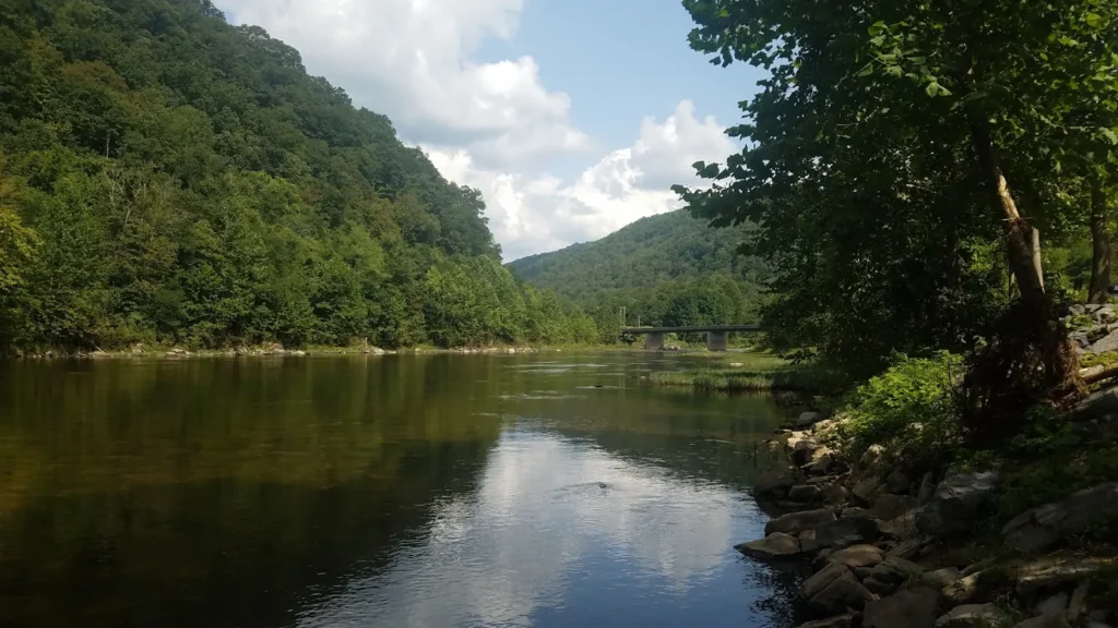
The photo at the top of this page is not Fishing Creek.
It is a regional stand-in, honestly captioned but generic — we will not put a name to a river we cannot prove. Send us a photograph you took here and it replaces the stand-in, with your credit on it.
Add a photo of this water
Landscape, not fish — the water itself. Reviewed by hand before it appears. The first one published here earns the Pioneer badge.
Fished this water? Add a photo
Reviewed by hand before it appears. Pick the water, not the spot — we never publish exact locations.
Access
Lamar - the gauge reach, with the fish culture station and public access nearby.
Fisherman's Paradise - the historic heritage water, with parking and a marked boundary.
Mill Hall - the lower creek near the Bald Eagle confluence, with road access.
Sugar Valley - the upper creek, smaller water reached from valley township roads.
Tylersville - a spring-fed upper reach near the state fish hatchery.
Cedar Run - a cold tributary joining the middle creek with walk-in access.
Bald Eagle Creek confluence - the downstream end below Mill Hall.
Seasons
Spring: the strongest season, with sulphurs, olives and the green drake emergence in late May.
Summer: spring input keeps water temperatures workable, with tricos and terrestrials the mainstay.
Fall: blue-winged olives on grey days and brown trout coloring up before the spawn.
Winter: fishable throughout thanks to the spring flow, with midges and small nymphs.
From the water
No logged trips yet. Be the first to put this water on your map.
Log this water
Fished it or cleaned it? Log in or create a free account to log a trip with photos and earn the waterway badge.
Questions
What is the current flow on the Fishing Creek?
As of Nov 2, 7:30 am, the USGS gauge Fishing Creek near Lamar, PA reads 56 cfs, with water temperature 50 F. Conditions update every 15 minutes.
What species can you catch on the Fishing Creek?
Anglers target Brook Trout, Brown Trout, Rainbow Trout on the Fishing Creek in Pennsylvania.
Are there fishing guides on the Fishing Creek?
GuidedFloats lists 1 guide and outfitters on the Fishing Creek. Claimed profiles accept booking requests; unclaimed profiles are built from public records and link to the business.
Where can you access the Fishing Creek?
Lamar - the gauge reach, with the fish culture station and public access nearby. Fisherman's Paradise - the historic heritage water, with parking and a marked boundary. Mill Hall - the lower creek near the Bald Eagle confluence, with road access. Sugar Valley - the upper creek, smaller water reached from valley township roads. Tylersville - a spring-fed upper reach near the state fish hatchery. Cedar Run - a cold tributary joining the middle creek with walk-in access. Bald Eagle Creek confluence - the downstream end below Mill Hall.
When is the best time to fish the Fishing Creek?
Spring: the strongest season, with sulphurs, olives and the green drake emergence in late May. Summer: spring input keeps water temperatures workable, with tricos and terrestrials the mainstay. Fall: blue-winged olives on grey days and brown trout coloring up before the spawn. Winter: fishable throughout thanks to the spring flow, with midges and small nymphs.
Where are the fishing regulations for the Fishing Creek?
Regulations change by season and section. Read the current rules on the Pennsylvania agency site: https://www.pa.gov/agencies/fishandboat/fishing/regulations