Fishes Kinnickinnic River
Spring creek · Western Wisconsin, Pierce and St. Croix counties, the limestone valley through River Falls to the St. Croix River · Wisconsin
Kinnickinnic River Fishing Guides
The Kinni, a spring fed limestone river through River Falls holding one of the densest wild brown trout populations in the Midwest.
Map of the Kinnickinnic River
26 numbered points: 13 bridges, 9 parks and conservation areas, 1 agency office, 2 hazards, 1 USGS gauge. Tap a marker for details. Reviewed Sep 25, 2026.
- Bridge crossing (13)
- Park / conservation area (9)
- Agency / conservation office (1)
- Dam / hazard (2)
- USGS gauge (1)
Map data © OpenStreetMap contributors. Points are curated from OpenStreetMap and state agency sources; confirm access and hours before you go.
Print it. Bag it. Bring it.Phones die, screens crack, and most of this water has no signal. Print this map, fold it into a zip-top bag or dry bag with your license, and you have a backup your electronics can’t give you. Every marker is numbered so you can say exactly where you are.
Open the printable mapAll 26 points on this map
| # | Point | Type | Lat, Lon | Notes |
|---|---|---|---|---|
| 1 | County Highway TT Road crossing | Bridge crossing | 44.97818, -92.51133 | Uppermost crossing on the headwater reach north-east of River Falls. |
| 2 | Trumpeter Swan Preserve Nature reserve · headwaters | Park / conservation area | 44.96120, -92.50717 | Wooded preserve on the spring headwaters, 0.08 km from the river. |
| 3 | Headwaters of the Kinnickinnic Fish and Wildlife Area Wisconsin DNR · headwaters | Park / conservation area | 44.95465, -92.50468 | DNR fish and wildlife area on the uppermost spring water. |
| 4 | 140th Street Road crossing | Bridge crossing | 44.95174, -92.51733 | Crossing in the headwater fishery-area reach. |
| 5 | Hanson Fishery Area Wisconsin DNR | Park / conservation area | 44.95138, -92.51750 | DNR fishery-area parcel on the upper river, public wading access. |
| 6 | Kinnickinnic River State Fishery Area Wisconsin DNR | Park / conservation area | 44.95080, -92.51797 | State fishery area on the upper river, the main block of public trout water above River Falls. |
| 7 | Steeple Drive Road crossing | Bridge crossing | 44.92289, -92.53156 | Upper-river crossing above County J. |
| 8 | County Highway J Road crossing | Bridge crossing | 44.91340, -92.53404 | Upper-river crossing. |
| 9 | Kelly Creek Preserve Nature preserve · 0.48 km from the river | Park / conservation area | 44.91040, -92.52916 | Preserve on Kelly Creek, the main cold-water tributary entering here. |
| 10 | North River Road Road crossing | Bridge crossing | 44.90135, -92.55818 | Mid-river crossing above River Falls. |
| 11 | Liberty Road Road crossing | Bridge crossing | 44.89927, -92.57858 | Mid-river crossing. |
| 12 | Quarry Road Road crossing | Bridge crossing | 44.89094, -92.59847 | Crossing on the reach above River Falls. |
| 13 | North Main Street Road crossing · River Falls | Bridge crossing | 44.87474, -92.62212 | City crossing at the head of River Falls. |
| 14 | Powell Avenue Road crossing · River Falls | Bridge crossing | 44.86991, -92.62847 | City crossing in River Falls. |
| 15 | West Division Street Road crossing · River Falls | Bridge crossing | 44.86261, -92.62454 | City crossing above the Junction Falls dam. |
| 16 | East Maple Street Road crossing · River Falls | Bridge crossing | 44.85980, -92.62645 | City crossing above the Junction Falls dam. |
| 17 | Veteran's Park City of River Falls | Park / conservation area | 44.85864, -92.62644 | City park on the river above the Junction Falls impoundment, 0.06 km from the water. |
| 18 | Winter Street Road crossing · River Falls | Bridge crossing | 44.85547, -92.63302 | City crossing beside the Junction Falls dam. |
| 19 | Junction Falls Dam City of River Falls hydro dam | Dam / hazard | 44.85524, -92.63339 | Upper River Falls dam. No through route over the structure. |
| 20 | Glen Park City of River Falls | Park / conservation area | 44.85300, -92.63465 | City park in the gorge between the two River Falls dams, 0.21 km from the water. |
| 21 | Powell Falls Dam WI dam 2WP180 · City of River Falls | Dam / hazard | 44.85096, -92.63902 | Lower River Falls dam. No through route over the structure. |
| 22 | Drewiske Family Preserve Private preserve · wooded | Park / conservation area | 44.83546, -92.69299 | Preserve on the lower river below River Falls, 0.04 km from the water. |
| 23 | USGS 05342000 · Kinnickinnic River near River Falls Live stage and discharge | USGS gauge | 44.83083, -92.73306 | Placed on the roster gauge coordinate, which falls on the centreline near the County F crossing, 0.03 km off the line. |
| 24 | County Road F Road crossing | Bridge crossing | 44.83104, -92.73332 | Lowest road crossing, at the head of the gorge above the St. Croix. |
| 25 | Kinnickinnic State Park Office Wisconsin DNR · 0.38 km from the river | Agency / conservation office | 44.83484, -92.73416 | Park office for Kinnickinnic State Park, which takes in the river mouth. |
| 26 | Kinnickinnic River Gorge and Delta State Natural Area Wisconsin DNR · river mouth | Park / conservation area | 44.82806, -92.76111 | Gorge and sand delta where the river enters the St. Croix, inside Kinnickinnic State Park. |
Guides on the Kinnickinnic River
Claimed profiles take booking requests. Unclaimed profiles are built from public records so the river is never empty; the guide can claim or remove one any time.
Order on this page: premium and outfitter plans first (labelled Premium placement), then claimed free profiles, then unclaimed — one published price, no bidding for position. How placement works
About the Kinnickinnic River
The Kinnickinnic River, called the Kinni by nearly everyone who fishes it, runs southwest through Pierce and St. Croix counties to meet the St. Croix River near Prescott. It is one of the premier trout streams in the upper Midwest and carries a wild brown trout population dense enough to be cited in fisheries literature. The city of River Falls sits on it, and the river runs through town before dropping into the gorge below.
Despite the name it fishes as a spring creek. Groundwater emerging from the limestone and sandstone of the western Wisconsin uplands supplies most of the flow, which keeps the river cold through July and open through much of the winter and gives it the stable clarity spring creeks are known for. The mineral content supports dense scud, sowbug and caddis populations, and the trout grow quickly and hold in far greater numbers per mile than the river size would suggest.
Brown trout are overwhelmingly the fish, and the population is wild and self sustaining with no meaningful stocking. Densities in the upper river are exceptional, though the average fish is modest in size, which is the trade characteristic of very productive small water. Brook trout hold in the coldest spring fed upper tributaries. The lower gorge below town holds fewer but noticeably larger fish, and it is the stretch anglers go to when they want size rather than numbers.
Access is good and varied. The river runs through public parkland in River Falls, Wisconsin maintains fishing easements along the valley, and the Kinnickinnic State Park at the confluence with the St. Croix covers the lower end. The gorge below town is rugged walking and the descent is real, which keeps pressure down there despite the quality of the fishing. The upper meadow reaches are open, easy walking and correspondingly busy.
It fishes technically. The upper river is narrow, clear and open, so the trout see anglers early and an upstream approach with fine tippet matters. Scuds and sowbugs produce year round, caddis carry the spring and early summer, and terrestrials are the summer answer in the meadow water. The gorge is bigger, faster and more forgiving, and streamers worked through the deeper runs are the way most of its larger browns are caught.
This water needs a real photo
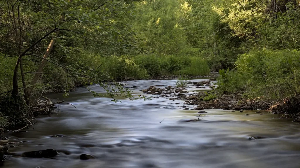
The photo at the top of this page is not Kinnickinnic River.
It is a regional stand-in, honestly captioned but generic — we will not put a name to a river we cannot prove. Send us a photograph you took here and it replaces the stand-in, with your credit on it.
Pioneer badgeUnclaimed
Add a photo of this water
Landscape, not fish — the water itself. Reviewed by hand before it appears. The first one published here earns the Pioneer badge.
Fished this water? Add a photo
Reviewed by hand before it appears. Pick the water, not the spot — we never publish exact locations.
Access
River Falls - the city on the river, with parkland frontage and full services.
Kinnickinnic State Park - the state park at the confluence with the St. Croix River.
The Kinni gorge - the rugged lower canyon below town holding the larger fish.
Wisconsin public fishing easements - the marked easements along the upper valley.
Prescott - the town at the St. Croix and Mississippi confluence below.
St. Croix River - the larger river receiving the Kinnickinnic.
Glen Park - the River Falls city park with in town access to the river.
Seasons
Spring: rising flows and the first caddis, with the river off color after snowmelt and rain.
Summer: stable cold spring flows, terrestrial fishing in the meadows and technical conditions.
Fall: cooling water, coloring browns and the best streamer fishing in the gorge.
Winter: open water at the springs and an established catch and release winter season.
From the water
No logged trips yet. Be the first to put this water on your map.
Log this water
Fished it or cleaned it? Log in or create a free account to log a trip with photos and earn the waterway badge.
Questions
What is the current flow on the Kinnickinnic River?
As of Nov 2, 7:00 am, the USGS gauge KINNICKINNIC RIVER NEAR RIVER FALLS, WI reads 93 cfs. Conditions update every 15 minutes.
What species can you catch on the Kinnickinnic River?
Anglers target Brook Trout, Brown Trout on the Kinnickinnic River in Wisconsin.
Are there fishing guides on the Kinnickinnic River?
GuidedFloats lists 1 guide and outfitters on the Kinnickinnic River. Claimed profiles accept booking requests; unclaimed profiles are built from public records and link to the business.
Where can you access the Kinnickinnic River?
River Falls - the city on the river, with parkland frontage and full services. Kinnickinnic State Park - the state park at the confluence with the St. Croix River. The Kinni gorge - the rugged lower canyon below town holding the larger fish. Wisconsin public fishing easements - the marked easements along the upper valley. Prescott - the town at the St. Croix and Mississippi confluence below. St. Croix River - the larger river receiving the Kinnickinnic. Glen Park - the River Falls city park with in town access to the river.
When is the best time to fish the Kinnickinnic River?
Spring: rising flows and the first caddis, with the river off color after snowmelt and rain. Summer: stable cold spring flows, terrestrial fishing in the meadows and technical conditions. Fall: cooling water, coloring browns and the best streamer fishing in the gorge. Winter: open water at the springs and an established catch and release winter season.
Where are the fishing regulations for the Kinnickinnic River?
Regulations change by season and section. Read the current rules on the Wisconsin agency site: https://dnr.wisconsin.gov/topic/fishing/regulations