Fishes Hebgen Lake
Lake · Southwest Montana, Gallatin County, the upper Madison River valley northwest of West Yellowstone · Montana
Hebgen Lake Fishing Guides
The Madison River impoundment above Quake Lake, famous for summer gulper fishing to cruising brown and rainbow trout sipping mayflies in flat water, with a gauge that reports lake elevation at the dam.
Map of the Hebgen Lake
17 numbered points: 5 access points, 6 campsites, 1 outfitter, 1 park or conservation area, 1 agency office, 1 hazard, 1 spring, 1 USGS gauge. Tap a marker for details. Reviewed Sep 23, 2026.
- Access / boat ramp (5)
- Campsite (6)
- Outfitter / canoe rental (1)
- Park / conservation area (1)
- Agency / conservation office (1)
- Dam / hazard (1)
- Spring (1)
- USGS gauge (1)
Map data © OpenStreetMap contributors. Points are curated from OpenStreetMap and state agency sources; confirm access and hours before you go.
Print it. Bag it. Bring it.Phones die, screens crack, and most of this water has no signal. Print this map, fold it into a zip-top bag or dry bag with your license, and you have a backup your electronics can’t give you. Every marker is numbered so you can say exactly where you are.
Open the printable mapAll 17 points on this map
| # | Point | Type | Lat, Lon | Notes |
|---|---|---|---|---|
| 1 | Hebgen Dam NorthWestern Energy · 1915 concrete-core dam | Dam / hazard | 44.86379, -111.33578 | Outlet of the lake and the head of the Madison below it. The 1959 Hebgen Lake earthquake cracked the dam and sent the lake surging over it; it holds, but keep well clear of the face and the spillway channel. |
| 2 | USGS 06038000 Hebgen Lake near West Yellowstone Lake elevation gauge at the dam | USGS gauge | 44.86361, -111.33556 | Reservoir surface elevation. Check it before a trip: Hebgen is drawn down through late summer and the shallow ramps at the head of the arms go out of service first. |
| 3 | Hebgen Dam Picnic Area Custer Gallatin NF · day use only | Park / conservation area | 44.84946, -111.31476 | Accessible fishing pier, picnic tables, vault toilet and interpretive panels just above the dam. No fee, open all year — the one developed day-use site on the north-west end. |
| 4 | Kirkwood Resort boat ramp Private resort ramp off Marina Loop | Access / boat ramp | 44.84528, -111.30869 | Concrete ramp at the head of the resort's marina basin, the closest launch to the dam. Reverse geocode puts it on Marina Loop inside Kirkwood; ask at the resort about launch fees and hours. |
| 5 | Kirkwood Resort & Marina 114500 Hebgen Lake Rd · pontoon and boat rental | Outfitter / canoe rental | 44.84203, -111.30202 | Marina, moorage, cabins and a small store on the north shore. Rents pontoons, fishing boats and paddle craft, and the water off the marina is one of the better-known winter ice-fishing areas. |
| 6 | Yellowstone Holiday boat ramp Private resort ramp off Holiday Drive | Access / boat ramp | 44.80301, -111.21686 | The resort's own launch, about 40 m from the campground entrance. Reverse geocode names Holiday Drive; treat it as a guest/fee ramp rather than a public one. |
| 7 | Yellowstone Holiday RV Campground & Marina 16990 Hebgen Lake Rd · private, full hook-up | Campsite | 44.80297, -111.21647 | RV and cabin resort with its own marina on the north shore, roughly midway between the dam and Rainbow Point. Open season only; reservations in July and August. |
| 8 | Corey Spring Named spring on the north shore | Spring | 44.80343, -111.17318 | Comes in within 80 m of the shoreline east of the Grayling Arm. A landmark on the bank rather than an access; there is no developed parking at it. |
| 9 | Rainbow Point Boat Launch Custer Gallatin NF · day use, sunrise to sunset | Access / boat ramp | 44.77967, -111.17489 | The north shore's public launch, on Rainbow Bay. Motorized and non-motorized, day use only; no water and no restroom at the ramp itself — use the campground's. |
| 10 | Rainbow Point Campground Custer Gallatin NF · 83 sites, 46 electric | Campsite | 44.77888, -111.17558 | The big campground on the lake, on Rainbow Bay with its own ramp and dock. Reservable, roughly mid-May to late September; loops B and C carry the electric sites. |
| 11 | Hebgen Lake Ranger District Office Custer Gallatin NF · West Yellowstone | Agency / conservation office | 44.66707, -111.09957 | The district office for every Forest Service campground, launch and day-use site on this lake. Call ahead for road, ramp and drawdown conditions: 406-823-6961. |
| 12 | Madison Arm Resort, Campground & Marina 5475 Madison Arm Rd · private | Campsite | 44.73613, -111.18730 | Campground, cabins and marina at the foot of the Madison Arm, reached off US 20 west of West Yellowstone. The only developed site on that arm. |
| 13 | Lonesomehurst Campground Custer Gallatin NF · 26 sites, ramp and dock | Campsite | 44.73441, -111.23172 | On the South Fork Arm among lodgepole pine, 4 miles north of US 20 on Denny Creek Road. Reservable; a boat ramp and dock sit inside the campground. |
| 14 | Lonesomehurst Boat Launch Custer Gallatin NF · day use only | Access / boat ramp | 44.73550, -111.23075 | The south shore's public launch, on the South Fork Arm. Motorized and non-motorized; no restrooms and no potable water at the ramp. |
| 15 | Cherry Creek Campground Custer Gallatin NF · 9 sites, first-come | Campsite | 44.75091, -111.26401 | Small first-come-first-served campground on Denny Creek Road above the South Fork Arm. No potable water and no boat ramp — lake fishing and swimming from the bank. |
| 16 | Fisherman's Point Custer Gallatin NF · fishing pier, day use | Access / boat ramp | 44.77228, -111.26793 | Designated accessible fishing pier on the west side, with an accessible toilet, table and trail. No camping and no ramp — this is the bank-angling stop on Denny Creek Road. |
| 17 | Spring Creek Campground Custer Gallatin NF · 15 sites, first-come | Campsite | 44.78442, -111.27547 | First-come campground 10 miles up Denny Creek Road, several sites right on the water. Vault toilets, no potable water, no ramp; open roughly late May to late September. |
Guides on the Hebgen Lake
Claimed profiles take booking requests. Unclaimed profiles are built from public records so the river is never empty; the guide can claim or remove one any time.
About the Hebgen Lake
Hebgen Lake impounds the Madison River a short drive northwest of West Yellowstone and runs roughly fifteen miles through a broad mountain valley at about sixty-five hundred feet. It is not a canyon reservoir. The basin is open and shallow-shouldered, with long weedy flats, extensive shallow arms and a main body that stays comparatively calm on summer mornings. The gauge reports lake elevation rather than discharge, which is the right measurement for a lake whose fishing depends on where the water line sits.
What makes Hebgen unusual is the gulper fishing. Through midsummer, calm mornings bring heavy Callibaetis and midge hatches over the flats, and brown and rainbow trout cruise the surface in visible lanes, sipping steadily as they go. Anglers do not cast to holding water here. They pick a fish, work out where it is travelling, and put a fly in front of it. It is sight fishing on still water and it is technical enough that it has built its own following.
Brown trout and rainbow trout are the primary fishery and both run to genuinely large sizes on the lake’s rich invertebrate base. Mountain whitefish are abundant. Westslope and Yellowstone cutthroat trout and Arctic grayling turn up in the system as well, particularly toward the tributary arms. The lake’s productivity comes from its weed beds and its shallow, sunlit flats, which grow the scuds, snails and mayflies that put weight on these fish faster than a river reach of the same size ever could.
The lake carries history beyond its fishing. The 1959 earthquake that dropped a mountainside into the Madison Canyon below the dam created Quake Lake and tilted the Hebgen basin itself, and the shoreline still shows the evidence.
Access is good, with Forest Service campgrounds, several ramps and a highway running the north shore. Wind builds most afternoons, so the productive window on the flats is usually early.
This water needs a real photo
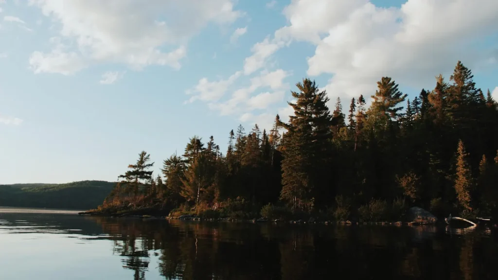
The photo at the top of this page is not Hebgen Lake.
It is a regional stand-in, honestly captioned but generic — we will not put a name to a river we cannot prove. Send us a photograph you took here and it replaces the stand-in, with your credit on it.
Pioneer badgeUnclaimed
Add a photo of this water
Landscape, not fish — the water itself. Reviewed by hand before it appears. The first one published here earns the Pioneer badge.
Pool right now
6,529.86ft NGVD29
- 24 hours-0.06 ft → steady
Reading taken 2h ago at USGS 06038000, Hebgen Lake near West Yellowstone, MT. Elevation is the surface of the lake above the survey datum, not depth. Source.
Fished this water? Add a photo
Reviewed by hand before it appears. Pick the water, not the spot — we never publish exact locations.
Access
West Yellowstone - the nearest town, with lodging, fly shops, guides and everything else.
Hebgen Dam - the gauge location at the lake outlet, with access to the lower end.
Madison Arm - a long shallow arm with a campground and ramp, prime gulper water.
Grayling Arm - the northern arm, weedy and productive on calm mornings.
Lonesome Hurst and Rainbow Point campgrounds - Forest Service access on the west and north shores.
Quake Lake - the earthquake-formed lake immediately downstream on the Madison.
Madison River below Hebgen - the celebrated tailwater reach running toward Ennis.
Seasons
Spring: ice comes off late and the lake fishes slowly, with streamers along the drop-offs the reliable approach.
Summer: the gulper season, with calm mornings bringing cruising trout to Callibaetis and midges on the flats.
Fall: brown trout stage toward the tributaries and streamer fishing turns on as the water cools.
Winter: the lake freezes and sees modest ice fishing pressure compared with the summer crowds.
From the water
No logged trips yet. Be the first to put this water on your map.
Log this water
Fished it or cleaned it? Log in or create a free account to log a trip with photos and earn the waterway badge.
Questions
What species can you catch on the Hebgen Lake?
Anglers target Arctic Grayling, Brown Trout, Mountain Whitefish, Rainbow Trout, Westslope Cutthroat Trout, Yellowstone Cutthroat Trout on the Hebgen Lake in Montana.
Are there fishing guides on the Hebgen Lake?
GuidedFloats lists 1 guide and outfitters on the Hebgen Lake. Claimed profiles accept booking requests; unclaimed profiles are built from public records and link to the business.
Where can you access the Hebgen Lake?
West Yellowstone - the nearest town, with lodging, fly shops, guides and everything else. Hebgen Dam - the gauge location at the lake outlet, with access to the lower end. Madison Arm - a long shallow arm with a campground and ramp, prime gulper water. Grayling Arm - the northern arm, weedy and productive on calm mornings. Lonesome Hurst and Rainbow Point campgrounds - Forest Service access on the west and north shores. Quake Lake - the earthquake-formed lake immediately downstream on the Madison. Madison River below Hebgen - the celebrated tailwater reach running toward Ennis.
When is the best time to fish the Hebgen Lake?
Spring: ice comes off late and the lake fishes slowly, with streamers along the drop-offs the reliable approach. Summer: the gulper season, with calm mornings bringing cruising trout to Callibaetis and midges on the flats. Fall: brown trout stage toward the tributaries and streamer fishing turns on as the water cools. Winter: the lake freezes and sees modest ice fishing pressure compared with the summer crowds.
Where are the fishing regulations for the Hebgen Lake?
Regulations change by season and section. Read the current rules on the Montana agency site: https://fwp.mt.gov/fish/regulations