Beta

GuidedFloats is in beta. The full site launches March 1, 2027. The mobile app follows.

Guides: claim before March 1, 2027 and your first full season of Premium is free. Claim your founding spot →

Home › Waters › Massachusetts › Jones River
Estuary · Plymouth County, the tidal river draining Silver Lake through Kingston into Kingston Bay and the top of Plymouth Bay on the Massachusetts South Shore · Massachusetts

Jones River Fishing Guides

A short South Shore tidal river with a restored herring run and a remnant sea run brook trout population, emptying into Kingston Bay beside Plymouth.
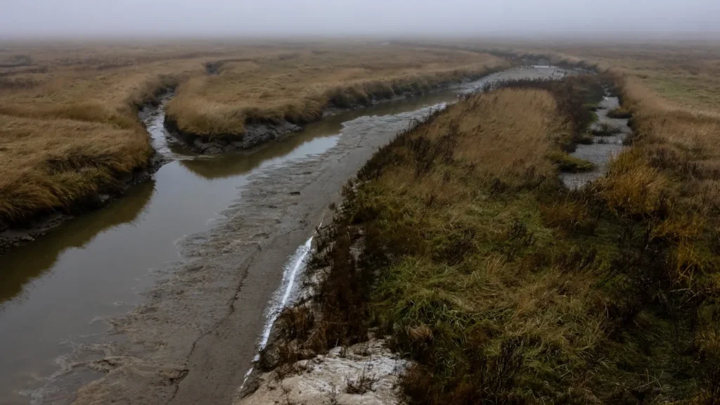
A muddy tidal creek winding through marshland on a foggy morning
Gauge location. Map data © OpenStreetMap contributors.

Guides on the Jones River

Claimed profiles take booking requests. Unclaimed profiles are built from public records so the river is never empty; the guide can claim or remove one any time.

No guides listed yet

Guide or outfit this water? Create your profile. Listing is free, the commission is 10% or 7% with a premium profile, and premium profiles list first on this water.

About the Jones River

The Jones River is short by any measure, running only a handful of miles from the outlet of Silver Lake through the town of Kingston and into Kingston Bay at the north end of Plymouth Bay. What it lacks in length it makes up for in significance. This is one of the most closely studied small coastal rivers in Massachusetts, the subject of decades of restoration work, and the tidal reach below the head of tide supports a genuinely diverse assemblage for a river that a strong caster could nearly throw across.

River herring are the engine of the system. The run up the Jones was severely depressed for most of the twentieth century and has recovered substantially since fish passage was improved and the Wapping Road area obstructions were addressed, and the alewife and blueback that push through in April and May bring striped bass in behind them. Schoolie bass are the most commonly caught fish in the tidal reach through the warm months, with larger fish working the mouth and the flats off Kingston Bay on the bigger tides. White perch hold in the brackish middle reach year round and winter flounder are still taken in the lower river and the bay.

The freshwater half of the river matters too. The Jones carries a remnant population of brook trout, and some of those fish are sea run, dropping into the estuary to feed and returning to the cold tributary water. Salters of this kind persist in only a short list of Massachusetts streams and they are the reason the river attracts attention out of proportion to its size. The gauge reports both discharge and stage, which on a tidal river means the record has to be read with the tide in mind rather than as a simple flow series. Anglers who learn the timing of the tide at the gauge quickly find that the river fishes on a two hour window either side of the turn rather than on the clock.

This water needs a real photo

The photo at the top of this page is not Jones River.

It is a regional stand-in, honestly captioned but generic — we will not put a name to a river we cannot prove. Send us a photograph you took here and it replaces the stand-in, with your credit on it.

Add a photo of this water See the badges

Pioneer badgeUnclaimed

Add a photo of this water

Landscape, not fish — the water itself. Reviewed by hand before it appears. The first one published here earns the Pioneer badge.

Never published. It is how the badge is held for you until member accounts open.

Posting to Jones River.

JPG, PNG or WebP, up to 12 MB. Landscape orientation looks best at the top of the page. We resize it and strip the location data out of the file.

The name printed under the photo and on your badge. Leave blank to stay anonymous.

Reader photo license v1.0 — the short version:

  • You grant Guided Floats, LLC a non-exclusive, royalty-free license to publish, resize and crop your photo on guidedfloats.com and in GuidedFloats’ own social posts and apps. You keep the copyright and can use the photo anywhere else.
  • You confirm that you took the photo yourself, that publishing it does not infringe anyone else’s rights, and that anyone recognisable in it (or a parent or guardian, if they are under 18) is happy for it to appear here.
  • Credit is printed beside the photo wherever it appears on the site, using the credit name you give us. Leave it blank and we use your name; write “Anonymous” for no name. Your email address is never published.
  • Withdrawing is one email to hello@guidedfloats.com naming the photo. It comes off the site within 7 days.
Read the full license

Version 1.0, dated 6 September 2026. Applies to every photograph submitted to GuidedFloats through the contact form, a species page, or the community board.

1. What you give us

By ticking the box on the form you grant Guided Floats, LLC (“GuidedFloats”, “we”) a non-exclusive, worldwide, royalty-free license to store, copy, resize, crop and display your photograph on guidedfloats.com, in GuidedFloats’ own social media accounts and mobile apps, and in material that promotes the site itself, in connection with the fish, water or community feature you sent it in for. The license lasts until you withdraw it (section 4).

You keep the copyright. The license is not exclusive, so you can use the photo anywhere else and license it to anyone else. We will not sell your photo, license it on to anyone else on its own, or use it in paid advertising for a third party.

2. What you confirm

You confirm that you took the photograph yourself (or otherwise own the rights to it), that you have the right to grant this license, and that publishing the photo does not infringe anyone else’s copyright, privacy or other rights.

If any person is recognisable in the photo, you confirm that they have agreed to its being published here, and that a parent or guardian has agreed on behalf of anyone under 18. Please do not send photographs of other people’s catches, screenshots, or pictures copied from other websites or social media.

3. Credit

We print the credit name you give us beside the photo wherever it appears on the site, and record it as the photo’s creator in the page’s structured data. If you leave the credit blank we use the name you gave us on the form. Write “Anonymous” if you prefer no name at all. Your email address, phone number and the exact spot the photo was taken are never published.

4. Withdrawing the license

You can withdraw the license at any time by emailing hello@guidedfloats.com, or by using the contact form, and telling us which photo you mean. We will remove the photo from guidedfloats.com within 7 days of receiving your message and stop using it in anything new. Copies that are already outside our control — search-engine caches, social posts that have already gone out, printed material already produced — may take longer to disappear or may not be recallable, and we are not responsible for those.

5. What we may do

We choose which photos to publish and may decline any submission without giving a reason. We may crop, resize, sharpen or colour-correct a photo for display, and we may remove a photo at any time. We will not alter a photo in a way that misrepresents the fish, the water or you.

6. Your details

We keep your name, email address, the credit name, the water and date you gave us, and the network address the submission came from, with the submission record, as our evidence of this license. We hold that record for as long as the photo is published and for the retention period described in our privacy policy. Location data that your camera or phone embedded in the file is removed before the photo is published.

7. Versions

The version of this license you accepted is stored with your submission and printed with the photo. A later version does not apply to a photo you have already sent unless you agree to it.

Fished this water? Add a photo

Reviewed by hand before it appears. Pick the water, not the spot — we never publish exact locations.

Never published. We use it only if we need to ask about the photo.

Posting to Jones River.

JPG, PNG or WebP, up to 12 MB. We resize it and strip the location data out of the file.

The name shown under the photo. Leave blank to stay anonymous.

Reader photo license v1.0 — the short version:

  • You grant Guided Floats, LLC a non-exclusive, royalty-free license to publish, resize and crop your photo on guidedfloats.com and in GuidedFloats’ own social posts and apps. You keep the copyright and can use the photo anywhere else.
  • You confirm that you took the photo yourself, that publishing it does not infringe anyone else’s rights, and that anyone recognisable in it (or a parent or guardian, if they are under 18) is happy for it to appear here.
  • Credit is printed beside the photo wherever it appears on the site, using the credit name you give us. Leave it blank and we use your name; write “Anonymous” for no name. Your email address is never published.
  • Withdrawing is one email to hello@guidedfloats.com naming the photo. It comes off the site within 7 days.
Read the full license

Version 1.0, dated 6 September 2026. Applies to every photograph submitted to GuidedFloats through the contact form, a species page, or the community board.

1. What you give us

By ticking the box on the form you grant Guided Floats, LLC (“GuidedFloats”, “we”) a non-exclusive, worldwide, royalty-free license to store, copy, resize, crop and display your photograph on guidedfloats.com, in GuidedFloats’ own social media accounts and mobile apps, and in material that promotes the site itself, in connection with the fish, water or community feature you sent it in for. The license lasts until you withdraw it (section 4).

You keep the copyright. The license is not exclusive, so you can use the photo anywhere else and license it to anyone else. We will not sell your photo, license it on to anyone else on its own, or use it in paid advertising for a third party.

2. What you confirm

You confirm that you took the photograph yourself (or otherwise own the rights to it), that you have the right to grant this license, and that publishing the photo does not infringe anyone else’s copyright, privacy or other rights.

If any person is recognisable in the photo, you confirm that they have agreed to its being published here, and that a parent or guardian has agreed on behalf of anyone under 18. Please do not send photographs of other people’s catches, screenshots, or pictures copied from other websites or social media.

3. Credit

We print the credit name you give us beside the photo wherever it appears on the site, and record it as the photo’s creator in the page’s structured data. If you leave the credit blank we use the name you gave us on the form. Write “Anonymous” if you prefer no name at all. Your email address, phone number and the exact spot the photo was taken are never published.

4. Withdrawing the license

You can withdraw the license at any time by emailing hello@guidedfloats.com, or by using the contact form, and telling us which photo you mean. We will remove the photo from guidedfloats.com within 7 days of receiving your message and stop using it in anything new. Copies that are already outside our control — search-engine caches, social posts that have already gone out, printed material already produced — may take longer to disappear or may not be recallable, and we are not responsible for those.

5. What we may do

We choose which photos to publish and may decline any submission without giving a reason. We may crop, resize, sharpen or colour-correct a photo for display, and we may remove a photo at any time. We will not alter a photo in a way that misrepresents the fish, the water or you.

6. Your details

We keep your name, email address, the credit name, the water and date you gave us, and the network address the submission came from, with the submission record, as our evidence of this license. We hold that record for as long as the photo is published and for the retention period described in our privacy policy. Location data that your camera or phone embedded in the file is removed before the photo is published.

7. Versions

The version of this license you accepted is stored with your submission and printed with the photo. A later version does not apply to a photo you have already sent unless you agree to it.

Flow alert

Tell me when the Jones River cfs

Now: 27.4 cfs, read 5:15 pm CDT, Sun Oct 18, 2026 (USGS 01105870, JONES RIVER AT KINGSTON, MA).

We never use this address for anything else and never share it. See the privacy policy.

Access

Kingston - the town the river runs through, with the main public access points and the nearest services.
Silver Lake - the headwater pond at the top of the system, a water supply with restricted access.
Kingston Bay - the receiving water at the mouth, with flats fishing for striped bass on the tide.
Plymouth - the larger town immediately south, with tackle shops, boat ramps and full services.
Jones River Landing - the community landing on the tidal reach, the most straightforward river access.
Town Brook - the neighbouring Plymouth stream with its own herring run and restoration work.
Boston - an hour north, with the nearest airport and the bulk of the region's services.

Seasons

Spring: the herring run arrives and the first striped bass follow it into the river, making this the peak of the year.
Summer: schoolie bass hold through the tidal reach and the fishing settles into a tide driven routine morning and evening.
Fall: bass feed hard on the way out and the sea run brook trout move back toward the freshwater reaches.
Winter: the river is quiet and largely unfished, with the estuary holding a few resident white perch.

From the water

No logged trips yet. Be the first to put this water on your map.

Log this water

Fished it or cleaned it? Log in or create a free account to log a trip with photos and earn the waterway badge.

Questions

What is the current flow on the Jones River?

As of Oct 18, 5:15 pm, the USGS gauge JONES RIVER AT KINGSTON, MA reads 27 cfs. Conditions update every 15 minutes.

What species can you catch on the Jones River?

Anglers target American Eel, Bluefish, Brook Trout, Chain Pickerel, Largemouth Bass, Striped Bass, White Perch, Winter Flounder on the Jones River in Massachusetts.

Where can you access the Jones River?

Kingston - the town the river runs through, with the main public access points and the nearest services. Silver Lake - the headwater pond at the top of the system, a water supply with restricted access. Kingston Bay - the receiving water at the mouth, with flats fishing for striped bass on the tide. Plymouth - the larger town immediately south, with tackle shops, boat ramps and full services. Jones River Landing - the community landing on the tidal reach, the most straightforward river access. Town Brook - the neighbouring Plymouth stream with its own herring run and restoration work. Boston -...

When is the best time to fish the Jones River?

Spring: the herring run arrives and the first striped bass follow it into the river, making this the peak of the year. Summer: schoolie bass hold through the tidal reach and the fishing settles into a tide driven routine morning and evening. Fall: bass feed hard on the way out and the sea run brook trout move back toward the freshwater reaches. Winter: the river is quiet and largely unfished, with the estuary holding a few resident white perch.

Where are the fishing regulations for the Jones River?

Regulations change by season and section. Read the current rules on the Massachusetts agency site: https://www.mass.gov/recreational-saltwater-fishing