Fishes Deerfield River
Tailwater · Berkshires · Massachusetts
Deerfield River Fishing Guides
New England best-known trout tailwater, running out of Vermont through Fife Brook and the catch-and-release water at Charlemont in the northern Berkshires.
Map of the Deerfield River
37 numbered points: 2 access points, 1 campsite, 1 outfitter, 14 bridges, 8 parks and conservation areas, 1 regulation section limit, 8 hazards, 1 USGS gauge, 1 point of interest. Tap a marker for details. Reviewed Sep 26, 2026.
- Access / boat ramp (2)
- Campsite (1)
- Outfitter / canoe rental (1)
- Bridge crossing (14)
- Park / conservation area (8)
- Regulation section limit (1)
- Dam / hazard (8)
- USGS gauge (1)
- Point of interest (1)
Map data © OpenStreetMap contributors. Points are curated from OpenStreetMap and state agency sources; confirm access and hours before you go.
Print it. Bag it. Bring it.Phones die, screens crack, and most of this water has no signal. Print this map, fold it into a zip-top bag or dry bag with your license, and you have a backup your electronics can’t give you. Every marker is numbered so you can say exactly where you are.
Open the printable mapAll 37 points on this map
| # | Point | Type | Lat, Lon | Notes |
|---|---|---|---|---|
| 1 | Sherman Dam Sherman Reservoir, Monroe | Dam / hazard | 42.72986, -72.92979 | First dam below the Vermont line. The pond above it is Sherman Reservoir; the river below runs to the No. 5 station at Monroe Bridge. |
| 2 | Deerfield No. 5 Dam New England Power No. 5 station | Dam / hazard | 42.72264, -72.93870 | OSM carries it as New England Power Company Number 5. An unnamed dam way sits on the same structure and is not shipped twice. |
| 3 | Monroe Bridge Depot Street / Monroe Hill Road | Bridge crossing | 42.72222, -72.93872 | The village of Monroe Bridge takes its name from this crossing, immediately below the No. 5 station. |
| 4 | Monroe Bridge Overlook roadside pull-off | Park / conservation area | 42.72208, -72.93934 | Small overlook above the No. 5 station at the head of the upper river. |
| 5 | Trail Head Picnic Area River Road, Florida | Park / conservation area | 42.70344, -72.95029 | Picnic site and trailhead on River Road between Sherman Dam and Fife Brook. |
| 6 | Bear Swamp Recreation Area Bear Swamp project, Florida | Park / conservation area | 42.69050, -72.96597 | Open-access recreation ground at the Bear Swamp pumped-storage project above Fife Brook Dam. |
| 7 | Fife Brook Dam Bear Swamp lower reservoir | Dam / hazard | 42.68554, -72.97646 | Tagged in OSM as the Bear Swamp Pumped Storage Lower Dam; it is the Fife Brook Dam that gauges the upper river. Upstream limit of the state Catch and Release Area (Upper Section). |
| 8 | Fife Brook Fishing and Boating Access River Road, Florida | Access / boat ramp | 42.68014, -72.97623 | The put-in for the upper float, about 0.6 km below the dam. OSM tags the site as parking; the name on the node is the state access name. |
| 9 | Hoosac Tunnel railroad trestle lower limit, C&R Upper Section | Regulation section limit | 42.67428, -72.99514 | Downstream boundary of the Deerfield River Catch and Release Area (Upper Section), which runs from Fife Brook Dam to this trestle. Boundary only - read the rules on the MassWildlife page. |
| 10 | Tunnel Road bridge Hoosac Tunnel, Florida | Bridge crossing | 42.66638, -72.98653 | Road crossing by the Hoosac Tunnel east portal, just below the trestle. |
| 11 | Zoar Road bridge Zoar, Charlemont | Bridge crossing | 42.65578, -72.93660 | Upper of the two Zoar crossings; the freight main line bridges the river 60 m away. |
| 12 | Zoar Gap Rapids class III at release flows | Dam / hazard | 42.65495, -72.95562 | The named rapid of the upper river. Wading here is only sensible between releases; know the schedule before you get in. |
| 13 | Zoar Road bridge at Zoar Gap where River Road becomes Zoar Road | Bridge crossing | 42.65249, -72.95473 | Crossing at the foot of Zoar Gap, beside the picnic-area access. |
| 14 | Zoar Picnic Area Access River Road, Charlemont | Access / boat ramp | 42.65112, -72.95226 | State access point and picnic area below Zoar Gap; the usual take-out for the upper float. |
| 15 | Route 2 bridge, west Charlemont Mohawk Trail, MA 2 | Bridge crossing | 42.64209, -72.92240 | |
| 16 | Mohawk Park campground on Route 2, Charlemont | Campsite | 42.64061, -72.91271 | Riverside campground and caravan site on the Mohawk Trail. |
| 17 | Hail to the Sunrise Memorial Park Mohawk Trail, Charlemont | Park / conservation area | 42.63964, -72.91360 | Riverside park on Route 2 with the Hail to the Sunrise statue; bank water in front of it. |
| 18 | Route 2 bridge, Charlemont Mohawk Trail, MA 2 | Bridge crossing | 42.63852, -72.90918 | |
| 19 | Zoar Outdoor 7 Main Street, Charlemont | Outfitter / canoe rental | 42.62773, -72.88367 | Raft, kayak and tubing livery with a walk-in outfitters shop; paddlesports only, no fishing tackle. OSM spells the name in lower case. |
| 20 | Route 8A bridge West Hawley Road, Charlemont | Bridge crossing | 42.62625, -72.88277 | |
| 21 | USGS 01168500 - Deerfield River at Charlemont river stage and discharge | USGS gauge | 42.62600, -72.85419 | The gauge this page reads from. Check it and the release schedule together before floating the upper river. |
| 22 | Catamount State Forest Colrain / Charlemont | Park / conservation area | 42.62060, -72.73979 | State forest reaching the north bank; OSM records access as restricted, so check at the gate. |
| 23 | Deerfield No. 4 Dam New England Power No. 4 station, Buckland | Dam / hazard | 42.61997, -72.74546 | The forebay dam 500 m downstream is part of the same structure and is not shipped twice. |
| 24 | Route 2 bridge, Shelburne Mohawk Trail, MA 2 | Bridge crossing | 42.61834, -72.74656 | |
| 25 | Route 2 / Route 112 bridge Mohawk Trail, Buckland | Bridge crossing | 42.61357, -72.73739 | |
| 26 | Deerfield No. 3 Dam Shelburne Falls | Dam / hazard | 42.60280, -72.73957 | Two OSM ways carry this name on one structure; the forebay dam below it is the same complex. |
| 27 | Bridge Street bridge MA 2A, Shelburne Falls | Bridge crossing | 42.60366, -72.74034 | Village crossing beside the Bridge of Flowers, with parking on both banks. |
| 28 | Salmon Falls Glacial Potholes Shelburne Falls | Point of interest | 42.60228, -72.73877 | Bedrock potholes and ledge below the Gardner Falls dam. A landmark and a viewpoint, not an access. |
| 29 | Gardner Falls Main Dam Shelburne / Buckland | Dam / hazard | 42.59149, -72.73020 | The station canal dam 300 m away belongs to the same complex. |
| 30 | Gardner Falls Road bridge Shelburne | Bridge crossing | 42.59110, -72.73082 | |
| 31 | Mohawk Trail Conservation Area open access | Park / conservation area | 42.59328, -72.72755 | Protected land on the river below Gardner Falls. |
| 32 | Deerfield No. 2 Dam New England Power No. 2 station | Dam / hazard | 42.57325, -72.70674 | |
| 33 | South River State Forest Conway / Deerfield | Park / conservation area | 42.56259, -72.68704 | State forest on the lower river at the South River mouth. |
| 34 | Bardwells Ferry Road bridge Conway / Shelburne | Bridge crossing | 42.55537, -72.67785 | Historic iron bridge over the lower river and a long-standing wade and canoe access. |
| 35 | West Deerfield Upper Road bridge Deerfield | Bridge crossing | 42.52671, -72.63237 | |
| 36 | Connecticut River Greenway State Park Montague / Deerfield | Park / conservation area | 42.56853, -72.59238 | State greenway land at the Deerfield's mouth on the Connecticut. |
| 37 | Route 5 / Route 10 bridge Greenfield Road, Deerfield | Bridge crossing | 42.56921, -72.59189 | The last road crossing above the mouth. |
Guides on the Deerfield River
Claimed profiles take booking requests. Unclaimed profiles are built from public records so the river is never empty; the guide can claim or remove one any time.
About the Deerfield River
The Deerfield rises in southern Vermont and runs about seventy miles through the Berkshire hills to the Connecticut River at Deerfield, and along the way it passes through a chain of hydroelectric dams that turn it into the most reliable trout river in Massachusetts. The reach below Fife Brook Dam is the heart of it: cold releases keep the water in the fifties through the summer, and the river runs through a wooded gorge with pocket water, ledges and long runs that fish well for a wading angler in any month.
Brown and rainbow trout are the mainstay, with a genuine wild brown component alongside heavy stocking, and there is a catch-and-release section that holds the best fish. Brook trout come in from the tributaries, smallmouth bass take over in the warmer lower river below Shelburne Falls, and landlocked salmon are present in places. The hatches are classic Northeastern: Hendricksons and caddis in spring, sulphurs and cahills through early summer, terrestrials in August, olives into fall. It is also one of the few New England rivers with real winter fishing.
The one thing every angler must understand here is generation. The Charlemont gauge shows the effect of releases from Fife Brook, and the river changes from an easily waded stream to a fast, dangerous, whitewater-rafting flow in a matter of minutes when a release starts. Release schedules are published; read them, know where you can get out, and move when the water starts to rise. Whitewater releases on summer weekends make the river essentially unfishable in the gorge.
Charlemont and Shelburne Falls are the base towns, with shops, guides and rafting outfitters. The Zoar Gap area is the busiest reach.
This water needs a real photo
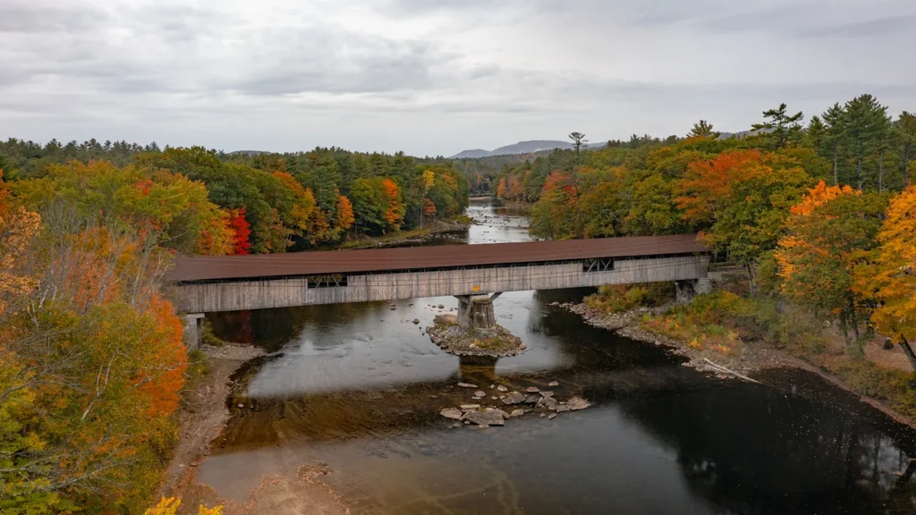
The photo at the top of this page is not Deerfield River.
It is a regional stand-in, honestly captioned but generic — we will not put a name to a river we cannot prove. Send us a photograph you took here and it replaces the stand-in, with your credit on it.
Pioneer badgeUnclaimed
Add a photo of this water
Landscape, not fish — the water itself. Reviewed by hand before it appears. The first one published here earns the Pioneer badge.
Fished this water? Add a photo
Reviewed by hand before it appears. Pick the water, not the spot — we never publish exact locations.
Access
Fife Brook Dam: the top of the tailwater and the main put-in.
Zoar Gap: the well-known whitewater and pocket-water reach.
Charlemont: town access near the gauge, and the catch-and-release water.
Route 2 pullouts: continuous roadside access through the valley.
Shelburne Falls: the Bridge of Flowers, the glacial potholes and lower river access.
Buckland and the Cold River confluence: cold tributary water.
Below Shelburne Falls: warmer water and smallmouth bass.
Seasons
March through May: heavy water and the Hendrickson hatch; the first great fishing of the year.
June and July: sulphurs and caddis; plan around whitewater release days.
August and September: terrestrials and cold releases while other rivers are too warm.
October through February: blue-winged olives, streamers and genuine winter fishing on the tailwater.
From the water
No logged trips yet. Be the first to put this water on your map.
Log this water
Fished it or cleaned it? Log in or create a free account to log a trip with photos and earn the waterway badge.
Questions
What is the current flow on the Deerfield River?
As of Oct 19, 3:30 am, the USGS gauge DEERFIELD RIVER AT CHARLEMONT, MA reads 253 cfs, the 25th percentile for this date. Conditions update every 15 minutes.
What species can you catch on the Deerfield River?
Anglers target Brook Trout, Brown Trout, Landlocked Atlantic Salmon, Rainbow Trout, Smallmouth Bass on the Deerfield River in Massachusetts.
Are there fishing guides on the Deerfield River?
GuidedFloats lists 2 guides and outfitters on the Deerfield River. Claimed profiles accept booking requests; unclaimed profiles are built from public records and link to the business.
Where can you access the Deerfield River?
Fife Brook Dam: the top of the tailwater and the main put-in. Zoar Gap: the well-known whitewater and pocket-water reach. Charlemont: town access near the gauge, and the catch-and-release water. Route 2 pullouts: continuous roadside access through the valley. Shelburne Falls: the Bridge of Flowers, the glacial potholes and lower river access. Buckland and the Cold River confluence: cold tributary water. Below Shelburne Falls: warmer water and smallmouth bass.
When is the best time to fish the Deerfield River?
March through May: heavy water and the Hendrickson hatch; the first great fishing of the year. June and July: sulphurs and caddis; plan around whitewater release days. August and September: terrestrials and cold releases while other rivers are too warm. October through February: blue-winged olives, streamers and genuine winter fishing on the tailwater.
Where are the fishing regulations for the Deerfield River?
Regulations change by season and section. Read the current rules on the Massachusetts agency site: https://www.mass.gov/freshwater-fishing-regulations