Androscoggin River (New Hampshire) Fishing Guides
The Great North Woods river from Errol down through Pontook and Berlin to Gorham, with landlocked salmon, big brook trout and pocket water you can wade all summer.
Map of the Androscoggin River (New Hampshire)
52 numbered points: 22 access points, 2 campsites, 1 bait & fly shop, 1 outfitter, 7 bridges, 4 parks and conservation areas, 4 regulation section limits, 10 hazards, 1 USGS gauge. Tap a marker for details. Reviewed Sep 25, 2026.
- Access / boat ramp (22)
- Campsite (2)
- Bait, tackle & fly shop (1)
- Outfitter / canoe rental (1)
- Bridge crossing (7)
- Park / conservation area (4)
- Regulation section limit (4)
- Dam / hazard (10)
- USGS gauge (1)
Print it. Bag it. Bring it.Phones die, screens crack, and most of this water has no signal. Print this map, fold it into a zip-top bag or dry bag with your license, and you have a backup your electronics can’t give you. Every marker is numbered so you can say exactly where you are.
Open the printable mapAll 52 points on this map
| # | Point | Type | Lat, Lon | Notes |
|---|---|---|---|---|
| 1 | Steamer Diamond Boat Ramp Errol - gravel ramp | Access / boat ramp | 44.79146, -71.10826 | Uppermost ramp on the NH reach, just below the Umbagog outlet. |
| 2 | NH 16 bridge, Errol Dam Road / NH 16 | Bridge crossing | 44.78821, -71.12052 | |
| 3 | Errol Dam Boat Ramp NH Fish & Game - concrete-plank trailer ramp | Access / boat ramp | 44.78731, -71.12090 | The main trailered launch at Errol, immediately above the dam. |
| 4 | Errol Dam Portage river-left | Dam / hazard | 44.78665, -71.12454 | |
| 5 | Errol special-rule section NH Fish & Game - fly-fishing-only water | Regulation section limit | 44.78665, -71.12454 | Section runs from Errol Dam downstream to the markers at the dead water at Bragg Bay. Boundary only; see NH Fish and Game for the rules. |
| 6 | Indian Cove Cartop Access Site Cartop / hand-carry | Access / boat ramp | 44.78280, -71.12900 | |
| 7 | Northern Waters Errol - riverside campsite | Campsite | 44.78060, -71.13036 | |
| 8 | Northern Waters Outfitters Errol - guides, rentals and shuttles | Outfitter / canoe rental | 44.77882, -71.13167 | |
| 9 | NH 26 bridge, Errol Upton Road / NH 26 | Bridge crossing | 44.77825, -71.13185 | |
| 10 | Androscoggin River Cartop Access Site NH DOT - cartop / hand-carry | Access / boat ramp | 44.77828, -71.13227 | |
| 11 | L.L. Cote Errol - sporting goods, tackle and licences | Bait, tackle & fly shop | 44.78122, -71.13705 | |
| 12 | Mollidgewock State Park NH State Parks - cartop, riverside campsites | Access / boat ramp | 44.74365, -71.14519 | |
| 13 | NH 16 bridge, Errol-Dummer Berlin Road / NH 16 | Bridge crossing | 44.74713, -71.16718 | |
| 14 | Androscoggin Wayside Access NH DOT - cartop | Access / boat ramp | 44.74133, -71.18020 | |
| 15 | Cartop Access - Seven Islands NH DOT - cartop | Access / boat ramp | 44.71439, -71.17367 | |
| 16 | NH 16 bridge, Dummer Berlin Road / NH 16 | Bridge crossing | 44.67798, -71.17970 | |
| 17 | Cartop Access - Gaging Station Cartop, by the Cambridge gauge | Access / boat ramp | 44.66667, -71.18043 | |
| 18 | Cartop Access, Dummer NH DES - cartop / shore fishing | Access / boat ramp | 44.66390, -71.21670 | |
| 19 | Cartop Access, Pontook Reservoir NH DES - cartop | Access / boat ramp | 44.64686, -71.23280 | |
| 20 | Pontook Recreational Facility Concrete trailer ramp on Pontook Reservoir | Access / boat ramp | 44.63380, -71.24940 | |
| 21 | Pontook Reservoir Dam Portage; releases run the rapids below | Dam / hazard | 44.63310, -71.24809 | |
| 22 | Dummer special-rule section NH Fish & Game - downstream limit at Pontook Dam | Regulation section limit | 44.63310, -71.24809 | Section runs from the Dummer-Cambridge town line downstream to Pontook Dam. Boundary only; see NH Fish and Game for the rules. |
| 23 | Dummer to Berlin special-rule section NH Fish & Game - upstream limit at Wheeler Bay | Regulation section limit | 44.61502, -71.22269 | Section runs from the Wheeler Bay boundary line in Dummer downstream to Sawmill Dam in Berlin. Boundary only; see NH Fish and Game for the rules. |
| 24 | Bofinger Conservation Area Boat Ramp NH Fish & Game - gravel trailer ramp | Access / boat ramp | 44.61503, -71.22176 | |
| 25 | Milan Community Forest Town of Milan | Park / conservation area | 44.55730, -71.17322 | |
| 26 | Nansen Ski Jump State Historic Site NH State Parks | Park / conservation area | 44.53271, -71.16949 | |
| 27 | Nansen Wayside State Park Boat Ramp NH State Parks - cartop | Access / boat ramp | 44.53081, -71.16354 | |
| 28 | 12th Street Bridge, Berlin | Bridge crossing | 44.48945, -71.16363 | |
| 29 | Horne Field Boat Launch City of Berlin - gravel launch | Access / boat ramp | 44.48417, -71.16584 | |
| 30 | Sawmill Dam Berlin - Great Lakes Hydro America | Dam / hazard | 44.47902, -71.16737 | |
| 31 | Berlin to Shelburne special-rule section NH Fish & Game - upstream limit at Sawmill Dam | Regulation section limit | 44.47902, -71.16737 | Section runs from Sawmill Dam in Berlin downstream to the Maine-New Hampshire boundary. Boundary only; see NH Fish and Game for the rules. |
| 32 | Northern Forest Heritage Park Berlin - riverside park and museum | Park / conservation area | 44.47903, -71.16957 | |
| 33 | Riverside Dam Berlin | Dam / hazard | 44.47461, -71.16963 | |
| 34 | Community Field Boat Launch City of Berlin - cartop / shore fishing | Access / boat ramp | 44.46960, -71.17696 | |
| 35 | J Brodie Smith Dam Berlin | Dam / hazard | 44.46929, -71.17933 | |
| 36 | Cross Dam Berlin | Dam / hazard | 44.45683, -71.18611 | |
| 37 | Cascade Impoundment Access Cartop | Access / boat ramp | 44.45476, -71.18686 | |
| 38 | Cascade Dam Berlin | Dam / hazard | 44.44902, -71.18663 | |
| 39 | USGS gauge 01054000 - Androscoggin River near Gorham Live flow and stage | USGS gauge | 44.43583, -71.19028 | |
| 40 | Upper Gorham Impoundment Access Cartop, by the Gorham Hydro picnic area | Access / boat ramp | 44.40977, -71.19558 | |
| 41 | Upper Gorham Dam Great Lakes Hydro America | Dam / hazard | 44.40837, -71.19518 | |
| 42 | Gorham Hydro shore access NH DOT - footbridge across the river channel | Access / boat ramp | 44.40250, -71.19910 | |
| 43 | Gorham Canoe Portage Take-Out Portage around the Gorham dam; parking near US 2 | Access / boat ramp | 44.38986, -71.16829 | |
| 44 | Gorham Dam Portage river-right | Dam / hazard | 44.38946, -71.16681 | |
| 45 | Gorham Canoe Portage Put-In Downstream end of the Gorham portage | Access / boat ramp | 44.39007, -71.16114 | |
| 46 | Lead Mine State Forest launch NH DNCR - unimproved dirt launch | Access / boat ramp | 44.39900, -71.12750 | |
| 47 | Shelburne Dam | Dam / hazard | 44.40390, -71.11524 | |
| 48 | North Road bridge, Shelburne | Bridge crossing | 44.40425, -71.11477 | |
| 49 | Androscoggin Wildlife Management Area NH Fish & Game | Park / conservation area | 44.40420, -71.11155 | |
| 50 | Timberland Campground Shelburne | Campsite | 44.40833, -71.09078 | |
| 51 | Meadow Road bridge, Shelburne | Bridge crossing | 44.40449, -71.06775 | |
| 52 | Shelburne Canoe Launch Town of Shelburne - cartop | Access / boat ramp | 44.40493, -71.06736 | Last NH access before the Maine line. |
Guides on the Androscoggin River (New Hampshire)
Claimed profiles take booking requests. Unclaimed profiles are built from public records so the river is never empty; the guide can claim or remove one any time.
About the Androscoggin River (New Hampshire)
The Androscoggin leaves Umbagog Lake at Errol and runs south through the northern New Hampshire woods past Pontook Reservoir, Milan, Berlin and Gorham before crossing into Maine. Through New Hampshire it is a broad, boulder-strewn, cold river in country that is mostly forest, with moose in the alders and the Presidential Range on the skyline. It is the best big-water trout and salmon river in the state and one of the more wadeable rivers of its size in New England.
Landlocked Atlantic salmon are the marquee fish, dropping down out of Umbagog and holding in the runs and pools below Errol, where the reach immediately below the dam is the best-known water on the river. Brook trout, some of them genuinely large by New Hampshire standards, share the same water, and brown and rainbow trout are present through the middle river. Below Berlin the river warms and smallmouth bass become the main quarry. The classic approach is a swung or stripped streamer in high water and dry flies and nymphs through the pocket water in summer.
The Gorham gauge reads the river below the Pontook and Berlin reaches. Flow here is a mix of natural runoff and the operation of the dams upstream, so it can change without any rain. Moderate readings are comfortable wading in the pocket water and good drift-boat flows; spring melt makes it big, cold and streamer-only; late-summer lows are clear and technical, and the salmon get very selective.
Errol, Milan, Berlin and Gorham cover lodging and access, and the Thirteen Mile Woods reach between Errol and Milan is the prettiest and the most fished.
This water needs a real photo
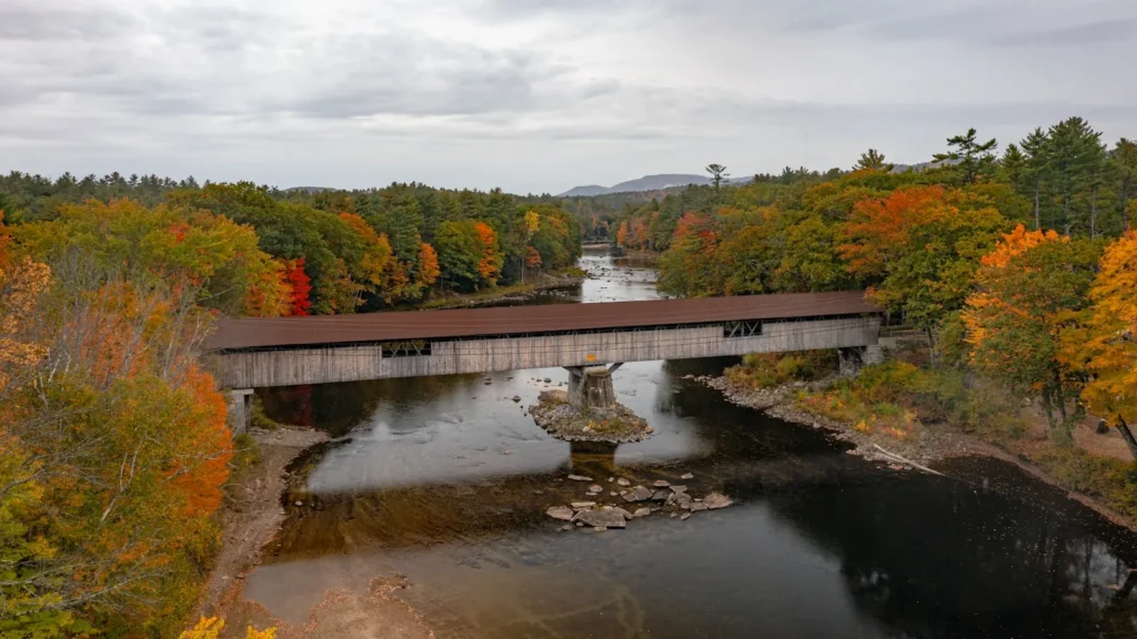
The photo at the top of this page is not Androscoggin River (New Hampshire).
It is a regional stand-in, honestly captioned but generic — we will not put a name to a river we cannot prove. Send us a photograph you took here and it replaces the stand-in, with your credit on it.
Add a photo of this water
Landscape, not fish — the water itself. Reviewed by hand before it appears. The first one published here earns the Pioneer badge.
Fished this water? Add a photo
Reviewed by hand before it appears. Pick the water, not the spot — we never publish exact locations.
Access
Errol Dam: the top of the river and the classic salmon pool.
Thirteen Mile Woods: continuous roadside access on Route 16 through the scenic reach.
Mollidgewock: state campground with river frontage.
Pontook Reservoir and dam: the middle river impoundment.
Milan and Dummer: pocket water and roadside pullouts.
Berlin and Gorham: town access near the gauge.
Umbagog Lake: the source, with its own fishery.
Seasons
April and May: high cold water, streamers, and the first salmon activity.
June and July: the peak dry-fly and salmon season with comfortable flows.
August: low clear water, technical fishing and warm afternoons; fish early.
September and October: fall salmon and brook trout in color, cold nights and foliage.
From the water
No logged trips yet. Be the first to put this water on your map.
Log this water
Fished it or cleaned it? Log in or create a free account to log a trip with photos and earn the waterway badge.
Questions
What is the current flow on the Androscoggin River (New Hampshire)?
As of Oct 19, 3:15 am, the USGS gauge Androscoggin River near Gorham, NH reads 1,360 cfs, the 10th percentile for this date. Conditions update every 15 minutes.
What species can you catch on the Androscoggin River (New Hampshire)?
Anglers target Brook Trout, Brown Trout, Landlocked Atlantic Salmon, Rainbow Trout, Smallmouth Bass on the Androscoggin River (New Hampshire) in New Hampshire.
Are there fishing guides on the Androscoggin River (New Hampshire)?
GuidedFloats lists 1 guide and outfitters on the Androscoggin River (New Hampshire). Claimed profiles accept booking requests; unclaimed profiles are built from public records and link to the business.
Where can you access the Androscoggin River (New Hampshire)?
Errol Dam: the top of the river and the classic salmon pool. Thirteen Mile Woods: continuous roadside access on Route 16 through the scenic reach. Mollidgewock: state campground with river frontage. Pontook Reservoir and dam: the middle river impoundment. Milan and Dummer: pocket water and roadside pullouts. Berlin and Gorham: town access near the gauge. Umbagog Lake: the source, with its own fishery.
When is the best time to fish the Androscoggin River (New Hampshire)?
April and May: high cold water, streamers, and the first salmon activity. June and July: the peak dry-fly and salmon season with comfortable flows. August: low clear water, technical fishing and warm afternoons; fish early. September and October: fall salmon and brook trout in color, cold nights and foliage.
Where are the fishing regulations for the Androscoggin River (New Hampshire)?
Regulations change by season and section. Read the current rules on the New Hampshire agency site: https://www.wildlife.nh.gov/laws-and-rules