Black River Fishing Guides
A remote White Mountains canyon river that is the stronghold of Arizona's native Apache trout.
Guides on the Black River
Claimed profiles take booking requests. Unclaimed profiles are built from public records so the river is never empty; the guide can claim or remove one any time.
No guides listed yet
Guide or outfit this water? Create your profile. Listing is free, the commission is 10% or 7% with a premium profile, and premium profiles list first on this water.
About the Black River
The Black River forms in the White Mountains of east-central Arizona and runs southwest through a deep, rough canyon that marks the boundary between the Fort Apache and San Carlos Apache reservations. It is the least developed trout river in the state and the hardest to reach, and both of those facts are the reason to go. Roads to the canyon are unpaved, slow and often impassable when wet, and the last stretch to the water is frequently on foot.
What lives here is the point. The Black and its forks are the core range of the Apache trout, Arizona’s state fish and one of only two trout native to the state. Decades of recovery work on these headwaters brought the species back from the edge, and the upper forks hold wild populations in water that looks much as it always has. Lower in the canyon the fishery shifts, with brown trout, stocked rainbows, smallmouth bass and catfish through the warmer reaches.
Fishing is small-water work. The upper river is a pocket-water stream fished with short casts, a dry-dropper rig and a lot of walking between holding lies, and the fish are not large. The reward is a wild native trout in a canyon where you are unlikely to see another angler all day. Below the forks the river opens out, the water warms, and a summer smallmouth float becomes possible when flows allow.
Permits are the thing to get right. Much of the river runs on tribal land, and fishing the reservation reaches requires a permit from the White Mountain Apache Tribe or the San Carlos Apache Tribe rather than, or in addition to, an Arizona licence. Rules differ between the two, and the boundary is the river itself. Sort the permit before you drive, because there is nowhere out there to sort it afterwards.
This water needs a real photo
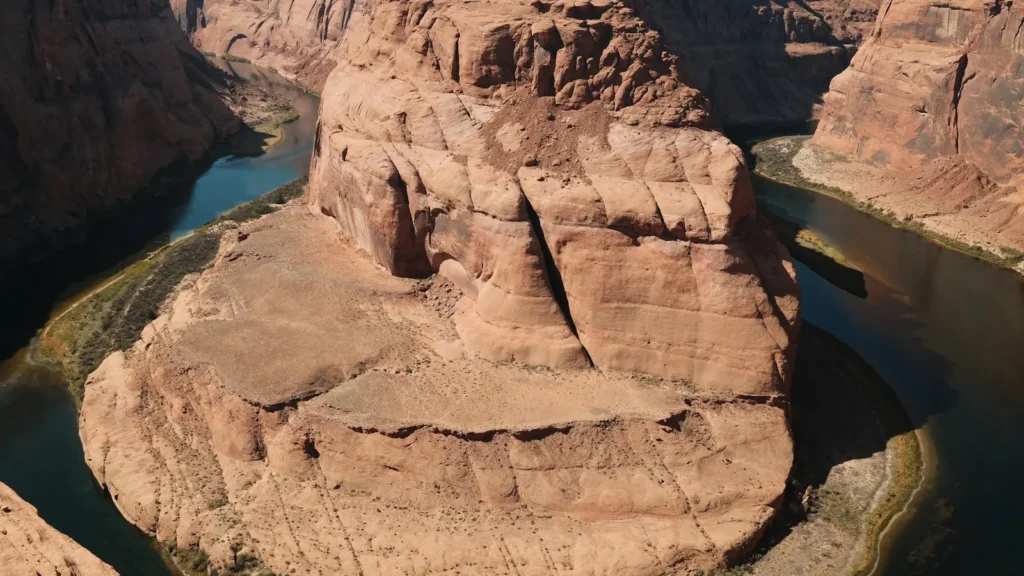
The photo at the top of this page is not Black River.
It is a regional stand-in, honestly captioned but generic — we will not put a name to a river we cannot prove. Send us a photograph you took here and it replaces the stand-in, with your credit on it.
Add a photo of this water
Landscape, not fish — the water itself. Reviewed by hand before it appears. The first one published here earns the Pioneer badge.
Fished this water? Add a photo
Reviewed by hand before it appears. Pick the water, not the spot — we never publish exact locations.
Access
Fort Apache - the White Mountain Apache tribal centre and the source of upstream permits.
Black River Crossing - the main road access to the canyon on the reservation boundary.
West Fork Black River - upper trout water with Forest Service campgrounds.
East Fork Black River - the other headwater fork, with wild trout and road access.
Diamond Rock and Buffalo Crossing - Forest Service campgrounds on the upper forks.
Apache-Sitgreaves National Forest roads - unpaved routes into the upper river, seasonal.
San Carlos Apache Reservation - the south bank, requiring a separate tribal permit.
Seasons
Spring: snowmelt fills the canyon and the upper forks run high and cold into May.
Summer: the prime season for the upper forks, with monsoon storms causing sudden rises.
Fall: low clear water, the best sight fishing of the year, and cool canyon weather.
Winter: snow closes the forest roads to the upper river for months at a time.
From the water
No logged trips yet. Be the first to put this water on your map.
Log this water
Fished it or cleaned it? Log in or create a free account to log a trip with photos and earn the waterway badge.
Questions
What is the current flow on the Black River?
As of Sep 17, 5:30 am, the USGS gauge BLACK RIVER NEAR FORT APACHE, AZ. reads 67 cfs. Conditions update every 15 minutes.
What species can you catch on the Black River?
Anglers target Apache Trout, Brown Trout, Channel Catfish, Rainbow Trout, Smallmouth Bass on the Black River in Arizona.
Where can you access the Black River?
Fort Apache - the White Mountain Apache tribal centre and the source of upstream permits. Black River Crossing - the main road access to the canyon on the reservation boundary. West Fork Black River - upper trout water with Forest Service campgrounds. East Fork Black River - the other headwater fork, with wild trout and road access. Diamond Rock and Buffalo Crossing - Forest Service campgrounds on the upper forks. Apache-Sitgreaves National Forest roads - unpaved routes into the upper river, seasonal. San Carlos Apache Reservation - the south bank, requiring a separate tribal permit.
When is the best time to fish the Black River?
Spring: snowmelt fills the canyon and the upper forks run high and cold into May. Summer: the prime season for the upper forks, with monsoon storms causing sudden rises. Fall: low clear water, the best sight fishing of the year, and cool canyon weather. Winter: snow closes the forest roads to the upper river for months at a time.
Where are the fishing regulations for the Black River?
Regulations change by season and section. Read the current rules on the Arizona agency site: https://www.azgfd.com/fishing-2/licenses-and-regulations/