Verde River Fishing Guides
The lower Verde below Bartlett Dam — a desert tailwater running through Tonto National Forest saguaro country an hour from Phoenix.
Map of the Verde River
14 numbered points: 3 access points, 2 campsites, 1 bridge, 1 agency office, 2 regulation section limits, 2 hazards, 1 USGS gauge, 2 points of interest. Tap a marker for details. Reviewed Sep 25, 2026.
- Access / boat ramp (3)
- Campsite (2)
- Bridge crossing (1)
- Agency / conservation office (1)
- Regulation section limit (2)
- Dam / hazard (2)
- USGS gauge (1)
- Point of interest (2)
Print it. Bag it. Bring it.Phones die, screens crack, and most of this water has no signal. Print this map, fold it into a zip-top bag or dry bag with your license, and you have a backup your electronics can’t give you. Every marker is numbered so you can say exactly where you are.
Open the printable mapAll 14 points on this map
| # | Point | Type | Lat, Lon | Notes |
|---|---|---|---|---|
| 1 | Bartlett Dam Head of the reach - concrete, completed 1939 - NID AZ10308 | Dam / hazard | 33.81860, -111.63189 | Every foot of flow below here is a Bartlett release, so levels rise and drop without notice. Dec 1-Jun 30 the bank below the dam is closed to foot and vehicle entry for nesting bald eagles; float through, do not land. |
| 2 | Riverside Campground Tonto NF, Cave Creek RD - vault toilets, no potable water | Campsite | 33.80986, -111.64646 | First developed site below the dam and the usual put-in, 1.2 mi down. Non-motorized boating only. The Forest Service page carries a closure for post-Riverside Wildfire recovery - check it before you drive out. |
| 3 | Low-head drop below Riverside Position measured, not published | Dam / hazard | 33.80805, -111.66136 | Paddler accounts describe a river-wide 2-4 ft low-head drop with a recirculation and a left-side strainer about a mile below Riverside. No agency maps it. Measured 1.0 mi down the channel it lands within 50 m of the gauge. |
| 4 | USGS 09510000 - Verde River below Bartlett Dam The gauge this page reads | USGS gauge | 33.80829, -111.66191 | Paddler sources put about 300 cfs as a comfortable minimum for the Bartlett Dam to Box Bar run; the reach is entirely dam-release water. |
| 5 | Needle Rock GNIS 32268 - 484 m | Point of interest | 33.77421, -111.66431 | The basalt spire the recreation site below is named for, 6.9 mi down from the dam. |
| 6 | Needle Rock Day Use Area and Non-Motorized Beach Tonto NF - hand launch off the beach - Tonto Pass | Access / boat ramp | 33.76697, -111.66996 | Non-motorized only; hand launch off the beach, trailers under 16 ft. AZGFD announced catchable Gila trout stockings here through May 2026. Dec 1-Jun 30 the east bank is closed for nesting eagles - float through, do not land there. |
| 7 | Box Bar Shoreline Area and River Access Point Tonto NF - hand launch - Tonto Pass - vault toilet only | Access / boat ramp | 33.74371, -111.66082 | Last Forest Service access above tribal land, 8.9 mi below the dam, and where most floaters take out. No water, no tables. A Dec 1-Jun 30 eagle closure covers the surrounding forest roads and the parking area. |
| 8 | Fort McDowell Yavapai Nation - upstream boundary River enters tribal land - 2.4 mi below Box Bar | Regulation section limit | 33.71391, -111.65158 | Below this line the river is on the Fort McDowell Yavapai Nation and floating on needs the Nation's permission. Boundary taken from the Census tribal-lands polygon; OSM boundary monument 2 sits 200 m off it. |
| 9 | Fort McDowell Tribal Office Fort McDowell Yavapai Nation - 2.3 km off the river | Agency / conservation office | 33.61935, -111.69917 | The Nation publishes no river float or fishing permit online, so this is where to ask. Community & Economic Development handles license and property use on 480-789-7742. |
| 10 | Beeline Highway (AZ 87) bridge The only road bridge over the whole reach | Bridge crossing | 33.58103, -111.67185 | Twenty-five miles of river and one crossing. It stands inside the reservation, so it is a landmark to count off rather than a place to get on or off the water. |
| 11 | Eagle View RV Resort Fort McDowell Yavapai Nation - RV resort, 150 m off the river | Campsite | 33.57449, -111.67418 | The only developed camping on the lower river, on tribal land a mile above the reservation's downstream boundary. A tribal enterprise, not a Forest Service site. |
| 12 | Fort McDowell Yavapai Nation - downstream boundary River leaves tribal land - 12.2 mi of river inside | Regulation section limit | 33.57005, -111.66819 | The river is back on public water below this line. Boundary taken from the Census tribal-lands polygon; OSM boundary monument 15 1/2 sits 120 m off it. |
| 13 | Salt River confluence Foot of the reach - 25.4 mi below Bartlett Dam | Point of interest | 33.54723, -111.66064 | The Verde ends here. Granite Reef Diversion Dam is about 4 mi further down the Salt, well below the take-out. |
| 14 | Phon D Sutton Day Use Area Tonto NF, Mesa RD - take-out - Tonto Pass | Access / boat ramp | 33.54697, -111.65715 | The standard take-out, just below the confluence on the Lower Salt. Hand launch only, no motors, day use only, no potable water. The Forest Service warns of fallen trees that trap floaters. |
Guides on the Verde River
Claimed profiles take booking requests. Unclaimed profiles are built from public records so the river is never empty; the guide can claim or remove one any time.
No guides listed yet
Guide or outfit this water? Create your profile. Listing is free, the commission is 10% or 7% with a premium profile, and premium profiles list first on this water.
About the Verde River
The lower Verde River below Bartlett Dam is the tailwater reach of Arizona’s last major free-flowing river, running southwest through Tonto National Forest toward the Salt River confluence east of Phoenix. Above the dam the Verde is a wild desert river; below it, releases from Bartlett Lake set the flow, and those releases swing hard with irrigation demand and with Salt River Project operations. The USGS gauge below Bartlett Dam reports discharge, stage and water temperature, and checking it is not optional here — the difference between a wadeable river and an unfishable one can be a single day’s release change.
The fishery is warmwater with a cold-water wrinkle. Largemouth and smallmouth bass are the main targets, along with yellow bass that wash down out of the lake, and the river holds good numbers of channel and flathead catfish in the deeper runs. Bluegill fill the slack water and common carp cruise the flats, where they have become a legitimate fly rod target. Arizona Game and Fish stocks rainbow trout in the cooler reach immediately below the dam during the winter months, which gives the tailwater a seasonal trout component that disappears by late spring.
This is wade-and-walk water for most of its length, with kayak and raft floats possible on higher releases. The setting is genuine Sonoran desert — saguaro, mesquite bosque and cottonwood galleries — and the riparian corridor is one of the best birding stretches in the state, which makes guided trips here as much about the place as the fish. Summer daytime heat is extreme and trips run early or not at all.
Access runs off Forest Road 19 and the Bartlett Dam road, with several developed recreation sites along the corridor. A Tonto Pass or America the Beautiful pass is required at most of them. Arizona fishing licenses are required, and the Game and Fish link below carries the current statewide and water-specific rules, including the trout stocking schedule for the reach below the dam.
This water needs a real photo
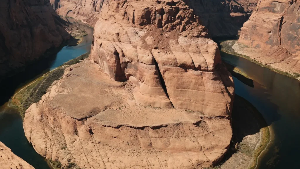
The photo at the top of this page is not Verde River.
It is a regional stand-in, honestly captioned but generic — we will not put a name to a river we cannot prove. Send us a photograph you took here and it replaces the stand-in, with your credit on it.
Add a photo of this water
Landscape, not fish — the water itself. Reviewed by hand before it appears. The first one published here earns the Pioneer badge.
Fished this water? Add a photo
Reviewed by hand before it appears. Pick the water, not the spot — we never publish exact locations.
Access
Bartlett Dam recreation site — the top of the tailwater immediately below the release.
Riverside Campground and day-use area — developed access on the upper tailwater reach.
Needle Rock Recreation Site — the most used wade and float access on the lower Verde.
Box Bar Recreation Site — mid-reach access off Forest Road 19.
Sheep Bridge / Forest Road crossings — remote upstream access requiring high clearance.
Fort McDowell Yavapai Nation reach — tribal permit required, separate from state access.
Salt-Verde confluence area — bottom-end access near the Salt River recreation corridor.
Seasons
Spring: rising temperatures and steady releases; the best all-around bass fishing of the year.
Summer: extreme heat, high irrigation releases, and fishing limited to dawn and dusk.
Fall: releases taper, the river clears and settles, and bass feed hard through October and November.
Winter: stocked rainbow trout below the dam, low flows, and the most comfortable wading conditions.
From the water
No logged trips yet. Be the first to put this water on your map.
Log this water
Fished it or cleaned it? Log in or create a free account to log a trip with photos and earn the waterway badge.
Questions
What is the current flow on the Verde River?
As of Nov 2, 5:35 am, the USGS gauge VERDE RIVER BELOW BARTLETT DAM, AZ reads 33,400 cfs, with water temperature 69.8 F. Conditions update every 15 minutes.
What species can you catch on the Verde River?
Anglers target Bluegill, Channel Catfish, Common Carp, Flathead Catfish, Largemouth Bass, Rainbow Trout, Smallmouth Bass, Yellow Bass on the Verde River in Arizona.
Where can you access the Verde River?
Bartlett Dam recreation site — the top of the tailwater immediately below the release. Riverside Campground and day-use area — developed access on the upper tailwater reach. Needle Rock Recreation Site — the most used wade and float access on the lower Verde. Box Bar Recreation Site — mid-reach access off Forest Road 19. Sheep Bridge / Forest Road crossings — remote upstream access requiring high clearance. Fort McDowell Yavapai Nation reach — tribal permit required, separate from state access. Salt-Verde confluence area — bottom-end access near the Salt River recreation corridor.
When is the best time to fish the Verde River?
Spring: rising temperatures and steady releases; the best all-around bass fishing of the year. Summer: extreme heat, high irrigation releases, and fishing limited to dawn and dusk. Fall: releases taper, the river clears and settles, and bass feed hard through October and November. Winter: stocked rainbow trout below the dam, low flows, and the most comfortable wading conditions.
Where are the fishing regulations for the Verde River?
Regulations change by season and section. Read the current rules on the Arizona agency site: https://www.azgfd.com/fishing-2/licenses-and-regulations/