Salmon River (Connecticut) Fishing Guides
Connecticut's classic fly-fishing river through the Salmon River State Forest — a Trout Management Area with an Atlantic salmon broodstock fishery.
Map of the Salmon River (Connecticut)
12 numbered points: 2 access points, 3 bridges, 4 parks and conservation areas, 1 regulation section limit, 1 hazard, 1 USGS gauge. Tap a marker for details. Reviewed Sep 26, 2026.
- Access / boat ramp (2)
- Bridge crossing (3)
- Park / conservation area (4)
- Regulation section limit (1)
- Dam / hazard (1)
- USGS gauge (1)
Print it. Bag it. Bring it.Phones die, screens crack, and most of this water has no signal. Print this map, fold it into a zip-top bag or dry bag with your license, and you have a backup your electronics can’t give you. Every marker is numbered so you can say exactly where you are.
Open the printable mapAll 12 points on this map
| # | Point | Type | Lat, Lon | Notes |
|---|---|---|---|---|
| 1 | Salmon River TMA - upstream limit Blackledge and Jeremy River confluence - Colchester | Regulation section limit | 41.57939, -72.42245 | DEEP defines the Salmon River Trout Management Area from this junction downstream to the Route 16 bridge. |
| 2 | Gateway Preserve Colchester Land Trust | Park / conservation area | 41.56740, -72.44128 | River frontage in the upper trout water. |
| 3 | Comstock Covered Bridge Comstock Bridge Road - East Hampton / Colchester | Bridge crossing | 41.55773, -72.44184 | Historic covered bridge, closed to cars; the best-known landmark on the river and the anchor for DEEP's inner fly-water boundary about half a mile upstream. |
| 4 | Route 16 bridge - Colchester Avenue Route 16 - East Hampton / Colchester | Bridge crossing | 41.55260, -72.44941 | Downstream limit of the Salmon River Trout Management Area and the upstream limit of DEEP's trophy trout reach, which runs from here to the Route 151 bridge. |
| 5 | USGS 01193500 - Salmon River near East Hampton United States Geological Survey | USGS gauge | 41.55221, -72.44924 | The reference gauge for this river, on the Route 16 bridge. |
| 6 | Fireman's Recreation Area Municipal - East Hampton | Park / conservation area | 41.55131, -72.44969 | Parking and river frontage at the Route 16 bridge. |
| 7 | Silvio O. Conte National Fish and Wildlife Refuge US Fish and Wildlife Service | Park / conservation area | 41.52723, -72.47074 | Federal refuge land on the lower river. OSM maps two polygons here; one marker shown. |
| 8 | Leesville Dam Haddam / East Hampton | Dam / hazard | 41.51667, -72.48284 | Low dam with a fishway; portage. OSM carries three structures at the site, merged to one. |
| 9 | Route 151 bridge - Moodus Road Route 151 - East Hampton / Haddam | Bridge crossing | 41.51252, -72.48193 | Downstream limit of DEEP's trophy trout reach; below here the river is tidal water. |
| 10 | Sunrise Road river access Off Sunrise Road - Leesville, East Haddam | Access / boat ramp | 41.50561, -72.48464 | OSM carries this slipway unnamed; the road name comes from a reverse geocode. |
| 11 | Sunrise State Park Connecticut DEEP - East Haddam | Park / conservation area | 41.50271, -72.48157 | State park on the lower river, the former Sunrise Resort. |
| 12 | Salmon River Boat Launch State of Connecticut - East Haddam | Access / boat ramp | 41.46714, -72.46846 | State launch near the Connecticut River confluence. OSM carries a ramp node and a park node; merged to one. |
Guides on the Salmon River (Connecticut)
Claimed profiles take booking requests. Unclaimed profiles are built from public records so the river is never empty; the guide can claim or remove one any time.
No guides listed yet
Guide or outfit this water? Create your profile. Listing is free, the commission is 10% or 7% with a premium profile, and premium profiles list first on this water.
About the Salmon River (Connecticut)
The Salmon River forms where the Blackledge and Jeremy rivers meet in Colchester and runs south through the Salmon River State Forest to the Connecticut River at East Haddam. It is a modest river by western standards but it is the best-known fly water in Connecticut, and it has been managed as such for decades. The reach through the state forest is a designated Trout Management Area with restrictive tackle and harvest rules. The USGS gauge near East Hampton reports discharge and stage on the main stem.
Brown and rainbow trout make up the bulk of the fishery, with brook trout in the colder tributaries and upper reaches. What sets the Salmon apart is the Atlantic salmon broodstock program: Connecticut DEEP stocks surplus adult Atlantic salmon from its hatchery into the river in the fall, creating one of the few places in the lower forty-eight where an angler can reasonably target large Atlantic salmon on a fly rod. Smallmouth bass and fallfish share the lower river, and American shad run up from the Connecticut in the spring.
The river is walk-and-wade throughout. The Trout Management Area holds the classic water — the covered bridge pool at Comstock Bridge and the runs above and below it are the most photographed stretches of trout water in the state. Pressure is real, especially in the weeks after the fall salmon stocking, and guides here work early and late and know which pools rest between waves of anglers. The river warms in summer, which concentrates fish in the coldest runs and argues for early starts.
Access is excellent thanks to the state forest, with parking areas along Route 16 and Route 149 and a good trail network. A Connecticut fishing license is required, plus a Trout and Salmon Stamp for anyone fishing the salmon program or keeping trout. The DEEP link below carries the current Trout Management Area rules, the broodstock stocking schedule and the seasonal tackle restrictions, which are specific to this river and change from the statewide defaults.
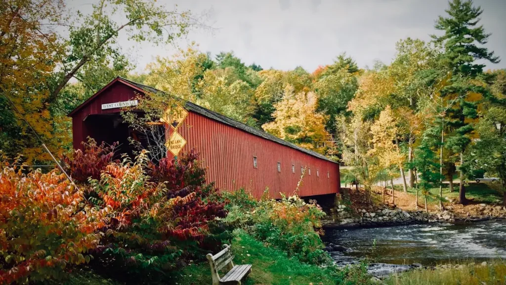
This water needs a real photo
The photo at the top of this page is not Salmon River (Connecticut).
It is a regional stand-in, honestly captioned but generic — we will not put a name to a river we cannot prove. Send us a photograph you took here and it replaces the stand-in, with your credit on it.
Add a photo of this water
Landscape, not fish — the water itself. Reviewed by hand before it appears. The first one published here earns the Pioneer badge.
Fished this water? Add a photo
Reviewed by hand before it appears. Pick the water, not the spot — we never publish exact locations.
Access
Salmon River State Forest, Route 16 pull-offs — the core Trout Management Area access.
Comstock Covered Bridge — the signature pool with parking and trail access.
Route 149 accesses near East Hampton — access at and near the USGS gauge.
Day Pond State Park area — upper river and tributary walk-in access.
Blackledge and Jeremy river confluence — top-of-river access for the forks.
Leesville Dam area — lower river access above the Connecticut confluence.
East Haddam / Connecticut River landings — bottom-end access for shad and smallmouth.
Seasons
Spring: stocked trout, strong flows and the American shad run up from the Connecticut in May.
Summer: low warm water; fishing concentrates in the coldest runs and starts at first light.
Fall: the Atlantic salmon broodstock stocking arrives and the river sees its heaviest use of the year.
Winter: open water through much of the season with salmon and holdover trout for those who dress for it.
From the water
No logged trips yet. Be the first to put this water on your map.
Log this water
Fished it or cleaned it? Log in or create a free account to log a trip with photos and earn the waterway badge.
Questions
What is the current flow on the Salmon River (Connecticut)?
As of Nov 2, 6:15 am, the USGS gauge SALMON RIVER NEAR EAST HAMPTON, CT reads 41 cfs. Conditions update every 15 minutes.
What species can you catch on the Salmon River (Connecticut)?
Anglers target American Shad, Atlantic Salmon, Brook Trout, Brown Trout, Fallfish, Rainbow Trout, Smallmouth Bass on the Salmon River (Connecticut) in Connecticut.
Where can you access the Salmon River (Connecticut)?
Salmon River State Forest, Route 16 pull-offs — the core Trout Management Area access. Comstock Covered Bridge — the signature pool with parking and trail access. Route 149 accesses near East Hampton — access at and near the USGS gauge. Day Pond State Park area — upper river and tributary walk-in access. Blackledge and Jeremy river confluence — top-of-river access for the forks. Leesville Dam area — lower river access above the Connecticut confluence. East Haddam / Connecticut River landings — bottom-end access for shad and smallmouth.
When is the best time to fish the Salmon River (Connecticut)?
Spring: stocked trout, strong flows and the American shad run up from the Connecticut in May. Summer: low warm water; fishing concentrates in the coldest runs and starts at first light. Fall: the Atlantic salmon broodstock stocking arrives and the river sees its heaviest use of the year. Winter: open water through much of the season with salmon and holdover trout for those who dress for it.
Where are the fishing regulations for the Salmon River (Connecticut)?
Regulations change by season and section. Read the current rules on the Connecticut agency site: https://portal.ct.gov/deep/fishing/regulations/fishing-regulations