Fishes Ammonoosuc River
River · Northern New Hampshire, the White Mountains between Mount Washington and the Connecticut River · New Hampshire
Ammonoosuc River Fishing Guides
A White Mountain freestone river falling from the Lakes of the Clouds on Mount Washington, holding wild brook trout in its pocket water.
Map of the Ammonoosuc River
37 numbered points: 2 access points, 12 campsites, 1 outfitter, 5 bridges, 8 parks and conservation areas, 8 hazards, 1 USGS gauge. Tap a marker for details. Reviewed Sep 25, 2026.
- Access / boat ramp (2)
- Campsite (12)
- Outfitter / canoe rental (1)
- Bridge crossing (5)
- Park / conservation area (8)
- Dam / hazard (8)
- USGS gauge (1)
Map data © OpenStreetMap contributors. Points are curated from OpenStreetMap and state agency sources; confirm access and hours before you go.
Print it. Bag it. Bring it.Phones die, screens crack, and most of this water has no signal. Print this map, fold it into a zip-top bag or dry bag with your license, and you have a backup your electronics can’t give you. Every marker is numbered so you can say exactly where you are.
Open the printable mapAll 37 points on this map
| # | Point | Type | Lat, Lon | Notes |
|---|---|---|---|---|
| 1 | Upper Falls Ammonoosuc gorge, Carroll | Dam / hazard | 44.26616, -71.41621 | |
| 2 | Middle Falls Ammonoosuc gorge, Carroll | Dam / hazard | 44.26441, -71.41914 | |
| 3 | Mount Deception Camping Area Carroll | Campsite | 44.27096, -71.47045 | |
| 4 | Lower Ammonoosuc Falls Carroll | Dam / hazard | 44.26977, -71.48299 | |
| 5 | Zealand Campground US Forest Service | Campsite | 44.26466, -71.49877 | |
| 6 | Sugarloaf I Campground US Forest Service | Campsite | 44.26052, -71.50396 | |
| 7 | Sugarloaf II Campground US Forest Service | Campsite | 44.25743, -71.50386 | |
| 8 | Zealand Picnic Area White Mountain National Forest | Park / conservation area | 44.26553, -71.49989 | |
| 9 | Twin Mountain Campground Carroll | Campsite | 44.26813, -71.53640 | |
| 10 | Living Water Campground Twin Mountain | Campsite | 44.27053, -71.53836 | |
| 11 | Ammonoosuc Campground Twin Mountain | Campsite | 44.26742, -71.54397 | |
| 12 | Along the River Campground & Cabins Carroll | Campsite | 44.27215, -71.55398 | |
| 13 | Twin Mountain Motor Court & RV Park Carroll | Campsite | 44.26910, -71.55945 | |
| 14 | Beech Hill Campground and Cabins Twin Mountain | Campsite | 44.27402, -71.57552 | |
| 15 | Ammonoosuc River Forest Society for the Protection of NH Forests | Park / conservation area | 44.27074, -71.59494 | |
| 16 | Tom Howe Trail SPNHF - walk-in, Bethlehem | Access / boat ramp | 44.26960, -71.60330 | The only public access site the NH GRANIT layer carries on the main stem. |
| 17 | USGS gauge 01137500 - Ammonoosuc River at Bethlehem Junction Live flow and stage | USGS gauge | 44.26867, -71.63036 | |
| 18 | US 302 bridge, Bethlehem Junction Main Street | Bridge crossing | 44.27284, -71.63228 | |
| 19 | Bethlehem Dam Bethlehem | Dam / hazard | 44.29030, -71.64847 | |
| 20 | Apple Hill Campground Bethlehem | Campsite | 44.29134, -71.67219 | |
| 21 | Brebner Farm and Forest Ammonoosuc Conservation Trust | Park / conservation area | 44.31204, -71.72210 | |
| 22 | Apthorp Dam Littleton | Dam / hazard | 44.30606, -71.74544 | |
| 23 | Riverwalk Covered Bridge Littleton | Bridge crossing | 44.30559, -71.77324 | |
| 24 | Littleton Riverfront Commons Littleton | Park / conservation area | 44.30515, -71.77580 | |
| 25 | Curran Suspension Bridge Littleton | Bridge crossing | 44.30608, -71.77810 | |
| 26 | Ammonoosuc River Wildlife Management Area II Ammonoosuc Conservation Trust | Park / conservation area | 44.29150, -71.80404 | |
| 27 | Littleton / Franconia Notch KOA Holiday Lisbon | Campsite | 44.24995, -71.85161 | |
| 28 | US 302 / NH 10 bridge, Lisbon North Main Street | Bridge crossing | 44.23800, -71.88008 | |
| 29 | Lower Lisbon Dam Lisbon | Dam / hazard | 44.21445, -71.91095 | |
| 30 | Lisbon Lions Club Community Fields Lisbon | Park / conservation area | 44.21324, -71.91430 | |
| 31 | Ammonoosuc River Dam Bath | Dam / hazard | 44.16666, -71.96712 | |
| 32 | Jean Chamberlin North Conservation Area Ammonoosuc Conservation Trust | Park / conservation area | 44.15592, -72.03405 | |
| 33 | Bath-Haverhill Covered Bridge Woodsville | Bridge crossing | 44.15468, -72.03639 | |
| 34 | Woodsville Hydroelectric Dam Woodsville | Dam / hazard | 44.15475, -72.03651 | |
| 35 | Woodsville Community Field Canoe Access Town of Haverhill - cartop | Access / boat ramp | 44.14950, -72.03990 | Listed on the Connecticut River just below the Ammonoosuc mouth; the usual take-out for the lower river. |
| 36 | Railroad Park Woodsville | Park / conservation area | 44.15412, -72.03875 | |
| 37 | Ammonoosuc Outings Woodsville - boat rental | Outfitter / canoe rental | 44.15360, -72.03982 |
Guides on the Ammonoosuc River
Claimed profiles take booking requests. Unclaimed profiles are built from public records so the river is never empty; the guide can claim or remove one any time.
Order on this page: premium and outfitter plans first (labelled Premium placement), then claimed free profiles, then unclaimed — one published price, no bidding for position. How placement works
About the Ammonoosuc River
The Ammonoosuc River begins at the Lakes of the Clouds high on the southwest shoulder of Mount Washington and falls steeply northwest through the White Mountains before turning toward the Connecticut River at Woodsville. The gauge at Bethlehem Junction covers a drainage of about eighty-eight square miles, which is the upper and steepest part of that course, and the river there is classic New England freestone water over granite boulder and ledge.
Gradient defines the fishing. The upper river is a chain of plunge pools, pocket water and short runs, and it is best fished by working upstream methodically rather than covering distance. Wild brook trout are the characteristic fish of these headwaters and the reason most anglers come, typically small but bright and willing. Brown and rainbow trout appear more often in the lower, gentler reaches, where New Hampshire also stocks.
The river is cold, and it stays fishable through summer better than lowland New England streams because of its elevation and shade. It responds hard to rain, however, and can go from wadeable to unfishable within hours after a mountain storm. Spring runoff from the Presidential Range is heavy and late, and the river often does not settle until well into the season.
Access is exceptionally good by New England standards. The White Mountain National Forest covers much of the upper drainage, Route 302 follows the river through Crawford Notch and beyond, and the Appalachian Trail and the Ammonoosuc Ravine Trail reach the headwaters directly. Bethlehem, Littleton and the Notch itself give an angler plenty of bases within a short drive. New Hampshire manages parts of the river under specific regulations and stocks the lower reaches, so the current rulebook is worth consulting before fishing a particular section.
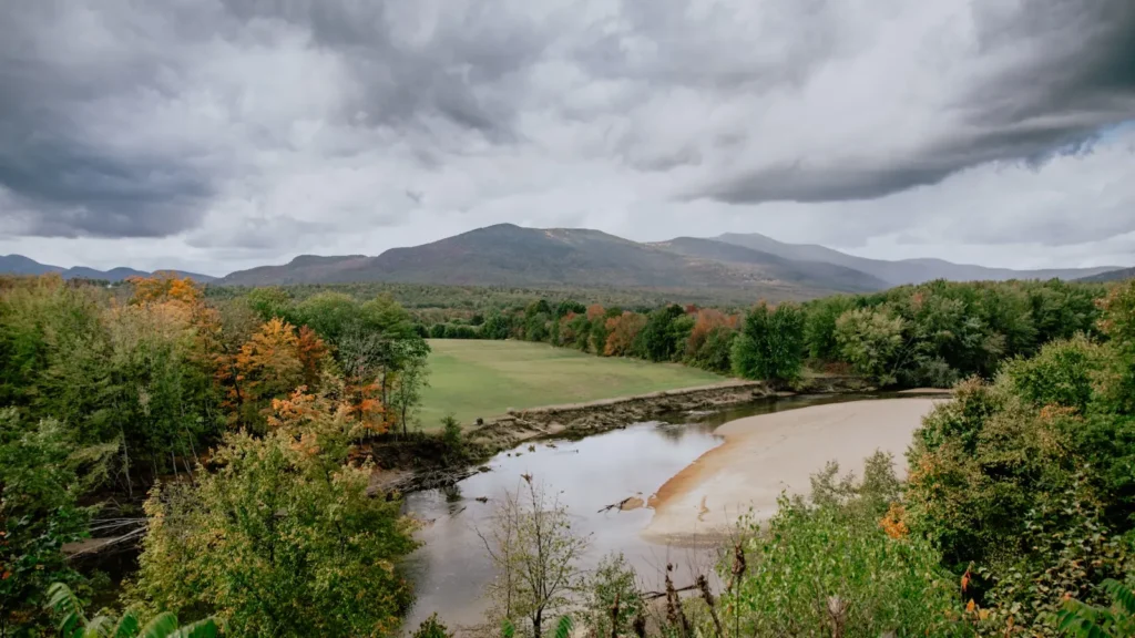
This water needs a real photo
The photo at the top of this page is not Ammonoosuc River.
It is a regional stand-in, honestly captioned but generic — we will not put a name to a river we cannot prove. Send us a photograph you took here and it replaces the stand-in, with your credit on it.
Pioneer badgeUnclaimed
Add a photo of this water
Landscape, not fish — the water itself. Reviewed by hand before it appears. The first one published here earns the Pioneer badge.
Fished this water? Add a photo
Reviewed by hand before it appears. Pick the water, not the spot — we never publish exact locations.
Access
Bethlehem Junction - the gauge reach with roadside access.
Ammonoosuc Ravine Trail - foot access to the headwaters below Mount Washington.
Crawford Notch State Park - public access to the upper river.
Twin Mountain - a convenient base on the upper river.
Littleton - the largest town on the river, with tackle and lodging.
Lisbon - access to the lower river toward the Connecticut.
Woodsville - the confluence with the Connecticut River.
Seasons
Spring: heavy late runoff from the Presidentials, fishable as it drops.
Summer: the most reliable season, with wild brook trout in the pocket water.
Fall: low clear water, colouring brook trout and excellent conditions.
Winter: largely closed or inaccessible under snow at this elevation.
From the water
No logged trips yet. Be the first to put this water on your map.
Log this water
Fished it or cleaned it? Log in or create a free account to log a trip with photos and earn the waterway badge.
Questions
What is the current flow on the Ammonoosuc River?
As of Nov 2, 6:30 am, the USGS gauge AMMONOOSUC RIVER AT BETHLEHEM JUNCTION, NH reads 52 cfs. Conditions update every 15 minutes.
What species can you catch on the Ammonoosuc River?
Anglers target Brook Trout, Brown Trout, Fallfish, Landlocked Salmon, Rainbow Trout, Smallmouth Bass, White Sucker on the Ammonoosuc River in New Hampshire.
Are there fishing guides on the Ammonoosuc River?
GuidedFloats lists 1 guide and outfitters on the Ammonoosuc River. Claimed profiles accept booking requests; unclaimed profiles are built from public records and link to the business.
Where can you access the Ammonoosuc River?
Bethlehem Junction - the gauge reach with roadside access. Ammonoosuc Ravine Trail - foot access to the headwaters below Mount Washington. Crawford Notch State Park - public access to the upper river. Twin Mountain - a convenient base on the upper river. Littleton - the largest town on the river, with tackle and lodging. Lisbon - access to the lower river toward the Connecticut. Woodsville - the confluence with the Connecticut River.
When is the best time to fish the Ammonoosuc River?
Spring: heavy late runoff from the Presidentials, fishable as it drops. Summer: the most reliable season, with wild brook trout in the pocket water. Fall: low clear water, colouring brook trout and excellent conditions. Winter: largely closed or inaccessible under snow at this elevation.
Where are the fishing regulations for the Ammonoosuc River?
Regulations change by season and section. Read the current rules on the New Hampshire agency site: https://www.eregulations.com/newhampshire/fishing/freshwater