Beta

GuidedFloats is in beta. The full site launches March 1, 2027. The mobile app follows.

Guides: claim before March 1, 2027 and your first full season of Premium is free. Claim your founding spot →

Home › Waters › Missouri › Little Piney Creek
Spring creek · Ozarks · Missouri

Little Piney Creek Fishing Guides

The biggest of Missouri's wild trout creeks: nearly ten Blue Ribbon miles south of Rolla, over a thousand fish per mile near Lane Spring, and the only one with a live gauge.
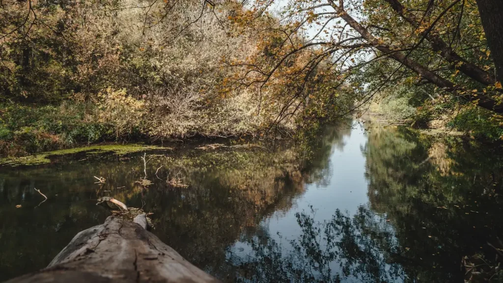
A quiet river winding through dense hardwood forest

Map of the Little Piney Creek

7 numbered points: 5 access points, 1 spring, 1 USGS gauge. Tap a marker for details. Reviewed Sep 6, 2026.

Printable version →
  • Access / boat ramp (5)
  • Spring (1)
  • USGS gauge (1)
Map data © OpenStreetMap contributors. Points are curated from OpenStreetMap and state agency sources; confirm access and hours before you go.

Print it. Bag it. Bring it.Phones die, screens crack, and most of this water has no signal. Print this map, fold it into a zip-top bag or dry bag with your license, and you have a backup your electronics can’t give you. Every marker is numbered so you can say exactly where you are.

Open the printable map
All 7 points on this map
#PointTypeLat, LonNotes
1Piney Spring
Piney Spring Branch
Spring37.77834, -91.81317MDC's Blue Ribbon description takes in Piney Spring Branch as well as the main creek.
2Highway 63 Access
Slipway at the US 63 crossing
Access / boat ramp37.79163, -91.82907OSM names this one only 'Hwy 63'. Upstream end of the easy-access water near Newburg.
3USGS 06932000 - Little Piney Creek at Newburg
USGS streamgauge
USGS gauge37.79747, -91.83649Small spring-fed creek: it clears fast, but a summer thunderstorm will colour it for a day.
4Highway W Access
Slipway at the Route W crossing
Access / boat ramp37.82842, -91.86133OSM name is 'Hwy W'.
5FS Access
Mark Twain National Forest
Access / boat ramp37.86460, -91.87097Forest Service ramp on the lower Blue Ribbon water.
6Milldam Hollow Access
Blue Ribbon lower limit
Access / boat ramp37.88219, -91.87274MDC's Blue Ribbon section runs 9.9 miles from the Phelps County line down to this access; the White Ribbon section runs 3.7 miles below it. Names and boundaries only - read the current rules before you fish.
7Highway T Access
Last ramp above the Gasconade
Access / boat ramp37.91009, -91.90377OSM name is 'Hyw T'. The creek meets the Gasconade a few hundred yards below.

Guides on the Little Piney Creek

Claimed profiles take booking requests. Unclaimed profiles are built from public records so the river is never empty; the guide can claim or remove one any time.

No guides listed yet

Guide or outfit this water? Create your profile. Listing is free, the commission is 10% or 7% with a premium profile, and premium profiles list first on this water.

About the Little Piney Creek

Little Piney Creek runs north out of the hills south of Rolla to meet the Gasconade near Jerome, and it is the largest of Missouri’s six wild trout creeks by a comfortable margin. The Blue Ribbon section is 9.9 miles, from the Phelps County line in sections 9 and 16 of T35N R8W, taking in Piney Spring Branch and Lane Spring Branch, down to Milldam Hollow Access. Below Milldam Hollow the water becomes a White Ribbon put-and-take section with completely different rules, so the boundary matters more here than on any of the other creeks.

Lane, Piney and Yancy Mill springs supply the cold water. The result is the strongest trout population of the six: MDC reports stable numbers above a thousand fish per mile near Lane Spring, a reproducing population running mostly eight to twelve inches, and fish past twenty inches where the habitat is best. Fall 2024 sampling upstream of Vida Slab found multiple year classes and a fish over eighteen and a half inches. MDC calls the stretch from Highway 63 down to Vida Slab the best chance at a quality wild rainbow anywhere in the area, and the highest fish-per-mile density among the nearby Blue Ribbon waters. There is an amusing catch in MDC’s own notes: small fish here are aggressive enough that five-inch rainbows regularly beat the big ones to the fly.

It is also the one creek of the six with room to cast. Big pools, deep scours and swift runs make it feel like a small river rather than a spring branch, and it is the only one where a canoe or kayak is worth considering to reach water you cannot walk to. Ozark sculpin live here, and anglers report smallmouth in the warmer water lower down. The gauge at Newburg sits below the Blue Ribbon reach, so read it as an indicator of what the whole drainage is doing rather than as the flow at your feet.

All six Blue Ribbon areas carry the same rules: flies and artificial lures only, no soft plastic, natural or scented baits for any species, an eighteen-inch minimum length, a daily limit of one trout, and no porous-soled waders. Gigging, bowfishing and atlatls are prohibited. Read the MDC page for this water before you fish it, because the boundaries are specific and posted, and a trout caught outside the marked section does not count toward the slam.

This water needs a real photo

The photo at the top of this page is not Little Piney Creek.

It is a regional stand-in, honestly captioned but generic — we will not put a name to a river we cannot prove. Send us a photograph you took here and it replaces the stand-in, with your credit on it.

Add a photo of this water See the badges

Pioneer badgeUnclaimed

Add a photo of this water

Landscape, not fish — the water itself. Reviewed by hand before it appears. The first one published here earns the Pioneer badge.

Never published. It is how the badge is held for you until member accounts open.

Posting to Little Piney Creek.

JPG, PNG or WebP, up to 12 MB. Landscape orientation looks best at the top of the page. We resize it and strip the location data out of the file.

The name printed under the photo and on your badge. Leave blank to stay anonymous.

Reader photo license v1.0 — the short version:

  • You grant Guided Floats, LLC a non-exclusive, royalty-free license to publish, resize and crop your photo on guidedfloats.com and in GuidedFloats’ own social posts and apps. You keep the copyright and can use the photo anywhere else.
  • You confirm that you took the photo yourself, that publishing it does not infringe anyone else’s rights, and that anyone recognisable in it (or a parent or guardian, if they are under 18) is happy for it to appear here.
  • Credit is printed beside the photo wherever it appears on the site, using the credit name you give us. Leave it blank and we use your name; write “Anonymous” for no name. Your email address is never published.
  • Withdrawing is one email to hello@guidedfloats.com naming the photo. It comes off the site within 7 days.
Read the full license

Version 1.0, dated 6 September 2026. Applies to every photograph submitted to GuidedFloats through the contact form, a species page, or the community board.

1. What you give us

By ticking the box on the form you grant Guided Floats, LLC (“GuidedFloats”, “we”) a non-exclusive, worldwide, royalty-free license to store, copy, resize, crop and display your photograph on guidedfloats.com, in GuidedFloats’ own social media accounts and mobile apps, and in material that promotes the site itself, in connection with the fish, water or community feature you sent it in for. The license lasts until you withdraw it (section 4).

You keep the copyright. The license is not exclusive, so you can use the photo anywhere else and license it to anyone else. We will not sell your photo, license it on to anyone else on its own, or use it in paid advertising for a third party.

2. What you confirm

You confirm that you took the photograph yourself (or otherwise own the rights to it), that you have the right to grant this license, and that publishing the photo does not infringe anyone else’s copyright, privacy or other rights.

If any person is recognisable in the photo, you confirm that they have agreed to its being published here, and that a parent or guardian has agreed on behalf of anyone under 18. Please do not send photographs of other people’s catches, screenshots, or pictures copied from other websites or social media.

3. Credit

We print the credit name you give us beside the photo wherever it appears on the site, and record it as the photo’s creator in the page’s structured data. If you leave the credit blank we use the name you gave us on the form. Write “Anonymous” if you prefer no name at all. Your email address, phone number and the exact spot the photo was taken are never published.

4. Withdrawing the license

You can withdraw the license at any time by emailing hello@guidedfloats.com, or by using the contact form, and telling us which photo you mean. We will remove the photo from guidedfloats.com within 7 days of receiving your message and stop using it in anything new. Copies that are already outside our control — search-engine caches, social posts that have already gone out, printed material already produced — may take longer to disappear or may not be recallable, and we are not responsible for those.

5. What we may do

We choose which photos to publish and may decline any submission without giving a reason. We may crop, resize, sharpen or colour-correct a photo for display, and we may remove a photo at any time. We will not alter a photo in a way that misrepresents the fish, the water or you.

6. Your details

We keep your name, email address, the credit name, the water and date you gave us, and the network address the submission came from, with the submission record, as our evidence of this license. We hold that record for as long as the photo is published and for the retention period described in our privacy policy. Location data that your camera or phone embedded in the file is removed before the photo is published.

7. Versions

The version of this license you accepted is stored with your submission and printed with the photo. A later version does not apply to a photo you have already sent unless you agree to it.

Fished this water? Add a photo

Reviewed by hand before it appears. Pick the water, not the spot — we never publish exact locations.

Never published. We use it only if we need to ask about the photo.

Posting to Little Piney Creek.

JPG, PNG or WebP, up to 12 MB. We resize it and strip the location data out of the file.

The name shown under the photo. Leave blank to stay anonymous.

Reader photo license v1.0 — the short version:

  • You grant Guided Floats, LLC a non-exclusive, royalty-free license to publish, resize and crop your photo on guidedfloats.com and in GuidedFloats’ own social posts and apps. You keep the copyright and can use the photo anywhere else.
  • You confirm that you took the photo yourself, that publishing it does not infringe anyone else’s rights, and that anyone recognisable in it (or a parent or guardian, if they are under 18) is happy for it to appear here.
  • Credit is printed beside the photo wherever it appears on the site, using the credit name you give us. Leave it blank and we use your name; write “Anonymous” for no name. Your email address is never published.
  • Withdrawing is one email to hello@guidedfloats.com naming the photo. It comes off the site within 7 days.
Read the full license

Version 1.0, dated 6 September 2026. Applies to every photograph submitted to GuidedFloats through the contact form, a species page, or the community board.

1. What you give us

By ticking the box on the form you grant Guided Floats, LLC (“GuidedFloats”, “we”) a non-exclusive, worldwide, royalty-free license to store, copy, resize, crop and display your photograph on guidedfloats.com, in GuidedFloats’ own social media accounts and mobile apps, and in material that promotes the site itself, in connection with the fish, water or community feature you sent it in for. The license lasts until you withdraw it (section 4).

You keep the copyright. The license is not exclusive, so you can use the photo anywhere else and license it to anyone else. We will not sell your photo, license it on to anyone else on its own, or use it in paid advertising for a third party.

2. What you confirm

You confirm that you took the photograph yourself (or otherwise own the rights to it), that you have the right to grant this license, and that publishing the photo does not infringe anyone else’s copyright, privacy or other rights.

If any person is recognisable in the photo, you confirm that they have agreed to its being published here, and that a parent or guardian has agreed on behalf of anyone under 18. Please do not send photographs of other people’s catches, screenshots, or pictures copied from other websites or social media.

3. Credit

We print the credit name you give us beside the photo wherever it appears on the site, and record it as the photo’s creator in the page’s structured data. If you leave the credit blank we use the name you gave us on the form. Write “Anonymous” if you prefer no name at all. Your email address, phone number and the exact spot the photo was taken are never published.

4. Withdrawing the license

You can withdraw the license at any time by emailing hello@guidedfloats.com, or by using the contact form, and telling us which photo you mean. We will remove the photo from guidedfloats.com within 7 days of receiving your message and stop using it in anything new. Copies that are already outside our control — search-engine caches, social posts that have already gone out, printed material already produced — may take longer to disappear or may not be recallable, and we are not responsible for those.

5. What we may do

We choose which photos to publish and may decline any submission without giving a reason. We may crop, resize, sharpen or colour-correct a photo for display, and we may remove a photo at any time. We will not alter a photo in a way that misrepresents the fish, the water or you.

6. Your details

We keep your name, email address, the credit name, the water and date you gave us, and the network address the submission came from, with the submission record, as our evidence of this license. We hold that record for as long as the photo is published and for the retention period described in our privacy policy. Location data that your camera or phone embedded in the file is removed before the photo is published.

7. Versions

The version of this license you accepted is stored with your submission and printed with the photo. A later version does not apply to a photo you have already sent unless you agree to it.

Flow alert

Tell me when the Little Piney Creek cfs

Now: 64.7 cfs, read 7:00 am CST, Mon Nov 2, 2026 (USGS 06932000, Little Piney Creek at Newburg, MO).

We never use this address for anything else and never share it. See the privacy policy.

Access

Lane Spring Recreation Area, Mark Twain National Forest - camping available. From Rolla, Highway 63 south 12 miles, then west at the Forest Service sign for Lane Spring and 1.5 miles in on pavement.
Milldam Hollow Access - off Forest Road 1735 at the end of County Road 7400. This is the downstream boundary of the Blue Ribbon section; below it the creek is a White Ribbon put-and-take area with different limits.
Vida Slab - MDC samples upstream from here, and rates Highway 63 down to Vida Slab as the best water on the creek.
The White Ribbon section downstream is reached by Highway T and County Road 7400.
Private land is interleaved with Forest Service ground across the 9.9 regulated miles; wade fishing on private property requires landowner permission.
The only one of the six with enough water that a canoe or kayak is worth considering.

Seasons

Spring: high water and the best distribution of fish through the runs. The creek can run off-colour after a hard rain and drops back quickly.
Summer: the springs hold it cold enough to fish all summer, and the extra size here makes it more forgiving than the smaller creeks in low water.
Fall: prime. Cool water, low flows, and the biggest fish of the year moving in the better habitat above Vida Slab.
Winter: open and productive. Wild rainbows spawn December into mid-March, so avoid wading the pale spawning gravel.

From the water

No logged trips yet. Be the first to put this water on your map.

Log this water

Fished it or cleaned it? Log in or create a free account to log a trip with photos and earn the waterway badge.

Questions

What is the current flow on the Little Piney Creek?

As of Nov 2, 7:00 am, the USGS gauge Little Piney Creek at Newburg, MO reads 65 cfs. Conditions update every 15 minutes.

What species can you catch on the Little Piney Creek?

Anglers target Rainbow Trout, Smallmouth Bass on the Little Piney Creek in Missouri.

Where can you access the Little Piney Creek?

Lane Spring Recreation Area, Mark Twain National Forest - camping available. From Rolla, Highway 63 south 12 miles, then west at the Forest Service sign for Lane Spring and 1.5 miles in on pavement. Milldam Hollow Access - off Forest Road 1735 at the end of County Road 7400. This is the downstream boundary of the Blue Ribbon section; below it the creek is a White Ribbon put-and-take area with different limits. Vida Slab - MDC samples upstream from here, and rates Highway 63 down to Vida Slab as the best water on the creek. The White Ribbon section downstream is reached by Highway T and County...

When is the best time to fish the Little Piney Creek?

Spring: high water and the best distribution of fish through the runs. The creek can run off-colour after a hard rain and drops back quickly. Summer: the springs hold it cold enough to fish all summer, and the extra size here makes it more forgiving than the smaller creeks in low water. Fall: prime. Cool water, low flows, and the biggest fish of the year moving in the better habitat above Vida Slab. Winter: open and productive. Wild rainbows spawn December into mid-March, so avoid wading the pale spawning gravel.

Where are the fishing regulations for the Little Piney Creek?

Regulations change by season and section. Read the current rules on the Missouri agency site: https://mdc.mo.gov/fishing/regulations/special-waterbody-regulations/little-piney-creek