Penobscot River Fishing Guides and Conditions, Maine
Maine's largest river system, and the main stem above Bangor is a broad, boulder-strewn smallmouth and landlocked salmon float that guides run in canoes and drift boats from ice-out into October.
Guides on the Penobscot River
Claimed profiles take booking requests. Unclaimed profiles are built from public records so the river is never empty; the guide can claim or remove one any time.
No guides listed yet
Guide or outfit this water? Create your profile. Listing is free, the commission is 10% or 7% with a premium profile, and premium profiles list first on this water.
About the Penobscot River
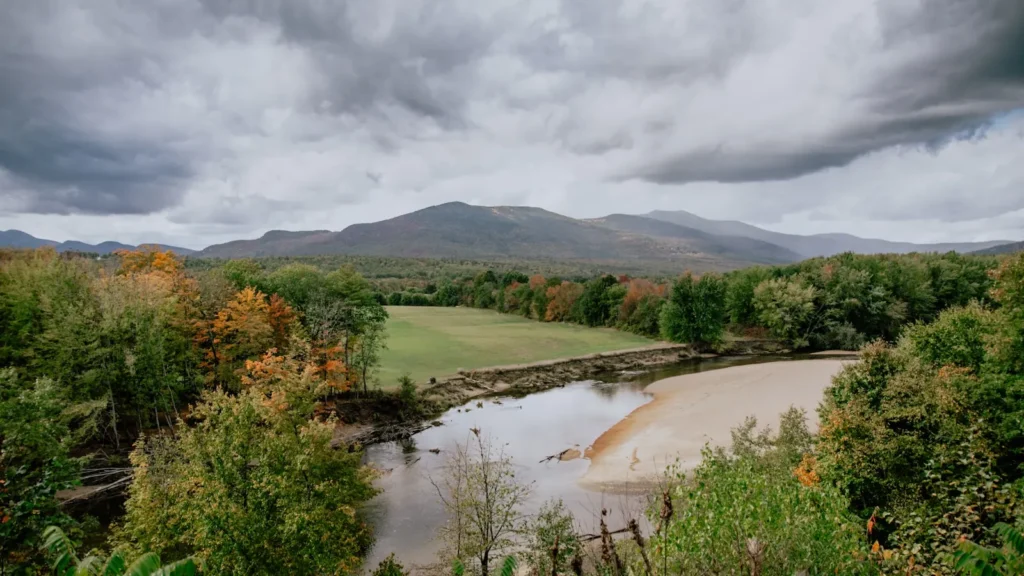
The Penobscot drains a third of Maine, and the main stem that guides actually fish runs from the confluence of the East and West branches down through Medway, Mattawamkeag, Winn and West Enfield toward Old Town. It is a big, low-gradient river by Maine standards, wide enough that wind matters and shallow enough over long stretches that a loaded canoe will find gravel if the rower is not paying attention. The bed is cobble and ledge, broken by long flat pools and short riffle drops, and the water clears quickly after rain because so much of the basin is forest rather than farmland.
Smallmouth bass are the workhorse fishery and the reason most float trips get booked. They are abundant, willing, and distributed through nearly every piece of holding water from the branch confluence downstream, which makes the river forgiving for anglers who are new to moving water. Landlocked salmon are the prize, concentrated in the faster, colder water near the branch confluence and around the West Enfield reach, and they draw fly anglers in spring and again in September. Chain pickerel and white perch fill out the catch in the slower backwaters, and the river’s restored sea-run alewife and shad runs have changed what the lower system looks like in early summer.
Access is genuinely easy for a river this size. Route 2 and Route 116 shadow the main stem, so put-ins and takeouts are rarely more than a few minutes off pavement, and the traditional float segments are short enough to run in a half day. Guides work the river from canoes on the upper sections and from drift boats where the flow allows. The West Enfield gauge is the reference reading for the lower main stem and is what most outfitters check before committing to a float plan.
Fished this water? Add a photo
Reviewed by hand before it appears. Pick the water, not the spot — we never publish exact locations.
Access
West Enfield boat launch, off Route 2 just below the gauge - the standard takeout for the lower main stem float and the easiest hard-surface ramp on this reach.
Mattawamkeag Wilderness Park, Route 2 east of town - camping, a canoe launch, and the usual upstream put-in for the long float toward Winn.
Medway launch near the East Branch confluence - the top of the classic salmon water and the coldest reach in summer.
Winn public landing, off Route 2 - splits the Mattawamkeag to West Enfield run into two manageable half days.
Old Town and Milford ramps serve the lower river below the gauge, where the water widens and powerboats become more common.
Much of the shoreline is private woodland or paper company ground; stay on gravel bars and below the high-water mark unless access is posted as public.
Wind on the long flats is the practical limit on canoe days here, more often than flow is.
Seasons
Spring: high, cold and pushy through May. Landlocked salmon fishing near the branch confluence is at its best and smallmouth are still staging in the deeper pools.
Summer: the core smallmouth season. Flows drop, the river warms, and topwater fishing on the flats and drop-offs is reliable from late June into August.
Fall: September brings cooling water, a second salmon window, and the heaviest smallmouth of the year feeding hard before the freeze.
Winter: the main stem ices over and float trips stop. Planning for the following season generally starts once ice-out timing is clear in April.
From the water
No logged trips yet. Be the first to put this water on your map.
Log this water
Fished it or cleaned it? Log in or create a free account to log a trip with photos and earn the waterway badge.
Questions
What is the current flow on the Penobscot River?
As of Sep 6, 2:30 am, the USGS gauge Penobscot River at West Enfield, Maine reads 3,530 cfs. Conditions update every 15 minutes.
What species can you catch on the Penobscot River?
Anglers target American Shad, Chain Pickerel, Landlocked Salmon, Smallmouth Bass, White Perch on the Penobscot River in Maine.
Where can you access the Penobscot River?
West Enfield boat launch, off Route 2 just below the gauge - the standard takeout for the lower main stem float and the easiest hard-surface ramp on this reach. Mattawamkeag Wilderness Park, Route 2 east of town - camping, a canoe launch, and the usual upstream put-in for the long float toward Winn. Medway launch near the East Branch confluence - the top of the classic salmon water and the coldest reach in summer. Winn public landing, off Route 2 - splits the Mattawamkeag to West Enfield run into two manageable half days. Old Town and Milford ramps serve the lower river below the gauge, where...
When is the best time to fish the Penobscot River?
Spring: high, cold and pushy through May. Landlocked salmon fishing near the branch confluence is at its best and smallmouth are still staging in the deeper pools. Summer: the core smallmouth season. Flows drop, the river warms, and topwater fishing on the flats and drop-offs is reliable from late June into August. Fall: September brings cooling water, a second salmon window, and the heaviest smallmouth of the year feeding hard before the freeze. Winter: the main stem ices over and float trips stop. Planning for the following season generally starts once ice-out timing is clear in April.
Where are the fishing regulations for the Penobscot River?
Regulations change by season and section. Read the current rules on the Maine agency site: https://www.maine.gov/ifw/fishing-boating/fishing/laws-rules.html