Esopus Creek Fishing Guides
The Catskills' rainbow trout creek - a big, boulder-strewn freestone flowing off Slide Mountain through Phoenicia to the Ashokan, with flow governed as much by the Shandaken Tunnel as by rainfall.
Map of the Esopus Creek
43 numbered points: 9 access points, 3 campsites, 1 bait & fly shop, 2 outfitters, 5 bridges, 13 parks and conservation areas, 1 agency office, 2 regulation section limits, 6 hazards, 1 USGS gauge. Tap a marker for details. Reviewed Sep 21, 2026.
- Access / boat ramp (9)
- Campsite (3)
- Bait, tackle & fly shop (1)
- Outfitter / canoe rental (2)
- Bridge crossing (5)
- Park / conservation area (13)
- Agency / conservation office (1)
- Regulation section limit (2)
- Dam / hazard (6)
- USGS gauge (1)
Print it. Bag it. Bring it.Phones die, screens crack, and most of this water has no signal. Print this map, fold it into a zip-top bag or dry bag with your license, and you have a backup your electronics can’t give you. Every marker is numbered so you can say exactly where you are.
Open the printable mapAll 43 points on this map
| # | Point | Type | Lat, Lon | Notes |
|---|---|---|---|---|
| 1 | Winnisook Lake Dam Head of the mapped main stem | Dam / hazard | 42.01570, -74.41182 | Outlet dam of Winnisook Lake on the north slope of Slide Mountain, the pond at the head of Esopus Creek. The mapped centre line of the creek starts here. |
| 2 | Otter Falls Headwater reach above Oliverea | Dam / hazard | 42.03122, -74.41898 | Named waterfall on the headwater reach; four more unnamed drops are mapped within the next two kilometres of creek. |
| 3 | McKinley Hollow Unit NYC DEP Watershed Recreation Unit | Park / conservation area | 42.06736, -74.46076 | City water-supply land open to fishing with a free NYC DEP Access Permit; DEP publishes a map of the unit. The unit boundary touches the creek at line-km 8.9. |
| 4 | Cold Spring Lodge Big Indian | Campsite | 42.07205, -74.46012 | Private lodge property at Big Indian, mapped in OpenStreetMap as a campsite on the headwater reach. Not a public campground. |
| 5 | Oliverea Unit NYC DEP Watershed Recreation Unit | Park / conservation area | 42.07637, -74.45165 | City water-supply land open to fishing with a free NYC DEP Access Permit; DEP publishes a map of the unit. |
| 6 | Wild Quality section - upper limit, Lost Clove Creek Lost Clove Road bridge, also named Dunham Bridge | Regulation section limit | 42.09772, -74.44918 | DEC's Wild Quality reach runs from Ashokan Reservoir upstream to the confluence with Lost Clove Creek. Lost Clove Creek is not in OpenStreetMap, so the limit is placed at the Lost Clove Road bridge where it comes in. |
| 7 | Indian Grove Unit NYC DEP Watershed Recreation Unit | Park / conservation area | 42.10509, -74.44613 | City water-supply land open to fishing with a free NYC DEP Access Permit; DEP publishes a map of the unit. Big Indian Park, a hamlet park, sits on the same reach a few hundred metres away. |
| 8 | Public fishing rights parking, Creekside Drive - upper Big Indian | Access / boat ramp | 42.11756, -74.42402 | One of three DEC public-fishing-rights parking areas on Creekside Drive. The state publishes the location of each lot and no name for it; this is the upstream one of the three. |
| 9 | Public fishing rights parking, Creekside Drive - middle Big Indian | Access / boat ramp | 42.11731, -74.41992 | Middle of the three DEC public-fishing-rights lots on Creekside Drive, about 400 m of creek below the upper one. The state publishes no name for it. |
| 10 | Public fishing rights parking, Creekside Drive - lower Big Indian | Access / boat ramp | 42.11846, -74.40342 | Downstream of the three DEC public-fishing-rights lots on Creekside Drive, about 1.3 km of creek below the middle one. The state publishes no name for it. |
| 11 | Glenbrook Park Shandaken - 48 Route 28 | Park / conservation area | 42.12210, -74.39877 | Town of Shandaken park on the creek between the Creekside Drive fishing-rights lots and the hamlet of Shandaken. |
| 12 | Shandaken Unit NYC DEP Watershed Recreation Unit | Park / conservation area | 42.12527, -74.38867 | City water-supply land open to fishing with a free NYC DEP Access Permit; DEP publishes a map of the unit. Its mapped centre sits about 800 m back from the creek, so use the DEP map for the water frontage. |
| 13 | Fox Hollow Unit NYC DEP Watershed Recreation Unit | Park / conservation area | 42.11694, -74.38193 | City water-supply land open to fishing with a free NYC DEP Access Permit; DEP publishes a map of the unit. |
| 14 | Allaben Unit NYC DEP Watershed Recreation Unit | Park / conservation area | 42.10636, -74.34705 | City water-supply land open to fishing with a free NYC DEP Access Permit; DEP publishes a map of the unit. A DEC public-fishing-rights parking area on Route 28 sits at the creek here, 50 m of line from the unit. |
| 15 | Sheridan Mountain Unit NYC DEP Watershed Recreation Unit | Park / conservation area | 42.09501, -74.33027 | City water-supply land open to fishing with a free NYC DEP Access Permit; DEP publishes a map of the unit. |
| 16 | The Town Tinker Tube Rental 10 Bridge Street, Phoenicia | Outfitter / canoe rental | 42.08309, -74.31277 | Tube livery on the creek at the Bridge Street crossing in Phoenicia; address from the business's own site and geocoded to an exact match. |
| 17 | Phoenicia Black Bear Campground Phoenicia | Campsite | 42.08294, -74.31111 | Campground on the creek at Phoenicia, immediately below the Bridge Street crossing. |
| 18 | Sleepy Hollow Campgrounds Mount Pleasant | Campsite | 42.06898, -74.30505 | Creekside campground below Phoenicia. A DEC public-fishing-rights parking area on Plank Road sits at the water at the same point. |
| 19 | Catskill Outfitters 5579 Route 28, Phoenicia | Bait, tackle & fly shop | 42.06270, -74.30729 | Fly shop and guide service on Route 28 beside the creek. The address is the one the shop publishes on its own site; a local directory still lists it at 7 Church Street, which is unresolved. |
| 20 | Esopus Creek Fishing Access Mount Pleasant | Access / boat ramp | 42.05621, -74.29776 | Named fishing access on the creek at Mount Pleasant, mapped in OpenStreetMap under this name. |
| 21 | Mount Pleasant Unit NYC DEP Watershed Recreation Unit | Park / conservation area | 42.05547, -74.29368 | City water-supply land open to fishing with a free NYC DEP Access Permit; DEP publishes a map of the unit. A DEC public-fishing-rights parking area on Route 28 sits about 300 m of creek downstream. |
| 22 | Public fishing rights parking, Mount Pleasant Road Mount Pleasant | Access / boat ramp | 42.04919, -74.28566 | DEC public-fishing-rights parking area on Mount Pleasant Road. The state publishes the location and the water it serves, and no name for the lot. |
| 23 | Mount Tremper Unit NYC DEP Watershed Recreation Unit | Park / conservation area | 42.03834, -74.27989 | City water-supply land open to fishing with a free NYC DEP Access Permit; DEP publishes a map of the unit. The last DEP unit on the creek above Ashokan Reservoir. |
| 24 | Catskills Visitor Center Route 28, Mount Tremper | Agency / conservation office | 42.02767, -74.26981 | Catskill Park visitor centre on Route 28 beside the creek - maps, trail and access information for the whole upper valley. |
| 25 | USGS 01362500 - Esopus Creek at Coldbrook Real-time flow and stage | USGS gauge | 42.01450, -74.27020 | The gauge the water page reads. It sits on the last free-flowing kilometre above Ashokan Reservoir, so it reports the whole upper creek including the Shandaken Tunnel release. |
| 26 | Public fishing rights parking, Route 28A, Boiceville Boiceville | Access / boat ramp | 42.00341, -74.27132 | The lowest DEC public-fishing-rights lot on the upper creek, on Route 28A just above the reservoir. The state publishes no name for it. |
| 27 | Boiceville Bridge Route 28A at Boiceville | Bridge crossing | 41.99918, -74.27043 | The last crossing above Ashokan Reservoir and the usual take-out landmark for the upper creek. |
| 28 | Wild Quality section - lower limit, Ashokan Reservoir Where the creek enters the Upper (West) Basin | Regulation section limit | 41.99736, -74.27500 | The lower end of DEC's Wild Quality reach, placed where the mapped centre line crosses the reservoir shoreline, 0.46 km below the Boiceville Bridge. The reach measures about 29 km (18 mi). |
| 29 | Olive Bridge Dam, Ashokan Reservoir NYC DEP - OSM spells it Olivebridge | Dam / hazard | 41.93896, -74.21853 | NYC DEP's Olive Bridge Dam impounds Ashokan Reservoir. Water reaches the creek below through what DEP calls the Ashokan Reservoir Release Channel, which is why the lower Esopus runs cold and clear or turbid depending on the release. |
| 30 | Winchell's Falls Lower Esopus below the dam | Dam / hazard | 41.92753, -74.20063 | Ledge drop on the lower Esopus, about 200 m of creek below the Wiggly Bridge. The first real obstruction below the reservoir. |
| 31 | Hurley Mountain Road bridge Marbletown | Bridge crossing | 41.87910, -74.14472 | The only mapped crossing in the twelve kilometres of lower creek between Winchell's Falls and Tongore Park. |
| 32 | Tongore Park Town of Olive | Park / conservation area | 41.87315, -74.14060 | Town park on the lower Esopus at the bottom of the Marbletown bend. |
| 33 | Wynkoop Road bridge Hurley | Bridge crossing | 41.92725, -74.06801 | Crossing at Hurley, the only mapped feature on the creek for ten kilometres either side. |
| 34 | Unnamed hand launch, Charles Street Park Unnamed in OpenStreetMap - Town of Ulster | Access / boat ramp | 41.96121, -74.01173 | A slipway mapped at the creek edge of Charles Street Park with no name. OSM tags it no-vehicle, so it is a carry-in launch rather than a trailer ramp. |
| 35 | Leggs Mills Road bridge Town of Ulster | Bridge crossing | 41.99505, -73.99774 | Crossing on the lower creek between Kingston and Glenerie Falls. |
| 36 | Glenerie Falls Lower Esopus above Saugerties | Dam / hazard | 42.02052, -73.98460 | A run of ledges mapped as six separate drops over about 600 m of creek; this marker is the head of them. The head of tide on the Esopus is below, at Saugerties. |
| 37 | Glasco Turnpike bridge Saugerties | Bridge crossing | 42.03804, -73.97162 | The last road crossing above the Saugerties village reach. |
| 38 | Esopus Bend Nature Preserve Esopus Creek Conservancy - Saugerties | Park / conservation area | 42.06760, -73.95734 | Land-trust preserve on the creek, not a public agency site. Published entrances are 10 Shady Lane, 50 Sterley Avenue and One Preserve Way; no boat launch is published. |
| 39 | I Paddle New York Saugerties village reach | Outfitter / canoe rental | 42.07205, -73.95165 | Paddle livery on the creek at Saugerties, just above the village beach. |
| 40 | Saugerties Village Beach South Partition Street - OSM calls it Saugerties Public Beach Park | Access / boat ramp | 42.07117, -73.95134 | The best-documented public access on the lower Esopus: Village of Saugerties park above the Cantine Dam with a hard-surface launch. A village launch permit is required. |
| 41 | Cantine Dam OSM names it Diamond Mills Paper Company Dam | Dam / hazard | 42.07210, -73.94977 | The dam at Saugerties village, immediately below the village beach. It is the head of the tidal reach; everything below it is Hudson tidewater. |
| 42 | Tina Chorvas Waterfront Park Saugerties - hand launch, village permit | Access / boat ramp | 42.07156, -73.94549 | Waterfront park with a mapped slipway on the tidal creek below the Cantine Dam. The village groups it with its Hudson River launches, so treat it as a tidewater put-in. |
| 43 | Ruth Reynolds Glunt Nature Preserve Saugerties Lighthouse - mouth of the creek | Park / conservation area | 42.07213, -73.93345 | Preserve at the mouth, where the Esopus meets the Hudson. The lighthouse trail leaves from here. |
Guides on the Esopus Creek
Claimed profiles take booking requests. Unclaimed profiles are built from public records so the river is never empty; the guide can claim or remove one any time.
Order on this page: premium and outfitter plans first (labelled Premium placement), then claimed free profiles, then unclaimed — one published price, no bidding for position. How placement works
About the Esopus Creek
Esopus Creek rises on the flanks of Slide Mountain and runs east and then south through Big Indian, Shandaken, Phoenicia and Boiceville into the Ashokan Reservoir. It is the largest of the classic Catskill streams by volume and the least delicate in character: wide, boulder-strewn, fast, and often coloured. Where the Beaverkill and the Willowemoc reward finesse, the Esopus rewards heavy wading, weighted flies and a willingness to fish water that is moving hard. It is the creek that made the Catskills a rainbow trout destination rather than a brown trout one.
The fishery is dominated by wild rainbows, descended from stockings that go back well over a century and now reproducing on their own in the tributaries. They run smaller than the browns of the neighbouring rivers but they are numerous, they fight above their weight in fast water, and they are spread through the entire creek. Brown trout hold in the deeper pools and grow large in the lower reaches near the reservoir, and brook trout persist in the cold headwater tributaries above Big Indian. The mayfly hatches follow the standard Catskill calendar, but on the Esopus the practical answer is often a nymph fished deep through pocket water.
The complication that defines this creek is the Shandaken Tunnel, which diverts water from the Schoharie Reservoir into the Esopus at the Portal above Allaben. When the tunnel is running, flow and turbidity in the main stem jump regardless of local weather, and the creek below the Portal can be high and off-colour on a bluebird day. That makes the Coldbrook gauge, which reads discharge, stage and water temperature, the single most useful planning tool on the water – it captures the combined effect of rainfall and diversion.
This water needs a real photo
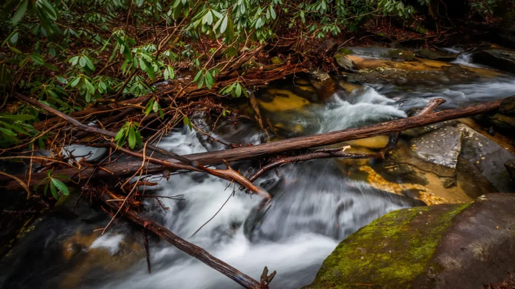
The photo at the top of this page is not Esopus Creek.
It is a regional stand-in, honestly captioned but generic — we will not put a name to a river we cannot prove. Send us a photograph you took here and it replaces the stand-in, with your credit on it.
Add a photo of this water
Landscape, not fish — the water itself. Reviewed by hand before it appears. The first one published here earns the Pioneer badge.
Fished this water? Add a photo
Reviewed by hand before it appears. Pick the water, not the spot — we never publish exact locations.
Access
Phoenicia - the town sits on the creek with multiple pull-offs and walk-in paths, and is the practical centre of access for the middle reach.
Route 28 parallels the creek from Big Indian to Boiceville, with numbered turnouts serving most of the productive water.
The Shandaken Tunnel Portal above Allaben - the point where diverted water enters the creek and the dividing line between the small upper stream and the big main stem.
New York State public fishing rights easements are marked with yellow signs along much of the corridor; they permit fishing and streamside walking, not parking or camping.
Boiceville and the reach approaching the Ashokan Reservoir hold the largest brown trout and are reached from Route 28A.
The upper creek above Big Indian is small, cold and largely brook trout water, accessed on foot from Oliverea Road.
Tubing traffic through Phoenicia is heavy on summer weekends; fish early or fish above the tubing reach.
Seasons
Spring: high, cold and often heavy with runoff. April and May bring the best hatches and the most active rainbows once the water drops into shape.
Summer: the tunnel keeps the main stem cooler than an unaided freestone would be, so fishing continues, but turbidity from diversion is the standard complaint. Early mornings are best.
Fall: prime. Low clear water, cool temperatures, and browns moving toward the tributaries. The most pleasant fishing of the year.
Winter: the creek stays open in the faster water and holds fish, but access is icy and the season rules vary by section - check the current New York regulations.
From the water
No logged trips yet. Be the first to put this water on your map.
Log this water
Fished it or cleaned it? Log in or create a free account to log a trip with photos and earn the waterway badge.
Questions
What is the current flow on the Esopus Creek?
As of Nov 2, 7:00 am, the USGS gauge ESOPUS CREEK AT COLDBROOK NY reads 385 cfs, with water temperature 48.9 F. Conditions update every 15 minutes.
What species can you catch on the Esopus Creek?
Anglers target Brook Trout, Brown Trout, Rainbow Trout on the Esopus Creek in New York.
Are there fishing guides on the Esopus Creek?
GuidedFloats lists 1 guide and outfitters on the Esopus Creek. Claimed profiles accept booking requests; unclaimed profiles are built from public records and link to the business.
Where can you access the Esopus Creek?
Phoenicia - the town sits on the creek with multiple pull-offs and walk-in paths, and is the practical centre of access for the middle reach. Route 28 parallels the creek from Big Indian to Boiceville, with numbered turnouts serving most of the productive water. The Shandaken Tunnel Portal above Allaben - the point where diverted water enters the creek and the dividing line between the small upper stream and the big main stem. New York State public fishing rights easements are marked with yellow signs along much of the corridor; they permit fishing and streamside walking, not parking or campin...
When is the best time to fish the Esopus Creek?
Spring: high, cold and often heavy with runoff. April and May bring the best hatches and the most active rainbows once the water drops into shape. Summer: the tunnel keeps the main stem cooler than an unaided freestone would be, so fishing continues, but turbidity from diversion is the standard complaint. Early mornings are best. Fall: prime. Low clear water, cool temperatures, and browns moving toward the tributaries. The most pleasant fishing of the year. Winter: the creek stays open in the faster water and holds fish, but access is icy and the season rules vary by section - check the curren...
Where are the fishing regulations for the Esopus Creek?
Regulations change by season and section. Read the current rules on the New York agency site: https://dec.ny.gov/things-to-do/freshwater-fishing/regulations