SG
StriperFun Guide Service
Albany, KY
GuidedFloats is in beta. The full site launches March 1, 2027. The mobile app follows.
Guides: claim before March 1, 2027 and your first full season of Premium is free. Claim your founding spot →
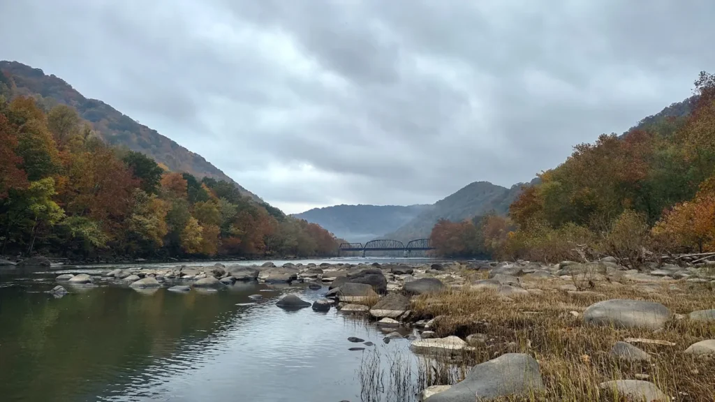
The Cordell Hull tailwater on the upper Cumberland near Carthage - cold, generation-driven water below the dam holding striped bass, smallmouth and a strong late-winter walleye run.
Claimed profiles take booking requests. Unclaimed profiles are built from public records so the river is never empty; the guide can claim or remove one any time.
Cordell Hull Dam sits on the Cumberland River just upstream of Carthage, Tennessee, and the water it releases sets the character of the river for many miles downstream. Like every generation tailwater, this reach has two states: still and wadeable when the units are off, and a fast, cold, rising river within minutes of the horn. The bed below the dam is limestone ledge and gravel with deep scour holes near the structure, grading into a broader, slower river as it works down toward Carthage and the Caney Fork confluence.
Striped bass are what the tailwater is best known for. They stack below the dam through the warm months because the released water stays cold when the rest of the river does not, and guides run trips specifically for them from late spring into September. Smallmouth bass hold on the ledges and in the current seams year-round and are the most consistent catch. White bass run up to the dam in spring in large numbers, walleye make a late-winter spawning push into the tailrace, and blue catfish hold in the deep scour water immediately below the structure. It is a genuinely mixed fishery in a short piece of river.
Access is concentrated at the dam. The Corps of Engineers maintains a tailwater recreation area with a boat ramp and bank fishing platforms, and most fishing happens either from that bank or from boats launched there. Wading is possible during generation-off windows and is dangerous at any other time, because the river can come up several feet with very little warning. The gauge below the dam reports water temperature and stage but publishes no discharge series, which means the release schedule matters more than any flow number when planning a trip here.
Reviewed by hand before it appears. Pick the water, not the spot — we never publish exact locations.
Cordell Hull Dam tailwater area - Corps of Engineers boat ramp, parking and bank fishing access immediately below the structure.
Defeated Creek and the Carthage area serve the reach downstream where the river widens and slows.
Bank fishing platforms at the tailwater are the safest option during generation and the most heavily used spot on the reach.
The Caney Fork confluence below Carthage adds a second cold-water input and holds fish through the summer.
Wading is only sensible during confirmed generation-off windows; check the release schedule before committing to it.
The horn and the warning lights at the dam mean the river is about to rise - leave the water immediately, not after one more cast.
Restricted zones immediately below the dam are buoyed and enforced; boats must stay downstream of the markers.
Spring: white bass run up to the dam in March and April and the tailrace is at its busiest. High, cold water and frequent generation.
Summer: the striped bass fishery peaks as fish concentrate in the cold released water while the rest of the river warms past their tolerance.
Fall: cooling water spreads fish back downstream, smallmouth fishing on the ledges is at its best, and pressure drops off sharply.
Winter: walleye push into the tailrace late in the season, and the deep scour holes below the dam hold blue catfish through the coldest months.
No logged trips yet. Be the first to put this water on your map.
Fished it or cleaned it? Log in or create a free account to log a trip with photos and earn the waterway badge.
Anglers target Blue Catfish, Smallmouth Bass, Striped Bass, Walleye, White Bass on the Cumberland River below Cordell Hull Dam in Tennessee.
GuidedFloats lists 1 guide and outfitters on the Cumberland River below Cordell Hull Dam. Claimed profiles accept booking requests; unclaimed profiles are built from public records and link to the business.
Cordell Hull Dam tailwater area - Corps of Engineers boat ramp, parking and bank fishing access immediately below the structure. Defeated Creek and the Carthage area serve the reach downstream where the river widens and slows. Bank fishing platforms at the tailwater are the safest option during generation and the most heavily used spot on the reach. The Caney Fork confluence below Carthage adds a second cold-water input and holds fish through the summer. Wading is only sensible during confirmed generation-off windows; check the release schedule before committing to it. The horn and the warning...
Spring: white bass run up to the dam in March and April and the tailrace is at its busiest. High, cold water and frequent generation. Summer: the striped bass fishery peaks as fish concentrate in the cold released water while the rest of the river warms past their tolerance. Fall: cooling water spreads fish back downstream, smallmouth fishing on the ledges is at its best, and pressure drops off sharply. Winter: walleye push into the tailrace late in the season, and the deep scour holes below the dam hold blue catfish through the coldest months.
Regulations change by season and section. Read the current rules on the Tennessee agency site: https://www.tn.gov/twra/fishing/fishing-regulations.html