Fishes Maumee River
River · Northwestern Ohio in Lucas and Wood counties, running northeast from the Indiana line past Defiance and Grand Rapids through Waterville and Perrysburg to Maumee Bay on Lake Erie · Ohio
Maumee River Fishing Guides
Host of the largest walleye spawning run in the United States, with tens of thousands of anglers wading the rapids above Toledo every spring.
Map of the Maumee River
58 numbered points: 6 access points, 3 campsites, 3 bait & fly shops, 2 outfitters, 26 bridges, 11 parks and conservation areas, 2 regulation section limits, 2 hazards, 1 USGS gauge, 2 points of interest. Tap a marker for details. Reviewed Oct 23, 2026.
- Access / boat ramp (6)
- Campsite (3)
- Bait, tackle & fly shop (3)
- Outfitter / canoe rental (2)
- Bridge crossing (26)
- Park / conservation area (11)
- Regulation section limit (2)
- Dam / hazard (2)
- USGS gauge (1)
- Point of interest (2)
Map data © OpenStreetMap contributors. Points are curated from OpenStreetMap and state agency sources; confirm access and hours before you go.
Print it. Bag it. Bring it.Phones die, screens crack, and most of this water has no signal. Print this map, fold it into a zip-top bag or dry bag with your license, and you have a backup your electronics can’t give you. Every marker is numbered so you can say exactly where you are.
Open the printable mapAll 58 points on this map
| # | Point | Type | Lat, Lon | Notes |
|---|---|---|---|---|
| 1 | SR 49 | Bridge crossing | 41.19845, -84.74687 | |
| 2 | Riverside Veterans Memorial Park Village park, Antwerp | Park / conservation area | 41.18342, -84.73518 | Riverside village park at the top of the Ohio reach. |
| 3 | US 127 | Bridge crossing | 41.26002, -84.55412 | |
| 4 | The Bend Road | Bridge crossing | 41.27539, -84.51558 | |
| 5 | CSX Garrett Subdivision Rail crossing | Bridge crossing | 41.28312, -84.50705 | |
| 6 | US 24 | Bridge crossing | 41.28143, -84.40840 | |
| 7 | Napoleon, Defiance and Western Railroad Rail crossing | Bridge crossing | 41.28885, -84.36498 | |
| 8 | Clinton Street Defiance | Bridge crossing | 41.28908, -84.36101 | |
| 9 | Fort Defiance Park Historic fort site, Defiance | Park / conservation area | 41.28757, -84.35742 | Site of Fort Defiance at the Auglaize confluence; riverside park with parking. OSM spells it 'Oldfort Defiance Park'. |
| 10 | Domersville Road | Bridge crossing | 41.29220, -84.32351 | |
| 11 | Buckeye Trail Footpath crossing | Bridge crossing | 41.29333, -84.28667 | |
| 12 | Independence Dam State Park Campground State park campground | Campsite | 41.29095, -84.24673 | ODNR campground on the Independence Dam pool below Defiance. |
| 13 | Henry Street Napoleon | Bridge crossing | 41.32137, -84.20003 | |
| 14 | South Perry Street Napoleon | Bridge crossing | 41.38764, -84.12245 | |
| 15 | Suzie Q's Private campground | Campsite | 41.39780, -84.11254 | Riverside private campground above Napoleon. |
| 16 | US 6 | Bridge crossing | 41.40964, -84.05890 | |
| 17 | DT&I Subdivision Rail crossing | Bridge crossing | 41.41142, -84.03293 | |
| 18 | Damascus Bridge | Bridge crossing | 41.40886, -84.00930 | |
| 19 | North Turkeyfoot State Area ODNR state area | Park / conservation area | 41.41266, -83.98970 | State ground on the north bank above Grand Rapids. |
| 20 | Mary Jane Thurston State Park Campground State park campground | Campsite | 41.41036, -83.87793 | ODNR campground at Grand Rapids, beside Mary Jane Thurston State Park. |
| 21 | Providence Dam Low dam at Grand Rapids | Dam / hazard | 41.41568, -83.87170 | Portage at Providence Metropark. OSM maps the structure as two weirs; this is the river-side one. |
| 22 | Providence Metropark Metroparks Toledo | Park / conservation area | 41.41657, -83.86425 | Park at the dam and canal lock; the portage and parking are here. |
| 23 | Toledo, Lake Erie and Western Railway Rail crossing | Bridge crossing | 41.41474, -83.86308 | |
| 24 | Miami and Erie Canal Lock 44 Restored canal lock | Point of interest | 41.41560, -83.86116 | Restored lock beside the dam at Providence Metropark, with the canal-boat landing. |
| 25 | Grand Rapids Road Grand Rapids | Bridge crossing | 41.41426, -83.86080 | |
| 26 | Otsego Park Access Wood County park access | Access / boat ramp | 41.44490, -83.78632 | River access at Otsego Park, below Grand Rapids. |
| 27 | Missionary Island State Wildlife Area ODNR state wildlife area | Park / conservation area | 41.47504, -83.74476 | Island wildlife area; its easternmost point is a named boundary in Ohio's Maumee River rules. |
| 28 | Farnsworth Kayak Concession Metropark paddle concession | Outfitter / canoe rental | 41.47875, -83.74717 | Seasonal kayak hire at Farnsworth Metropark. |
| 29 | Indianola Overlook Bird-viewing overlook | Point of interest | 41.48330, -83.74218 | Overlook on the Farnsworth Metropark rapids reach. |
| 30 | Lima and Toledo Electric Railway Rail crossing | Bridge crossing | 41.48625, -83.72834 | |
| 31 | Miltonville Fishing Access Roadside fishing access | Access / boat ramp | 41.48914, -83.71457 | Parking and bank access on the Miltonville reach. |
| 32 | SR 64 Waterville | Bridge crossing | 41.50002, -83.71359 | |
| 33 | Maumee Rapids Rapids reach, Waterville to Maumee | Dam / hazard | 41.52023, -83.70998 | The rapids the spring walleye run holds in: wadeable at low flow, pushy in spring. |
| 34 | Fallen Timbers State Memorial State memorial, Maumee | Park / conservation area | 41.54371, -83.69717 | Battlefield memorial on the bluff above the rapids. |
| 35 | I 475 / US 23 | Bridge crossing | 41.54550, -83.68292 | |
| 36 | Side Cut Metropark Metroparks Toledo | Park / conservation area | 41.54829, -83.67762 | The walleye-run park: parking, canal remnants and the Blue Grass Island wade. |
| 37 | Buttonwood-Betty C Black Recreation Area Wood County river access | Access / boat ramp | 41.54680, -83.67290 | Parking and bank access on the Perrysburg side of the rapids reach. |
| 38 | Blue Grass Island Wading access, Side Cut Metropark | Access / boat ramp | 41.55090, -83.66975 | Island wade at the heart of the spring walleye run, reached on foot from Side Cut. |
| 39 | Fort Meigs State Memorial State memorial, Perrysburg | Park / conservation area | 41.55270, -83.65085 | Reconstructed 1813 fort on the bluff above the river. |
| 40 | Toledo and Maumee Valley Railway Rail crossing | Bridge crossing | 41.55672, -83.65116 | |
| 41 | US 20 / SR 25 Perrysburg to Maumee | Bridge crossing | 41.55734, -83.65034 | |
| 42 | Maumee Tackle Fishing Outfitters Tackle shop, Maumee | Bait, tackle & fly shop | 41.56172, -83.65366 | Walleye-run tackle, licences and river reports. |
| 43 | Audubon Islands Nature Preserve State nature preserve | Park / conservation area | 41.56672, -83.63632 | Island preserve in the river between Perrysburg and Maumee. |
| 44 | Maple Street Boat Launch Public boat launch, Perrysburg | Access / boat ramp | 41.56666, -83.62623 | Surfaced launch below the rapids; the usual powerboat put-in. |
| 45 | Fin Feather Fur Outfitters Outdoor store, Maumee | Outfitter / canoe rental | 41.54629, -83.58616 | Large tackle and outdoor store about 3 km off the river. |
| 46 | Bass Pro Shops Tackle store, Rossford | Bait, tackle & fly shop | 41.56015, -83.58858 | Tackle and licences near the I-75 crossing. |
| 47 | Ohio Turnpike | Bridge crossing | 41.58042, -83.60665 | |
| 48 | Pier 75 Marina Marina, Toledo | Access / boat ramp | 41.62659, -83.54511 | Lower-river marina with ramp access to the bay reach. |
| 49 | I 75 Rossford | Bridge crossing | 41.62537, -83.54213 | |
| 50 | NS Chicago Line Rail crossing | Bridge crossing | 41.63241, -83.53098 | |
| 51 | Middlegrounds Metropark Metroparks Toledo | Park / conservation area | 41.63844, -83.53580 | Downtown Toledo riverfront park with a paddle launch. |
| 52 | Main Street Toledo | Bridge crossing | 41.65171, -83.52693 | |
| 53 | Glass City Metropark Metroparks Toledo | Park / conservation area | 41.65475, -83.51805 | East-bank riverfront park below downtown. |
| 54 | Craig Bridge Street Toledo | Bridge crossing | 41.65978, -83.51145 | |
| 55 | Spot & Spams Bait Shop Bait shop, Toledo | Bait, tackle & fly shop | 41.72461, -83.46932 | Bait for the lower river and Maumee Bay. |
| 56 | USGS 04193500 - Maumee River at Waterville USGS streamgauge | USGS gauge | 41.50005, -83.71271 | Live stage and discharge for this river. |
| 57 | Maumee River special-regulation reach - lower Section: Ohio Turnpike bridge up to Missionary Island | Regulation section limit | 41.47504, -83.74476 | Ohio names this reach in OAC 1501:31-13-01. The boundaries are the Ohio Turnpike bridge downstream and the easternmost point of Missionary Island upstream; check ODNR for the current rules before you fish. |
| 58 | Maumee River special-regulation reach - Lake Erie district Section: Providence Dam to the Maumee Bay line | Regulation section limit | 41.41568, -83.87170 | Ohio names this reach in OAC 1501:31-13-01, running from the Grand Rapids Providence dam to a line in Maumee Bay from Little Cedar Point to Turtle Island. Boundary only - check ODNR for the current rules. |
Guides on the Maumee River
Claimed profiles take booking requests. Unclaimed profiles are built from public records so the river is never empty; the guide can claim or remove one any time.
Order on this page: premium and outfitter plans first (labelled Premium placement), then claimed free profiles, then unclaimed — one published price, no bidding for position. How placement works
About the Maumee River
Every March and April the Maumee hosts what is generally reckoned the largest freshwater fish run in the country, and certainly the largest walleye run. Several hundred thousand walleye leave the western basin of Lake Erie and push up the river to spawn on the limestone rapids between Perrysburg and Grand Rapids, and they are followed by tens of thousands of anglers standing shoulder to shoulder in the current. It is a spectacle as much as a fishery, and it is unlike anything else in American angling.
The run fishery is simple and specific. Anglers wade the shallow rapids and cast weighted jigs tipped with soft plastic, working them across the current on a tight line. Ohio sets special regulations for the run, including a single hook restriction and a snagging rule that is actively enforced, and the daily limits change through the season. Wading is on slick, uneven limestone in cold, pushy spring water, and studded boots and a wading staff are genuinely necessary rather than merely advisable.
Outside the spring the Maumee is a good and almost entirely overlooked warmwater river. White bass run up behind the walleye in May in enormous numbers. Smallmouth fish well through the summer on the same rapids, and the river holds channel and flathead catfish, drum and carp in sizes that surprise people. This gauge sits at Waterville in the heart of the run water and reports discharge, stage and water temperature, and both numbers matter here – the run times to water temperature, and high spring discharge makes the rapids unwadeable. Check it daily through March. Parking at the popular metroparks fills before dawn on a good run weekend, and the islands close to wading whenever the river comes up.
This water needs a real photo
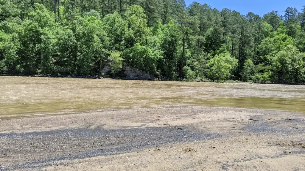
The photo at the top of this page is not Maumee River.
It is a regional stand-in, honestly captioned but generic — we will not put a name to a river we cannot prove. Send us a photograph you took here and it replaces the stand-in, with your credit on it.
Pioneer badgeUnclaimed
Add a photo of this water
Landscape, not fish — the water itself. Reviewed by hand before it appears. The first one published here earns the Pioneer badge.
Fished this water? Add a photo
Reviewed by hand before it appears. Pick the water, not the spot — we never publish exact locations.
Access
Side Cut Metropark in Maumee - the best-known access point for the spring walleye run.
Orleans Park in Perrysburg - bank and wading access on the lower run water.
Jerome Road rapids - heavily used wading water during the run.
Farnsworth Metropark near Waterville - the reach this gauge reads, with parking and trails.
Bluegrass Island - a traditional run location reached by wading, closed at high water.
Grand Rapids and Mary Jane Thurston State Park - upper run water and a boat ramp.
Maumee Bay State Park - the river mouth and the Lake Erie transition.
Seasons
Spring: the walleye run from March into April, then white bass in May - the busiest months by far.
Summer: excellent and nearly unpressured smallmouth fishing on the same rapids, plus catfish at night.
Fall: falling water, good smallmouth and a light second walleye showing in the lower river.
Winter: cold and mostly ice-affected, with limited fishing until the run begins.
From the water
No logged trips yet. Be the first to put this water on your map.
Log this water
Fished it or cleaned it? Log in or create a free account to log a trip with photos and earn the waterway badge.
Questions
What is the current flow on the Maumee River?
As of Nov 2, 7:00 am, the USGS gauge Maumee River at Waterville OH reads 726 cfs, with water temperature 57.6 F. Conditions update every 15 minutes.
What species can you catch on the Maumee River?
Anglers target Channel Catfish, Common Carp, Flathead Catfish, Freshwater Drum, Largemouth Bass, Smallmouth Bass, Walleye, White Bass on the Maumee River in Ohio.
Are there fishing guides on the Maumee River?
GuidedFloats lists 1 guide and outfitters on the Maumee River. Claimed profiles accept booking requests; unclaimed profiles are built from public records and link to the business.
Where can you access the Maumee River?
Side Cut Metropark in Maumee - the best-known access point for the spring walleye run. Orleans Park in Perrysburg - bank and wading access on the lower run water. Jerome Road rapids - heavily used wading water during the run. Farnsworth Metropark near Waterville - the reach this gauge reads, with parking and trails. Bluegrass Island - a traditional run location reached by wading, closed at high water. Grand Rapids and Mary Jane Thurston State Park - upper run water and a boat ramp. Maumee Bay State Park - the river mouth and the Lake Erie transition.
When is the best time to fish the Maumee River?
Spring: the walleye run from March into April, then white bass in May - the busiest months by far. Summer: excellent and nearly unpressured smallmouth fishing on the same rapids, plus catfish at night. Fall: falling water, good smallmouth and a light second walleye showing in the lower river. Winter: cold and mostly ice-affected, with limited fishing until the run begins.
Where are the fishing regulations for the Maumee River?
Regulations change by season and section. Read the current rules on the Ohio agency site: https://ohiodnr.gov/buy-and-apply/hunting-fishing-boating/fishing-resources/fishing-regulations