Genesee River Fishing Guides
A north-flowing western New York river with the Letchworth gorge up top and one of Lake Ontario most productive urban steelhead fisheries at the bottom.
Map of the Genesee River
41 numbered points: 12 access points, 1 campsite, 1 bait & fly shop, 12 parks and conservation areas, 4 regulation section limits, 10 hazards, 1 USGS gauge. Tap a marker for details. Reviewed Sep 22, 2026.
- Access / boat ramp (12)
- Campsite (1)
- Bait, tackle & fly shop (1)
- Park / conservation area (12)
- Regulation section limit (4)
- Dam / hazard (10)
- USGS gauge (1)
Print it. Bag it. Bring it.Phones die, screens crack, and most of this water has no signal. Print this map, fold it into a zip-top bag or dry bag with your license, and you have a backup your electronics can’t give you. Every marker is numbered so you can say exactly where you are.
Open the printable mapAll 41 points on this map
| # | Point | Type | Lat, Lon | Notes |
|---|---|---|---|---|
| 1 | Pennsylvania state line DEC reach boundary | Regulation section limit | 41.99947, -77.87279 | Upstream end of the New York water. DEC's stocked-extended reach runs from here downstream to the Route 19 bridge at Shongo. Above this point the river is in Potter County, Pennsylvania, under Pennsylvania rules. |
| 2 | Public fishing rights parking, Hawks Road NYS DEC | Access / boat ramp | 42.00155, -77.87853 | State-published public fishing rights parking. DEC publishes the lot location and no site name; this one sits on Hawks Road just inside New York. |
| 3 | Route 19 bridge, Shongo DEC reach boundary - NY 19 | Regulation section limit | 42.01524, -77.89482 | DEC's catch-and-release reach begins here and runs downstream; the stocked-extended reach above it runs up to the state line. A public fishing rights parking lot sits at the bridge. OSM names the road Stannards Road, ref NY 19. |
| 4 | Public fishing rights parking, Graves Road NYS DEC, Shongo | Access / boat ramp | 42.02442, -77.90495 | State-published public fishing rights parking inside the catch-and-release reach. DEC publishes the location and no site name. |
| 5 | Public fishing rights parking, Jack Bridge Road NYS DEC, Stannards | Access / boat ramp | 42.07547, -77.92485 | State-published public fishing rights parking below the catch-and-release water. DEC publishes the location and no site name. |
| 6 | Island Park, Wellsville Village of Wellsville | Park / conservation area | 42.11675, -77.94447 | Village park on the river at Wellsville, beside the Dyke Street reach. |
| 7 | Public fishing parking, West Dyke Street Wellsville | Access / boat ramp | 42.11610, -77.94616 | Two adjacent published parking lots about seven metres apart are shown here as one marker. Village-managed river access in Wellsville. |
| 8 | River Walk, Wellsville Village of Wellsville | Park / conservation area | 42.12562, -77.96091 | Riverside walk on the left bank through Wellsville; foot access to the water along the village reach. |
| 9 | Public fishing rights parking, County Road 9 NYS DEC, Town of Scio | Access / boat ramp | 42.17125, -77.98528 | State-published public fishing rights parking on the Scio reach. DEC publishes the location and no site name. |
| 10 | Amity River Access Park Town of Amity | Access / boat ramp | 42.20616, -78.02106 | Named river access park on the left bank above Belmont. Tagged as a park in OSM; it is an access site. |
| 11 | First Responder's River Access, Belmont Village of Belmont | Access / boat ramp | 42.22475, -78.03004 | Named river access immediately above the Belmont dam. A DEC public fishing rights parking lot sits about 30 m away and is folded into this marker. |
| 12 | State Dam at Belmont Low dam - portage | Dam / hazard | 42.22382, -78.03068 | Dam in the village of Belmont. It is also a DEC reach boundary: the stocked-extended water upstream of it is defined from this dam upstream toward York's Corners. |
| 13 | Village Park, Belfast Village of Belfast | Park / conservation area | 42.34369, -78.11143 | Village park beside the river at Belfast, about 550 m off the centreline. |
| 14 | Genesee Valley Greenway State Park NYS OPRHP - rail-trail | Park / conservation area | 42.36737, -78.13460 | Linear state park on the old Genesee Valley Canal and railroad bed. It follows the river for most of its length between Belfast and Rochester; this marker is one point on a long corridor. |
| 15 | Genesee Valley Wildlife Management Area NYS DEC | Park / conservation area | 42.51969, -78.03888 | State wildlife management area on the river flats below Fillmore; DEC land with walk-in river frontage. |
| 16 | Upper Falls, Letchworth State Park Waterfall - no passage | Dam / hazard | 42.57807, -78.04914 | First of Letchworth's three big falls, under the Portage railroad viaduct. The gorge reach is not floatable. |
| 17 | Middle Falls, Letchworth State Park Waterfall - no passage | Dam / hazard | 42.58310, -78.04258 | The largest of the three Letchworth falls, below Glen Iris. |
| 18 | Lower Falls, Letchworth State Park Waterfall - no passage | Dam / hazard | 42.58563, -78.02029 | Third of the Letchworth falls. Two further unnamed drops between Middle and Lower Falls are mapped in OSM and are not shown separately. |
| 19 | Letchworth State Park NYS OPRHP | Park / conservation area | 42.65816, -77.97055 | Seventeen miles of gorge, the three falls and the rim roads. Marker is the park centroid, not an access point; use the park's own map for the gorge overlooks and trails. |
| 20 | Highbanks Campground, Letchworth NYS OPRHP | Campsite | 42.69805, -77.93420 | The park's main campground, on the east rim above the lower gorge. Letchworth also has lettered cabin areas A to E and a group campground nearby; they are not shown separately. |
| 21 | Mount Morris Dam USACE flood control dam | Dam / hazard | 42.73327, -77.90706 | Army Corps flood-control dam at the foot of the gorge. No passage. The tailwater below it is a DEC special-regulation reach. |
| 22 | Mount Morris Power Dam Low dam - portage | Dam / hazard | 42.73842, -77.88181 | Second, smaller dam below the flood-control structure, near the NY 36 crossing. |
| 23 | First railroad bridge below Route 36 DEC reach boundary | Regulation section limit | 42.74032, -77.87800 | Downstream limit of DEC's Mount Morris tailwater reach, which DEC defines as running from the Mount Morris Dam to the first railroad bridge below State Route 36. This is that bridge, 0.39 km below NY 36. |
| 24 | Genesee River Waterway Access Monroe County reach | Access / boat ramp | 42.98240, -77.73367 | Named waterway access on the lower river above Rush. |
| 25 | Rush Riverside Refuge Town of Rush | Park / conservation area | 43.01033, -77.72450 | Town nature preserve on the river bank at Rush, with trails to the water. |
| 26 | Genesee River Canoe and Small Boat Access Canoe / car-top launch | Access / boat ramp | 43.03011, -77.72385 | Car-top launch on the lower river; the only named paddling access between Rush and Genesee Valley Park. |
| 27 | Genesee Valley Park, Rochester City of Rochester | Park / conservation area | 43.11621, -77.64652 | Olmsted park where the river meets the Erie Canal. Riverside paths, canal junction and the city's upstream river frontage. |
| 28 | USGS 04231600 - Genesee River at Ford Street Bridge, Rochester Live stage and discharge | USGS gauge | 43.14172, -77.61631 | The river gauge for this page. Read it before you go; the lower river runs high and coloured after rain on the Allegany headwaters. |
| 29 | Court Street Dam, Rochester Dam - no passage | Dam / hazard | 43.15229, -77.60902 | Dam in downtown Rochester holding the pool above High Falls. No passage. |
| 30 | High Falls, Rochester 96 ft waterfall - no passage | Dam / hazard | 43.16131, -77.61340 | The big falls in the middle of the city. Viewing from the Pont de Rennes bridge and High Falls Terrace Park on the west rim. |
| 31 | Middle Falls, Rochester Waterfall - no passage | Dam / hazard | 43.17671, -77.62804 | Second of the three Rochester falls, in the Maplewood gorge. |
| 32 | Lower Falls, Rochester Waterfall - reach boundary | Dam / hazard | 43.17939, -77.62773 | Third Rochester falls and the upstream limit of DEC's Lake Ontario tributary reach, which is defined from the Route 104 bridge upstream to the Lower Falls. Lower Falls Overlook Park is on the rim here. |
| 33 | Public fishing parking, Seth Green Drive City of Rochester | Access / boat ramp | 43.18713, -77.62348 | Published parking on the gorge road below the Lower Falls, in the tributary-run reach. |
| 34 | Route 104 bridge (Veterans Memorial Bridge) DEC reach boundary | Regulation section limit | 43.19257, -77.62063 | Downstream limit of DEC's Lake Ontario tributary reach on the Genesee, which runs from this bridge upstream to the Lower Falls. |
| 35 | Maplewood Park, Rochester City of Rochester | Park / conservation area | 43.19645, -77.62298 | Olmsted park on the west rim of the lower gorge, with the rose garden and stairs toward the river. |
| 36 | Seneca Park, Rochester Monroe County | Park / conservation area | 43.20858, -77.61961 | Long county park on the east rim of the gorge below the falls, with trail access down toward the water. |
| 37 | Turning Point Park, Rochester City of Rochester | Park / conservation area | 43.22861, -77.61775 | Riverside park at the old turning basin, with a boardwalk out over the water on the last slack reach above Charlotte. |
| 38 | Mitchels Live Bait and Tackle 4531 Lake Ave, Rochester | Bait, tackle & fly shop | 43.25337, -77.61254 | Bait and tackle a few hundred metres west of the river mouth at Charlotte, listed on Monroe County's own bait and tackle page. No website found; call ahead for hours before relying on it. |
| 39 | Public boat launch, Charlotte West bank at the mouth | Access / boat ramp | 43.25405, -77.60893 | Two adjacent paved and concrete public slipways on the west bank at Charlotte, shown as one marker. Neither carries a name in OSM. Two further slipways here are tagged private. |
| 40 | Public fishing parking, Coast Guard Access Summerville, east bank | Access / boat ramp | 43.25555, -77.60378 | Published parking on the east bank at Summerville, at the river mouth opposite Charlotte. |
| 41 | Ontario Beach Park City of Rochester | Park / conservation area | 43.26001, -77.60522 | Lakefront park at the river mouth; the pier at the west side of the channel is the classic shore stand for the fall run. |
Guides on the Genesee River
Claimed profiles take booking requests. Unclaimed profiles are built from public records so the river is never empty; the guide can claim or remove one any time.
No guides listed yet
Guide or outfit this water? Create your profile. Listing is free, the commission is 10% or 7% with a premium profile, and premium profiles list first on this water.
About the Genesee River
The Genesee is unusual for an eastern river in that it flows north, running from the Pennsylvania border through western New York to Lake Ontario at Rochester. Along the way it does two dramatic things: it cuts the Letchworth gorge, three waterfalls and six hundred feet of cliff that earned the park its nickname, and it cuts a second gorge straight through the middle of Rochester before reaching the lake.
The lower gorge is the fishery that draws travelling anglers. From the Lower Falls down to the harbour, the Genesee receives a heavy autumn run of chinook and coho salmon, followed by steelhead and brown trout that hold in the gorge pools through winter and into spring. It is genuinely urban fishing – you are within sight of the city – and it is productive enough that it runs shoulder to shoulder on good days. Access is by trail into the gorge, and the walk down is considerably easier than the walk back out.
Above the barrier the river is a different animal. Smallmouth bass, walleye, northern pike and channel catfish occupy the middle reaches between Letchworth and Rochester, and the upper river through the Southern Tier is small, agricultural and lightly fished. Letchworth State Park itself offers limited river access because of the gorge walls, but the water above and below the park is reachable.
The Genesee is a muddy river by nature and colours up hard after rain, which is the main constraint on the steelhead season. Check the gauge and give it a few days after a storm. Rochester-area shops and guides cover the lower gorge.
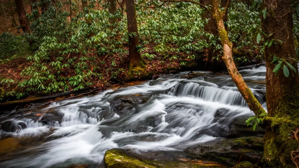
This water needs a real photo
The photo at the top of this page is not Genesee River.
It is a regional stand-in, honestly captioned but generic — we will not put a name to a river we cannot prove. Send us a photograph you took here and it replaces the stand-in, with your credit on it.
Add a photo of this water
Landscape, not fish — the water itself. Reviewed by hand before it appears. The first one published here earns the Pioneer badge.
Fished this water? Add a photo
Reviewed by hand before it appears. Pick the water, not the spot — we never publish exact locations.
Access
Rochester lower gorge - the main salmon and steelhead water below the falls.
Ford Street Bridge - the gauge reach in the city.
Seth Green Drive - trail access into the lower gorge pools.
Charlotte and the harbour - the Lake Ontario mouth and pier fishing.
Letchworth State Park - the upper gorge and limited river access.
Mount Morris area - middle river access below Letchworth.
Avon - middle river bank and launch access.
Seasons
Spring: dropping flows, the spring steelhead run and good walleye on the middle river.
Summer: low warm water, smallmouth and pike above the barrier, quiet in the gorge.
Fall: chinook and coho entering the lower gorge, the busiest season of the year.
Winter: cold gorge fishing for holdover steelhead and brown trout when ice allows.
From the water
No logged trips yet. Be the first to put this water on your map.
Log this water
Fished it or cleaned it? Log in or create a free account to log a trip with photos and earn the waterway badge.
Questions
What is the current flow on the Genesee River?
As of Nov 2, 6:30 am, the USGS gauge GENESEE RIVER AT FORD STREET BRIDGE, ROCHESTER NY reads 1,120 cfs, with water temperature 52.5 F. Conditions update every 15 minutes.
What species can you catch on the Genesee River?
Anglers target Brown Trout, Channel Catfish, Chinook Salmon, Coho Salmon, Northern Pike, Smallmouth Bass, Steelhead, Walleye on the Genesee River in New York.
Where can you access the Genesee River?
Rochester lower gorge - the main salmon and steelhead water below the falls. Ford Street Bridge - the gauge reach in the city. Seth Green Drive - trail access into the lower gorge pools. Charlotte and the harbour - the Lake Ontario mouth and pier fishing. Letchworth State Park - the upper gorge and limited river access. Mount Morris area - middle river access below Letchworth. Avon - middle river bank and launch access.
When is the best time to fish the Genesee River?
Spring: dropping flows, the spring steelhead run and good walleye on the middle river. Summer: low warm water, smallmouth and pike above the barrier, quiet in the gorge. Fall: chinook and coho entering the lower gorge, the busiest season of the year. Winter: cold gorge fishing for holdover steelhead and brown trout when ice allows.
Where are the fishing regulations for the Genesee River?
Regulations change by season and section. Read the current rules on the New York agency site: https://dec.ny.gov/things-to-do/freshwater-fishing/regulations