Beta

GuidedFloats is in beta. The full site launches March 1, 2027. The mobile app follows.

Guides: claim before March 1, 2027 and your first full season of Premium is free. Claim your founding spot →

Home › Waters › New Hampshire › Winnicut River
Estuary · Rockingham County, a short coastal river entering Great Bay at Greenland near Portsmouth on the New Hampshire seacoast · New Hampshire

Winnicut River Fishing Guides

A short seacoast river entering Great Bay at Greenland, opened up by a dam removal and now running to the tide without interruption.
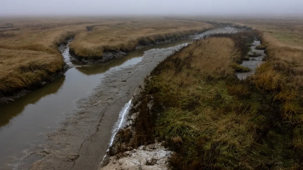
A muddy tidal creek winding through marshland on a foggy morning

Map of the Winnicut River

14 numbered points: 1 access point, 3 bridges, 9 parks and conservation areas, 1 USGS gauge. Tap a marker for details. Reviewed Sep 26, 2026.

Printable version →
  • Access / boat ramp (1)
  • Bridge crossing (3)
  • Park / conservation area (9)
  • USGS gauge (1)
Map data © OpenStreetMap contributors. Points are curated from OpenStreetMap and state agency sources; confirm access and hours before you go.

Print it. Bag it. Bring it.Phones die, screens crack, and most of this water has no signal. Print this map, fold it into a zip-top bag or dry bag with your license, and you have a backup your electronics can’t give you. Every marker is numbered so you can say exactly where you are.

Open the printable map
All 14 points on this map
#PointTypeLat, LonNotes
1Chen Property
Town of North Hampton conservation land
Park / conservation area42.97759, -70.85787
2Dalton Easement
Town of North Hampton conservation easement
Park / conservation area42.97505, -70.85741
3Robie Conservation Land
North Hampton Conservation Commission
Park / conservation area42.98053, -70.86844
4Corbett Farm
North Hampton Conservation Commission
Park / conservation area42.98558, -70.87465
5Winnicutt Road bridge
Town road, NHDOT structure
Bridge crossing43.00932, -70.87103OSM spells the road Winnicutt with two t values, which is the road name rather than a typo.
6The Dustin-Booker Farm
Town of North Hampton
Park / conservation area43.00439, -70.85321
7USGS gauge 01073785 - Winnicut River at Greenland
US Geological Survey streamgauge
USGS gauge43.03583, -70.84750Live stage and discharge for the river. Coordinate taken from the site roster.
8Russell A. Robinson Winnicut Memorial Park
Greenland town park
Park / conservation area43.03582, -70.84671On the river at the former dam and fishway site, beside the state cartop access.
9Great Bay Winnicut River Cartop Facility
NH Fish and Game and Town of Greenland, cartop
Access / boat ramp43.03679, -70.84763The only access site the state access inventory lists on this river. Gravel parking, no trailer ramp. Built at the site of the Winnicut River dam, which was removed.
10Portsmouth Avenue bridge
NH 33
Bridge crossing43.03610, -70.84799The main crossing, beside the cartop access and the memorial park.
11Caswell Park
Greenland town park
Park / conservation area43.04029, -70.84880
12Portland Subdivision rail bridge
CSX Portsmouth Branch
Bridge crossing43.04205, -70.84248The only rail crossing on the river.
13Great Bay National Wildlife Refuge
Refuge land on the lower river
Park / conservation area43.04576, -70.84949OSM records the operator as NH Fish and Game; the refuge itself is federal.
14Brackett Brook Wildlife Management Area
NH Fish and Game
Park / conservation area43.05777, -70.87296

Guides on the Winnicut River

Claimed profiles take booking requests. Unclaimed profiles are built from public records so the river is never empty; the guide can claim or remove one any time.

No guides listed yet

Guide or outfit this water? Create your profile. Listing is free, the commission is 10% or 7% with a premium profile, and premium profiles list first on this water.

About the Winnicut River

The Winnicut River is a small river by any standard, rising in the low country of Rockingham County and running a short distance northeast to enter Great Bay at Greenland, a few miles inland from Portsmouth. What it lacks in length it makes up for in position: Great Bay is one of the more significant estuaries on the New England coast, and the Winnicut is one of the rivers feeding it, which puts a genuine tidal fishery within a very short drive of the New Hampshire seacoast towns.

The gauge at Greenland reports discharge and stage. The river’s defining recent event was the removal of the old dam near the mouth, which reopened the channel between the tidal water and the reaches above and restored passage for migratory fish into a system that had been cut off for a long time. River herring and other diadromous species use the river again, and their movement is the engine that drives much of what happens here, since the predators follow the bait. Flows are small and respond quickly to rain, and the lower river is tidal, so the stage record mixes freshwater runoff with the twice-daily tide.

Striped bass are the main draw and work up into the river on the tide through the warmer months, following bait and holding around the structure near the mouth and in the deeper bends. They are mostly school fish rather than large ones, but they are accessible from shore, which matters. American eel are abundant throughout. Above the tidal reach the river holds trout in the cooler sections, along with largemouth, pickerel and yellow perch in the slower water. Great Bay itself, immediately downstream, is the larger prize and a proper destination for striped bass and flounder in season.

This water needs a real photo

The photo at the top of this page is not Winnicut River.

It is a regional stand-in, honestly captioned but generic — we will not put a name to a river we cannot prove. Send us a photograph you took here and it replaces the stand-in, with your credit on it.

Add a photo of this water See the badges

Pioneer badgeUnclaimed

Add a photo of this water

Landscape, not fish — the water itself. Reviewed by hand before it appears. The first one published here earns the Pioneer badge.

Never published. It is how the badge is held for you until member accounts open.

Posting to Winnicut River.

JPG, PNG or WebP, up to 12 MB. Landscape orientation looks best at the top of the page. We resize it and strip the location data out of the file.

The name printed under the photo and on your badge. Leave blank to stay anonymous.

Reader photo license v1.0 — the short version:

  • You grant Guided Floats, LLC a non-exclusive, royalty-free license to publish, resize and crop your photo on guidedfloats.com and in GuidedFloats’ own social posts and apps. You keep the copyright and can use the photo anywhere else.
  • You confirm that you took the photo yourself, that publishing it does not infringe anyone else’s rights, and that anyone recognisable in it (or a parent or guardian, if they are under 18) is happy for it to appear here.
  • Credit is printed beside the photo wherever it appears on the site, using the credit name you give us. Leave it blank and we use your name; write “Anonymous” for no name. Your email address is never published.
  • Withdrawing is one email to hello@guidedfloats.com naming the photo. It comes off the site within 7 days.
Read the full license

Version 1.0, dated 6 September 2026. Applies to every photograph submitted to GuidedFloats through the contact form, a species page, or the community board.

1. What you give us

By ticking the box on the form you grant Guided Floats, LLC (“GuidedFloats”, “we”) a non-exclusive, worldwide, royalty-free license to store, copy, resize, crop and display your photograph on guidedfloats.com, in GuidedFloats’ own social media accounts and mobile apps, and in material that promotes the site itself, in connection with the fish, water or community feature you sent it in for. The license lasts until you withdraw it (section 4).

You keep the copyright. The license is not exclusive, so you can use the photo anywhere else and license it to anyone else. We will not sell your photo, license it on to anyone else on its own, or use it in paid advertising for a third party.

2. What you confirm

You confirm that you took the photograph yourself (or otherwise own the rights to it), that you have the right to grant this license, and that publishing the photo does not infringe anyone else’s copyright, privacy or other rights.

If any person is recognisable in the photo, you confirm that they have agreed to its being published here, and that a parent or guardian has agreed on behalf of anyone under 18. Please do not send photographs of other people’s catches, screenshots, or pictures copied from other websites or social media.

3. Credit

We print the credit name you give us beside the photo wherever it appears on the site, and record it as the photo’s creator in the page’s structured data. If you leave the credit blank we use the name you gave us on the form. Write “Anonymous” if you prefer no name at all. Your email address, phone number and the exact spot the photo was taken are never published.

4. Withdrawing the license

You can withdraw the license at any time by emailing hello@guidedfloats.com, or by using the contact form, and telling us which photo you mean. We will remove the photo from guidedfloats.com within 7 days of receiving your message and stop using it in anything new. Copies that are already outside our control — search-engine caches, social posts that have already gone out, printed material already produced — may take longer to disappear or may not be recallable, and we are not responsible for those.

5. What we may do

We choose which photos to publish and may decline any submission without giving a reason. We may crop, resize, sharpen or colour-correct a photo for display, and we may remove a photo at any time. We will not alter a photo in a way that misrepresents the fish, the water or you.

6. Your details

We keep your name, email address, the credit name, the water and date you gave us, and the network address the submission came from, with the submission record, as our evidence of this license. We hold that record for as long as the photo is published and for the retention period described in our privacy policy. Location data that your camera or phone embedded in the file is removed before the photo is published.

7. Versions

The version of this license you accepted is stored with your submission and printed with the photo. A later version does not apply to a photo you have already sent unless you agree to it.

Fished this water? Add a photo

Reviewed by hand before it appears. Pick the water, not the spot — we never publish exact locations.

Never published. We use it only if we need to ask about the photo.

Posting to Winnicut River.

JPG, PNG or WebP, up to 12 MB. We resize it and strip the location data out of the file.

The name shown under the photo. Leave blank to stay anonymous.

Reader photo license v1.0 — the short version:

  • You grant Guided Floats, LLC a non-exclusive, royalty-free license to publish, resize and crop your photo on guidedfloats.com and in GuidedFloats’ own social posts and apps. You keep the copyright and can use the photo anywhere else.
  • You confirm that you took the photo yourself, that publishing it does not infringe anyone else’s rights, and that anyone recognisable in it (or a parent or guardian, if they are under 18) is happy for it to appear here.
  • Credit is printed beside the photo wherever it appears on the site, using the credit name you give us. Leave it blank and we use your name; write “Anonymous” for no name. Your email address is never published.
  • Withdrawing is one email to hello@guidedfloats.com naming the photo. It comes off the site within 7 days.
Read the full license

Version 1.0, dated 6 September 2026. Applies to every photograph submitted to GuidedFloats through the contact form, a species page, or the community board.

1. What you give us

By ticking the box on the form you grant Guided Floats, LLC (“GuidedFloats”, “we”) a non-exclusive, worldwide, royalty-free license to store, copy, resize, crop and display your photograph on guidedfloats.com, in GuidedFloats’ own social media accounts and mobile apps, and in material that promotes the site itself, in connection with the fish, water or community feature you sent it in for. The license lasts until you withdraw it (section 4).

You keep the copyright. The license is not exclusive, so you can use the photo anywhere else and license it to anyone else. We will not sell your photo, license it on to anyone else on its own, or use it in paid advertising for a third party.

2. What you confirm

You confirm that you took the photograph yourself (or otherwise own the rights to it), that you have the right to grant this license, and that publishing the photo does not infringe anyone else’s copyright, privacy or other rights.

If any person is recognisable in the photo, you confirm that they have agreed to its being published here, and that a parent or guardian has agreed on behalf of anyone under 18. Please do not send photographs of other people’s catches, screenshots, or pictures copied from other websites or social media.

3. Credit

We print the credit name you give us beside the photo wherever it appears on the site, and record it as the photo’s creator in the page’s structured data. If you leave the credit blank we use the name you gave us on the form. Write “Anonymous” if you prefer no name at all. Your email address, phone number and the exact spot the photo was taken are never published.

4. Withdrawing the license

You can withdraw the license at any time by emailing hello@guidedfloats.com, or by using the contact form, and telling us which photo you mean. We will remove the photo from guidedfloats.com within 7 days of receiving your message and stop using it in anything new. Copies that are already outside our control — search-engine caches, social posts that have already gone out, printed material already produced — may take longer to disappear or may not be recallable, and we are not responsible for those.

5. What we may do

We choose which photos to publish and may decline any submission without giving a reason. We may crop, resize, sharpen or colour-correct a photo for display, and we may remove a photo at any time. We will not alter a photo in a way that misrepresents the fish, the water or you.

6. Your details

We keep your name, email address, the credit name, the water and date you gave us, and the network address the submission came from, with the submission record, as our evidence of this license. We hold that record for as long as the photo is published and for the retention period described in our privacy policy. Location data that your camera or phone embedded in the file is removed before the photo is published.

7. Versions

The version of this license you accepted is stored with your submission and printed with the photo. A later version does not apply to a photo you have already sent unless you agree to it.

Flow alert

Tell me when the Winnicut River cfs

Now: 41 cfs, read 5:30 pm CDT, Sun Oct 18, 2026 (USGS 01073785, WINNICUT RIVER AT GREENLAND, NR PORTSMOUTH, NH).

We never use this address for anything else and never share it. See the privacy policy.

Access

Greenland - the town at the gauge, with the main river access and the reference point for conditions.
Great Bay - the estuary the river enters, the region's principal striped bass and flounder fishery.
Portsmouth - a short drive northeast, with full services, tackle shops, lodging and restaurants.
Great Bay National Estuarine Research Reserve - offering trails, viewing and public shoreline access.
Exeter River - the larger river entering the same estuary system south, a good alternative.
Stratham - adjacent to the river, with further road access to the upper reaches.
Hampton Harbour - south on the open coast, with launches and full saltwater fishing.

Seasons

Spring: the river wakes up as herring return and the first striped bass push into the bay behind them.
Summer: the peak, with schoolie bass working up the river on the tide and shore access at its most productive.
Fall: excellent as bait floods out of the estuary and the bass feed hard before moving offshore.
Winter: quiet and cold, with the tidal reach largely empty and the upper river the only real option.

From the water

No logged trips yet. Be the first to put this water on your map.

Log this water

Fished it or cleaned it? Log in or create a free account to log a trip with photos and earn the waterway badge.

Questions

What is the current flow on the Winnicut River?

As of Oct 18, 5:30 pm, the USGS gauge WINNICUT RIVER AT GREENLAND, NR PORTSMOUTH, NH reads 41 cfs. Conditions update every 15 minutes.

What species can you catch on the Winnicut River?

Anglers target American Eel, American Shad, Brook Trout, Brown Trout, Chain Pickerel, Largemouth Bass, Rainbow Trout, Smallmouth Bass, Striped Bass, White Perch, Winter Flounder, Yellow Perch on the Winnicut River in New Hampshire.

Where can you access the Winnicut River?

Greenland - the town at the gauge, with the main river access and the reference point for conditions. Great Bay - the estuary the river enters, the region's principal striped bass and flounder fishery. Portsmouth - a short drive northeast, with full services, tackle shops, lodging and restaurants. Great Bay National Estuarine Research Reserve - offering trails, viewing and public shoreline access. Exeter River - the larger river entering the same estuary system south, a good alternative. Stratham - adjacent to the river, with further road access to the upper reaches. Hampton Harbour - south on...

When is the best time to fish the Winnicut River?

Spring: the river wakes up as herring return and the first striped bass push into the bay behind them. Summer: the peak, with schoolie bass working up the river on the tide and shore access at its most productive. Fall: excellent as bait floods out of the estuary and the bass feed hard before moving offshore. Winter: quiet and cold, with the tidal reach largely empty and the upper river the only real option.

Where are the fishing regulations for the Winnicut River?

Regulations change by season and section. Read the current rules on the New Hampshire agency site: https://www.wildlife.nh.gov/fishing-new-hampshire/fishing-rules-and-regulations