Farmington River Fishing Guides
Connecticut premier trout river, a cold tailwater below Hogback Dam through Riverton, New Hartford and Collinsville with wild browns and a year-round season.
Map of the Farmington River
55 numbered points: 11 access points, 1 campsite, 1 bait & fly shop, 1 outfitter, 20 bridges, 14 parks and conservation areas, 1 agency office, 1 regulation section limit, 4 hazards, 1 USGS gauge. Tap a marker for details. Reviewed Sep 26, 2026.
- Access / boat ramp (11)
- Campsite (1)
- Bait, tackle & fly shop (1)
- Outfitter / canoe rental (1)
- Bridge crossing (20)
- Park / conservation area (14)
- Agency / conservation office (1)
- Regulation section limit (1)
- Dam / hazard (4)
- USGS gauge (1)
Print it. Bag it. Bring it.Phones die, screens crack, and most of this water has no signal. Print this map, fold it into a zip-top bag or dry bag with your license, and you have a backup your electronics can’t give you. Every marker is numbered so you can say exactly where you are.
Open the printable mapAll 55 points on this map
| # | Point | Type | Lat, Lon | Notes |
|---|---|---|---|---|
| 1 | Farmington River TMA Section 3 - upper reach New Hartford | Regulation section limit | 41.86683, -72.95426 | The mainstem begins here at the West and East Branch confluence, inside Section 3 of the Farmington River Trout Management Area, which DEEP defines from the Route 219 bridge down to the Route 177 bridge in Unionville. |
| 2 | Route 44 bridge - New Hartford US 44 - New Hartford | Bridge crossing | 41.85509, -72.95699 | |
| 3 | DEEP riverside campsite Connecticut DEEP - New Hartford | Campsite | 41.84531, -72.96328 | OSM names this only 'DEEP campsite'. |
| 4 | Route 44 bridge - Canton US 44, Albany Turnpike - Canton | Bridge crossing | 41.83616, -72.92963 | |
| 5 | Route 202 bridge - Canton US 202 - Canton | Bridge crossing | 41.83288, -72.92847 | |
| 6 | Town Bridge Road bridge Canton | Bridge crossing | 41.82469, -72.92808 | Long-used wading and paddling access above Collinsville. |
| 7 | Old River Road canoe access Off Old River Road - Collinsville, Canton | Access / boat ramp | 41.81822, -72.92204 | Tagged for canoe use, no fee; OSM carries it unnamed. |
| 8 | Route 179 bridge - River Road Route 179 - Canton | Bridge crossing | 41.81656, -72.92006 | |
| 9 | Farmington River Trail canoe access Off the Farmington River Trail - Collinsville | Access / boat ramp | 41.81268, -72.92220 | OSM carries this slipway unnamed; the trail name comes from a reverse geocode. |
| 10 | Collinsville Canoe and Kayak Livery and shop - Collinsville | Outfitter / canoe rental | 41.81177, -72.92317 | Re-typed from a boat shop; this is the river's main canoe and kayak livery. |
| 11 | Bridge Street bridge - Collinsville Route 179 - Canton | Bridge crossing | 41.81025, -72.92556 | |
| 12 | Collins Company Upper Dam Collinsville, Canton | Dam / hazard | 41.81017, -72.92554 | Portage at the old axe works. |
| 13 | Collins Company Lower Dam Collinsville, Canton | Dam / hazard | 41.80049, -72.92672 | Second Collins Company structure; portage. |
| 14 | Route 179 bridge - Canton Road Route 179 - Avon / Burlington | Bridge crossing | 41.78297, -72.92313 | |
| 15 | Burlington State Fish Hatchery Connecticut DEEP - Burlington | Agency / conservation office | 41.76437, -72.93759 | OSM maps only the hatchery ponds, 2.2 km off the river; this is the state hatchery that stocks the Farmington system. |
| 16 | Unionville dams Unionville, Farmington | Dam / hazard | 41.77470, -72.90342 | OSM carries three unnamed dam structures along the Power Dams Trail here; treat the whole reach as a portage. |
| 17 | Route 4 bridge - Unionville Route 4, Collinsville Road - Farmington | Bridge crossing | 41.76458, -72.89615 | |
| 18 | Route 177 bridge - Unionville Route 177, South Main Street - Farmington | Bridge crossing | 41.75591, -72.88679 | Downstream limit of Section 3 of the Farmington River Trout Management Area and the upstream limit of DEEP's Lower Farmington River reach, which runs from here to Rainbow Reservoir. |
| 19 | Farmington Avenue bridge - Unionville Route 4 - Farmington | Bridge crossing | 41.75661, -72.88244 | |
| 20 | Tunxis Mead Park Town of Farmington | Park / conservation area | 41.73240, -72.85505 | Riverside town park and launch point on the Farmington meadows. |
| 21 | Farmington Avenue bridge - Farmington Route 4 - Farmington | Bridge crossing | 41.72882, -72.82848 | |
| 22 | Shade Swamp Sanctuary State of Connecticut - Farmington | Park / conservation area | 41.71338, -72.85330 | State sanctuary with blue-blazed trails on the river's south bend. |
| 23 | Old Farms Road river access Off Old Farms Road - Avon | Access / boat ramp | 41.77219, -72.82163 | OSM carries a slipway and a service spur here, both unnamed; merged to one. |
| 24 | Old Farms Road bridge Avon | Bridge crossing | 41.77253, -72.82128 | |
| 25 | Fisher Meadows Recreation Area Town of Avon | Park / conservation area | 41.78336, -72.82841 | The main town river frontage in Avon, with parking and trails to the water. |
| 26 | Old Farms Road access - Old Avon Village Off Old Farms Road - Avon | Access / boat ramp | 41.79817, -72.83112 | OSM carries this slipway unnamed. |
| 27 | Alsop Meadows Town of Avon | Park / conservation area | 41.80234, -72.82452 | Riverside open space on the Avon flats. |
| 28 | Alsop Meadows canoe launch Off the Spur Trail - Avon | Access / boat ramp | 41.80518, -72.82399 | OSM tags this slipway 'Canoe Launch' with no name. |
| 29 | Routes 44 and 10 bridge - Avon US 44 / Route 10, East Main Street - Avon | Bridge crossing | 41.80685, -72.82273 | |
| 30 | Nod Brook State Wildlife Area State of Connecticut - Avon | Park / conservation area | 41.81896, -72.82276 | State wildlife area on the river between Avon and Simsbury. |
| 31 | Pinchot Sycamore Area Town of Simsbury - Weatogue | Park / conservation area | 41.84666, -72.80591 | Park around the Pinchot Sycamore, the largest tree in Connecticut, with river access. OSM maps it as two polygons. |
| 32 | Route 185 bridge - Weatogue Route 185, Hartford Road - Simsbury | Bridge crossing | 41.84715, -72.80733 | |
| 33 | Pinchot Sycamore canoe access Off Hartford Road - Weatogue, Simsbury | Access / boat ramp | 41.84779, -72.80728 | OSM carries this slipway unnamed. |
| 34 | Simsbury State Wildlife Area State of Connecticut - Simsbury | Park / conservation area | 41.85177, -72.80649 | |
| 35 | Hop Brook Landing at the Flower Bridge Simsbury | Park / conservation area | 41.86892, -72.80008 | Landing beside the Drake Hill Flower Bridge. |
| 36 | Drake Hill Flower Bridge Drake Hill Road - Simsbury | Bridge crossing | 41.86915, -72.79853 | Historic iron bridge planted with flower boxes; a Simsbury landmark on the water. |
| 37 | Vincent's Sporting Goods Sporting goods - Simsbury | Bait, tackle & fly shop | 41.87484, -72.80057 | Independent shop a short way off the river in Simsbury centre. |
| 38 | Curtiss Park Town of Simsbury | Park / conservation area | 41.89684, -72.77968 | Riverside park above Tariffville. OSM maps it as three polygons. |
| 39 | Route 315 bridge - Tariffville Road Route 315 - Simsbury | Bridge crossing | 41.89467, -72.78383 | |
| 40 | Tariffville Park Town of Simsbury | Park / conservation area | 41.91410, -72.76835 | The access for the Tariffville Gorge reach. |
| 41 | Route 189 bridge - Tariffville Route 189, Hartford Avenue - Simsbury / Bloomfield | Bridge crossing | 41.91173, -72.76216 | At the head of the Tariffville Gorge. |
| 42 | USGS 01189995 - Farmington River at Tariffville United States Geological Survey | USGS gauge | 41.90828, -72.75935 | The reference gauge for this river and the one the gorge is read from. |
| 43 | Tunxis Avenue river access Off Tunxis Avenue - Spoonville, East Granby | Access / boat ramp | 41.90318, -72.75989 | OSM carries this slipway unnamed. |
| 44 | Route 189 river access - Bloomfield Off Route 189 - Bloomfield | Access / boat ramp | 41.90035, -72.75592 | OSM carries this slipway unnamed. |
| 45 | Route 187 bridge - Spoonville Route 187, South Main Street - East Granby / Bloomfield | Bridge crossing | 41.89705, -72.74931 | DEEP names the Route 187 bridge at Rainbow Reservoir as the downstream limit of the Lower Farmington River reach. |
| 46 | Old Church Road river access Off Old Church Road - Spoonville, East Granby | Access / boat ramp | 41.89330, -72.74121 | OSM carries two unnamed slipways here; merged to one. |
| 47 | Farmington River Park East Granby | Park / conservation area | 41.89086, -72.73957 | |
| 48 | Windsor Wildlife Management Area State of Connecticut - Windsor | Park / conservation area | 41.88811, -72.72871 | |
| 49 | Northwest Park Town of Windsor | Park / conservation area | 41.90537, -72.70398 | Town park and nature centre above Rainbow Reservoir. |
| 50 | Rainbow Reservoir Boat Launch State of Connecticut - Windsor | Access / boat ramp | 41.91402, -72.70475 | State launch on the reservoir. OSM carries three features at this site; merged to one. |
| 51 | Rainbow Reservoir Dam Windsor | Dam / hazard | 41.91491, -72.69376 | Rainbow Dam. DEEP's tidal waters and tributaries reach begins about 3,000 feet below it, at the Rainbow Brook confluence. |
| 52 | John R. Welch Park Town of Windsor | Park / conservation area | 41.90091, -72.68183 | |
| 53 | Route 75 bridge - Poquonock Route 75, Poquonock Avenue - Windsor | Bridge crossing | 41.90075, -72.67921 | |
| 54 | Town Boat Launch - Farmington River Town of Windsor - off Pleasant Street | Access / boat ramp | 41.85728, -72.64024 | Town launch near the Connecticut River confluence; OSM carries the ramp unnamed beside the named launch polygon. |
| 55 | Route 159 bridge - Palisado Avenue Route 159 - Windsor | Bridge crossing | 41.85693, -72.63849 | Last crossing above the Connecticut River confluence. |
Guides on the Farmington River
Claimed profiles take booking requests. Unclaimed profiles are built from public records so the river is never empty; the guide can claim or remove one any time.
About the Farmington River
The Farmington is the trout river in Connecticut and one of the best in the Northeast. The West Branch below Hogback Dam at Riverton runs cold all summer on bottom releases from the Colebrook and Barkhamsted reservoirs, and the river from there down through Peoples State Forest, New Hartford, Collinsville and Unionville is a long, varied, heavily fished and genuinely excellent trout fishery. The Tariffville gorge at the bottom adds a stretch of ledge and pocket water below the confluence with the main stem.
Brown trout are the fish. The river holds a strong wild brown population alongside the well-known Survivor Strain program, and fish that have been in the river for several seasons behave like wild fish and are fished for accordingly. Rainbows fill in, brook trout come out of the tributaries, and smallmouth take the warmer lower water. The hatches are excellent and long-running, from Hendricksons and caddis in spring through sulphurs, cahills and the summer evening dry-fly fishing that the river is known for, into olives and midges in the cold months.
The Tariffville gauge reads the bottom of the system and reflects both the West Branch release and the main-stem inflow. Release changes at Hogback set the character of the upper river: moderate flows are ideal for wading the permanent catch-and-release water at Peoples Forest, high summer releases push wading anglers to the edges, and low winter flows make the fish very spooky. Read the number, and remember the upper river can be fishing well while the lower river is high and off-color from a tributary.
Riverton, New Hartford, Collinsville and Simsbury are the bases, with fly shops and guides. The permanent catch-and-release reach is the most fished water in the state.
This water needs a real photo
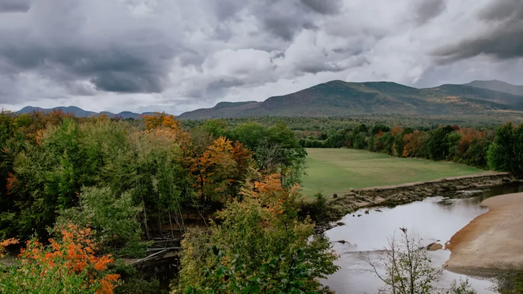
The photo at the top of this page is not Farmington River.
It is a regional stand-in, honestly captioned but generic — we will not put a name to a river we cannot prove. Send us a photograph you took here and it replaces the stand-in, with your credit on it.
Add a photo of this water
Landscape, not fish — the water itself. Reviewed by hand before it appears. The first one published here earns the Pioneer badge.
Fished this water? Add a photo
Reviewed by hand before it appears. Pick the water, not the spot — we never publish exact locations.
Access
Hogback Dam and Riverton: the top of the West Branch tailwater.
Peoples State Forest: the permanent catch-and-release water, the best-known reach.
Whittemore and Church Pool: classic named pools with parking.
New Hartford and Satans Kingdom: mid-river access and tubing traffic in summer.
Collinsville and Unionville: lower West Branch and main-stem access.
Tariffville Gorge: ledge and pocket water at the gauge reach.
Rainbow Dam: the bottom of the river above the Connecticut.
Seasons
Open year-round on much of the river, with a true winter fishery.
April and May: Hendricksons, caddis and the heaviest hatches of the year.
June through August: cold releases and famous evening dry-fly fishing; expect tubers at Satans Kingdom.
September through March: olives, midges, streamers and wild browns with almost no company.
From the water
No logged trips yet. Be the first to put this water on your map.
Log this water
Fished it or cleaned it? Log in or create a free account to log a trip with photos and earn the waterway badge.
Questions
What is the current flow on the Farmington River?
As of Oct 19, 3:15 am, the USGS gauge FARMINGTON RIVER AT TARIFFVILLE, CT reads 558 cfs, the 53rd percentile for this date. Conditions update every 15 minutes.
What species can you catch on the Farmington River?
Anglers target Atlantic Salmon, Brook Trout, Brown Trout, Rainbow Trout, Smallmouth Bass on the Farmington River in Connecticut.
Are there fishing guides on the Farmington River?
GuidedFloats lists 3 guides and outfitters on the Farmington River. Claimed profiles accept booking requests; unclaimed profiles are built from public records and link to the business.
Where can you access the Farmington River?
Hogback Dam and Riverton: the top of the West Branch tailwater. Peoples State Forest: the permanent catch-and-release water, the best-known reach. Whittemore and Church Pool: classic named pools with parking. New Hartford and Satans Kingdom: mid-river access and tubing traffic in summer. Collinsville and Unionville: lower West Branch and main-stem access. Tariffville Gorge: ledge and pocket water at the gauge reach. Rainbow Dam: the bottom of the river above the Connecticut.
When is the best time to fish the Farmington River?
Open year-round on much of the river, with a true winter fishery. April and May: Hendricksons, caddis and the heaviest hatches of the year. June through August: cold releases and famous evening dry-fly fishing; expect tubers at Satans Kingdom. September through March: olives, midges, streamers and wild browns with almost no company.
Where are the fishing regulations for the Farmington River?
Regulations change by season and section. Read the current rules on the Connecticut agency site: https://portal.ct.gov/deep/fishing/regulations/fishing-regulations