Fishes Housatonic River
River · Litchfield Hills · Connecticut
Housatonic River Fishing Guides
A big, ledgy freestone river through the Litchfield Hills, with a trout management area at Cornwall and one of the best river smallmouth fisheries in New England below it.
Map of the Housatonic River
59 numbered points: 15 access points, 4 campsites, 1 bait & fly shop, 2 outfitters, 15 bridges, 12 parks and conservation areas, 1 agency office, 8 hazards, 1 USGS gauge. Tap a marker for details. Reviewed Sep 26, 2026.
- Access / boat ramp (15)
- Campsite (4)
- Bait, tackle & fly shop (1)
- Outfitter / canoe rental (2)
- Bridge crossing (15)
- Park / conservation area (12)
- Agency / conservation office (1)
- Dam / hazard (8)
- USGS gauge (1)
Map data © OpenStreetMap contributors. Points are curated from OpenStreetMap and state agency sources; confirm access and hours before you go.
Print it. Bag it. Bring it.Phones die, screens crack, and most of this water has no signal. Print this map, fold it into a zip-top bag or dry bag with your license, and you have a backup your electronics can’t give you. Every marker is numbered so you can say exactly where you are.
Open the printable mapAll 59 points on this map
| # | Point | Type | Lat, Lon | Notes |
|---|---|---|---|---|
| 1 | Route 44 bridge - Salisbury Road US 44 - Salisbury / North Canaan | Bridge crossing | 42.00504, -73.35736 | First highway crossing below the Massachusetts line. |
| 2 | Great Falls Reservoir Access Canoe access - Falls Village | Access / boat ramp | 41.96385, -73.37183 | Slipway above Great Falls Dam; tagged for canoe use. |
| 3 | Great Falls Dam Falls Village | Dam / hazard | 41.96319, -73.37179 | Portage. The falls below the dam run dry when the canal is diverting. |
| 4 | Falls Mountain Road bridge Falls Village - AMC Connecticut Chapter | Bridge crossing | 41.95828, -73.37067 | Crossing below the Great Falls powerhouse reach. |
| 5 | Routes 7 and 112 bridge - Lime Rock US 7 / Route 112 - Salisbury / Canaan | Bridge crossing | 41.93429, -73.36193 | Upstream limit of the Housatonic River Trout Management Area, which runs from here to the Routes 4 and 7 bridge at Cornwall Bridge. |
| 6 | Belter Lime Rock Preserve Nature preserve - Salisbury | Park / conservation area | 41.92705, -73.36842 | Riverside preserve on the west bank in the trout management water. |
| 7 | Belter's Campsites Free riverside campsite | Campsite | 41.92682, -73.36344 | OSM records a bear box and a pit toilet, no fee. |
| 8 | Sycamore Field Preserve Town of Salisbury | Park / conservation area | 41.92662, -73.35992 | Open river frontage on the east bank. |
| 9 | Dean's Ravine Campsite Walk-in campsite | Campsite | 41.92053, -73.34794 | Set back from the river at the mouth of Dean's Ravine. |
| 10 | Route 128 bridge - West Cornwall Route 128 - Cornwall / Sharon | Bridge crossing | 41.87156, -73.36394 | The West Cornwall covered bridge; the main put-in and take-out landmark on the trout water. |
| 11 | Brokaw Preserve Cornwall Conservation Trust | Park / conservation area | 41.86733, -73.35773 | East-bank preserve between West Cornwall and Cornwall Bridge. |
| 12 | Route 7 bridge below West Cornwall US 7 - Cornwall | Bridge crossing | 41.86609, -73.36964 | Highway crossing in the middle of the trout management water. |
| 13 | Clarke Outdoors Canoe, kayak and raft livery - West Cornwall | Outfitter / canoe rental | 41.86068, -73.37528 | OSM spells the name 'Clark Outdoors'; corrected here. Shop and shuttle on Route 7. |
| 14 | Housatonic Meadows State Park Connecticut DEEP | Park / conservation area | 41.84509, -73.37845 | The main state river frontage on the trout water. |
| 15 | Housatonic Meadows State Park Campground Connecticut DEEP | Campsite | 41.83820, -73.37967 | Riverside state campground inside the park. |
| 16 | Route 7 bridge at Housatonic Meadows US 7 - Sharon / Cornwall | Bridge crossing | 41.83344, -73.38310 | |
| 17 | Routes 4 and 7 bridge - Cornwall Bridge US 7 / Route 4 - Cornwall / Sharon | Bridge crossing | 41.82001, -73.37334 | Downstream limit of the Housatonic River Trout Management Area. DEEP also posts a three-mile fly-water reach immediately above this bridge. |
| 18 | Silver Hill Campsite Free walk-in campsite | Campsite | 41.81540, -73.38961 | OSM records a water pump, a bear box and a privy. |
| 19 | Route 341 bridge - Kent Route 341 - Kent | Bridge crossing | 41.72687, -73.48131 | Town crossing at Kent. |
| 20 | Bulls Bridge Dam FirstLight - Kent | Dam / hazard | 41.67822, -73.50863 | Upstream limit of the Bull's Bridge Trout Management Area, which runs from this impoundment dam to the Gaylordsville bridge. Portage; the gorge below is class IV-V water. |
| 21 | Spooner Dam Bulls Bridge complex - Kent | Dam / hazard | 41.67611, -73.51144 | Second structure in the Bulls Bridge diversion works. |
| 22 | Bulls Bridge Bulls Bridge Road - Kent | Bridge crossing | 41.67573, -73.50923 | Historic covered bridge over the gorge; parking and river access at the west end. |
| 23 | Route 7 bridge - Gaylordsville US 7 - New Milford | Bridge crossing | 41.66004, -73.49187 | Downstream limit of the Bull's Bridge Trout Management Area, which DEEP also extends up the Ten Mile River to the New York line. |
| 24 | Kent Road river access - Gaylordsville Off US 7 - New Milford | Access / boat ramp | 41.65866, -73.49216 | OSM carries this slipway unnamed; the road and village come from a reverse geocode. |
| 25 | USGS 01200500 - Housatonic River at Gaylordsville United States Geological Survey | USGS gauge | 41.65304, -73.48982 | The reference gauge for this river. |
| 26 | Eleanor and Howard Hunt Nature Preserve Northwest Connecticut Land Conservancy | Park / conservation area | 41.61561, -73.45915 | River frontage above New Milford. |
| 27 | Sega Meadows Park Town of New Milford | Park / conservation area | 41.60101, -73.45294 | Riverside town park with trail access to the water. |
| 28 | Boardman Road bridge New Milford | Bridge crossing | 41.59317, -73.44982 | Long-standing access point; the USGS New Milford gauge sits on this crossing. |
| 29 | Route 202 and 67 bridge - New Milford US 202 / Route 67 - New Milford | Bridge crossing | 41.57510, -73.41543 | |
| 30 | Anderson Avenue river access Off Anderson Avenue - New Milford | Access / boat ramp | 41.56447, -73.40797 | OSM carries this slipway unnamed; the road name comes from a reverse geocode. |
| 31 | Bleachery Dam New Milford | Dam / hazard | 41.56576, -73.41134 | DEEP names this dam as the downstream limit of the Housatonic bass management water. |
| 32 | Grove Street river access - Addis Park Off Grove Street - Lanesville, New Milford | Access / boat ramp | 41.55538, -73.40657 | Slipway at the town's Addis Park; OSM carries it unnamed. |
| 33 | Sunny Valley Preserve The Nature Conservancy - Bridgewater | Park / conservation area | 41.51292, -73.38260 | OSM maps the preserve as five separate tracts along Lake Lillinonah; one marker shown. |
| 34 | Bridgewater town launch - Tappen Road Off Tappen Road - Bridgewater | Access / boat ramp | 41.52542, -73.40031 | Slipway at the Bridgewater town park on Lake Lillinonah; OSM carries it unnamed. |
| 35 | Route 133 bridge - Bridgewater Route 133 - Bridgewater / Brookfield | Bridge crossing | 41.48013, -73.35058 | Crossing of Lake Lillinonah. |
| 36 | Lake Lillinonah Boat Launch State of Connecticut - Bridgewater | Access / boat ramp | 41.48022, -73.34885 | State trailer launch. OSM carries three nodes at this site; merged to one. |
| 37 | Lake Lillinonah Park launch Off Hanover Road - Newtown | Access / boat ramp | 41.47139, -73.33252 | Town park slipway; OSM carries the ramp unnamed beside the named park polygon. |
| 38 | River Road canoe access above Shepaug Dam FirstLight - Southbury | Access / boat ramp | 41.45028, -73.29601 | Tagged permissive for canoe use; the road name comes from a reverse geocode. |
| 39 | Shepaug Dam FirstLight - Southbury / Newtown | Dam / hazard | 41.44861, -73.29568 | Head of Lake Zoar. Portage. |
| 40 | Lake Zoar Wildlife Area Southbury | Park / conservation area | 41.42871, -73.23845 | Shoreline wildlife area beside the state launch. |
| 41 | Lake Zoar Boat Launch State of Connecticut - Southbury | Access / boat ramp | 41.42772, -73.23612 | State trailer launch on Lake Zoar. |
| 42 | Lee Farm Drive canoe access Off Lee Farm Drive - Lakeside, Southbury | Access / boat ramp | 41.43116, -73.22661 | Tagged for canoe use; OSM carries it unnamed. |
| 43 | Kettletown State Park Connecticut DEEP - Southbury | Park / conservation area | 41.42324, -73.20630 | State park on the Lake Zoar shore. |
| 44 | Jackson Cove launch Off Jackson Cove Road - Oxford | Access / boat ramp | 41.41154, -73.19041 | Slipway at the Town of Oxford's Jackson Cove Park; OSM carries the ramp unnamed. |
| 45 | Old Bridge Road river access Off Old Bridge Road - Newtown | Access / boat ramp | 41.39023, -73.18639 | OSM carries this slipway unnamed; the road name comes from a reverse geocode. |
| 46 | Stevenson Dam FirstLight - Monroe / Oxford | Dam / hazard | 41.38334, -73.17135 | Route 34 runs across the dam crest. Foot of Lake Zoar, head of Lake Housatonic. |
| 47 | Lake Housatonic Dam Derby / Shelton | Dam / hazard | 41.32538, -73.10214 | The Derby dam at the foot of Lake Housatonic; head of tidewater. |
| 48 | Bridge Street bridge - Derby to Shelton Derby / Shelton | Bridge crossing | 41.31919, -73.09110 | |
| 49 | O'Sullivan's Island Recreation Park City of Derby | Park / conservation area | 41.31471, -73.08388 | Riverside park at the mouth of the Naugatuck River. |
| 50 | Sow and Pigs Jetty Tidal Housatonic - Derby | Dam / hazard | 41.30899, -73.07650 | Navigation hazard mapped as a training jetty. |
| 51 | Blanchette Sporting Goods Sporting goods - Shelton | Bait, tackle & fly shop | 41.29310, -73.11123 | Independent shop about 2.7 km off the river; the nearest tackle source on the lower reach. |
| 52 | NOAA Fisheries Milford Laboratory Northeast Fisheries Science Center - Milford | Agency / conservation office | 41.21193, -73.05350 | Federal fisheries laboratory near the river mouth. OSM carries five nodes for the campus; merged to one. |
| 53 | Housatonic River Boat Launch State of Connecticut - Milford | Access / boat ramp | 41.20499, -73.10794 | State tidal launch on the Devon reach. |
| 54 | Boardwalk Marina Boat Sales and Rentals Boat rental - Milford | Outfitter / canoe rental | 41.20232, -73.11328 | |
| 55 | Route 1 bridge - Devon US 1 - Milford / Stratford | Bridge crossing | 41.20028, -73.11046 | |
| 56 | Caswell Street canoe access Off Caswell Street - Milford | Access / boat ramp | 41.22209, -73.10696 | Tagged for canoe use, no trailers; OSM carries it unnamed. |
| 57 | Charles E. Wheeler Wildlife Management Area State of Connecticut - Milford | Park / conservation area | 41.18482, -73.10816 | Tidal marsh at the river mouth. |
| 58 | Birdseye Street boat launch Stratford | Access / boat ramp | 41.19034, -73.12141 | OSM names this only 'Boat Launch'; the street comes from a reverse geocode. |
| 59 | Bond's Dock Town of Stratford | Park / conservation area | 41.18604, -73.12275 | Tidal river access park. |
Guides on the Housatonic River
Claimed profiles take booking requests. Unclaimed profiles are built from public records so the river is never empty; the guide can claim or remove one any time.
About the Housatonic River
The Housatonic runs south out of the Berkshires through the northwest corner of Connecticut, past Falls Village, Cornwall and Kent, and on toward Long Island Sound. Through the Litchfield Hills it is a wide, shallow, ledge-and-boulder river with long flats, hard pocket water and a covered-bridge kind of beauty. It is a very different river from the Farmington: bigger, warmer, more freestone, and fished as much for smallmouth as for trout.
The trout management area between Falls Village and Cornwall Bridge is the famous water, holding brown and rainbow trout with good hatches, including a well-known hendrickson and a strong fall olive period. Because it is a freestone river it warms in midsummer, and thermal refuge areas near the cold tributary mouths are closed or restricted in hot weather to protect stressed trout, which every angler should check before fishing in July and August. Below the trout water the river becomes an excellent smallmouth fishery, with northern pike in the slower reaches and large carp on the flats for anglers who want them.
The Gaylordsville gauge sits on the lower river below the trout water. Moderate readings mean wadeable ledges and good float conditions; spring melt makes the river big and pushy, and the ledge drops that are fun in a raft at moderate flows get serious at high water. Late-summer low water is warm, clear and best fished at dawn, and that is when the smallmouth fishing below Kent is at its best.
Cornwall Bridge, West Cornwall, Kent and Falls Village are the base towns, with fly shops and outfitters. The Appalachian Trail runs beside the river for several miles.
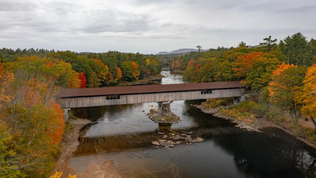
This water needs a real photo
The photo at the top of this page is not Housatonic River.
It is a regional stand-in, honestly captioned but generic — we will not put a name to a river we cannot prove. Send us a photograph you took here and it replaces the stand-in, with your credit on it.
Pioneer badgeUnclaimed
Add a photo of this water
Landscape, not fish — the water itself. Reviewed by hand before it appears. The first one published here earns the Pioneer badge.
Fished this water? Add a photo
Reviewed by hand before it appears. Pick the water, not the spot — we never publish exact locations.
Access
Falls Village: the top of the trout management area.
Housatonic Meadows State Park: campground, parking and the best-known trout water.
West Cornwall and the covered bridge: mid-river access and pocket water.
Cornwall Bridge: shops, guides and the bottom of the trout water.
Kent and Bulls Bridge: the transition to smallmouth water.
Gaylordsville: lower river access at the gauge.
New Milford and Lake Lillinonah: the bottom of the smallmouth reach.
Seasons
April and May: high water, Hendricksons and the strongest trout fishing of the year.
June: the last good trout weeks before it warms; smallmouth start.
July and August: warm water, check thermal refuge closures; excellent smallmouth fishing at dawn.
September through November: cooling water, fall olives, big smallmouth and beautiful weather.
From the water
No logged trips yet. Be the first to put this water on your map.
Log this water
Fished it or cleaned it? Log in or create a free account to log a trip with photos and earn the waterway badge.
Questions
What is the current flow on the Housatonic River?
As of Oct 19, 3:00 am, the USGS gauge HOUSATONIC RIVER AT GAYLORDSVILLE, CT reads 787 cfs, the 56th percentile for this date. Conditions update every 15 minutes.
What species can you catch on the Housatonic River?
Anglers target Brown Trout, Carp, Northern Pike, Rainbow Trout, Smallmouth Bass on the Housatonic River in Connecticut.
Are there fishing guides on the Housatonic River?
GuidedFloats lists 2 guides and outfitters on the Housatonic River. Claimed profiles accept booking requests; unclaimed profiles are built from public records and link to the business.
Where can you access the Housatonic River?
Falls Village: the top of the trout management area. Housatonic Meadows State Park: campground, parking and the best-known trout water. West Cornwall and the covered bridge: mid-river access and pocket water. Cornwall Bridge: shops, guides and the bottom of the trout water. Kent and Bulls Bridge: the transition to smallmouth water. Gaylordsville: lower river access at the gauge. New Milford and Lake Lillinonah: the bottom of the smallmouth reach.
When is the best time to fish the Housatonic River?
April and May: high water, Hendricksons and the strongest trout fishing of the year. June: the last good trout weeks before it warms; smallmouth start. July and August: warm water, check thermal refuge closures; excellent smallmouth fishing at dawn. September through November: cooling water, fall olives, big smallmouth and beautiful weather.
Where are the fishing regulations for the Housatonic River?
Regulations change by season and section. Read the current rules on the Connecticut agency site: https://portal.ct.gov/deep/fishing/regulations/fishing-regulations