Barton River Fishing Guides
The Northeast Kingdom's spring rainbow river, running north to South Bay on Lake Memphremagog and drawing a run of lake-run fish as soon as the ice goes out.
Guides on the Barton River
Claimed profiles take booking requests. Unclaimed profiles are built from public records so the river is never empty; the guide can claim or remove one any time.
No guides listed yet
Guide or outfit this water? Create your profile. Listing is free, the commission is 10% or 7% with a premium profile, and premium profiles list first on this water.
About the Barton River
The Barton River runs north through Vermont’s Northeast Kingdom from the village of Barton, past Coventry, and into South Bay at the southern end of Lake Memphremagog. Like its neighbour the Clyde it is primarily valued for the fish that come up out of the lake rather than those that live in it year round, and in the Barton’s case the headline is the spring run of lake-run rainbow trout. These are fish that winter in Memphremagog and push up into the river as soon as the ice clears, and for a few weeks each spring the Barton is among the most sought-after water in the state.
The run is the reason most anglers come, but the river repays attention outside it. Landlocked salmon use it in autumn, brown and brook trout hold in the colder reaches and tributaries, and the slower lower river and South Bay carry northern pike, walleye and yellow perch. The valley is agricultural for much of its length, which keeps the gradient gentle and the banks open, and the river carries more colour after rain than a forested drainage of the same size would. That turbidity is often an advantage in spring, when it gives the running fish cover.
The gauge near Coventry reports discharge and stage on a drainage of roughly one hundred and fifty-five square miles. Timing is everything on this river: the spring window is short, it is governed by ice-out and flow rather than the calendar, and reading the gauge is the most practical way to judge it from a distance. The Northeast Kingdom remains the quietest corner of Vermont, and outside the few weeks of the spring run the Barton sees very little pressure. Spawning fish are encountered in both spring and autumn and should be handled accordingly.
This water needs a real photo
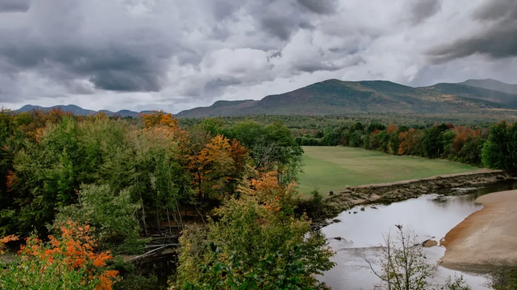
The photo at the top of this page is not Barton River.
It is a regional stand-in, honestly captioned but generic — we will not put a name to a river we cannot prove. Send us a photograph you took here and it replaces the stand-in, with your credit on it.
Add a photo of this water
Landscape, not fish — the water itself. Reviewed by hand before it appears. The first one published here earns the Pioneer badge.
Fished this water? Add a photo
Reviewed by hand before it appears. Pick the water, not the spot — we never publish exact locations.
Access
Coventry - the gauge reach and the most direct access to the lower river above South Bay.
South Bay - the shallow southern arm of Lake Memphremagog that the river enters, and where fish stage before running.
Barton - the village at the head of the river and the upstream reference point for the system.
Orleans - a mid-river village providing road access and a base for the middle reaches.
Willoughby River confluence - the junction with the neighbouring river, well known in its own right for the spring run.
Route 5 corridor - the road following the valley and the practical route between access points.
Newport - the nearest town of size at the north end of Memphremagog, for lodging, supplies and guides.
Seasons
Spring: the defining season, with lake-run rainbows pushing up from Memphremagog as soon as the ice clears and the river at its busiest.
Summer: low and often warm in the agricultural reaches, with resident trout holding in the colder tributaries and shaded water.
Fall: landlocked salmon move up out of the lake and the river fishes quietly with almost no competition for space.
Winter: frozen through most of the season, with fishing effectively confined to the lake until ice-out.
From the water
No logged trips yet. Be the first to put this water on your map.
Log this water
Fished it or cleaned it? Log in or create a free account to log a trip with photos and earn the waterway badge.
Questions
What is the current flow on the Barton River?
As of Nov 2, 7:30 am, the USGS gauge BARTON RIVER NEAR COVENTRY, VT reads 25 cfs. Conditions update every 15 minutes.
What species can you catch on the Barton River?
Anglers target Brook Trout, Brown Trout, Landlocked Salmon, Northern Pike, Rainbow Trout, Steelhead, Walleye, Yellow Perch on the Barton River in Vermont.
Where can you access the Barton River?
Coventry - the gauge reach and the most direct access to the lower river above South Bay. South Bay - the shallow southern arm of Lake Memphremagog that the river enters, and where fish stage before running. Barton - the village at the head of the river and the upstream reference point for the system. Orleans - a mid-river village providing road access and a base for the middle reaches. Willoughby River confluence - the junction with the neighbouring river, well known in its own right for the spring run. Route 5 corridor - the road following the valley and the practical route between access po...
When is the best time to fish the Barton River?
Spring: the defining season, with lake-run rainbows pushing up from Memphremagog as soon as the ice clears and the river at its busiest. Summer: low and often warm in the agricultural reaches, with resident trout holding in the colder tributaries and shaded water. Fall: landlocked salmon move up out of the lake and the river fishes quietly with almost no competition for space. Winter: frozen through most of the season, with fishing effectively confined to the lake until ice-out.
Where are the fishing regulations for the Barton River?
Regulations change by season and section. Read the current rules on the Vermont agency site: https://vtfishandwildlife.com/fish/fishing-regulations