Fishes Buffalo River
River · Ozarks · Arkansas
Buffalo River Fishing Guides
America's first National River, a hundred and thirty-five undammed miles under five-hundred-foot bluffs, and the float trip most Arkansans measure others against.
Map of the Buffalo River
49 numbered points: 23 access points, 8 campsites, 4 outfitters, 4 bridges, 2 parks and conservation areas, 4 agency offices, 1 USGS gauge, 3 points of interest. Tap a marker for details. Reviewed Sep 7, 2026.
- Access / boat ramp (23)
- Campsite (8)
- Outfitter / canoe rental (4)
- Bridge crossing (4)
- Park / conservation area (2)
- Agency / conservation office (4)
- USGS gauge (1)
- Point of interest (3)
Map data © OpenStreetMap contributors. Points are curated from OpenStreetMap and state agency sources; confirm access and hours before you go.
Print it. Bag it. Bring it.Phones die, screens crack, and most of this water has no signal. Print this map, fold it into a zip-top bag or dry bag with your license, and you have a backup your electronics can’t give you. Every marker is numbered so you can say exactly where you are.
Open the printable mapAll 49 points on this map
| # | Point | Type | Lat, Lon | Notes |
|---|---|---|---|---|
| 1 | Boxley Bridge River Access NPS · AR 21 low-water bridge, Boxley Valley | Access / boat ramp | 35.96129, -93.40423 | Uppermost NPS access. The Boxley-to-Ponca reach only floats after heavy rain; most trips start at Ponca. Elk graze the valley fields at dawn and dusk. |
| 2 | Lost Valley Trailhead NPS day-use area · AR 43 | Park / conservation area | 36.01035, -93.37435 | Trail to Eden Falls and Cob Cave. Day use only; no river access here. |
| 3 | Ponca River Access NPS · AR 74 low-water bridge | Access / boat ramp | 36.02110, -93.35512 | Classic put-in for the Ponca–Kyles Landing run (10.7 mi) beneath Big Bluff and Hemmed-In Hollow. Check the Ponca gauge before launching; the upper river is a spring-flow float. |
| 4 | Buffalo Outdoor Center Canoe & kayak rental, shuttles · Ponca | Outfitter / canoe rental | 36.02275, -93.36318 | NPS-authorized concessioner at the AR 43 / AR 74 junction in Ponca. |
| 5 | AGFC Ponca Elk Education Center Arkansas Game & Fish Commission · Ponca | Agency / conservation office | 36.02273, -93.36209 | Exhibits on the Buffalo River elk herd and area wildlife; a good place to ask about current conditions. |
| 6 | Steel Creek Campground NPS · 26 walk-in tent sites + 14 horse sites | Campsite | 36.03989, -93.34611 | Under Roark Bluff. Fee season mid-March to mid-November; primitive and free in winter. |
| 7 | Steel Creek River Access NPS · gravel bar launch | Access / boat ramp | 36.03931, -93.33623 | Alternative put-in 2 miles below Ponca; shortens the run to Kyles Landing. |
| 8 | Big Bluff Tallest bluff face in the Ozarks (~550 ft) | Point of interest | 36.04924, -93.31963 | River right. The Goat Trail runs along a ledge partway up; no camping on the bluff. |
| 9 | Hemmed-In Hollow Falls 209-ft waterfall · short hike from the river | Point of interest | 36.07207, -93.30740 | Tallest waterfall between the Rockies and Appalachians. Land on river left below Big Bluff and follow the side trail up the hollow. |
| 10 | Kyles Landing Campground NPS · 33 walk-in tent sites | Campsite | 36.05574, -93.28073 | Reached by a steep gravel road off AR 74. Fee season mid-March to mid-November. |
| 11 | Kyles Landing River Access NPS · gravel bar | Access / boat ramp | 36.05687, -93.27971 | Take-out for the Ponca run and put-in for Kyles–Pruitt (about 10 mi via Erbie and Ozark). |
| 12 | Erbie Campground NPS · 13 drive-in, 13 walk-in, 5 group sites | Campsite | 36.07168, -93.21498 | Historic Erbie low-water bridge and the Parker-Hickman farmstead nearby. |
| 13 | Erbie River Access NPS | Access / boat ramp | 36.07095, -93.21237 | Mid-point of the Kyles Landing–Pruitt run; reached by gravel road from AR 7 north of Jasper. |
| 14 | Ozark Campground NPS · 30 sites, pavilion | Campsite | 36.06406, -93.15995 | Drive-in campground off AR 7. Fee season mid-March to mid-November. |
| 15 | Ozark River Access NPS | Access / boat ramp | 36.06515, -93.15903 | Short 2-mile float from here to Pruitt Landing. |
| 16 | Pruitt Ranger Station NPS · AR 7 north of Jasper | Agency / conservation office | 36.06024, -93.13952 | Upper District contact station; seasonal hours. River information and permits. |
| 17 | AR 7 bridge at Pruitt Arkansas Highway 7 | Bridge crossing | 36.06085, -93.13768 | Main road crossing of the upper river. |
| 18 | Pruitt Landing River Access NPS · concrete ramp, picnic area | Access / boat ramp | 36.05746, -93.13613 | Put-in for the Pruitt–Hasty run (6.8 mi). Day-use area with a swimming hole. |
| 19 | Hasty River Access NPS · below the AR 74 low-water bridge | Access / boat ramp | 36.00805, -93.08147 | Popular summer swimming spot with bluff views. Hasty–Carver is a short 3-mile float. |
| 20 | AR 123 bridge at Carver Arkansas Highway 123 | Bridge crossing | 35.98337, -93.04258 | |
| 21 | Carver River Access NPS · 8 walk-in tent sites at the access | Access / boat ramp | 35.98268, -93.04072 | Start of the long, remote Carver–Mount Hersey–Woolum reach (about 15 mi with few road contacts). |
| 22 | Gene Rush Buffalo River WMA AGFC wildlife management area · south side | Park / conservation area | 35.98008, -93.01795 | Public hunting land bordering the river below Carver. |
| 23 | Mount Hersey River Access NPS · unimproved gravel road, primitive camping | Access / boat ramp | 36.00905, -92.95308 | Remote access; Skull Bluff and the Narrows (Tha Nars) are just downstream. Mt Hersey–Woolum is 8.6 mi. |
| 24 | Woolum River Access NPS · gravel bar, primitive camping | Access / boat ramp | 35.97019, -92.88671 | Richland Creek enters just above. Woolum–Tyler Bend is about 11 mi through the Woolum to Baker Ford stretch. |
| 25 | Woolum Campground NPS · primitive, no designated sites, no fee | Campsite | 35.97045, -92.88345 | |
| 26 | Baker Ford Access NPS · gravel bar | Access / boat ramp | 35.98074, -92.81353 | Between Woolum and Tyler Bend; reached by county road from US 65 at Silver Hill. |
| 27 | Tyler Bend River Access NPS · upper and lower ramps | Access / boat ramp | 35.98948, -92.76685 | Hub of the Middle District. Tyler Bend–Gilbert is 5.5 mi past Grinders Ferry; a gentle family float in summer. |
| 28 | Tyler Bend Visitor Center NPS · main park visitor center, off US 65 | Agency / conservation office | 35.98626, -92.76293 | Park headquarters contact point: exhibits, maps, river levels, backcountry information. |
| 29 | Tyler Bend Campground NPS · 27 drive-in, 10 walk-in, 5 group sites | Campsite | 35.98694, -92.75955 | Largest developed campground on the middle river; showers, pavilion. Fee season mid-March to mid-November. |
| 30 | Buffalo River Outfitters Canoe rental & shuttle · Silver Hill on US 65 | Outfitter / canoe rental | 35.96672, -92.74625 | Concessioner for the middle river (Tyler Bend, Grinders Ferry, Gilbert runs). |
| 31 | Silver Hill Float Service Canoe rental & shuttle · Silver Hill on US 65 | Outfitter / canoe rental | 35.96878, -92.74665 | |
| 32 | USGS 07056000 Buffalo River near St. Joe At the US 65 bridge | USGS gauge | 35.98306, -92.74722 | The gauge most floaters quote for the middle and lower river. |
| 33 | US 65 bridge (Grinders Ferry) US Highway 65 | Bridge crossing | 35.98388, -92.74847 | |
| 34 | Grinders Ferry River Access NPS · at US 65, gravel bar camping | Access / boat ramp | 35.98496, -92.74435 | Busy summer swimming and rope-swing spot just below the highway bridge. |
| 35 | Gilbert River Access NPS · concrete ramp, gravel bar camping | Access / boat ramp | 35.98671, -92.71495 | Historic railroad town of Gilbert with a general store and canoe outfitter. Gilbert–Maumee is about 11 mi. |
| 36 | Gilbert General Store Supplies, ice, canoe rental (Buffalo Camping & Canoeing) | Point of interest | 35.98882, -92.71590 | One of the few resupply points on the river, a short walk up from the Gilbert access. |
| 37 | Red Bluff Road Access NPS · walk-in, parking area | Access / boat ramp | 36.01614, -92.65705 | Foot access only; no vehicle launch. |
| 38 | Maumee North River Access NPS · north bank, gravel bar | Access / boat ramp | 36.03481, -92.62921 | |
| 39 | Maumee South River Access NPS · south bank, 6 primitive campsites | Access / boat ramp | 36.03901, -92.63637 | Maumee–Dillards Ferry is about 9 mi through the Lower District bluffs. |
| 40 | Spring Creek Access NPS · 12 primitive tent sites, no fee | Access / boat ramp | 36.03065, -92.58449 | Private boats only from here; 4.6 mi to Dillards Ferry. |
| 41 | AR 14 bridge (Dillards Ferry) Arkansas Highway 14 | Bridge crossing | 36.06707, -92.57753 | |
| 42 | Dillards Ferry River Access NPS · concrete ramp at AR 14 | Access / boat ramp | 36.06704, -92.57818 | Put-in for the Dillards Ferry–Buffalo Point (about 3 mi) and Rush (9 mi) floats; quieter fishing water below. |
| 43 | Buffalo Point Campground NPS · 80 drive-in, 21 walk-in, 5 group sites (loops A–E) | Campsite | 36.06995, -92.55663 | The river's largest campground, with cabins, showers and a concession restaurant in season. Reserve ahead in summer. |
| 44 | Buffalo Point River Access NPS · concrete ramp, gravel bar | Access / boat ramp | 36.06951, -92.55468 | |
| 45 | Buffalo Point Ranger Station NPS · AR 268 | Agency / conservation office | 36.07886, -92.57385 | Lower District contact station. |
| 46 | Rush Campground NPS · 12 walk-in tent sites | Campsite | 36.12300, -92.55027 | Beside the Rush Historic District, a zinc-mining ghost town. |
| 47 | Rush Landing River Access NPS · last road access for 25 miles | Access / boat ramp | 36.12432, -92.54894 | Below Rush the river enters the Lower Buffalo Wilderness: no take-out until Buffalo City on the White River. Plan an overnight. |
| 48 | Buffalo City River Access AGFC ramp on the White River just below the confluence | Access / boat ramp | 36.16452, -92.44060 | End of the Buffalo. Take out here on the White; the tailwater can rise quickly when Bull Shoals Dam generates. |
| 49 | Rileys Outfitter Buffalo City · shuttles, boats, lodging | Outfitter / canoe rental | 36.17104, -92.43340 |
Guides on the Buffalo River
Claimed profiles take booking requests. Unclaimed profiles are built from public records so the river is never empty; the guide can claim or remove one any time.
About the Buffalo River
The Buffalo became the first National River in 1972, which stopped the dams and preserved a hundred and thirty-five miles of free-flowing Ozark water beneath some of the tallest bluffs between the Appalachians and the Rockies. Big Bluff at the Goat Trail rises more than five hundred feet over the water. It is the signature float trip of Arkansas and one of the best in the country, run in canoes and kayaks over anything from a day to a week.
The river has three sections and they are genuinely different trips. The upper river from Ponca to Pruitt is the whitewater section, floatable mainly in spring, with the most dramatic bluffs and the fastest water. The middle river from Pruitt to Highway 14 floats most of the year and offers the best combination of scenery and reliability. The lower river to the White River confluence is wide, slow and floatable in any season. Smallmouth bass are the fishery throughout, with largemouth and spotted bass in the slower water and bream everywhere in summer.
The St. Joe gauge covers the middle river. Readings in the 100 to 800 cfs range float comfortably; the upper river needs considerably more water and typically runs only from March into June, while low late-summer readings under fifty mean the middle river becomes a wade-and-drag trip. Flash flooding is a genuine hazard here, and the Park Service posts float conditions by section.
Ponca, Jasper, Yellville and Gilbert are the access towns, with a good network of concessioner liveries and shuttles. Elk are commonly seen in the Boxley Valley at the top of the river, which is a trip in itself in the fall.
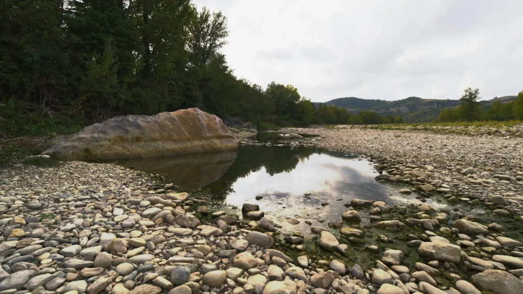
This water needs a real photo
The photo at the top of this page is not Buffalo River.
It is a regional stand-in, honestly captioned but generic — we will not put a name to a river we cannot prove. Send us a photograph you took here and it replaces the stand-in, with your credit on it.
Pioneer badgeUnclaimed
Add a photo of this water
Landscape, not fish — the water itself. Reviewed by hand before it appears. The first one published here earns the Pioneer badge.
Fished this water? Add a photo
Reviewed by hand before it appears. Pick the water, not the spot — we never publish exact locations.
Access
Ponca and Steel Creek: the top of the upper whitewater section, spring floating only.
Kyles Landing and Erbie: upper river accesses under the big bluffs.
Pruitt and Hasty: the top of the reliable middle river.
Carver and Woolum: middle river gravel bar accesses.
Gilbert and Grinders Ferry near St. Joe: access at the gauge, the most-used middle river reach.
Buffalo Point and Rush: lower river access with camping.
White River confluence: the bottom of the National River.
Seasons
March through May: the only dependable window for the upper river and the best flow overall.
June and July: middle and lower river floating, warm water, heavy holiday traffic.
August and September: low water, wading and short floats on the lower river.
October and November: fall color, elk in the Boxley Valley and the best smallmouth fishing of the year.
From the water
No logged trips yet. Be the first to put this water on your map.
Log this water
Fished it or cleaned it? Log in or create a free account to log a trip with photos and earn the waterway badge.
Questions
What is the current flow on the Buffalo River?
As of Oct 18, 5:45 pm, the USGS gauge Buffalo River near St. Joe, AR reads 115 cfs, the 63rd percentile for this date. Conditions update every 15 minutes.
What species can you catch on the Buffalo River?
Anglers target Bluegill, Channel Catfish, Largemouth Bass, Longear Sunfish, Smallmouth Bass, Spotted Bass on the Buffalo River in Arkansas.
Are there fishing guides on the Buffalo River?
GuidedFloats lists 1 guide and outfitters on the Buffalo River. Claimed profiles accept booking requests; unclaimed profiles are built from public records and link to the business.
Where can you access the Buffalo River?
Ponca and Steel Creek: the top of the upper whitewater section, spring floating only. Kyles Landing and Erbie: upper river accesses under the big bluffs. Pruitt and Hasty: the top of the reliable middle river. Carver and Woolum: middle river gravel bar accesses. Gilbert and Grinders Ferry near St. Joe: access at the gauge, the most-used middle river reach. Buffalo Point and Rush: lower river access with camping. White River confluence: the bottom of the National River.
When is the best time to fish the Buffalo River?
March through May: the only dependable window for the upper river and the best flow overall. June and July: middle and lower river floating, warm water, heavy holiday traffic. August and September: low water, wading and short floats on the lower river. October and November: fall color, elk in the Boxley Valley and the best smallmouth fishing of the year.
Where are the fishing regulations for the Buffalo River?
Regulations change by season and section. Read the current rules on the Arkansas agency site: https://www.agfc.com/regulations/general-fishing-regulations/