Fishes White River
Tailwater · Ozarks · Arkansas
White River Fishing Guides
The Bull Shoals tailwater, a hundred miles of cold water through Cotter and Norfork that has produced world-record brown trout and supports a year-round guide fleet.
Map of the White River
36 numbered points: 16 access points, 2 bait & fly shops, 3 outfitters, 6 bridges, 2 parks and conservation areas, 3 regulation section limits, 1 hazard, 1 USGS gauge, 2 points of interest. Tap a marker for details. Reviewed Sep 7, 2026.
- Access / boat ramp (16)
- Bait, tackle & fly shop (2)
- Outfitter / canoe rental (3)
- Bridge crossing (6)
- Park / conservation area (2)
- Regulation section limit (3)
- Dam / hazard (1)
- USGS gauge (1)
- Point of interest (2)
Map data © OpenStreetMap contributors. Points are curated from OpenStreetMap and state agency sources; confirm access and hours before you go.
Print it. Bag it. Bring it.Phones die, screens crack, and most of this water has no signal. Print this map, fold it into a zip-top bag or dry bag with your license, and you have a backup your electronics can’t give you. Every marker is numbered so you can say exactly where you are.
Open the printable mapAll 36 points on this map
| # | Point | Type | Lat, Lon | Notes |
|---|---|---|---|---|
| 1 | Bull Shoals Dam USACE · eight generators | Dam / hazard | 36.36605, -92.57507 | Water can rise several feet in minutes when generation starts — listen for the horn and keep an eye on the bank. The special-regulation reach starts 100 yards below the dam. |
| 2 | Bull Shoals Catch-and-Release Area 100 yards below the dam to the upstream boundary of the state park | Regulation section limit | 36.36478, -92.57824 | Seasonal special-regulation reach. Dates and rules on the AGFC site; approximate marker on the centerline. |
| 3 | Bull Shoals-White River State Park Arkansas State Parks · campground, trout dock, ramp, Gaston Visitor Center | Park / conservation area | 36.36378, -92.58577 | Campground on the river bank below the dam with a public ramp and trout dock; walk-in wading along the park shoreline when the water is off. |
| 4 | Bull Shoals Seasonal Brown Trout Area Wing dike at the state park trout dock to the park's downstream boundary | Regulation section limit | 36.36145, -92.58679 | Winter-season special area. Dates and rules on the AGFC site; approximate marker. |
| 5 | Gaston's White River Resort Lakeview · trout dock, guides, restaurant, fly shop, airstrip | Outfitter / canoe rental | 36.34799, -92.55956 | The AGFC's Gaston's public access ramp sits beside the resort. Marker placed at the resort airstrip. |
| 6 | White Hole Access AGFC · ramp, about 7 miles below the dam | Access / boat ramp | 36.32918, -92.53526 | Deep pool popular with drift boats. Approximate location, placed by river mile. |
| 7 | Wildcat Shoals Access AGFC · ramp off Wildcat Access Road, about 11 miles below the dam | Access / boat ramp | 36.30804, -92.57469 | Long wadeable shoal at low water; classic dry-fly water. |
| 8 | US 62/412 bridge above Cotter US Highways 62 & 412 | Bridge crossing | 36.28446, -92.52808 | |
| 9 | Natural State Fly Shop Cotter · flies, tackle, guides | Bait, tackle & fly shop | 36.26713, -92.54043 | |
| 10 | Cotter Bridge (US 62B) 1930 rainbow-arch bridge, National Register | Bridge crossing | 36.26733, -92.54445 | |
| 11 | Cotter Access (Big Spring Park) AGFC ramp in the city park, about 16.8 miles below the dam | Access / boat ramp | 36.26635, -92.54418 | Trout Capital USA. Cotter Spring boils up in the park; camping and wade access along the park bank. |
| 12 | Cotter Trout Dock Cotter · guided float trips, boats | Outfitter / canoe rental | 36.26590, -92.54342 | Oldest trout dock on the river, in Big Spring Park. |
| 13 | Big Spring Park City of Cotter · camping, picnic, spring | Park / conservation area | 36.26602, -92.54231 | |
| 14 | Rim Shoals Catch-and-Release Area Sign above the mouth of Jenkins Creek to the first power line downstream | Regulation section limit | 36.25689, -92.48156 | About 21 miles below the dam. Rules on the AGFC site; approximate marker on the centerline. |
| 15 | Rim Shoals Access AGFC · ramp and walk-in access via Rim Shoals Lane | Access / boat ramp | 36.25751, -92.47164 | Braided island shoals — the best-known wade fishery on the river at low water. Placed at the access road. |
| 16 | Ranchette Access AGFC · ramp, about 26.5 miles below the dam | Access / boat ramp | 36.20316, -92.47788 | Approximate location, placed by river mile. |
| 17 | Buffalo City Access AGFC · ramp just below the Buffalo River confluence | Access / boat ramp | 36.16452, -92.44060 | Take-out for Buffalo River floats too. Trout water continues; smallmouth mix in below the Buffalo. |
| 18 | Rileys Outfitter Buffalo City · shuttles, boats, lodging | Outfitter / canoe rental | 36.17104, -92.43340 | |
| 19 | Cartney Access AGFC · ramp, about 34.5 miles below the dam | Access / boat ramp | 36.19451, -92.38238 | Placed at the Cartney settlement; approximate. |
| 20 | Shipps Ferry Access AGFC · ramp, about 36 miles below the dam | Access / boat ramp | 36.21325, -92.35698 | |
| 21 | AR 341 (Push Mountain Road) bridge Arkansas Highway 341 | Bridge crossing | 36.22364, -92.29954 | |
| 22 | USGS gauge — White River near Norfork Gauge used for this water's flow reading | USGS gauge | 36.22361, -92.30000 | Reads both Bull Shoals releases and, just below, Norfork Dam water. Generation schedules from both dams matter here. |
| 23 | Norfork Access AGFC · ramp at the North Fork confluence, about 42 miles below the dam | Access / boat ramp | 36.20930, -92.29093 | The Norfork tailwater enters here, adding cold water for the next 50 miles of trout river. |
| 24 | Jacob Wolf House Historic Site Arkansas Heritage · 1829 territorial courthouse | Point of interest | 36.21046, -92.28701 | Oldest public structure in Arkansas, on the bluff above the confluence. |
| 25 | Norfork Adventure Supply Norfork · fly shop, kayak rental, shuttles | Bait, tackle & fly shop | 36.20798, -92.28642 | |
| 26 | Red's Landing Access AGFC · ramp at the end of Reds Landing Lane, about 49 miles below the dam | Access / boat ramp | 36.16129, -92.25551 | Placed at the access lane; approximate. |
| 27 | Chesmond Ferry Access AGFC · ramp off Chesmond Road, about 56.6 miles below the dam | Access / boat ramp | 36.10891, -92.18631 | Placed at the access road; approximate. |
| 28 | Calico Rock Historic District River town on the bluff · restaurants, lodging, guides | Point of interest | 36.11813, -92.14293 | |
| 29 | Calico Rock City Park Access AGFC ramp in the city park, about 59.6 miles below the dam | Access / boat ramp | 36.11604, -92.14277 | |
| 30 | AR 5 bridge at Calico Rock Arkansas Highway 5 | Bridge crossing | 36.11522, -92.14331 | |
| 31 | Optimus Access AGFC · ramp, about 69.8 miles below the dam | Access / boat ramp | 36.02294, -92.08218 | Approximate location, placed by river mile. |
| 32 | Mount Olive Access AGFC · ramp at Mount Olive | Access / boat ramp | 36.00063, -92.09293 | Placed at the settlement; approximate. |
| 33 | Sylamore Access AGFC · ramp at the AR 5/9/14 bridge, about 76.7 miles below the dam | Access / boat ramp | 35.94153, -92.11423 | Sylamore Creek enters nearby; Blanchard Springs and the Ozark National Forest are up the creek road. |
| 34 | AR 5/9/14 bridge at Sylamore State Highways 5, 9 and 14 | Bridge crossing | 35.93936, -92.11336 | |
| 35 | Guion Access AGFC ramp at Guion Park, about 89.4 miles below the dam | Access / boat ramp | 35.93202, -91.95154 | Lower end of the AGFC-managed trout water. |
| 36 | AR 58 bridge at Guion Arkansas Highway 58 · end of the trout-managed reach | Bridge crossing | 35.92434, -91.94793 |
Guides on the White River
Claimed profiles take booking requests. Unclaimed profiles are built from public records so the river is never empty; the guide can claim or remove one any time.
About the White River
The White River below Bull Shoals Dam is the largest trout fishery in the mid-South and one of the most productive in the country. Cold releases from Bull Shoals and, on the tributary, Norfork Lake hold the river in the fifties for roughly a hundred miles through Cotter, Buffalo City and beyond, and the brown trout in it grow to sizes that have produced state and, historically, world records.
Guided fishing here is a river-boat tradition as much as a fly fishing one. Johnboats drift the runs with the current while anglers fish nymphs and small jigs, and drift boats and rafts work the same water for fly anglers. The Catch and Release area below Bull Shoals Dam and the Rim Shoals water are the best-known reaches, and the Norfork tailwater a few miles downstream is smaller, colder and more technical. Sowbugs and midges are the everyday flies; the shad kill in winter and the caddis in spring are the events.
The Norfork gauge reads the White below the confluence. Generation from Bull Shoals is what matters: on low or no generation the river wades in long stretches and the fishing is technical, and on full generation it rises several feet within an hour or two and becomes a boat fishery. The Corps publishes the schedule, and every guide on this river plans the day around it. Rising water is a real hazard for waders on these shoals.
Cotter calls itself Trout Capital USA, with Mountain Home, Bull Shoals and Norfork nearby, and there are more guides, lodges and shuttle services here than anywhere else in Arkansas.
This water needs a real photo
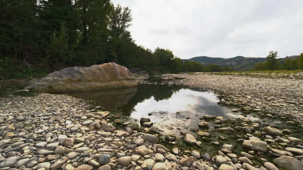
The photo at the top of this page is not White River.
It is a regional stand-in, honestly captioned but generic — we will not put a name to a river we cannot prove. Send us a photograph you took here and it replaces the stand-in, with your credit on it.
Pioneer badgeUnclaimed
Add a photo of this water
Landscape, not fish — the water itself. Reviewed by hand before it appears. The first one published here earns the Pioneer badge.
Fished this water? Add a photo
Reviewed by hand before it appears. Pick the water, not the spot — we never publish exact locations.
Access
Bull Shoals Dam and the Catch and Release area: the top of the tailwater.
Bull Shoals-White River State Park: ramp, lodging and access below the dam.
Wildcat Shoals and Rim Shoals: the best-known wade and float reaches.
Cotter: town access, the Big Spring park and multiple ramps.
Buffalo City: the Buffalo River confluence and lower access.
Norfork and the North Fork tailwater: the colder, smaller tributary fishery near the gauge.
Always check the Bull Shoals generation schedule before wading.
Seasons
Year-round; the tailwater fishes in every month.
January and February: the shad kill below the dam, big browns and cold weather.
March through May: caddis, moderate generation and the best all-around fishing.
June through August: heavy generation in wet years, cold water in Arkansas heat, night fishing for browns.
October through December: brown trout spawning, protected areas closed, and excellent fishing around them.
From the water
No logged trips yet. Be the first to put this water on your map.
Log this water
Fished it or cleaned it? Log in or create a free account to log a trip with photos and earn the waterway badge.
Questions
What is the current flow on the White River?
As of Oct 18, 5:30 pm, the USGS gauge White River near Norfork, AR reads 1,720 cfs, the 10th percentile for this date. Conditions update every 15 minutes.
What species can you catch on the White River?
Anglers target Brook Trout, Brown Trout, Cutthroat Trout, Rainbow Trout, Smallmouth Bass on the White River in Arkansas.
Are there fishing guides on the White River?
GuidedFloats lists 5 guides and outfitters on the White River. Claimed profiles accept booking requests; unclaimed profiles are built from public records and link to the business.
Where can you access the White River?
Bull Shoals Dam and the Catch and Release area: the top of the tailwater. Bull Shoals-White River State Park: ramp, lodging and access below the dam. Wildcat Shoals and Rim Shoals: the best-known wade and float reaches. Cotter: town access, the Big Spring park and multiple ramps. Buffalo City: the Buffalo River confluence and lower access. Norfork and the North Fork tailwater: the colder, smaller tributary fishery near the gauge. Always check the Bull Shoals generation schedule before wading.
When is the best time to fish the White River?
Year-round; the tailwater fishes in every month. January and February: the shad kill below the dam, big browns and cold weather. March through May: caddis, moderate generation and the best all-around fishing. June through August: heavy generation in wet years, cold water in Arkansas heat, night fishing for browns. October through December: brown trout spawning, protected areas closed, and excellent fishing around them.
Where are the fishing regulations for the White River?
Regulations change by season and section. Read the current rules on the Arkansas agency site: https://www.agfc.com/regulations/general-fishing-regulations/