Amite River Fishing Guides
The sandbar river east of Baton Rouge, running down out of Mississippi through Denham Springs to Lake Maurepas with clear water, gravel bars and good bass and bream fishing.
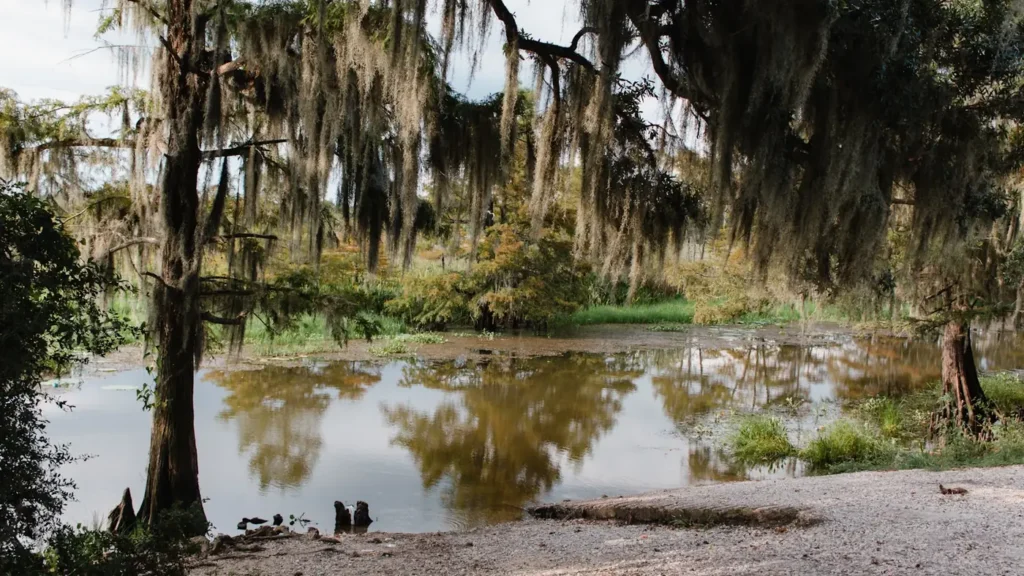
Guides on the Amite River
Claimed profiles take booking requests. Unclaimed profiles are built from public records so the river is never empty; the guide can claim or remove one any time.
No guides listed yet
Guide or outfit this water? Create your profile. Listing is free, the commission is 10% or 7% with a premium profile, and premium profiles list first on this water.
About the Amite River
The Amite rises in southwest Mississippi and runs south through the Florida Parishes past Denham Springs and Port Vincent to Lake Maurepas. Through its middle reaches it is a sand-and-gravel river with wide bars, clear water when it is low, and cypress and hardwoods along the banks, which makes it look and fish more like a Gulf Coast pineywoods stream than the swamp water most people associate with south Louisiana. Below Port Vincent it slows, deepens and becomes tidal.
Largemouth and spotted bass are the primary sport fish, holding on the cut banks, the gravel bar drops and around the woody cover. Bluegill and redear sunfish, called chinquapin locally, are abundant and are a major part of the spring fishery. Black crappie, or sac-a-lait, stack in the deeper bends and the slower lower river in late winter. Channel and flathead catfish work the holes, and striped bass and other Gulf species move up into the tidal reaches from Lake Maurepas. The upper river is a paddling and wading fishery; the lower river is boat water.
The Denham Springs gauge reads the lower-middle river. This basin floods dramatically, as it did catastrophically in 2016, and the gauge can go from a quiet reading to a record in a couple of days when a stalled system parks over the Florida Parishes. Moderate readings mean clear water, exposed gravel bars and excellent fishing; high water floods the bottomlands, scatters fish and makes the river dangerous with floating timber. Low late-summer water is very clear and the fish get spooky.
Denham Springs, Port Vincent, Watson and Magnolia give access, and Baton Rouge is twenty minutes from the middle river.
This water needs a real photo
The photo at the top of this page is not Amite River.
It is a regional stand-in, honestly captioned but generic — we will not put a name to a river we cannot prove. Send us a photograph you took here and it replaces the stand-in, with your credit on it.
Add a photo of this water
Landscape, not fish — the water itself. Reviewed by hand before it appears. The first one published here earns the Pioneer badge.
Fished this water? Add a photo
Reviewed by hand before it appears. Pick the water, not the spot — we never publish exact locations.
Access
Denham Springs: town access near the gauge.
Port Vincent and Head of Island: lower river ramps toward Lake Maurepas.
Magnolia Bridge and Grangeville: middle-river gravel bar access.
Darlington and the Mississippi line: upper river paddling reaches.
Comite River confluence: the main tributary, with its own fishery.
Bayou Manchac: the historic channel toward the Mississippi.
Lake Maurepas: the tidal bottom end.
Seasons
Spring: high water early, then the best bass and bream fishing of the year on the falling river.
Summer: low clear water, gravel bars exposed, early mornings and shade lines.
Fall: comfortable weather, clear water and good bass fishing on the bars.
Winter: crappie in the deeper bends and catfish in the holes; watch for flood events.
From the water
No logged trips yet. Be the first to put this water on your map.
Log this water
Fished it or cleaned it? Log in or create a free account to log a trip with photos and earn the waterway badge.
Questions
What is the current flow on the Amite River?
As of Oct 19, 3:15 am, the USGS gauge Amite River near Denham Springs, LA reads 323 cfs, the 10th percentile for this date. Conditions update every 15 minutes.
What species can you catch on the Amite River?
Anglers target Black Crappie, Bluegill, Channel Catfish, Flathead Catfish, Largemouth Bass, Redear Sunfish, Spotted Bass, Striped Bass on the Amite River in Louisiana.
Where can you access the Amite River?
Denham Springs: town access near the gauge. Port Vincent and Head of Island: lower river ramps toward Lake Maurepas. Magnolia Bridge and Grangeville: middle-river gravel bar access. Darlington and the Mississippi line: upper river paddling reaches. Comite River confluence: the main tributary, with its own fishery. Bayou Manchac: the historic channel toward the Mississippi. Lake Maurepas: the tidal bottom end.
When is the best time to fish the Amite River?
Spring: high water early, then the best bass and bream fishing of the year on the falling river. Summer: low clear water, gravel bars exposed, early mornings and shade lines. Fall: comfortable weather, clear water and good bass fishing on the bars. Winter: crappie in the deeper bends and catfish in the holes; watch for flood events.
Where are the fishing regulations for the Amite River?
Regulations change by season and section. Read the current rules on the Louisiana agency site: https://www.wlf.louisiana.gov/page/recreational-freshwater-finfish-and-crawfish