Fishes Lake of the Woods
Lake · Northwest Angle · Minnesota
Lake of the Woods Fishing Guides
The walleye capital of Minnesota — a vast border lake with 65,000 miles of shoreline reach, a huge sauger population, world-class winter fishing, and a gauge at Warroad tracking lake stage.
Map of the Lake of the Woods
42 numbered points: 3 access points, 1 campsite, 3 bait & fly shops, 15 outfitters, 4 bridges, 10 parks and conservation areas, 1 agency office, 1 regulation section limit, 2 USGS gauges, 2 points of interest. Tap a marker for details. Reviewed Oct 23, 2026.
- Access / boat ramp (3)
- Campsite (1)
- Bait, tackle & fly shop (3)
- Outfitter / canoe rental (15)
- Bridge crossing (4)
- Park / conservation area (10)
- Agency / conservation office (1)
- Regulation section limit (1)
- USGS gauge (2)
- Point of interest (2)
Map data © OpenStreetMap contributors. Points are curated from OpenStreetMap and state agency sources; confirm access and hours before you go.
Print it. Bag it. Bring it.Phones die, screens crack, and most of this water has no signal. Print this map, fold it into a zip-top bag or dry bag with your license, and you have a backup your electronics can’t give you. Every marker is numbered so you can say exactly where you are.
Open the printable mapAll 42 points on this map
| # | Point | Type | Lat, Lon | Notes |
|---|---|---|---|---|
| 1 | Border Bait Wheelers Point, Four Mile Bay | Bait, tackle & fly shop | 48.83671, -94.70403 | Bait stop at the Rainy River mouth end of the lake. |
| 2 | Sportsman's Sleepers Wheelers Point | Outfitter / canoe rental | 48.83239, -94.70510 | Sleeper fish house rental on the Four Mile Bay shore. |
| 3 | Log Cabin Bait Wheelers Point | Bait, tackle & fly shop | 48.83297, -94.70955 | |
| 4 | T J Prop Shop Inc Wheelers Point | Outfitter / canoe rental | 48.83537, -94.70484 | Boat and prop repair at Wheelers Point. |
| 5 | Lake of the Woods Marine Wheelers Point | Outfitter / canoe rental | 48.82982, -94.71175 | Boat dealer and service at the Rainy River mouth. |
| 6 | Border View Lodge Wheelers Point | Outfitter / canoe rental | 48.83815, -94.69646 | Resort and guide service at the mouth of the Rainy River. |
| 7 | Wigwam Resort Wheelers Point | Outfitter / canoe rental | 48.84095, -94.69873 | Resort and guide service on Four Mile Bay. |
| 8 | Bayside Camp Ground Four Mile Bay | Campsite | 48.84217, -94.70084 | |
| 9 | Four Mile Bay Wildlife Management Area Minnesota DNR, Four Mile Bay | Park / conservation area | 48.84373, -94.73440 | State wildlife management area on the bay west of the river mouth. |
| 10 | County Highway 8 CR 8, Bostic Bay | Bridge crossing | 48.83014, -94.77787 | |
| 11 | Bugsy's on Bostic Bostic Bay | Outfitter / canoe rental | 48.83156, -94.77488 | Resort on Bostic Bay, south shore. |
| 12 | Sweet's Fishing with Steve Sweet Bostic Bay | Outfitter / canoe rental | 48.83181, -94.77843 | Guide service working the south shore and Big Traverse Bay. |
| 13 | Morris Point South shore | Park / conservation area | 48.85181, -94.76803 | |
| 14 | Morris Point Lake View Lodge Morris Point | Outfitter / canoe rental | 48.85267, -94.78157 | Resort and guide service on the south shore. |
| 15 | Zippel Bay State Park State park, Zippel Bay | Park / conservation area | 48.86553, -94.87295 | The lake's state park, with the harbour and beach on Zippel Bay. |
| 16 | Zippel Bay Resort Zippel Bay | Outfitter / canoe rental | 48.85625, -94.88818 | Resort and guide service west of the state park. |
| 17 | Prosper Wildlife Management Area Minnesota DNR, south shore | Park / conservation area | 48.88922, -94.89276 | |
| 18 | Long Point Resort Long Point | Outfitter / canoe rental | 48.96914, -94.95163 | Resort and guide service at Long Point. |
| 19 | Larry Bernhoft Wildlife Management Area Minnesota DNR, Long Point | Park / conservation area | 48.96939, -94.98887 | |
| 20 | Rocky Point Wildlife Management Area Minnesota DNR, Rocky Point | Park / conservation area | 48.96152, -95.03723 | |
| 21 | Rocky Point South-west shore | Park / conservation area | 48.96075, -95.06783 | |
| 22 | Rock Harbor Marina, Rocky Point | Access / boat ramp | 48.96033, -95.06834 | Sheltered harbour and launch at Rocky Point. |
| 23 | Arnesen's Rocky Point Resort Rocky Point | Outfitter / canoe rental | 48.96080, -95.06595 | Resort and guide service at Rocky Point. |
| 24 | United States Customs and Border Protection Warroad | Agency / conservation office | 48.89865, -95.31943 | CBP office in Warroad, the U.S. port of entry town on the south shore. |
| 25 | State Avenue MN 11, Warroad River | Bridge crossing | 48.90294, -95.32011 | Highway 11 crossing of the Warroad River above the lake. |
| 26 | USGS 05140520 Lake of the Woods at Warroad Primary level reference | USGS gauge | 48.90415, -95.31607 | Lake level gauge at Warroad on the south-west shore. |
| 27 | Allison Park Warroad | Park / conservation area | 48.90608, -95.31252 | |
| 28 | Taylor Road CR 74, Warroad River | Bridge crossing | 48.91265, -95.30735 | |
| 29 | Rainbow Park Warroad | Park / conservation area | 48.90741, -95.30031 | |
| 30 | Lakeview Park Warroad | Park / conservation area | 48.90768, -95.30236 | |
| 31 | Warroad Estates Marina North of Warroad | Access / boat ramp | 48.93790, -95.32644 | |
| 32 | USGS 05140521 Lake of the Woods at Springsteel Island near Warroad Second level gauge | USGS gauge | 48.94582, -95.30690 | Lake level gauge off Springsteel Island, mapped in OSM. |
| 33 | Springsteel Resort & Marina Springsteel Island | Access / boat ramp | 48.94601, -95.30647 | Marina and resort launch on the point north of Warroad. |
| 34 | Young's Bay Resort Angle Inlet, Northwest Angle | Outfitter / canoe rental | 49.34566, -94.97078 | Resort at Young's Bay, the Northwest Angle's harbour. |
| 35 | Angle Outpost Resort Northwest Angle | Outfitter / canoe rental | 49.34500, -95.00571 | |
| 36 | Jake's Northwest Angle Angle Inlet | Bait, tackle & fly shop | 49.34726, -95.06270 | Resort store and bait at Angle Inlet. |
| 37 | Northwest Angle Resort Angle Inlet | Outfitter / canoe rental | 49.35063, -95.08133 | |
| 38 | Crow Creek Drive Northwest CR 332, Angle Inlet | Bridge crossing | 49.35201, -95.08183 | |
| 39 | Angle Inlet School Angle Inlet | Point of interest | 49.35295, -95.08167 | The one-room school at Angle Inlet, the landmark of the Northwest Angle. |
| 40 | Prothero's Post Resort Angle Inlet | Outfitter / canoe rental | 49.35711, -95.08360 | |
| 41 | Northern Most Point of the Continental United States Northwest Angle, 49th parallel | Point of interest | 49.38316, -95.15339 | The northernmost point of the contiguous United States, on the Angle shore. |
| 42 | Minnesota-Canada boundary waters - Lake of the Woods Minnesota Rules 6266.0700, subp. 1, item R | Regulation section limit | 48.95000, -94.95000 | Lake of the Woods is a Minnesota-Canada boundary water. The rule covers the lake in Lake of the Woods and Roseau Counties and its listed tributaries. Check the current DNR boundary-water regulations before you fish. |
Guides on the Lake of the Woods
Claimed profiles take booking requests. Unclaimed profiles are built from public records so the river is never empty; the guide can claim or remove one any time.
Order on this page: premium and outfitter plans first (labelled Premium placement), then claimed free profiles, then unclaimed — one published price, no bidding for position. How placement works
About the Lake of the Woods
Lake of the Woods is one of the great inland fisheries of North America, a border water shared by Minnesota, Ontario and Manitoba, covering roughly a million acres with a shoreline broken into thousands of islands across the Northwest Angle. The Minnesota portion, reached from Warroad, Baudette and the Rainy River, is what most guided effort focuses on. The USGS gauge at Warroad reads lake stage, which on a lake this size is driven by wind setup and seasonal inflow rather than by any dam release schedule.
Walleye are the reason people come. The lake supports an enormous population across a wide range of sizes, and the fishery runs hard through all four seasons rather than concentrating in a few weeks. Sauger are abundant alongside them and often outnumber walleye in the deeper basin. Northern pike grow large in the weedy bays, smallmouth bass hold on the rock of the Angle islands, and muskellunge are present in genuine trophy sizes. Lake sturgeon in the Rainy River system are a distinct and carefully regulated fishery.
Winter is not an off-season here — it is arguably the main one. Ice roads and sleeper houses put anglers over deep-basin walleye and sauger from January into March, and the resort infrastructure around Baudette and Warroad is built around it. The spring Rainy River run brings walleye upstream in numbers before the lake opener, under its own set of regulations.
The scale of this lake is the practical challenge. Weather moves fast, the fetch is enormous, and a wind that would be an inconvenience elsewhere builds a serious sea here. Navigation across the Angle requires charts and attention, and crossing into Ontario waters carries licensing and border reporting requirements. Most first-time visitors are better served by a local guide or resort operation than by launching alone.
This water needs a real photo
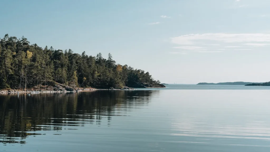
The photo at the top of this page is not Lake of the Woods.
It is a regional stand-in, honestly captioned but generic — we will not put a name to a river we cannot prove. Send us a photograph you took here and it replaces the stand-in, with your credit on it.
Pioneer badgeUnclaimed
Add a photo of this water
Landscape, not fish — the water itself. Reviewed by hand before it appears. The first one published here earns the Pioneer badge.
Pool right now
1,059.75ft NAVD88
- 24 hours+0.02 ft → steady
Reading taken 31 min ago at USGS 05140520, LAKE OF THE WOODS AT WARROAD, MN. Elevation is the surface of the lake above the survey datum, not depth. Source.
Fished this water? Add a photo
Reviewed by hand before it appears. Pick the water, not the spot — we never publish exact locations.
Access
Warroad city harbor and public ramp — the USGS gauge site, deep-water access to the south shore.
Baudette and Wheelers Point ramps — main access to the Rainy River mouth and the big traverse.
Zippel Bay state park — improved ramp and harbor on the Minnesota south shore.
Long Point public access — western south-shore ramp toward Buffalo Point.
Rocky Point access — protected launch west of Wheelers Point.
Northwest Angle resorts and ramps — island-country access via Manitoba road or by boat.
Rainy River landings at Birchdale and Franz Jevne — upstream access for the spring run.
Seasons
Spring: the Rainy River walleye run peaks from late March into April under separate regulations, then the lake opener in May puts fish shallow along the south shore.
Summer: strong walleye and sauger fishing over mud and rock in the main basin, with pike in the bays and smallmouth on the Angle islands through July and August.
Fall: outstanding. Cooling water concentrates big walleye and pike shallow through September and October, and muskellunge fishing peaks before freeze-up.
Winter: a full season. Ice roads and sleeper houses run from January into March over deep-basin walleye, sauger and burbot; travel only on established, monitored routes.
From the water
No logged trips yet. Be the first to put this water on your map.
Log this water
Fished it or cleaned it? Log in or create a free account to log a trip with photos and earn the waterway badge.
Questions
What species can you catch on the Lake of the Woods?
Anglers target Black Crappie, Burbot, Lake Sturgeon, Lake Whitefish, Muskellunge, Northern Pike, Sauger, Smallmouth Bass, Walleye, Yellow Perch on the Lake of the Woods in Minnesota.
Are there fishing guides on the Lake of the Woods?
GuidedFloats lists 2 guides and outfitters on the Lake of the Woods. Claimed profiles accept booking requests; unclaimed profiles are built from public records and link to the business.
Where can you access the Lake of the Woods?
Warroad city harbor and public ramp — the USGS gauge site, deep-water access to the south shore. Baudette and Wheelers Point ramps — main access to the Rainy River mouth and the big traverse. Zippel Bay state park — improved ramp and harbor on the Minnesota south shore. Long Point public access — western south-shore ramp toward Buffalo Point. Rocky Point access — protected launch west of Wheelers Point. Northwest Angle resorts and ramps — island-country access via Manitoba road or by boat. Rainy River landings at Birchdale and Franz Jevne — upstream access for the spring run.
When is the best time to fish the Lake of the Woods?
Spring: the Rainy River walleye run peaks from late March into April under separate regulations, then the lake opener in May puts fish shallow along the south shore. Summer: strong walleye and sauger fishing over mud and rock in the main basin, with pike in the bays and smallmouth on the Angle islands through July and August. Fall: outstanding. Cooling water concentrates big walleye and pike shallow through September and October, and muskellunge fishing peaks before freeze-up. Winter: a full season. Ice roads and sleeper houses run from January into March over deep-basin walleye, sauger and bu...
Where are the fishing regulations for the Lake of the Woods?
Regulations change by season and section. Read the current rules on the Minnesota agency site: https://www.dnr.state.mn.us/regulations/fishing/index.html