Bennett Spring Fishing Guides
One of Missouri's four trout parks — roughly 100 million gallons a day out of the spring branch into the Niangua, with daily-tag trout fishing from March through October and catch-and-release in winter.
Map of the Bennett Spring
26 numbered points: 2 access points, 5 campsites, 4 outfitters, 3 bridges, 1 park or conservation area, 3 agency offices, 3 regulation section limits, 2 hazards, 2 springs, 1 USGS gauge. Tap a marker for details. Reviewed Sep 7, 2026.
- Access / boat ramp (2)
- Campsite (5)
- Outfitter / canoe rental (4)
- Bridge crossing (3)
- Park / conservation area (1)
- Agency / conservation office (3)
- Regulation section limit (3)
- Dam / hazard (2)
- Spring (2)
- USGS gauge (1)
Print it. Bag it. Bring it.Phones die, screens crack, and most of this water has no signal. Print this map, fold it into a zip-top bag or dry bag with your license, and you have a backup your electronics can’t give you. Every marker is numbered so you can say exactly where you are.
Open the printable mapAll 26 points on this map
| # | Point | Type | Lat, Lon | Notes |
|---|---|---|---|---|
| 1 | Bennett Spring Head of the branch · Bennett Spring State Park | Spring | 37.71657, -92.85675 | One of Missouri's largest springs, roughly 100 million gallons a day. The spring pool is the head of the 1.5-mile branch; the trout water starts here. |
| 2 | USGS gauge · Bennett Spring Spring flow gauge at the spring | USGS gauge | 37.71715, -92.85757 | Live flow for the branch. Coordinates from the GuidedFloats roster. |
| 3 | Zone 1 · spring to the hatchery dam Upper zone · starts at the spring pool outlet | Regulation section limit | 37.71817, -92.85805 | Zone 1 runs from the spring down to the hatchery dam. Zones are posted in the park; methods and limits are set by MDC and Missouri State Parks — check the park regulation page before you fish. |
| 4 | Bennett Spring State Park Missouri State Parks · Dallas & Laclede counties | Park / conservation area | 37.71687, -92.85233 | Missouri's most-visited trout park. Daily trout tag sold in the park during the March 1 – October 31 season; a winter catch-and-release season runs on select days. |
| 5 | Bennett Spring Nature Center Missouri State Parks · exhibits & park information | Agency / conservation office | 37.72184, -92.85536 | Interpretive center on the east bank below the spring. Trail maps, naturalist programs and the park's natural history. |
| 6 | Low drop at the MO 64A bridge Unnamed fall in OSM · just above the highway bridge | Dam / hazard | 37.72328, -92.85608 | A small drop mapped just upstream of the MO 64A bridge. Wade with care around the structure. |
| 7 | MO 64A bridge MO 64A · main park road | Bridge crossing | 37.72383, -92.85550 | Highway bridge below the nature center. The hatchery raceways sit just downstream on the east bank. |
| 8 | Bennett Spring Fish Hatchery Missouri Department of Conservation | Agency / conservation office | 37.72530, -92.85518 | MDC hatchery that raises and stocks the rainbow trout for the branch. Raceways are open to visitors; the hatchery dam marks the bottom of Zone 1. |
| 9 | Hatchery dam Concrete dam · BSSP 10 park road crosses on it | Dam / hazard | 37.72785, -92.85558 | The dam below the hatchery, with a low-water road crossing on the crest. Zone 1 ends and Zone 2 begins here. Do not wade the face of the dam. |
| 10 | Zone 2 · hatchery dam to the Whistle Bridge Middle zone · below the dam | Regulation section limit | 37.72819, -92.85654 | Zone 2 runs from the hatchery dam down to the Whistle Bridge, the footbridge below the park store. Marker set just below the dam. |
| 11 | Bennett Spring State Park Office Missouri State Parks | Agency / conservation office | 37.72607, -92.85771 | Park office in the central park area with the park store (daily tags, tackle) and the dining lodge nearby. |
| 12 | Campground 3 Missouri State Parks · Bennett Spring State Park | Campsite | 37.72691, -92.85969 | |
| 13 | Campground 2 Missouri State Parks · Bennett Spring State Park | Campsite | 37.72764, -92.86135 | |
| 14 | Campground 4 Missouri State Parks · Bennett Spring State Park | Campsite | 37.72585, -92.86477 | |
| 15 | Campground 5 Missouri State Parks · Bennett Spring State Park | Campsite | 37.72463, -92.86763 | Westernmost loop, farthest from the branch. |
| 16 | Campground 1 Missouri State Parks · Bennett Spring State Park | Campsite | 37.73143, -92.85993 | Closest loop to the lower branch and the Niangua. |
| 17 | Campground 1 road bridge BSSP 1 park road · near the mouth | Bridge crossing | 37.73347, -92.86040 | Last road crossing of the branch before it meets the Niangua. |
| 18 | Zone 3 · Whistle Bridge to the Niangua River Lower zone · marker approximate | Regulation section limit | 37.73292, -92.85948 | Zone 3 runs from the Whistle Bridge down to the Niangua. The Whistle Bridge is not mapped in OSM, so this marker sits at the Campground 1 road bridge near the mouth; the zone begins upstream of here. |
| 19 | Bennett Spring State Park Landing Canoe landing · mouth of the spring branch | Access / boat ramp | 37.73374, -92.86132 | Park landing where the branch meets the Niangua River. |
| 20 | Sand Spring On the Niangua · just below the branch mouth | Spring | 37.73623, -92.86101 | Small spring on the Niangua beside Sand Spring Resort. |
| 21 | Sand Spring Resort Cabins, canoe rental · Niangua River | Outfitter / canoe rental | 37.73690, -92.86092 | Resort with its own launch on the Niangua at the branch mouth. |
| 22 | MO 64 bridge over the Niangua MO 64 · Niangua River | Bridge crossing | 37.73793, -92.86073 | Highway bridge on the Niangua just below the branch; the MDC access is under it. |
| 23 | Hidden Valley Outfitters Canoe, kayak & raft rental, camping · MO 64 | Outfitter / canoe rental | 37.73937, -92.85916 | Outfitter on the Niangua beside the MO 64 bridge; its launch is on the river below the bridge. |
| 24 | Bennett Spring Access MDC · Niangua River at MO 64 | Access / boat ramp | 37.74100, -92.86062 | MDC access on the Niangua just below the spring branch — the usual put-in for the Bennett Spring to Barclay float. |
| 25 | Riverfront Campground & Canoe Rental Camping, canoe rental · Niangua River | Outfitter / canoe rental | 37.73474, -92.87300 | Private campground and canoe rental on the Niangua west of the park. |
| 26 | Fort Niangua River Resort Cabins, camping, canoe rental · Niangua River | Outfitter / canoe rental | 37.73708, -92.89084 | Resort and outfitter about 1.5 miles down the Niangua from the branch. |
Guides on the Bennett Spring
Claimed profiles take booking requests. Unclaimed profiles are built from public records so the river is never empty; the guide can claim or remove one any time.
No guides listed yet
Guide or outfit this water? Create your profile. Listing is free, the commission is 10% or 7% with a premium profile, and premium profiles list first on this water.
About the Bennett Spring
Bennett Spring is one of the four Missouri trout parks and the busiest of them. The spring itself discharges on the order of a hundred million gallons a day into a mile-long spring branch that runs to the Niangua River in Dallas and Laclede counties. The branch holds a constant temperature in the high fifties year-round, which is what makes trout possible this far south, and the Missouri Department of Conservation hatchery at the park stocks it daily through the tagged season. It is not a wilderness fishery and does not pretend to be — it is a managed, social, generational one, and opening day on the first of March draws thousands of people shoulder to shoulder along the branch.
The fish are almost entirely rainbow trout, with a smaller number of brown trout that hold over and grow large in the deeper holes. The park is divided into zones: Zone 1 is flies only, Zone 2 allows flies and artificial lures, and Zone 3 permits bait, which shapes where different anglers concentrate. Scud, sowbug and midge imitations do most of the work for fly anglers, and small jigs and spinners cover the lure water. The winter catch-and-release season, running from the second Friday in November into the second Monday in February, is a completely different experience: flies and artificial lures only, no tags required, few people, and the best chance at the holdover browns.
Everything here is wading and bank fishing along a short, intensively managed run. Access is excellent, with parking, paths and improved banks the length of the branch, plus a campground, lodge and store in the state park. It is one of the easiest waters in the state to bring a beginner or a family to, and the crowding is the price of that.
The USGS gauge on the spring reports discharge from the spring itself. Because output is remarkably stable, the useful reading is whether recent rain has pushed the branch up and coloured it.
This water needs a real photo
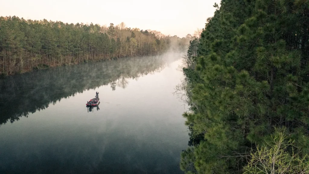
The photo at the top of this page is not Bennett Spring.
It is a regional stand-in, honestly captioned but generic — we will not put a name to a river we cannot prove. Send us a photograph you took here and it replaces the stand-in, with your credit on it.
Add a photo of this water
Landscape, not fish — the water itself. Reviewed by hand before it appears. The first one published here earns the Pioneer badge.
Fished this water? Add a photo
Reviewed by hand before it appears. Pick the water, not the spot — we never publish exact locations.
Access
Bennett Spring State Park main lot — parking at the spring head and the top of Zone 1.
Zone 1 flies-only reach — improved bank access from the spring down to the first bridge.
Zone 2 flies-and-lures reach — mid-branch access with parking along the park road.
Zone 3 bait-permitted reach — lower branch access nearest the Niangua confluence.
Park campground loops — walk-in bank access along the branch.
Niangua River confluence — access to the river below the branch for smallmouth in summer.
Bennett Spring hatchery area — viewing and access adjacent to the stocking operation.
Seasons
Spring: opening day is March 1 and the branch is crowded and heavily stocked through the spring.
Summer: daily tag fishing continues; fish early to beat both the heat and the crowds.
Fall: the tagged season runs through October 31 with the most comfortable weather of the year.
Winter: catch-and-release, flies and artificial lures only, from the second Friday in November — quiet water and the best shot at browns.
From the water
No logged trips yet. Be the first to put this water on your map.
Log this water
Fished it or cleaned it? Log in or create a free account to log a trip with photos and earn the waterway badge.
Questions
What is the current flow on the Bennett Spring?
As of Nov 2, 6:00 am, the USGS gauge Bennett Spring at Bennett Springs, MO reads 96 cfs. Conditions update every 15 minutes.
What species can you catch on the Bennett Spring?
Anglers target Brown Trout, Rainbow Trout on the Bennett Spring in Missouri.
Where can you access the Bennett Spring?
Bennett Spring State Park main lot — parking at the spring head and the top of Zone 1. Zone 1 flies-only reach — improved bank access from the spring down to the first bridge. Zone 2 flies-and-lures reach — mid-branch access with parking along the park road. Zone 3 bait-permitted reach — lower branch access nearest the Niangua confluence. Park campground loops — walk-in bank access along the branch. Niangua River confluence — access to the river below the branch for smallmouth in summer. Bennett Spring hatchery area — viewing and access adjacent to the stocking operation.
When is the best time to fish the Bennett Spring?
Spring: opening day is March 1 and the branch is crowded and heavily stocked through the spring. Summer: daily tag fishing continues; fish early to beat both the heat and the crowds. Fall: the tagged season runs through October 31 with the most comfortable weather of the year. Winter: catch-and-release, flies and artificial lures only, from the second Friday in November — quiet water and the best shot at browns.
Where are the fishing regulations for the Bennett Spring?
Regulations change by season and section. Read the current rules on the Missouri agency site: https://mdc.mo.gov/fishing/regulations