Beta

GuidedFloats is in beta. The full site launches March 1, 2027. The mobile app follows.

Guides: claim before March 1, 2027 and your first full season of Premium is free. Claim your founding spot →

Home › Waters › New Hampshire › Ashuelot River below Surry Mountain Dam
Tailwater · Cheshire County, the controlled reach below Surry Mountain Dam running south toward Keene in southwestern New Hampshire · New Hampshire

Ashuelot River below Surry Mountain Dam Fishing Guides

The controlled reach below Surry Mountain Dam above Keene, where release rather than rainfall sets the flow and the trout fishing with it.
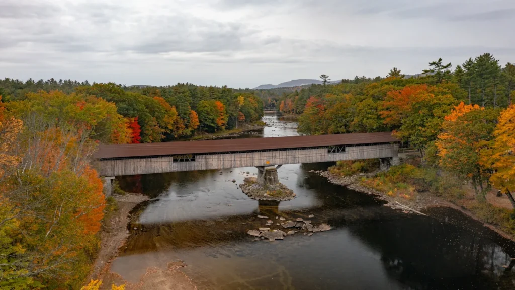
A bridge over a still river lined with autumn hardwoods in New England

Map of the Ashuelot River below Surry Mountain Dam

9 numbered points: 4 bridges, 2 parks and conservation areas, 2 hazards, 1 USGS gauge. Tap a marker for details. Reviewed Sep 26, 2026.

Printable version →
  • Bridge crossing (4)
  • Park / conservation area (2)
  • Dam / hazard (2)
  • USGS gauge (1)
Map data © OpenStreetMap contributors. Points are curated from OpenStreetMap and state agency sources; confirm access and hours before you go.

Print it. Bag it. Bring it.Phones die, screens crack, and most of this water has no signal. Print this map, fold it into a zip-top bag or dry bag with your license, and you have a backup your electronics can’t give you. Every marker is numbered so you can say exactly where you are.

Open the printable map
All 9 points on this map
#PointTypeLat, LonNotes
1Surry Mountain Lake
US Army Corps of Engineers
Park / conservation area43.01612, -72.31563Impoundment immediately above the dam; recreation area and the source of the tailwater's flow.
2Surry Mountain Dam
US Army Corps of Engineers
Dam / hazard42.99776, -72.30882Head of the tailwater. Releases here set the whole reach.
3USGS streamgauge - Ashuelot River below Surry Mountain Dam
USGS
USGS gauge42.99480, -72.31120Sits just below the dam; the release gauge for this reach.
4Court Street
Keene
Bridge crossing42.96051, -72.30300
5Ashuelot River Dam (Keene)
Keene
Dam / hazard42.93353, -72.28907Dam in Keene; the practical downstream end of the tailwater reach.
6West Street
Keene
Bridge crossing42.93279, -72.28977
7Hickey-Desilets Pocket Park
Keene
Park / conservation area42.92728, -72.28730Small riverside park in Keene.
8Winchester Street
Keene
Bridge crossing42.92712, -72.28664
9Ashuelot Rail Trail
Rail trail
Bridge crossing42.92463, -72.28455Former railroad bridge, now the Ashuelot Rail Trail crossing.

Guides on the Ashuelot River below Surry Mountain Dam

Claimed profiles take booking requests. Unclaimed profiles are built from public records so the river is never empty; the guide can claim or remove one any time.

No guides listed yet

Guide or outfit this water? Create your profile. Listing is free, the commission is 10% or 7% with a premium profile, and premium profiles list first on this water.

About the Ashuelot River below Surry Mountain Dam

The Ashuelot River runs south through Cheshire County to meet the Connecticut River at Hinsdale, and the reach below Surry Mountain Dam is a distinct fishery from the river above it. The dam is a flood-control structure built by the Army Corps of Engineers in the 1940s, and it does what flood-control dams do: it holds water back during high-runoff events and releases it in a managed way afterwards, which changes the behaviour of the river below in ways that matter to anyone fishing it.

The gauge sits directly below the dam and reports discharge and stage. On a freestone New England river the flow reading is a record of last night’s weather. Here it is a record of an operational decision, and the two are not the same thing. After a significant storm the reach below the dam can be running hard for days while the rain itself has long stopped, and conversely the river can hold a steady, moderate, entirely fishable flow through a dry stretch that would leave an unregulated stream skinny and warm. Checking the gauge before driving is genuinely worthwhile rather than a formality.

The trout fishing through this reach is supported by stocking, with brown and rainbow trout the main quarry and brook trout coming in from the colder tributaries. Holdover fish occur and the better ones are found in the deeper pools and against the ledge. Below the dam the river warms as it runs toward Keene, and the lower part of the reach shifts increasingly toward smallmouth, fallfish and pickerel through the summer, which is worth planning around rather than fighting. Access is reasonable, with the Corps recreation area at the dam, road crossings and town conservation land, and the river is small enough to be fished comfortably on foot in waders.

This water needs a real photo

The photo at the top of this page is not Ashuelot River below Surry Mountain Dam.

It is a regional stand-in, honestly captioned but generic — we will not put a name to a river we cannot prove. Send us a photograph you took here and it replaces the stand-in, with your credit on it.

Add a photo of this water See the badges

Pioneer badgeUnclaimed

Add a photo of this water

Landscape, not fish — the water itself. Reviewed by hand before it appears. The first one published here earns the Pioneer badge.

Never published. It is how the badge is held for you until member accounts open.

Posting to Ashuelot River below Surry Mountain Dam.

JPG, PNG or WebP, up to 12 MB. Landscape orientation looks best at the top of the page. We resize it and strip the location data out of the file.

The name printed under the photo and on your badge. Leave blank to stay anonymous.

Reader photo license v1.0 — the short version:

  • You grant Guided Floats, LLC a non-exclusive, royalty-free license to publish, resize and crop your photo on guidedfloats.com and in GuidedFloats’ own social posts and apps. You keep the copyright and can use the photo anywhere else.
  • You confirm that you took the photo yourself, that publishing it does not infringe anyone else’s rights, and that anyone recognisable in it (or a parent or guardian, if they are under 18) is happy for it to appear here.
  • Credit is printed beside the photo wherever it appears on the site, using the credit name you give us. Leave it blank and we use your name; write “Anonymous” for no name. Your email address is never published.
  • Withdrawing is one email to hello@guidedfloats.com naming the photo. It comes off the site within 7 days.
Read the full license

Version 1.0, dated 6 September 2026. Applies to every photograph submitted to GuidedFloats through the contact form, a species page, or the community board.

1. What you give us

By ticking the box on the form you grant Guided Floats, LLC (“GuidedFloats”, “we”) a non-exclusive, worldwide, royalty-free license to store, copy, resize, crop and display your photograph on guidedfloats.com, in GuidedFloats’ own social media accounts and mobile apps, and in material that promotes the site itself, in connection with the fish, water or community feature you sent it in for. The license lasts until you withdraw it (section 4).

You keep the copyright. The license is not exclusive, so you can use the photo anywhere else and license it to anyone else. We will not sell your photo, license it on to anyone else on its own, or use it in paid advertising for a third party.

2. What you confirm

You confirm that you took the photograph yourself (or otherwise own the rights to it), that you have the right to grant this license, and that publishing the photo does not infringe anyone else’s copyright, privacy or other rights.

If any person is recognisable in the photo, you confirm that they have agreed to its being published here, and that a parent or guardian has agreed on behalf of anyone under 18. Please do not send photographs of other people’s catches, screenshots, or pictures copied from other websites or social media.

3. Credit

We print the credit name you give us beside the photo wherever it appears on the site, and record it as the photo’s creator in the page’s structured data. If you leave the credit blank we use the name you gave us on the form. Write “Anonymous” if you prefer no name at all. Your email address, phone number and the exact spot the photo was taken are never published.

4. Withdrawing the license

You can withdraw the license at any time by emailing hello@guidedfloats.com, or by using the contact form, and telling us which photo you mean. We will remove the photo from guidedfloats.com within 7 days of receiving your message and stop using it in anything new. Copies that are already outside our control — search-engine caches, social posts that have already gone out, printed material already produced — may take longer to disappear or may not be recallable, and we are not responsible for those.

5. What we may do

We choose which photos to publish and may decline any submission without giving a reason. We may crop, resize, sharpen or colour-correct a photo for display, and we may remove a photo at any time. We will not alter a photo in a way that misrepresents the fish, the water or you.

6. Your details

We keep your name, email address, the credit name, the water and date you gave us, and the network address the submission came from, with the submission record, as our evidence of this license. We hold that record for as long as the photo is published and for the retention period described in our privacy policy. Location data that your camera or phone embedded in the file is removed before the photo is published.

7. Versions

The version of this license you accepted is stored with your submission and printed with the photo. A later version does not apply to a photo you have already sent unless you agree to it.

Fished this water? Add a photo

Reviewed by hand before it appears. Pick the water, not the spot — we never publish exact locations.

Never published. We use it only if we need to ask about the photo.

Posting to Ashuelot River below Surry Mountain Dam.

JPG, PNG or WebP, up to 12 MB. We resize it and strip the location data out of the file.

The name shown under the photo. Leave blank to stay anonymous.

Reader photo license v1.0 — the short version:

  • You grant Guided Floats, LLC a non-exclusive, royalty-free license to publish, resize and crop your photo on guidedfloats.com and in GuidedFloats’ own social posts and apps. You keep the copyright and can use the photo anywhere else.
  • You confirm that you took the photo yourself, that publishing it does not infringe anyone else’s rights, and that anyone recognisable in it (or a parent or guardian, if they are under 18) is happy for it to appear here.
  • Credit is printed beside the photo wherever it appears on the site, using the credit name you give us. Leave it blank and we use your name; write “Anonymous” for no name. Your email address is never published.
  • Withdrawing is one email to hello@guidedfloats.com naming the photo. It comes off the site within 7 days.
Read the full license

Version 1.0, dated 6 September 2026. Applies to every photograph submitted to GuidedFloats through the contact form, a species page, or the community board.

1. What you give us

By ticking the box on the form you grant Guided Floats, LLC (“GuidedFloats”, “we”) a non-exclusive, worldwide, royalty-free license to store, copy, resize, crop and display your photograph on guidedfloats.com, in GuidedFloats’ own social media accounts and mobile apps, and in material that promotes the site itself, in connection with the fish, water or community feature you sent it in for. The license lasts until you withdraw it (section 4).

You keep the copyright. The license is not exclusive, so you can use the photo anywhere else and license it to anyone else. We will not sell your photo, license it on to anyone else on its own, or use it in paid advertising for a third party.

2. What you confirm

You confirm that you took the photograph yourself (or otherwise own the rights to it), that you have the right to grant this license, and that publishing the photo does not infringe anyone else’s copyright, privacy or other rights.

If any person is recognisable in the photo, you confirm that they have agreed to its being published here, and that a parent or guardian has agreed on behalf of anyone under 18. Please do not send photographs of other people’s catches, screenshots, or pictures copied from other websites or social media.

3. Credit

We print the credit name you give us beside the photo wherever it appears on the site, and record it as the photo’s creator in the page’s structured data. If you leave the credit blank we use the name you gave us on the form. Write “Anonymous” if you prefer no name at all. Your email address, phone number and the exact spot the photo was taken are never published.

4. Withdrawing the license

You can withdraw the license at any time by emailing hello@guidedfloats.com, or by using the contact form, and telling us which photo you mean. We will remove the photo from guidedfloats.com within 7 days of receiving your message and stop using it in anything new. Copies that are already outside our control — search-engine caches, social posts that have already gone out, printed material already produced — may take longer to disappear or may not be recallable, and we are not responsible for those.

5. What we may do

We choose which photos to publish and may decline any submission without giving a reason. We may crop, resize, sharpen or colour-correct a photo for display, and we may remove a photo at any time. We will not alter a photo in a way that misrepresents the fish, the water or you.

6. Your details

We keep your name, email address, the credit name, the water and date you gave us, and the network address the submission came from, with the submission record, as our evidence of this license. We hold that record for as long as the photo is published and for the retention period described in our privacy policy. Location data that your camera or phone embedded in the file is removed before the photo is published.

7. Versions

The version of this license you accepted is stored with your submission and printed with the photo. A later version does not apply to a photo you have already sent unless you agree to it.

Flow alert

Tell me when the Ashuelot River below Surry Mountain Dam cfs

Now: 129 cfs, read 5:30 pm CDT, Sun Oct 18, 2026 (USGS 01158000, ASHUELOT RIVER BELOW SURRY MT DAM, NEAR KEENE, NH).

We never use this address for anything else and never share it. See the privacy policy.

Access

Surry Mountain Dam - the Corps flood-control structure at the head of the reach, with a recreation area and parking.
Surry Mountain Lake - the impoundment above the dam, offering warmwater fishing and a boat launch.
Keene - the city downstream, with tackle shops, lodging, groceries and full services.
Surry - the small town alongside the upper reach, with road access to the river.
Otter Brook - a neighbouring Corps-regulated stream east of Keene, a useful alternative when releases are high.
Connecticut River - the main stem the Ashuelot joins at Hinsdale, with a large and varied fishery.
Gilsum - upstream of the impoundment, giving access to the free-flowing upper Ashuelot.

Seasons

Spring: the main stocking season and the best trout fishing of the year, though releases can run high after storms.
Summer: the reach below the dam holds cooler than the open river, but the lower water turns toward bass and fallfish.
Fall: cooling water brings trout back on well, and settled autumn releases make for the most pleasant wading.
Winter: cold and largely dormant, with limited opportunity and access dictated by ice and snow at the dam.

From the water

No logged trips yet. Be the first to put this water on your map.

Log this water

Fished it or cleaned it? Log in or create a free account to log a trip with photos and earn the waterway badge.

Questions

What is the current flow on the Ashuelot River below Surry Mountain Dam?

As of Oct 18, 5:30 pm, the USGS gauge ASHUELOT RIVER BELOW SURRY MT DAM, NEAR KEENE, NH reads 129 cfs. Conditions update every 15 minutes.

What species can you catch on the Ashuelot River below Surry Mountain Dam?

Anglers target Brook Trout, Brown Trout, Chain Pickerel, Fallfish, Largemouth Bass, Rainbow Trout, Rock Bass, Smallmouth Bass, White Sucker, Yellow Perch on the Ashuelot River below Surry Mountain Dam in New Hampshire.

Where can you access the Ashuelot River below Surry Mountain Dam?

Surry Mountain Dam - the Corps flood-control structure at the head of the reach, with a recreation area and parking. Surry Mountain Lake - the impoundment above the dam, offering warmwater fishing and a boat launch. Keene - the city downstream, with tackle shops, lodging, groceries and full services. Surry - the small town alongside the upper reach, with road access to the river. Otter Brook - a neighbouring Corps-regulated stream east of Keene, a useful alternative when releases are high. Connecticut River - the main stem the Ashuelot joins at Hinsdale, with a large and varied fishery. Gilsum...

When is the best time to fish the Ashuelot River below Surry Mountain Dam?

Spring: the main stocking season and the best trout fishing of the year, though releases can run high after storms. Summer: the reach below the dam holds cooler than the open river, but the lower water turns toward bass and fallfish. Fall: cooling water brings trout back on well, and settled autumn releases make for the most pleasant wading. Winter: cold and largely dormant, with limited opportunity and access dictated by ice and snow at the dam.

Where are the fishing regulations for the Ashuelot River below Surry Mountain Dam?

Regulations change by season and section. Read the current rules on the New Hampshire agency site: https://www.wildlife.nh.gov/fishing-new-hampshire/fishing-rules-and-regulations