Fishes Lackawaxen River
River · Wayne and Pike counties in the northeastern Pocono region of Pennsylvania, from Honesdale through Hawley to the Delaware River at Lackawaxen · Pennsylvania
Lackawaxen River Fishing Guides
A northeastern Pennsylvania trout river feeding the Delaware, gauged near Honesdale above the Lake Wallenpaupack release that shapes the lower reach.
Map of the Lackawaxen River
15 numbered points: 4 access points, 2 bait & fly shops, 6 bridges, 2 hazards, 1 USGS gauge. Tap a marker for details. Reviewed Sep 18, 2026.
- Access / boat ramp (4)
- Bait, tackle & fly shop (2)
- Bridge crossing (6)
- Dam / hazard (2)
- USGS gauge (1)
Map data © OpenStreetMap contributors. Points are curated from OpenStreetMap and state agency sources; confirm access and hours before you go.
Print it. Bag it. Bring it.Phones die, screens crack, and most of this water has no signal. Print this map, fold it into a zip-top bag or dry bag with your license, and you have a backup your electronics can’t give you. Every marker is numbered so you can say exactly where you are.
Open the printable mapAll 15 points on this map
| # | Point | Type | Lat, Lon | Notes |
|---|---|---|---|---|
| 1 | Prompton Dam US Army Corps of Engineers | Dam / hazard | 41.58932, -75.32779 | Line-km 12.5 of 63.5 and the head of the flowing river. Everything above it is Prompton Lake; releases from the dam set the floatable water below. |
| 2 | US 6 bridge below Prompton Dam Roosevelt Highway | Bridge crossing | 41.58341, -75.32516 | Line-km 13.3, 0.004 km off the line. The first crossing below the dam. |
| 3 | Woolen Mill Dam Low-head dam above Honesdale | Dam / hazard | 41.57675, -75.28028 | Line-km 17.7, directly on the centreline. |
| 4 | Main Street bridge at Honesdale US 6 / PA 191 | Bridge crossing | 41.57668, -75.25790 | Line-km 19.9, 0.008 km off the line. The town crossing in Honesdale. |
| 5 | Sycamore Point Park Honesdale Borough / Wayne County | Access / boat ramp | 41.57707, -75.25539 | Line-km 20.2, 0.04 km off the line at the Dyberry Creek mouth. Concrete non-motorised launch opened in 2024; the top of the Honesdale-to-Hawley river trail. Placed from its published 12th Street address. |
| 6 | USGS 01430000 - Lackawaxen River at Honesdale USGS streamgage | USGS gauge | 41.56194, -75.24794 | Coordinates taken from the water's own roster record. It falls 0.086 km from the chained centreline at line-km 22.3, which is what confirms both. |
| 7 | Indian Orchard River Access Pennsylvania Fish & Boat Commission | Access / boat ramp | 41.54776, -75.21740 | Line-km 26.0, 0.018 km off the line. The only PFBC-owned access on the Lackawaxen itself, dedicated in 2025 at the midpoint of the river trail. Coordinates from the Commission's verified access-area layer. |
| 8 | White Mills Road bridge White Mills | Bridge crossing | 41.52573, -75.20478 | Line-km 30, 0.006 km off the line. The only mapped feature between Indian Orchard and Hawley. |
| 9 | Main Avenue bridge at Hawley US 6 / PA 590 | Bridge crossing | 41.47878, -75.18398 | Line-km 36.4, 0.012 km off the line, at the foot of the Honesdale-to-Hawley reach. |
| 10 | Housefly Fishing Fly shop, 217 Main Avenue, Hawley | Bait, tackle & fly shop | 41.47698, -75.18359 | 0.17 km off the river at line-km 36.4, beside the Main Avenue bridge. Not in OpenStreetMap; placed from its published street address. |
| 11 | Hawley River Access Hawley borough launch | Access / boat ramp | 41.47964, -75.17990 | Line-km 36.7, 0.04 km off the line. The take-out for the Honesdale reach and the put-in for the lower river. |
| 12 | Martin Road bridge at Kimbles Kimbles | Bridge crossing | 41.46703, -75.12295 | Line-km 43.2, 0.05 km off the line. No public launch is published at Kimbles; the bridge is the only mapped feature in this reach. |
| 13 | Rowland Road bridge Rowland | Bridge crossing | 41.47538, -75.03583 | Line-km 56.9, 0.05 km off the line, the last crossing above the Delaware confluence. |
| 14 | Two River Anglers Fly and tackle shop, 106 Scenic Drive, Lackawaxen | Bait, tackle & fly shop | 41.48643, -74.98986 | Line-km 63.1, 0.07 km off the river at the confluence, on the same road as the Zane Grey access. Placed from its published street address. |
| 15 | Zane Grey Access Pennsylvania Fish & Boat Commission | Access / boat ramp | 41.48629, -74.98727 | Line-km 63.4, 0.07 km off the line. The standard take-out for a Lackawaxen float. PFBC lists its water as the Delaware because the ramp sits just below the confluence. |
Guides on the Lackawaxen River
Claimed profiles take booking requests. Unclaimed profiles are built from public records so the river is never empty; the guide can claim or remove one any time.
Order on this page: premium and outfitter plans first (labelled Premium placement), then claimed free profiles, then unclaimed — one published price, no bidding for position. How placement works
About the Lackawaxen River
The Lackawaxen rises in the hills of Wayne County, runs through Honesdale where the Dyberry joins it, then east through Hawley and down to the Delaware River at the village of Lackawaxen. It is a mid-sized river with a genuine trout fishery and a long angling history – Zane Grey lived at the mouth and wrote about the water – and it now sees steady guided pressure as an alternative to the crowded upper Delaware a few miles away.
The river below Hawley is defined by Lake Wallenpaupack. Releases from the hydroelectric plant there enter through Wallenpaupack Creek and can change the lower river’s flow and temperature within an hour, which creates cold summer water and a genuine tailwater-style fishery all the way down to the Delaware. This gauge near Honesdale sits above that influence, on the freestone upper river, and reads what the natural watershed is doing rather than what the powerhouse is doing. Anglers fishing the lower river should watch the published release schedule as well as this number.
Brown trout are the main quarry and hold over well in the cooler reaches, with stocked rainbows through the spring and wild brook trout in the small feeder streams. Smallmouth bass take over the warmer summer water in the lower miles and are badly underrated here. American shad run up from the Delaware in late spring and reach the lower Lackawaxen in some years, and walleye are present near the mouth. Access is a mix of state-stocked public water, road pull-offs and private frontage, so anglers should check the Fish and Boat Commission access listings before setting out. The gauge reports precipitation, discharge and stage but no water temperature.
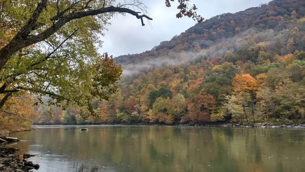
This water needs a real photo
The photo at the top of this page is not Lackawaxen River.
It is a regional stand-in, honestly captioned but generic — we will not put a name to a river we cannot prove. Send us a photograph you took here and it replaces the stand-in, with your credit on it.
Pioneer badgeUnclaimed
Add a photo of this water
Landscape, not fish — the water itself. Reviewed by hand before it appears. The first one published here earns the Pioneer badge.
Fished this water? Add a photo
Reviewed by hand before it appears. Pick the water, not the spot — we never publish exact locations.
Access
Honesdale riverfront and the Dyberry confluence - the closest public access to the gauge.
Route 6 pull-offs between Honesdale and Hawley - roadside access to the middle river.
Hawley Park and the Wallenpaupack Creek confluence - access to the head of the release-influenced reach.
Kimbles access off Route 590 - lower-river bank and small-boat access.
Rowland bridge access - lower-river parking and wadeable water.
Zane Grey Museum access at Lackawaxen - the mouth and the Delaware confluence.
Dyberry Creek public water above Honesdale - tributary access to wild and stocked trout.
Seasons
Spring: stocking and high freestone flows, with the best of the year's trout fishing from April into June.
Summer: warm water in the upper river, with the Wallenpaupack release keeping the lower reach cold and fishable.
Fall: cooling temperatures, active brown trout and light pressure once the summer crowds leave the Poconos.
Winter: low, cold water with limited access and occasional ice, and a small dedicated fly-fishing following.
From the water
No logged trips yet. Be the first to put this water on your map.
Log this water
Fished it or cleaned it? Log in or create a free account to log a trip with photos and earn the waterway badge.
Questions
What is the current flow on the Lackawaxen River?
As of Nov 2, 7:30 am, the USGS gauge Lackawaxen River near Honesdale, PA reads 78 cfs. Conditions update every 15 minutes.
What species can you catch on the Lackawaxen River?
Anglers target American Shad, Brook Trout, Brown Trout, Rainbow Trout, Smallmouth Bass, Walleye on the Lackawaxen River in Pennsylvania.
Are there fishing guides on the Lackawaxen River?
GuidedFloats lists 1 guide and outfitters on the Lackawaxen River. Claimed profiles accept booking requests; unclaimed profiles are built from public records and link to the business.
Where can you access the Lackawaxen River?
Honesdale riverfront and the Dyberry confluence - the closest public access to the gauge. Route 6 pull-offs between Honesdale and Hawley - roadside access to the middle river. Hawley Park and the Wallenpaupack Creek confluence - access to the head of the release-influenced reach. Kimbles access off Route 590 - lower-river bank and small-boat access. Rowland bridge access - lower-river parking and wadeable water. Zane Grey Museum access at Lackawaxen - the mouth and the Delaware confluence. Dyberry Creek public water above Honesdale - tributary access to wild and stocked trout.
When is the best time to fish the Lackawaxen River?
Spring: stocking and high freestone flows, with the best of the year's trout fishing from April into June. Summer: warm water in the upper river, with the Wallenpaupack release keeping the lower reach cold and fishable. Fall: cooling temperatures, active brown trout and light pressure once the summer crowds leave the Poconos. Winter: low, cold water with limited access and occasional ice, and a small dedicated fly-fishing following.
Where are the fishing regulations for the Lackawaxen River?
Regulations change by season and section. Read the current rules on the Pennsylvania agency site: https://www.pa.gov/agencies/fishandboat/fishing/regulations