Lehigh River Fishing Guides
A Pocono tailwater below Francis E. Walter Dam running through the Lehigh Gorge to Jim Thorpe, with wild browns up top and smallmouth in the lower valley.
Map of the Lehigh River
35 numbered points: 11 access points, 3 campsites, 3 bait & fly shops, 1 outfitter, 3 bridges, 2 parks and conservation areas, 4 regulation section limits, 7 hazards, 1 USGS gauge. Tap a marker for details. Reviewed Sep 18, 2026.
- Access / boat ramp (11)
- Campsite (3)
- Bait, tackle & fly shop (3)
- Outfitter / canoe rental (1)
- Bridge crossing (3)
- Park / conservation area (2)
- Regulation section limit (4)
- Dam / hazard (7)
- USGS gauge (1)
Print it. Bag it. Bring it.Phones die, screens crack, and most of this water has no signal. Print this map, fold it into a zip-top bag or dry bag with your license, and you have a backup your electronics can’t give you. Every marker is numbered so you can say exactly where you are.
Open the printable mapAll 35 points on this map
| # | Point | Type | Lat, Lon | Notes |
|---|---|---|---|---|
| 1 | JC's Live Bait & Tackle Gouldsboro · shop=fishing in OpenStreetMap | Bait, tackle & fly shop | 41.24459, -75.45716 | The only tackle shop mapped on the headwater Lehigh, 0.43 km off the river at line-km 6. |
| 2 | Great Falls of the Lehigh Named falls on the main stem | Dam / hazard | 41.12923, -75.62741 | Sits directly on the centreline at line-km 33, above the Francis E. Walter pool. |
| 3 | Francis E. Walter Dam US Army Corps of Engineers | Dam / hazard | 41.11277, -75.72205 | Line-km 46 of 172. Everything above it is reservoir; scheduled releases set the whitewater season below. |
| 4 | Stocked trout section — upper limit at the F. E. Walter Reservoir outlet Carbon/Luzerne reach · PFBC | Regulation section limit | 41.11402, -75.72161 | Upper limit of the PFBC year-round stocked reach that runs from the reservoir outlet to the Sandy Run confluence. Placed at the dam itself. See the PFBC regulations for what applies. |
| 5 | Boat launch below Francis E. Walter Dam Unnamed in OpenStreetMap | Access / boat ramp | 41.11014, -75.72380 | First launch below the dam, 0.45 km downriver of it at line-km 46.4 and 0.04 km off the line. Named here from the dam, not from an OSM name. |
| 6 | Pennsylvania Turnpike (I-476) crossing Northeast Extension | Bridge crossing | 41.10419, -75.74949 | The only crossing between the dam and White Haven; line-km 49. |
| 7 | Lehigh Gorge Campground Private campground, White Haven | Campsite | 41.06649, -75.75274 | 1.4 km off the river at line-km 55, just above the White Haven launch. |
| 8 | Boat launch below White Haven Unnamed in OpenStreetMap | Access / boat ramp | 41.05324, -75.77042 | Line-km 56.5, 0.02 km off the line and 0.9 km below White Haven borough. Three OSM slipway objects sit within 80 m here and are one site, mapped once. |
| 9 | Stocked trout section — lower limit at the Sandy Run confluence Carbon/Luzerne reach · PFBC | Regulation section limit | 41.01785, -75.73856 | Lower limit of the reach that starts at the F. E. Walter Reservoir outlet. Placed where the mapped Sandy Run centreline meets the Lehigh — 0.000 km, a shared vertex. |
| 10 | Rockport non-powered boat launch Lehigh Gorge · car-top only | Access / boat ramp | 40.96662, -75.75469 | Line-km 71, 0.02 km off the line. The mid-gorge access between White Haven and Jim Thorpe. |
| 11 | Lehigh Gorge State Park DCNR | Park / conservation area | 40.95342, -75.74630 | The park follows the river through the gorge; this is its OpenStreetMap label point at line-km 81. No boundary relation is mapped. |
| 12 | Stocked trout section — upper limit above the Glen Onoko railroad bridge Carbon reach · PFBC | Regulation section limit | 40.88577, -75.75723 | The published upper limit is 0.33 mile upriver of the railroad bridge at Glen Onoko. The bridge is mapped at line-km 91.9; walking 0.53 km up the chained centreline lands here, at line-km 91.3. |
| 13 | Glen Onoko railroad bridge CNJ line · also the D&L Trail crossing | Bridge crossing | 40.88289, -75.76065 | Line-km 91.9, 0.01 km off the line. The anchor the section limit above it is measured from. |
| 14 | PA 903 bridge at Jim Thorpe North Street | Bridge crossing | 40.86993, -75.73764 | Line-km 95.5. The town crossing at the gorge take-out. |
| 15 | Stocked trout section — lower limit at the Mauch Chunk Creek confluence Carbon reach · PFBC | Regulation section limit | 40.86195, -75.73739 | Lower limit of the reach that begins above the Glen Onoko railroad bridge. Placed where the mapped Mauch Chunk Creek centreline meets the Lehigh — 0.000 km, a shared vertex. |
| 16 | Lehighton Outdoor Center Boat rental and outfitter | Outfitter / canoe rental | 40.83252, -75.70639 | Line-km 103, 0.16 km off the river. Tagged shop=outdoor plus amenity=boat_rental in OpenStreetMap. |
| 17 | Emerald Hollow Campground Private campground | Campsite | 40.82541, -75.68767 | 0.5 km off the river at line-km 105. |
| 18 | East Penn Boat Ramp Line-km 110 | Access / boat ramp | 40.79233, -75.65633 | 0.10 km off the line, sharing a riverbank with the Riverview Park primitive campsites. |
| 19 | Primitive Camping at Riverview Park East Penn Township | Campsite | 40.79137, -75.65561 | Beside the East Penn ramp at line-km 110, 0.13 km off the line. |
| 20 | Lehigh Gap Boat Ramp Line-km 115 · PA 248 crossing | Access / boat ramp | 40.78213, -75.60694 | 0.06 km off the line at the Lehigh Gap water gap. |
| 21 | USGS 01451000 — Lehigh River at Walnutport USGS streamgage | USGS gauge | 40.75704, -75.60296 | Coordinates taken from the water's own roster record. It falls 0.048 km from the chained centreline at line-km 118, which is what confirms both. |
| 22 | Walnutport Boat Ramp Line-km 118 | Access / boat ramp | 40.75265, -75.60199 | 0.04 km off the line, 0.5 km below the gauge. |
| 23 | Three Mile Dam Low-head dam on the main stem | Dam / hazard | 40.72605, -75.54327 | Line-km 126, directly on the centreline. First of the old industrial dams on the lower river. |
| 24 | Treichlers Bridge Boat Ramp Line-km 127 | Access / boat ramp | 40.73370, -75.54044 | 0.05 km off the line, just below Three Mile Dam. |
| 25 | Willie Marx's Bait & Tackle Northampton · shop=fishing in OpenStreetMap | Bait, tackle & fly shop | 40.69011, -75.50529 | 0.10 km off the river at line-km 134, immediately above Northampton Dam. |
| 26 | Northampton Dam Low-head dam on the main stem | Dam / hazard | 40.68921, -75.50269 | Line-km 134, 0.004 km off the centreline. |
| 27 | Number Seven Dam Low-head dam on the main stem | Dam / hazard | 40.60674, -75.45466 | Line-km 145, directly on the centreline above Allentown. |
| 28 | Sand Island Boat Launch Bethlehem · Sand Island Park | Access / boat ramp | 40.61504, -75.38624 | Line-km 152, 0.12 km off the line. |
| 29 | Boat launch at Saucon Unnamed in OpenStreetMap | Access / boat ramp | 40.61980, -75.33654 | Line-km 157, 0.07 km off the line. Named from the Saucon hamlet node 0.09 km away; no other place name is within a kilometre of it. |
| 30 | Freeman's Island Nature reserve, mid-river | Park / conservation area | 40.63124, -75.33173 | A mapped river island at line-km 158. |
| 31 | PFBC Route 33 Access Pennsylvania Fish & Boat Commission | Access / boat ramp | 40.64488, -75.27178 | Line-km 164, 0.24 km off the line. Three OSM objects describe this one site. |
| 32 | Glendon Dam Low-head dam on the main stem | Dam / hazard | 40.65894, -75.24465 | Line-km 167, on the centreline. |
| 33 | Lehigh River Easton Access Easton · line-km 172 | Access / boat ramp | 40.68892, -75.20664 | 0.05 km off the line, immediately above Easton Dam and the Delaware confluence. |
| 34 | Easton Dam Low-head dam at the mouth | Dam / hazard | 40.68906, -75.20497 | The last dam on the Lehigh, 0.1 km above the Delaware confluence. |
| 35 | The Shad Den Bait & Tackle Easton · shop=fishing in OpenStreetMap | Bait, tackle & fly shop | 40.69596, -75.20685 | 0.77 km off the river near the mouth at line-km 172. |
Guides on the Lehigh River
Claimed profiles take booking requests. Unclaimed profiles are built from public records so the river is never empty; the guide can claim or remove one any time.
About the Lehigh River
The Lehigh drops out of the Poconos through the Lehigh Gorge, past Jim Thorpe, and down the valley through Allentown and Bethlehem to the Delaware at Easton. Two rivers live inside that description. Above and through the gorge it is a cold, boulder-filled trout river fed by releases from Francis E. Walter Dam, with wild brown trout that have come back strongly in recent decades. Below Jim Thorpe it warms and widens into a very good smallmouth and walleye river.
The gorge reach is the guided trout water, and it shares the river with one of the busiest whitewater rafting operations in the East. Scheduled dam releases drive the raft season, and those same releases determine when the trout water is wadeable and when it is not. On low-release days the gorge wades well and fishes beautifully with caddis, sulphurs and terrestrials; on release days the river belongs to the rafts. That schedule is published in advance, which makes planning easier here than on many tailwaters.
Below the gorge the smallmouth fishing from Walnutport down toward Allentown is underrated and easy to reach, with good numbers of fish and enough current to make wading productive. Shad run up from the Delaware in spring as far as the fish passage allows.
The Walnutport gauge sits well below the gorge and reads the whole upper basin. Look at it alongside the published release schedule rather than on its own. Jim Thorpe is the hub for outfitters, lodging and the rail trail that follows the gorge and reaches much of the upper river on foot or by bike.
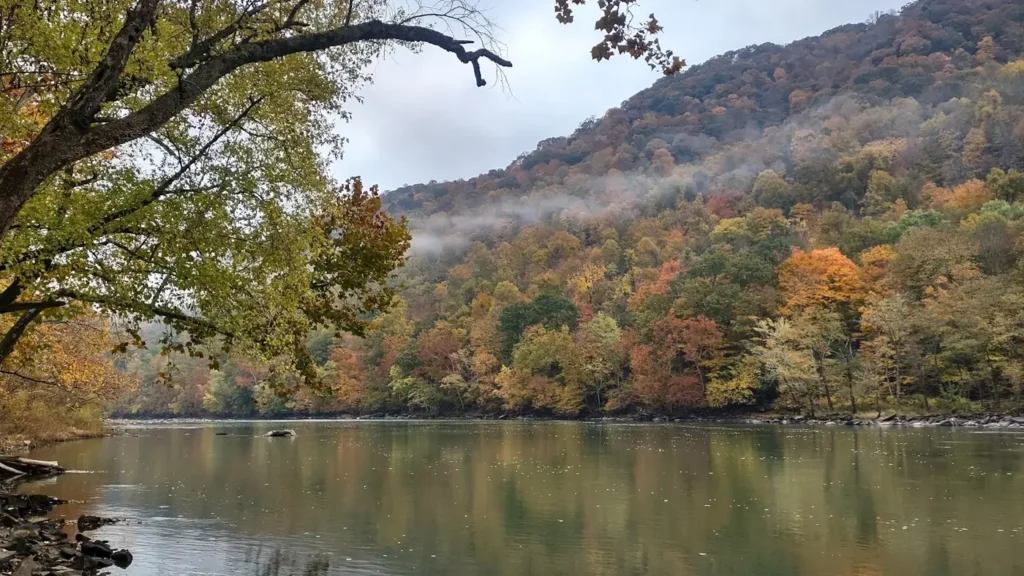
This water needs a real photo
The photo at the top of this page is not Lehigh River.
It is a regional stand-in, honestly captioned but generic — we will not put a name to a river we cannot prove. Send us a photograph you took here and it replaces the stand-in, with your credit on it.
Add a photo of this water
Landscape, not fish — the water itself. Reviewed by hand before it appears. The first one published here earns the Pioneer badge.
Fished this water? Add a photo
Reviewed by hand before it appears. Pick the water, not the spot — we never publish exact locations.
Access
Francis E. Walter Dam and White Haven: top of the gorge, rail trail access.
Lehigh Gorge State Park: trail access along the gorge with numerous walk-in points.
Rockport: mid-gorge access and raft launch.
Jim Thorpe: town access at the bottom of the gorge, outfitters and shuttles.
Bowmanstown, Palmerton and Walnutport: valley accesses in the smallmouth reach near the gauge.
Allentown, Bethlehem and Easton: lower river access toward the Delaware.
Seasons
April through June: stocked and wild trout in the gorge, sulphurs and caddis, shad in the lower river.
July and August: whitewater release season; fish the gorge on non-release days and the valley for smallmouth.
September and October: the best trout month up top and prime smallmouth below Jim Thorpe.
November through March: cold, low and quiet; the gorge fishes on mild days.
From the water
No logged trips yet. Be the first to put this water on your map.
Log this water
Fished it or cleaned it? Log in or create a free account to log a trip with photos and earn the waterway badge.
Questions
What is the current flow on the Lehigh River?
As of Oct 19, 4:30 am, the USGS gauge Lehigh River at Walnutport, PA reads 1,220 cfs, the 74th percentile for this date. Conditions update every 15 minutes.
What species can you catch on the Lehigh River?
Anglers target American Shad, Brown Trout, Rainbow Trout, Smallmouth Bass, Walleye on the Lehigh River in Pennsylvania.
Are there fishing guides on the Lehigh River?
GuidedFloats lists 1 guide and outfitters on the Lehigh River. Claimed profiles accept booking requests; unclaimed profiles are built from public records and link to the business.
Where can you access the Lehigh River?
Francis E. Walter Dam and White Haven: top of the gorge, rail trail access. Lehigh Gorge State Park: trail access along the gorge with numerous walk-in points. Rockport: mid-gorge access and raft launch. Jim Thorpe: town access at the bottom of the gorge, outfitters and shuttles. Bowmanstown, Palmerton and Walnutport: valley accesses in the smallmouth reach near the gauge. Allentown, Bethlehem and Easton: lower river access toward the Delaware.
When is the best time to fish the Lehigh River?
April through June: stocked and wild trout in the gorge, sulphurs and caddis, shad in the lower river. July and August: whitewater release season; fish the gorge on non-release days and the valley for smallmouth. September and October: the best trout month up top and prime smallmouth below Jim Thorpe. November through March: cold, low and quiet; the gorge fishes on mild days.
Where are the fishing regulations for the Lehigh River?
Regulations change by season and section. Read the current rules on the Pennsylvania agency site: https://www.pa.gov/agencies/fishandboat/fishing/regulations