Fishes Pymatuning Reservoir
Reservoir · Northwest Pennsylvania · Pennsylvania
Pymatuning Reservoir Fishing Guides
A big, shallow, fertile lake straddling the Ohio line, famous for walleye and muskellunge and for a horsepower rule that has kept it slow and quiet for decades.
Map of the Pymatuning Reservoir
28 numbered points: 16 access points, 5 campsites, 3 parks and conservation areas, 1 agency office, 2 hazards, 1 USGS gauge. Tap a marker for details. Reviewed Sep 22, 2026.
- Access / boat ramp (16)
- Campsite (5)
- Park / conservation area (3)
- Agency / conservation office (1)
- Dam / hazard (2)
- USGS gauge (1)
Map data © OpenStreetMap contributors. Points are curated from OpenStreetMap and state agency sources; confirm access and hours before you go.
Print it. Bag it. Bring it.Phones die, screens crack, and most of this water has no signal. Print this map, fold it into a zip-top bag or dry bag with your license, and you have a backup your electronics can’t give you. Every marker is numbered so you can say exactly where you are.
Open the printable mapAll 28 points on this map
| # | Point | Type | Lat, Lon | Notes |
|---|---|---|---|---|
| 1 | Pymatuning Reservoir Dam South end of the lake, Dam Road | Dam / hazard | 41.49895, -80.46091 | The earthen dam that impounds the reservoir and the head of the Shenango River below it. Boats must stay clear of the dam face and the spillway approach. |
| 2 | State Parks Launch and Parking Area Pymatuning State Park (PA) - DCNR | Access / boat ramp | 41.54513, -80.49444 | A DCNR launch and trailer lot on the mid-lake east shore, below Snodgrass Road. OSM spells its access road "St Parks Lauch & Parking Areas"; the spelling is corrected here. |
| 3 | Meadow Lake Campground Private campground, South Lake Road | Campsite | 41.56488, -80.49438 | A private campground set back about 700 m from the east shore. Listed because it is the only non-agency camping within a kilometre of this water. |
| 4 | Mooring Area 19 PA DCNR mooring area | Access / boat ramp | 41.60170, -80.50348 | A DCNR mooring area on the PA shore south of Espyville. The OSM node is tagged "Monogahela Mooring Area 19 - PA-DCNR"; that river name does not belong to this water and is not repeated here. |
| 5 | PA 285 launch at Espyville Unnamed in OSM - named from its road | Access / boat ramp | 41.60632, -80.50131 | The launch on the east shore where PA 285 reaches the water at Espyville. DCNR names an Espyville Marina on this shore; OSM carries no name here, so the road and place are used instead. |
| 6 | Manning Slipway - Pymatuning State Park (PA) | Access / boat ramp | 41.62433, -80.50163 | A named slipway on the PA east shore between Espyville and Tuttle Point. The name is OSM’s; no agency page read this run corroborates it. |
| 7 | Tuttle Point Campground Pymatuning State Park (PA) - DCNR | Campsite | 41.64281, -80.49091 | The state park campground on the east shore off PA 285, a few hundred metres south of the Tuttle Point launch. OSM tags it access=private, which does not match DCNR operating it. |
| 8 | Tuttle Point Boat Launch Pymatuning State Park (PA) - DCNR | Access / boat ramp | 41.64483, -80.48912 | The east-shore launch reached from PA 285, with the Tuttle Point campground and beach immediately south. |
| 9 | Linesville Spillway Sanctuary causeway, north-east arm | Dam / hazard | 41.62990, -80.44140 | The spillway on the causeway at the Pymatuning sanctuary - the one where carp mass under the bridge. A structure with moving water; it is a viewpoint from the wall, not a place to put a boat. |
| 10 | Linesville State Fish Hatchery Pennsylvania Fish & Boat Commission | Agency / conservation office | 41.64473, -80.42686 | The PFBC hatchery and visitor centre east of the lake at Linesville. DCNR’s own park page names the hatchery and visitor centre as the Commission’s facility here. |
| 11 | Linesville Marina Pymatuning State Park (PA) - marina and boat rental | Access / boat ramp | 41.65687, -80.46253 | The north-shore marina reached from U.S. 6, with boat rental. An unnamed slipway sits seven metres away and is the marina’s own ramp, so it is not shipped as a second point. |
| 12 | Linesville Campground Pymatuning State Park (PA) - DCNR | Campsite | 41.66013, -80.46318 | The state park campground on the north shore off U.S. 6, with the Linesville beach, picnic areas and cabins around it. |
| 13 | Alcatraz Slipway - PA north arm | Access / boat ramp | 41.66809, -80.47779 | A named slipway on the north arm above Linesville. The name is OSM’s local one; no agency page read this run carries it. |
| 14 | Clark Island Natural Area Pennsylvania Bureau of State Parks | Park / conservation area | 41.66519, -80.48833 | A designated natural area on the north arm of the lake. Its boundary reaches the shoreline at 0.27 km and its centre sits 0.78 km back. |
| 15 | Wilson Slipway and shore fishing - PA north end | Access / boat ramp | 41.67511, -80.48555 | The northernmost PA launch on the sheet, tagged in OSM as both a slipway and a fishing spot, with a viewpoint over the head of the lake. |
| 16 | Padanaram Road launch Ohio side - unnamed in OSM, named from its road | Access / boat ramp | 41.65355, -80.52228 | A ramp on the Ohio shore at Padanaram. ODNR names a Padanaram ramp on this side; OSM carries the slipway unnamed, so the road from the reverse geocode is used. |
| 17 | Pymatuning State Park (Ohio) Ohio Department of Natural Resources | Park / conservation area | 41.60125, -80.53341 | Ohio’s state park along the whole west shore. Its boundary meets the shoreline and its centre sits 0.41 km back, so it is placed on the park centroid rather than on any one facility. |
| 18 | Pymatuning Lake Road launch Ohio side - unnamed in OSM, named from its road | Access / boat ramp | 41.59721, -80.53779 | A ramp on the Ohio west shore. OSM carries a second unnamed ramp about 250 m north on the same road; the pair is condensed to one marker rather than printed as two dots. |
| 19 | Birches Boating Area Pymatuning State Park (Ohio) - ODNR | Access / boat ramp | 41.57096, -80.52847 | The Ohio boating area on the west shore. The name is carried by the marina polygon here; the ramp itself is an unnamed slipway 90 m away, and the two are shipped as one point. |
| 20 | Poplar Grove Picnic Site Pymatuning State Park (Ohio) - ODNR | Park / conservation area | 41.56460, -80.52913 | A shoreline picnic area on the Ohio west shore, 70 m from a ramp on Pymatuning Lake Road. |
| 21 | Pymatuning State Park Campground Boat Launch Pymatuning State Park (Ohio) - ODNR | Access / boat ramp | 41.55491, -80.52434 | The launch serving the Ohio campground, on the west shore south of Birches. |
| 22 | Pymatuning State Park Campground (Ohio) Ohio Department of Natural Resources | Campsite | 41.54752, -80.52794 | The Ohio campground on the west shore, with its own boat launch about 800 m north. ODNR names one campground on this side of the lake. |
| 23 | Pymatuning Lake Road launch at Poplar Grove Ohio side - unnamed in OSM | Access / boat ramp | 41.54602, -80.52646 | A ramp on the Ohio west shore beside the Poplar Grove picnic site, identified by the facility it serves rather than by a name OSM does not carry. |
| 24 | Williamsfield Road launch Unnamed in OSM - named from its road | Access / boat ramp | 41.53195, -80.51672 | A ramp on the PA shore at Turner, close to the state line. OSM carries the slipway unnamed; the road name is from a zoom-17 reverse geocode. |
| 25 | Jamestown Campground Pymatuning State Park (PA) - DCNR | Campsite | 41.52044, -80.50534 | The state park campground on the south shore, off U.S. 322, with the Jamestown beach, cabins and picnic areas around it. |
| 26 | Jamestown Boat Launch Pymatuning State Park (PA) - DCNR | Access / boat ramp | 41.52167, -80.50126 | The south-shore launch reached from U.S. 322; the campground, beach and cabins sit immediately west of it. |
| 27 | West State Road launch Unnamed in OSM - named from its road | Access / boat ramp | 41.51104, -80.47215 | A shoreline ramp on the PA south-east shore at Turner. OSM carries the slipway with no name, so it is identified here by the road a zoom-17 reverse geocode returned. |
| 28 | USGS 03101500 - Shenango River at Pymatuning Dam United States Geological Survey | USGS gauge | 41.49839, -80.46285 | The gauge on the roster for this water. It reads the Shenango River immediately below the dam, so it reports what the reservoir is releasing rather than lake level. |
Guides on the Pymatuning Reservoir
Claimed profiles take booking requests. Unclaimed profiles are built from public records so the river is never empty; the guide can claim or remove one any time.
About the Pymatuning Reservoir
Pymatuning straddles the Pennsylvania and Ohio border in the northwest corner of the state, a large, shallow, extremely fertile lake built in the 1930s across what had been a swamp. That history is the key to it: the lake is broad and flat with soft bottom, abundant weed growth and a forage base that grows fish quickly.
Walleye are the headline. Pymatuning supports one of the strongest walleye populations in Pennsylvania, and the fishing is a drifting and trolling game over flats and weed edges rather than a structure hunt. Muskellunge are the other signature species, and the lake has a long-standing reputation for producing them. Crappie, perch, bluegill and channel catfish are all abundant, and the panfishing is good enough to keep families busy for a whole holiday.
The lake is shared between two states, with the boundary running down the middle and separate regulations on each side. That is worth reading up on before you launch, particularly if you intend to fish across the line.
A long-standing horsepower restriction keeps big fast boats off Pymatuning, which is why it still feels like a lake from another era. Small boats, tiller outboards and drifting are the norm, and the water stays calm enough that a canoe is a reasonable choice on much of it.
The gauge below gives pool elevation. On a lake this shallow, a small change in level moves a great deal of weed edge in or out of reach, and the weed edge is where most of the fishing happens.
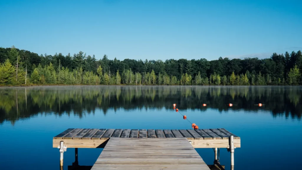
This water needs a real photo
The photo at the top of this page is not Pymatuning Reservoir.
It is a regional stand-in, honestly captioned but generic — we will not put a name to a river we cannot prove. Send us a photograph you took here and it replaces the stand-in, with your credit on it.
Pioneer badgeUnclaimed
Add a photo of this water
Landscape, not fish — the water itself. Reviewed by hand before it appears. The first one published here earns the Pioneer badge.
Fished this water? Add a photo
Reviewed by hand before it appears. Pick the water, not the spot — we never publish exact locations.
Access
Pymatuning State Park: multiple ramps, camping and extensive bank access.
Jamestown and Espyville: marinas and public ramps on the Pennsylvania side.
Linesville spillway: the famous causeway area and bank fishing.
Ohio side ramps: separate access with separate regulations.
Dam area: bank fishing and the deepest water in the lake.
Bank and pier access is unusually good throughout the park.
Note: horsepower restrictions apply and differ by state. Check before launching.
Seasons
Winter: ice fishing for walleye, perch and crappie when conditions allow.
Spring: the walleye spawn and the best fishing of the year.
Summer: drifting weed edges for walleye, muskie in the vegetation, panfish everywhere.
Fall: cooling water, feeding muskellunge and a second walleye push.
From the water
No logged trips yet. Be the first to put this water on your map.
Log this water
Fished it or cleaned it? Log in or create a free account to log a trip with photos and earn the waterway badge.
Questions
What species can you catch on the Pymatuning Reservoir?
Anglers target Black Crappie, Bluegill, Channel Catfish, Largemouth Bass, Muskellunge, Walleye, White Crappie, Yellow Perch on the Pymatuning Reservoir in Pennsylvania.
Are there fishing guides on the Pymatuning Reservoir?
GuidedFloats lists 1 guide and outfitters on the Pymatuning Reservoir. Claimed profiles accept booking requests; unclaimed profiles are built from public records and link to the business.
Where can you access the Pymatuning Reservoir?
Pymatuning State Park: multiple ramps, camping and extensive bank access. Jamestown and Espyville: marinas and public ramps on the Pennsylvania side. Linesville spillway: the famous causeway area and bank fishing. Ohio side ramps: separate access with separate regulations. Dam area: bank fishing and the deepest water in the lake. Bank and pier access is unusually good throughout the park. Note: horsepower restrictions apply and differ by state. Check before launching.
When is the best time to fish the Pymatuning Reservoir?
Winter: ice fishing for walleye, perch and crappie when conditions allow. Spring: the walleye spawn and the best fishing of the year. Summer: drifting weed edges for walleye, muskie in the vegetation, panfish everywhere. Fall: cooling water, feeding muskellunge and a second walleye push.
Where are the fishing regulations for the Pymatuning Reservoir?
Regulations change by season and section. Read the current rules on the Pennsylvania agency site: https://www.pa.gov/agencies/fishandboat/fishing/regulations