Fishes Ottauquechee River
River · East-central Vermont, running from Killington through Woodstock and Quechee Gorge to the Connecticut · Vermont
Ottauquechee River Fishing Guides
A classic Vermont freestone river from the Killington slopes through Woodstock and Quechee Gorge, fished for wild and stocked trout.
Map of the Ottauquechee River
37 numbered points: 1 access point, 23 bridges, 6 parks and conservation areas, 6 hazards, 1 USGS gauge. Tap a marker for details. Reviewed Sep 26, 2026.
- Access / boat ramp (1)
- Bridge crossing (23)
- Park / conservation area (6)
- Dam / hazard (6)
- USGS gauge (1)
Map data © OpenStreetMap contributors. Points are curated from OpenStreetMap and state agency sources; confirm access and hours before you go.
Print it. Bag it. Bring it.Phones die, screens crack, and most of this water has no signal. Print this map, fold it into a zip-top bag or dry bag with your license, and you have a backup your electronics can’t give you. Every marker is numbered so you can say exactly where you are.
Open the printable mapAll 37 points on this map
| # | Point | Type | Lat, Lon | Notes |
|---|---|---|---|---|
| 1 | Post Road Killington | Bridge crossing | 43.69605, -72.80458 | |
| 2 | Archie Baker Road | Bridge crossing | 43.68168, -72.78428 | |
| 3 | Thundering Brook Road | Bridge crossing | 43.67792, -72.78244 | |
| 4 | Valley Park | Park / conservation area | 43.66207, -72.77473 | |
| 5 | River Road | Bridge crossing | 43.66240, -72.77302 | |
| 6 | Rabeck Mountain Road | Bridge crossing | 43.65092, -72.76853 | |
| 7 | USGS gauge - Ottauquechee River near West Bridgewater Live flow and stage | USGS gauge | 43.62229, -72.75899 | |
| 8 | Mission Farm Road | Bridge crossing | 43.62197, -72.75864 | |
| 9 | Skyeship Bridge US 4 crossing | Bridge crossing | 43.61468, -72.75622 | |
| 10 | Mountainside Road | Bridge crossing | 43.59828, -72.71960 | |
| 11 | Gunderson Road | Bridge crossing | 43.59438, -72.69419 | |
| 12 | U.S. Route 4 | Bridge crossing | 43.58993, -72.66189 | |
| 13 | Vermont Route 100A | Bridge crossing | 43.58685, -72.65677 | |
| 14 | Blanchard Road | Bridge crossing | 43.58690, -72.62326 | |
| 15 | West Woodstock Road | Bridge crossing | 43.59542, -72.60331 | |
| 16 | Bridges Road | Bridge crossing | 43.60057, -72.56904 | |
| 17 | West Woodstock Bridge Covered bridge | Bridge crossing | 43.61428, -72.54285 | Carries Mill Road; OSM maps the covered structure and the road as two ways at one crossing. |
| 18 | Church Street Woodstock | Bridge crossing | 43.62223, -72.52551 | |
| 19 | Faulkner Park Woodstock | Park / conservation area | 43.62474, -72.52638 | |
| 20 | The Green Woodstock village green | Park / conservation area | 43.62408, -72.51985 | |
| 21 | Middle Covered Bridge Covered bridge, Woodstock | Bridge crossing | 43.62468, -72.52045 | |
| 22 | Teagles Landing Woodstock | Park / conservation area | 43.62533, -72.51746 | |
| 23 | Elm Street Woodstock | Bridge crossing | 43.62890, -72.51830 | |
| 24 | Tribou Park Woodstock | Park / conservation area | 43.62670, -72.51470 | |
| 25 | Taftsville Dam Weir | Dam / hazard | 43.63126, -72.46817 | |
| 26 | Covered Bridge Road Taftsville covered bridge | Bridge crossing | 43.63086, -72.46792 | |
| 27 | Downers Mill Dam Quechee | Dam / hazard | 43.64572, -72.41925 | Sits at the upstream end of the 0.92 km Dewey Mills Pond seam in the OSM centreline. |
| 28 | Deweys Mills Dam Quechee | Dam / hazard | 43.64139, -72.40696 | |
| 29 | Quechee State Park | Park / conservation area | 43.63933, -72.40976 | |
| 30 | Quechee Gorge Bridge US 4 over Quechee Gorge | Bridge crossing | 43.63740, -72.40860 | |
| 31 | Boat launch above North Hartland Lake Unnamed slipway in OSM | Access / boat ramp | 43.60539, -72.36511 | |
| 32 | North Hartland Dam US Army Corps of Engineers | Dam / hazard | 43.60462, -72.36109 | Flood-control dam at the head of North Hartland Lake. |
| 33 | U.S. Route 5 | Bridge crossing | 43.60233, -72.35400 | |
| 34 | Willard Twin Covered Bridge Covered bridge, North Hartland | Bridge crossing | 43.59361, -72.35022 | |
| 35 | Ottauquechee West Dam Weir | Dam / hazard | 43.59350, -72.35010 | One of a pair; the east structure is about 75 m downstream. |
| 36 | Ottauquechee East Dam Weir | Dam / hazard | 43.59375, -72.34916 | |
| 37 | New England Central Railroad Rail crossing near the mouth | Bridge crossing | 43.59230, -72.34813 |
Guides on the Ottauquechee River
Claimed profiles take booking requests. Unclaimed profiles are built from public records so the river is never empty; the guide can claim or remove one any time.
Order on this page: premium and outfitter plans first (labelled Premium placement), then claimed free profiles, then unclaimed — one published price, no bidding for position. How placement works
About the Ottauquechee River
The Ottauquechee rises on the flanks of Killington Peak in east-central Vermont and runs east through Bridgewater, Woodstock and Quechee before dropping into the Connecticut River at North Hartland. It is a compact river with a great deal packed into a short distance, including Quechee Gorge, the deepest gorge in Vermont, where the river has cut roughly a hundred and sixty feet into the bedrock.
Above Woodstock the river is a proper mountain freestone: cold, fast, running over boulder and ledge with a steep gradient off the Killington slopes and heavy tree cover along most of it. The gauge near West Bridgewater sits on this upper water, which drains a small basin and responds very quickly to rain. Downstream the valley opens, the gradient eases, and the river takes on the character of a classic New England valley stream through the meadows and village reaches around Woodstock.
Brook trout are wild and abundant in the upper river and its tributaries, and they are the most rewarding fish here for anglers who like small water. Brown trout hold in the deeper pools through the middle river and reach respectable size in the better holding water. Rainbow trout are stocked and distribute through the accessible reaches. Smallmouth bass appear in the lower river closer to the Connecticut, with fallfish and white sucker throughout.
The upper water is small enough to be fished effectively with a short rod and a careful approach. Summer levels can drop very low on the headwater reaches, and because the basin above the gauge is small the river rises and falls dramatically around storms, so the reading is worth checking the morning of a trip. Woodstock makes an easy base, and the river’s proximity to the Killington and Quechee corridors means it sees more casual pressure than a comparable Vermont stream further from the highway. Walking upstream from the obvious pullouts is usually enough to find undisturbed water.
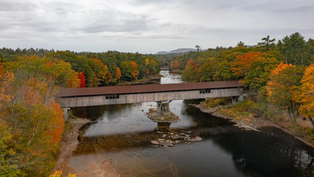
This water needs a real photo
The photo at the top of this page is not Ottauquechee River.
It is a regional stand-in, honestly captioned but generic — we will not put a name to a river we cannot prove. Send us a photograph you took here and it replaces the stand-in, with your credit on it.
Pioneer badgeUnclaimed
Add a photo of this water
Landscape, not fish — the water itself. Reviewed by hand before it appears. The first one published here earns the Pioneer badge.
Fished this water? Add a photo
Reviewed by hand before it appears. Pick the water, not the spot — we never publish exact locations.
Access
West Bridgewater - the gauge reach on the upper river below Killington.
Woodstock - the main village access on the middle river.
Quechee Gorge and Quechee State Park - access to the gorge reach and the trail system.
Bridgewater - access on the upper middle river.
North Hartland and the Connecticut confluence - the downstream end of the river.
US 4 corridor pullouts - road access following much of the river.
Taftsville - access on the lower middle river.
Seasons
Spring: high cold runoff from the Killington slopes, settling into good trout fishing.
Summer: low clear water on the upper river, best fished early with a careful approach.
Fall: excellent, with brown trout aggressive and foliage on the valley reaches.
Winter: cold and largely iced, with very limited fishing opportunity.
From the water
No logged trips yet. Be the first to put this water on your map.
Log this water
Fished it or cleaned it? Log in or create a free account to log a trip with photos and earn the waterway badge.
Questions
What is the current flow on the Ottauquechee River?
As of Nov 2, 6:30 am, the USGS gauge OTTAUQUECHEE RIVER NEAR WEST BRIDGEWATER, VT reads 13 cfs. Conditions update every 15 minutes.
What species can you catch on the Ottauquechee River?
Anglers target Brook Trout, Brown Trout, Fallfish, Rainbow Trout, Smallmouth Bass, White Sucker on the Ottauquechee River in Vermont.
Are there fishing guides on the Ottauquechee River?
GuidedFloats lists 1 guide and outfitters on the Ottauquechee River. Claimed profiles accept booking requests; unclaimed profiles are built from public records and link to the business.
Where can you access the Ottauquechee River?
West Bridgewater - the gauge reach on the upper river below Killington. Woodstock - the main village access on the middle river. Quechee Gorge and Quechee State Park - access to the gorge reach and the trail system. Bridgewater - access on the upper middle river. North Hartland and the Connecticut confluence - the downstream end of the river. US 4 corridor pullouts - road access following much of the river. Taftsville - access on the lower middle river.
When is the best time to fish the Ottauquechee River?
Spring: high cold runoff from the Killington slopes, settling into good trout fishing. Summer: low clear water on the upper river, best fished early with a careful approach. Fall: excellent, with brown trout aggressive and foliage on the valley reaches. Winter: cold and largely iced, with very limited fishing opportunity.
Where are the fishing regulations for the Ottauquechee River?
Regulations change by season and section. Read the current rules on the Vermont agency site: https://vtfishandwildlife.com/fish/fishing-regulations