Lake Monona Fishing Guides
A downtown Madison lake with a genuine trophy musky population, where the state capitol sits on the skyline and a guided boat can be on fish ten minutes after launching.
Map of the Lake Monona
32 numbered points: 6 access points, 2 outfitters, 4 bridges, 15 parks and conservation areas, 2 agency offices, 2 regulation section limits, 1 USGS gauge. Tap a marker for details. Reviewed Sep 25, 2026.
- Access / boat ramp (6)
- Outfitter / canoe rental (2)
- Bridge crossing (4)
- Park / conservation area (15)
- Agency / conservation office (2)
- Regulation section limit (2)
- USGS gauge (1)
Print it. Bag it. Bring it.Phones die, screens crack, and most of this water has no signal. Print this map, fold it into a zip-top bag or dry bag with your license, and you have a backup your electronics can’t give you. Every marker is numbered so you can say exactly where you are.
Open the printable mapAll 32 points on this map
| # | Point | Type | Lat, Lon | Notes |
|---|---|---|---|---|
| 1 | Turville Point Conservation Park Madison Parks · 68 acres of woods and shore | Park / conservation area | 43.05043, -89.37206 | |
| 2 | Olin-Turville Park Boat Ramp Madison Parks · concrete ramp | Access / boat ramp | 43.05552, -89.37742 | Trailer ramp at the south-west corner of the lake. |
| 3 | Olin Turville Park Canoe Launch Madison Parks · paved carry-in | Access / boat ramp | 43.05526, -89.37840 | Paddle carry-in beside the trailer ramp, logged by WDNR on Murphy Creek. |
| 4 | Olin Park City of Madison · south-west lakefront | Park / conservation area | 43.05504, -89.37977 | |
| 5 | Madison Parks Office City of Madison Parks Division | Agency / conservation office | 43.05702, -89.38001 | Manages most of the ramps and beaches on this sheet. |
| 6 | Bernie’s Beach Park Monona Bay shore | Park / conservation area | 43.05705, -89.38910 | |
| 7 | John Nolen Drive Monona Bay causeway | Bridge crossing | 43.06003, -89.38557 | Five OSM ways carry this name across the bay; one is shipped. |
| 8 | Wisconsin & Southern Railroad Monona Bay rail causeway | Bridge crossing | 43.05925, -89.38809 | |
| 9 | Brittingham Park City of Madison · Monona Bay | Park / conservation area | 43.06294, -89.39471 | |
| 10 | Brittingham Boats Madison Boats · canoe & kayak rental | Outfitter / canoe rental | 43.06365, -89.39108 | On Monona Bay in Brittingham Park. |
| 11 | USGS gauge 05429000 Lake Monona at Madison, WI | USGS gauge | 43.06333, -89.39706 | Lake-level gauge. Follow the link for the current reading. |
| 12 | Wisconsin Department of Natural Resources State headquarters, 101 S Webster St | Agency / conservation office | 43.07538, -89.38025 | On the lake’s north shore beside Law Park. |
| 13 | Law Park Boat Landing Madison Parks · concrete ramp | Access / boat ramp | 43.07542, -89.37507 | Downtown landing under the John Nolen Drive causeway. OSM calls it Law Park Boat Launch. |
| 14 | B.B. Clarke Beach Park City of Madison · swimming beach | Park / conservation area | 43.07774, -89.36871 | |
| 15 | Lake Monona limit — Tenney Lock Upstream boundary on the Yahara River | Regulation section limit | 43.09504, -89.37045 | The Lake Monona regulation extent reaches up the Yahara River to Tenney Lock. Boundary only — see the WDNR regulations for the rules. |
| 16 | Yahara Place Park City of Madison · north-east shore | Park / conservation area | 43.08732, -89.35170 | |
| 17 | Hudson Park City of Madison · effigy mounds on the shore | Park / conservation area | 43.08999, -89.34271 | |
| 18 | Atwood Avenue Starkweather Creek crossing | Bridge crossing | 43.09107, -89.33410 | |
| 19 | Olbrich Park Boat Ramp Madison Parks · concrete panel ramp | Access / boat ramp | 43.09030, -89.33423 | At the Starkweather Creek mouth; WDNR files it under Starkweather Creek and Lake Monona. |
| 20 | San Damiano Park City of Monona · former friary grounds | Park / conservation area | 43.07747, -89.32667 | |
| 21 | Stone Bridge Park City of Monona | Park / conservation area | 43.07502, -89.32862 | |
| 22 | Tonyawatha Park Boat Ramp Monona Parks & Recreation · concrete ramp | Access / boat ramp | 43.07182, -89.33767 | East-shore ramp in Tonyawatha Park. |
| 23 | Schluter Beach Park City of Monona · swimming beach | Park / conservation area | 43.07194, -89.33374 | |
| 24 | Waterman Park City of Monona · east shore | Park / conservation area | 43.07086, -89.33468 | |
| 25 | Winnequah Park City of Monona · south-east shore | Park / conservation area | 43.06370, -89.34240 | |
| 26 | Frost Woods Beach Park City of Monona · swimming beach | Park / conservation area | 43.05592, -89.33741 | |
| 27 | Indian Mounds Park City of Monona · effigy mounds | Park / conservation area | 43.05163, -89.33512 | |
| 28 | Rutabaga Paddlesports Paddlesport shop & rental, Monona | Outfitter / canoe rental | 43.04708, -89.32742 | A second OSM way carries this name 1.6 km off the lake; the Broadway store is the one shipped. |
| 29 | Tecumseh Avenue South-shore lagoon crossing | Bridge crossing | 43.05653, -89.34630 | |
| 30 | Lake Monona limit — US 12/18 bridge Downstream boundary on the Yahara River | Regulation section limit | 43.04425, -89.33253 | The extent reaches down the Yahara to the US 12/18 (South Beltline) bridge, where the Lake Waubesa water begins. |
| 31 | Winnequah Trail Boat Ramp Concrete ramp · Winnequah Trail | Access / boat ramp | 43.05632, -89.34964 | South-shore ramp. WDNR records Madison Parks as manager, OSM links the City of Monona page. |
| 32 | Esther Beach Park City of Madison · south shore | Park / conservation area | 43.04713, -89.35845 |
Guides on the Lake Monona
Claimed profiles take booking requests. Unclaimed profiles are built from public records so the river is never empty; the guide can claim or remove one any time.
Order on this page: premium and outfitter plans first (labelled Premium placement), then claimed free profiles, then unclaimed — one published price, no bidding for position. How placement works
About the Lake Monona
Lake Monona is the second lake in the Yahara chain, sitting immediately downstream of Mendota and wrapped on three sides by the city of Madison. It covers a little over three thousand acres and runs to about seventy feet at its deepest point, which is enough water to hold fish through a hot summer and enough shoreline development to make it one of the most convenient urban fisheries in the Midwest. The state capitol dome is visible from most of the lake, and that view is a fair summary of what fishing here is like: serious water in an unserious setting.
Musky are the headline. The Yahara lakes produce fish in the fifty-inch class every year, and Monona in particular has a reputation among Wisconsin guides as a lake where a client with no musky experience has a realistic chance of moving one. The population is supported by stocking and by an enormous forage base of panfish and cisco. Walleye are present and fished hard in spring near the Yahara outlets, and both bass species are abundant, with smallmouth relating to the rock and rip-rap along the causeways and largemouth in the weed edges and boat lifts.
The lake’s character changes sharply through the year. Summer brings heavy recreational boat traffic, which pushes serious fishing into the early morning and the last hour of light. Late fall is the best window for a big musky and the quietest the lake ever gets. Winter ice fishing for panfish and the occasional walleye is a Madison institution, though ice conditions on an urban lake with current at both ends deserve real caution. Because the chain is connected, guides frequently move a party between Monona, Mendota and Waubesa within a single trip, following clearer water or a wind-protected shoreline rather than committing the whole day to one basin.
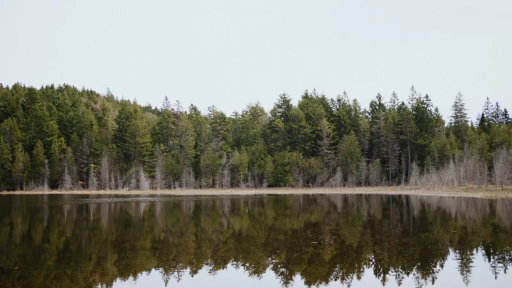
This water needs a real photo
The photo at the top of this page is not Lake Monona.
It is a regional stand-in, honestly captioned but generic — we will not put a name to a river we cannot prove. Send us a photograph you took here and it replaces the stand-in, with your credit on it.
Add a photo of this water
Landscape, not fish — the water itself. Reviewed by hand before it appears. The first one published here earns the Pioneer badge.
Pool right now
- 24 hours+0.01 ft → steady
- Water temperature60 F
Reading taken 1h ago at USGS 05429000, LAKE MONONA AT MADISON, WI. Elevation is the surface of the lake above the survey datum, not depth. Source.
Fished this water? Add a photo
Reviewed by hand before it appears. Pick the water, not the spot — we never publish exact locations.
Access
Olbrich Park launch - the main east side ramp, with parking and quick access to the north end weed beds.
Olin Park launch - the west side ramp closest to downtown and the Yahara outlet.
Brittingham Park - small launch and shore access on the northwest corner near the isthmus.
Yahara River between Mendota and Monona - current, walleye in spring, and a productive shore fishery.
Squaw Bay and Turville Point - protected shallow water and weed edges on the south shore.
The railroad causeway - rip-rap holding smallmouth bass and a reliable musky spot in fall.
Belle Isle and the east shore drop - the deepest structure on the lake and a summer musky area.
Seasons
Spring: walleye stack near the Yahara outlets after ice-out and bass move shallow as the water warms through May.
Summer: heavy boat traffic pushes good fishing into first and last light, with panfish steady all day on the weed edges.
Fall: the best musky window of the year, with cooling water, fewer boats and the largest fish of the season moving.
Winter: a Madison tradition for panfish and the occasional walleye, though current at both ends makes ice conditions variable.
From the water
No logged trips yet. Be the first to put this water on your map.
Log this water
Fished it or cleaned it? Log in or create a free account to log a trip with photos and earn the waterway badge.
Questions
What species can you catch on the Lake Monona?
Anglers target Black Crappie, Bluegill, Largemouth Bass, Muskellunge, Smallmouth Bass, Walleye, Yellow Perch on the Lake Monona in Wisconsin.
Are there fishing guides on the Lake Monona?
GuidedFloats lists 1 guide and outfitters on the Lake Monona. Claimed profiles accept booking requests; unclaimed profiles are built from public records and link to the business.
Where can you access the Lake Monona?
Olbrich Park launch - the main east side ramp, with parking and quick access to the north end weed beds. Olin Park launch - the west side ramp closest to downtown and the Yahara outlet. Brittingham Park - small launch and shore access on the northwest corner near the isthmus. Yahara River between Mendota and Monona - current, walleye in spring, and a productive shore fishery. Squaw Bay and Turville Point - protected shallow water and weed edges on the south shore. The railroad causeway - rip-rap holding smallmouth bass and a reliable musky spot in fall. Belle Isle and the east shore drop - the...
When is the best time to fish the Lake Monona?
Spring: walleye stack near the Yahara outlets after ice-out and bass move shallow as the water warms through May. Summer: heavy boat traffic pushes good fishing into first and last light, with panfish steady all day on the weed edges. Fall: the best musky window of the year, with cooling water, fewer boats and the largest fish of the season moving. Winter: a Madison tradition for panfish and the occasional walleye, though current at both ends makes ice conditions variable.
Where are the fishing regulations for the Lake Monona?
Regulations change by season and section. Read the current rules on the Wisconsin agency site: https://dnr.wisconsin.gov/topic/Fishing/regulations