Fishes Raystown Lake
Reservoir · Central Pennsylvania · Pennsylvania
Raystown Lake Fishing Guides
The largest lake entirely inside Pennsylvania: a deep, clear, steep-walled Corps reservoir on the Raystown Branch with a landlocked striped bass fishery unlike anything else in the state.
Map of the Raystown Lake
15 numbered points: 7 access points, 2 campsites, 1 park or conservation area, 1 hazard, 1 USGS gauge, 3 points of interest. Tap a marker for details. Reviewed Sep 21, 2026.
- Access / boat ramp (7)
- Campsite (2)
- Park / conservation area (1)
- Dam / hazard (1)
- USGS gauge (1)
- Point of interest (3)
Map data © OpenStreetMap contributors. Points are curated from OpenStreetMap and state agency sources; confirm access and hours before you go.
Print it. Bag it. Bring it.Phones die, screens crack, and most of this water has no signal. Print this map, fold it into a zip-top bag or dry bag with your license, and you have a backup your electronics can’t give you. Every marker is numbered so you can say exactly where you are.
Open the printable mapAll 15 points on this map
| # | Point | Type | Lat, Lon | Notes |
|---|---|---|---|---|
| 1 | Raystown Dam U.S. Army Corps of Engineers - the lake outlet | Dam / hazard | 40.43293, -78.00298 | The dam at the north end and the start of this clockwise list. OSM carries no dam feature here, so the point sits on the mapped Matson generating station at the dam toe. The river below is a separate fishery. |
| 2 | USGS 01563100 - Raystown Lake near Huntingdon Live pool elevation | USGS gauge | 40.43507, -78.00667 | Check the pool before towing a boat. Raystown is drawn down through the winter and the ramps go with it; the Corps posts weekend launch status on a hotline. |
| 3 | Trough Creek State Park PA DCNR - Great Trough Creek | Park / conservation area | 40.32668, -78.12536 | State park on the east side of the lake where Great Trough Creek comes in. This is the centroid of the park boundary, about 0.7 km back from the reservoir shoreline. |
| 4 | Trough Creek Campground PA DCNR - permit required | Campsite | 40.32527, -78.12736 | The campground inside Trough Creek State Park, about 0.9 km up the creek from the lake. |
| 5 | Tatman Run Boat Launch USACE - two lanes, mile marker 20 | Access / boat ramp | 40.31193, -78.17244 | The only launch on the eastern shore and one of two straight onto the main channel. Beach, picnic shelter, playground, 60 trailer spaces, floating dock; the ramp is steep. Unnamed in OSM, named from the Corps inventory. |
| 6 | Lake Raystown Resort Marina Concession marina, mile marker 21 | Access / boat ramp | 40.29526, -78.18216 | Full-service marina at the southern hub of the lake: fuel, grocery, houseboat and pontoon rentals, cruises, slips and a pump-out, with a launch ramp either side of it. |
| 7 | Lake Raystown Resort RRP Recreation LP - tents, RVs and cabins | Campsite | 40.29140, -78.18747 | Large private campground and resort on Corps ground at the south end of the lake, off PA 994. |
| 8 | Weaver Falls Boat Launch USACE - two lanes, mile marker 28 | Access / boat ramp | 40.24463, -78.23236 | The southernmost launch, on the west shore where Raystown reads more like a wide river than a lake. Picnic shelter, playground, 40 trailer spaces. The mapped Weaver Falls Access Area sits 0.2 km off. Via PA 913 at Saxton. |
| 9 | Shy Beaver Boat Launch USACE - three lanes, mile markers 21 to 22 | Access / boat ramp | 40.30024, -78.20798 | West-shore launch at the head of its own cove, with 148 trailer spaces, a floating dock and a concrete pier. The access road floods and can close. From PA 26 at Cherrytown onto Shy Beaver Road. |
| 10 | Juniata College Field Station (Shuster Hall) Shoreline landmark above the James Creek arm | Point of interest | 40.36752, -78.14453 | The Corps uses this hilltop building as a landmark in its on-water directions from the James Creek launch. It is a research station, not a public access. |
| 11 | Aitch Boat Launch USACE - west shore at the village of Aitch | Access / boat ramp | 40.37544, -78.16174 | Unnamed in OSM and placed here because the hamlet of Aitch is 0.25 km away while the next named place is 1.35 km off. A reservable picnic shelter is on the same ground. Most of old Aitch is under the lake. |
| 12 | Seven Points Boat Launch and Marina USACE and concession - mile marker 8.5 | Access / boat ramp | 40.37780, -78.07135 | The centre of the lake: the public ramp and the largest marina in Pennsylvania, 23 metres apart. The 261-site campground, the beach and the visitor centre are on the same ground and are in no public dataset. |
| 13 | Snyder's Run Boat Launch USACE - three lanes, near point marker H3 | Access / boat ramp | 40.44256, -78.03903 | The only launch on the northern end and the closest to the dam and the Rabbit Ears. Deep-water ramp that suits bigger boats, 78 trailer spaces, floating dock and pier. From Huntingdon by Point Road. |
| 14 | Hawn's Overlook Signed viewpoint above the lower lake | Point of interest | 40.42963, -78.01897 | Bluff-top overlook on the road in from Huntingdon, looking down the lower lake toward the dam. |
| 15 | Ridenour Overlook Signed viewpoint at the dam end | Point of interest | 40.43174, -78.01648 | The main public overlook at the dam end of the lake. |
Guides on the Raystown Lake
Claimed profiles take booking requests. Unclaimed profiles are built from public records so the river is never empty; the guide can claim or remove one any time.
Order on this page: premium and outfitter plans first (labelled Premium placement), then claimed free profiles, then unclaimed — one published price, no bidding for position. How placement works
About the Raystown Lake
Raystown is the largest lake lying entirely within Pennsylvania and the only one that fishes like a southern reservoir. The Corps impounded the Raystown Branch of the Juniata in the 1970s, and the result is long, deep, narrow and steep-walled, hemmed in by forested ridges with almost no development on the shoreline.
The signature fishery is landlocked striped bass. They were stocked, they thrive on the alewife forage base, and they are pursued the way stripers are pursued on the big southern lakes: with live bait on planer boards and free lines in the cool months, and on downlines over deep water in summer when the fish are pinned in the cool oxygenated layer. It is not a fishery most Pennsylvania anglers expect to find in their own state.
Smallmouth bass are excellent on the rock and the steep banks, largemouth hold in the coves and around wood, and there are lake trout in the deep water near the dam that are caught mostly by people fishing for something else. Crappie and walleye round it out.
The lake is deep and clear, which means summer fishing happens early and deep, and it means electronics matter here more than shoreline casting skill. It also means a spring day with a bit of colour in the water can be the best day of the year.
The gauge below reports pool elevation. Raystown runs a seasonal drawdown for flood storage and refills in spring. Because the banks are so steep the level change moves fish vertically rather than exposing flats, so its practical effect is mostly on ramps and on where the fish sit on a given contour.
This water needs a real photo
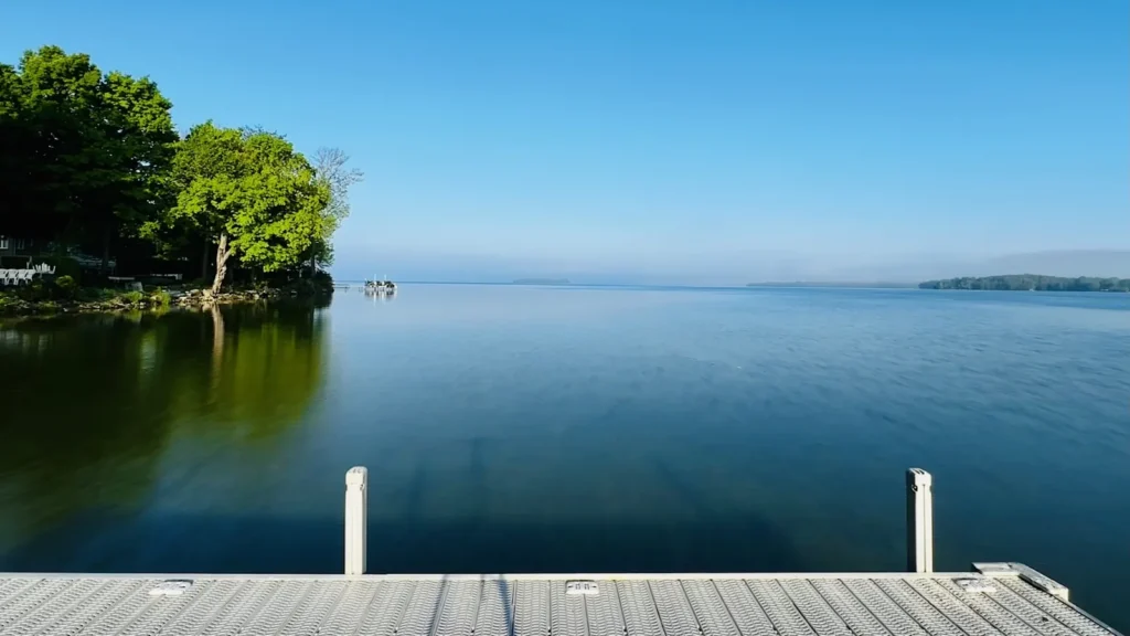
The photo at the top of this page is not Raystown Lake.
It is a regional stand-in, honestly captioned but generic — we will not put a name to a river we cannot prove. Send us a photograph you took here and it replaces the stand-in, with your credit on it.
Pioneer badgeUnclaimed
Add a photo of this water
Landscape, not fish — the water itself. Reviewed by hand before it appears. The first one published here earns the Pioneer badge.
Pool right now
782.13ft
- 24 hours-0.55 ft ↓ falling
- For the dateLow for the date
Reading taken 1h ago at USGS 01563100, Raystown Lake near Huntingdon, PA. Elevation is the surface of the lake above the survey datum, not depth. Source.
Fished this water? Add a photo
Reviewed by hand before it appears. Pick the water, not the spot — we never publish exact locations.
Access
Seven Points Recreation Area: the main Corps ramp, marina and campground.
Snyders Run and Aitch: mid-lake Corps ramps with good parking.
James Creek and Weaver Falls: upper lake access.
Tatman Run: day-use area with beach and bank access.
Dam area near Hesston: the deepest water and winter striper fishing.
Corps land surrounds the lake, so bank access is extensive but often steep.
Note: long and narrow. Plan your launch around the section you want.
Seasons
Winter: stripers shallow and roaming, few boats, cold and quiet.
Spring: the best all-round month, stripers on boards and smallmouth on the rock.
Summer: stripers deep on downlines, early starts, heavy recreational traffic.
Fall: schooling stripers on the surface and excellent smallmouth fishing.
From the water
No logged trips yet. Be the first to put this water on your map.
Log this water
Fished it or cleaned it? Log in or create a free account to log a trip with photos and earn the waterway badge.
Questions
What species can you catch on the Raystown Lake?
Anglers target Black Crappie, Channel Catfish, Lake Trout, Largemouth Bass, Smallmouth Bass, Striped Bass, Walleye on the Raystown Lake in Pennsylvania.
Are there fishing guides on the Raystown Lake?
GuidedFloats lists 1 guide and outfitters on the Raystown Lake. Claimed profiles accept booking requests; unclaimed profiles are built from public records and link to the business.
Where can you access the Raystown Lake?
Seven Points Recreation Area: the main Corps ramp, marina and campground. Snyders Run and Aitch: mid-lake Corps ramps with good parking. James Creek and Weaver Falls: upper lake access. Tatman Run: day-use area with beach and bank access. Dam area near Hesston: the deepest water and winter striper fishing. Corps land surrounds the lake, so bank access is extensive but often steep. Note: long and narrow. Plan your launch around the section you want.
When is the best time to fish the Raystown Lake?
Winter: stripers shallow and roaming, few boats, cold and quiet. Spring: the best all-round month, stripers on boards and smallmouth on the rock. Summer: stripers deep on downlines, early starts, heavy recreational traffic. Fall: schooling stripers on the surface and excellent smallmouth fishing.
Where are the fishing regulations for the Raystown Lake?
Regulations change by season and section. Read the current rules on the Pennsylvania agency site: https://www.pa.gov/agencies/fishandboat/fishing/regulations