Fishes Cayuga Lake, Salmon River
Lake · Finger Lakes · New York
Cayuga Lake Fishing Guides
The longest of the Finger Lakes: deep, cold and narrow, with a lake trout fishery that runs all year and tributary runs at both ends.
Map of the Cayuga Lake
20 numbered points: 9 access points, 1 campsite, 6 parks and conservation areas, 2 regulation section limits, 1 hazard, 1 USGS gauge. Tap a marker for details. Reviewed Sep 22, 2026.
- Access / boat ramp (9)
- Campsite (1)
- Park / conservation area (6)
- Regulation section limit (2)
- Dam / hazard (1)
- USGS gauge (1)
Map data © OpenStreetMap contributors. Points are curated from OpenStreetMap and state agency sources; confirm access and hours before you go.
Print it. Bag it. Bring it.Phones die, screens crack, and most of this water has no signal. Print this map, fold it into a zip-top bag or dry bag with your license, and you have a backup your electronics can’t give you. Every marker is numbered so you can say exactly where you are.
Open the printable mapAll 20 points on this map
| # | Point | Type | Lat, Lon | Notes |
|---|---|---|---|---|
| 1 | USGS gauge 04233500 - Cayuga Inlet (Cayuga Lake) at Ithaca Head of the lake, Ithaca | USGS gauge | 42.44572, -76.51264 | The lake's reference gauge. OSM carries the same station 36 m away tagged ref 04233500, official_name CAYUGA INLET (CAYUGA LAKE) AT ITHACA NY, operator USGS - two sources on one coordinate. |
| 2 | Cayuga Inlet - lower reach limit Inlet mouth at the head of the lake | Regulation section limit | 42.44649, -76.51304 | DEC bounds the Cayuga Inlet reach, and its flood control channel, from Cayuga Lake upstream to the posted NO FISHING boundary below the fishway in Tompkins County. This marker is the lake end of that reach. |
| 3 | Fall Creek - lower reach limit Fall Creek mouth at Stewart Park | Regulation section limit | 42.45979, -76.50935 | DEC bounds one Fall Creek reach from Cayuga Lake to the downstream edge of the railroad bridge below Rte. 13 in Ithaca, and a second from that bridge up to Ithaca Falls. This marker is the creek mouth, the lake end of the lower reach. |
| 4 | Stewart Park Ithaca lakefront at the Fall Creek mouth | Park / conservation area | 42.46259, -76.50361 | City of Ithaca park across the head of the lake. DEC's Cayuga Lake page lists it among the lake's public access points; OSM maps its lakefront dock, which is the feature this marker sits on. |
| 5 | East Shore Park East side of the head of the lake | Park / conservation area | 42.47151, -76.50359 | Small lakefront park on the east shore below Cayuga Heights, 0.01 km off the shoreline. |
| 6 | Myers Park Boat Launch Myers Point, Town of Lansing | Access / boat ramp | 42.53638, -76.54835 | Town of Lansing hard-surface ramp at Myers Point, 40-car trailer parking in DEC's launch inventory. A fee is posted. |
| 7 | Salt Point boat launch Salt Point, Lansing - hand launch | Access / boat ramp | 42.54205, -76.54984 | Free hand launch at the Salt Point natural area just north of Myers Point; DEC's inventory records 10-car parking. Canoes and kayaks rather than trailers. |
| 8 | Taughannock Falls State Park Boat Launch West shore, Taughannock Falls State Park | Access / boat ramp | 42.54719, -76.59757 | OPRHP hard-surface ramp inside Taughannock Falls State Park, 16-car trailer parking in DEC's inventory. The park's beach and gorge trail share the same entrance. |
| 9 | Cayuga Shores Wildlife Management Area East shore between Sheldrake and Aurora | Park / conservation area | 42.61542, -76.63581 | NYSDEC wildlife management area holding undeveloped east-shore frontage. Marker is the centre of the mapped area, 0.4 km off the water. |
| 10 | Long Point State Park Boat Launch Long Point State Park, east shore | Access / boat ramp | 42.71518, -76.70801 | OPRHP ramp on the point the park is named for, 35-car trailer parking in DEC's inventory. |
| 11 | Whitlock Nature Preserve West shore opposite Long Point | Park / conservation area | 42.71590, -76.75502 | Finger Lakes Land Trust preserve on the west shore; it adjoins the trust's VanRiper Conservation Area immediately to the north. |
| 12 | VanRiper Conservation Area West shore opposite Long Point | Park / conservation area | 42.71837, -76.75598 | Finger Lakes Land Trust conservation area on the west shore, next to Whitlock Nature Preserve. |
| 13 | Deans Cove Boat Launch Deans Cove, west shore | Access / boat ramp | 42.74484, -76.76799 | OPRHP hard-surface ramp at Deans Cove, 48-car trailer parking in DEC's inventory. OSM maps a marina polygon over the same site. |
| 14 | Frontenac Park Boat Launch Frontenac Park, Union Springs | Access / boat ramp | 42.84239, -76.69667 | Village of Union Springs ramp in Frontenac Park, 30-car parking in DEC's inventory. Frontenac Island lies just offshore. |
| 15 | Canoga Marsh Wildlife Management Area West shore at Canoga | Park / conservation area | 42.86350, -76.74258 | NYSDEC wildlife management area on the marshy west shore, 0.4 km off the water at its mapped centre. |
| 16 | Cayuga Lake State Park Campground Cayuga Lake State Park, north-west shore | Campsite | 42.89762, -76.75641 | The state park's camping area, 0.5 km back from the shore. The park's launch and swimming area share the same entrance. |
| 17 | Cayuga Lake State Park Boat Launch Cayuga Lake State Park, north-west shore | Access / boat ramp | 42.90037, -76.74949 | OPRHP ramp inside Cayuga Lake State Park, 50-car trailer parking in DEC's inventory - the largest launch on the north half of the lake. |
| 18 | Mud Lock Boat Launch North outlet at Mud Lock | Access / boat ramp | 42.94633, -76.73375 | NYSDEC launch at the lake's outlet beside Lock C/S1 on the Cayuga-Seneca Canal, 26-car parking. The only public access at the north end. |
| 19 | Mud Lock C&S Canal Dam Lake outlet, Cayuga-Seneca Canal | Dam / hazard | 42.94726, -76.73555 | The dam and lock that hold the lake's level at its north outlet. Boats lock through C/S1; there is no passage over the dam. |
| 20 | Allan H. Treman State Marine Park Ithaca, west of the inlet mouth | Access / boat ramp | 42.45645, -76.51247 | OPRHP's multi-lane ramp at the head of the lake, 140-car trailer parking in DEC's inventory - the biggest on Cayuga - beside a 474-slip marina. |
Guides on the Cayuga Lake
Claimed profiles take booking requests. Unclaimed profiles are built from public records so the river is never empty; the guide can claim or remove one any time.
Order on this page: premium and outfitter plans first (labelled Premium placement), then claimed free profiles, then unclaimed — one published price, no bidding for position. How placement works
About the Cayuga Lake
Cayuga is the longest of the Finger Lakes, running nearly forty miles north from Ithaca through steep-sided glacial valley country. It is deep, cold and narrow, and like the other large Finger Lakes it supports a two-storey fishery with coldwater species in the depths and warmwater species in the shallow ends.
Lake trout are the mainstay and are available all year, trolled deep in summer and caught closer to the surface in the cold months. Landlocked Atlantic salmon and brown trout share that water and are the more prized catches. Rainbow trout run the tributaries seasonally.
The shallow ends of the lake are different water entirely. The southern end near Ithaca and the northern end toward the outlet hold largemouth and smallmouth bass, northern pike and abundant yellow perch, and much of that fishing is reachable from small boats and in places from shore.
The tributary streams at both ends carry seasonal runs that draw anglers who never fish the lake itself, and those runs have their own regulations and seasons worth reading before you go.
Winter rarely locks the main lake, though the shallow ends and the inlet can freeze, and ice fishing there is a local tradition when conditions allow.
Cayuga is also the Finger Lake with the most usable public access, which is not true of all of them. State parks at both ends and along the shore mean an angler with a small boat or none at all has real options here.
The gauge below reports lake level, read at the Cayuga Inlet at Ithaca. Cayuga is regulated as part of the canal system, so the level is managed within a range and the reading is most useful for the shallow southern end where a foot genuinely matters.
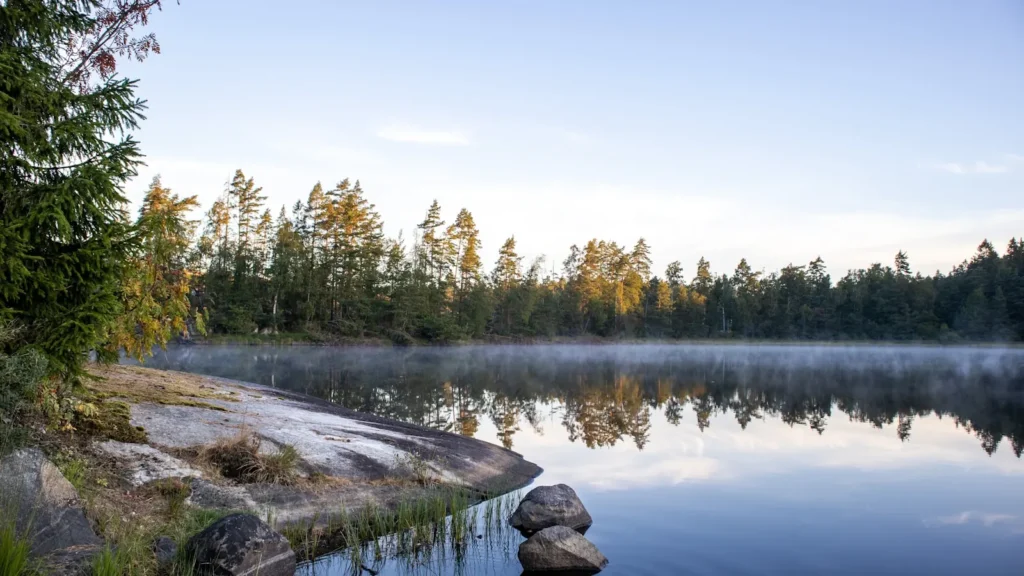
This water needs a real photo
The photo at the top of this page is not Cayuga Lake.
It is a regional stand-in, honestly captioned but generic — we will not put a name to a river we cannot prove. Send us a photograph you took here and it replaces the stand-in, with your credit on it.
Pioneer badgeUnclaimed
Add a photo of this water
Landscape, not fish — the water itself. Reviewed by hand before it appears. The first one published here earns the Pioneer badge.
Pool right now
381.78ft NAVD88
- 24 hours-0.03 ft → steady
- For the dateHigh for the date
Reading taken 1h ago at USGS 04233500, CAYUGA INLET (CAYUGA LAKE) AT ITHACA NY. Elevation is the surface of the lake above the survey datum, not depth. Source.
Fished this water? Add a photo
Reviewed by hand before it appears. Pick the water, not the spot — we never publish exact locations.
Access
Allan H. Treman State Marine Park at Ithaca: ramp and access to the south end.
Taughannock Falls State Park: ramp, camping and shore access on the west shore.
Long Point State Park and Deans Cove: mid-lake and northern launches.
Cayuga Lake State Park: access at the northern end.
Tributary streams at both ends carry seasonal runs with their own rules.
Ithaca and Seneca Falls have services and tackle.
Note: the lake is long, deep and narrow. Weather can change quickly on it.
Seasons
Winter: lake trout in the cold, and ice at the shallow ends when it forms.
Spring: trout and salmon near the surface, and tributary runs at both ends.
Summer: deep trolling for lake trout, bass and pike in the shallow ends.
Fall: cooling water brings the coldwater fish up and the tributaries come alive.
From the water
No logged trips yet. Be the first to put this water on your map.
Log this water
Fished it or cleaned it? Log in or create a free account to log a trip with photos and earn the waterway badge.
Questions
What species can you catch on the Cayuga Lake?
Anglers target Brown Trout, Lake Trout, Landlocked Salmon, Largemouth Bass, Northern Pike, Smallmouth Bass, Yellow Perch on the Cayuga Lake in New York.
Are there fishing guides on the Cayuga Lake?
GuidedFloats lists 1 guide and outfitters on the Cayuga Lake. Claimed profiles accept booking requests; unclaimed profiles are built from public records and link to the business.
Where can you access the Cayuga Lake?
Allan H. Treman State Marine Park at Ithaca: ramp and access to the south end. Taughannock Falls State Park: ramp, camping and shore access on the west shore. Long Point State Park and Deans Cove: mid-lake and northern launches. Cayuga Lake State Park: access at the northern end. Tributary streams at both ends carry seasonal runs with their own rules. Ithaca and Seneca Falls have services and tackle. Note: the lake is long, deep and narrow. Weather can change quickly on it.
When is the best time to fish the Cayuga Lake?
Winter: lake trout in the cold, and ice at the shallow ends when it forms. Spring: trout and salmon near the surface, and tributary runs at both ends. Summer: deep trolling for lake trout, bass and pike in the shallow ends. Fall: cooling water brings the coldwater fish up and the tributaries come alive.
Where are the fishing regulations for the Cayuga Lake?
Regulations change by season and section. Read the current rules on the New York agency site: https://dec.ny.gov/things-to-do/freshwater-fishing/regulations