Cypress Bayou Fishing Guides
A cypress-shaded Caddo Parish bayou draining the country southwest of Shreveport, with a dependable spring crappie run, shallow bass in the flooded brush, and an active discharge gauge near Keithville.
Guides on the Cypress Bayou
Claimed profiles take booking requests. Unclaimed profiles are built from public records so the river is never empty; the guide can claim or remove one any time.
No guides listed yet
Guide or outfit this water? Create your profile. Listing is free, the commission is 10% or 7% with a premium profile, and premium profiles list first on this water.
About the Cypress Bayou
Cypress Bayou drains the rolling pine and hardwood country southwest of Shreveport, moving north and east through Caddo Parish toward the Red River lowlands. The USGS gauge near Keithville records stage and discharge and is the practical reference for the whole middle corridor, because this is a flashy watershed: a heavy thunderstorm over the parish can double the flow overnight and drop it back inside three days. Anglers who learn the gauge learn the bayou.
The water itself is tannic and cypress-shaded, narrow in the upper reaches and widening into brushy sloughs and backwater ponds below. Largemouth bass are the headline fish and they relate hard to wood — laydowns, stumps, cypress knees and the outside of every bend. Spotted bass show up in the faster upper water. The crappie fishing is what fills the launches in March and April, when white and black crappie push into the brush tops and bridge timber in numbers that support a genuine local guide trade.
Bream fishing through May and June is excellent and underrated, with bluegill and redear bedding on the sand and gravel edges wherever the canopy opens. Channel and flathead catfish hold in the deep outside bends year-round and are the reliable fallback when a front shuts the bass down. Bowfin and longnose gar are common enough that anyone fishing soft plastics on the flats should expect to meet one.
Access is a mix of parish road crossings, small improved ramps and informal bank spots, which suits kayaks and jon boats far better than a full-size bass boat. There is enough timber in the water to punish a careless hull. Fish it on a falling gauge after a rise, keep the trolling motor down, and work the wood methodically rather than covering distance.
This water needs a real photo
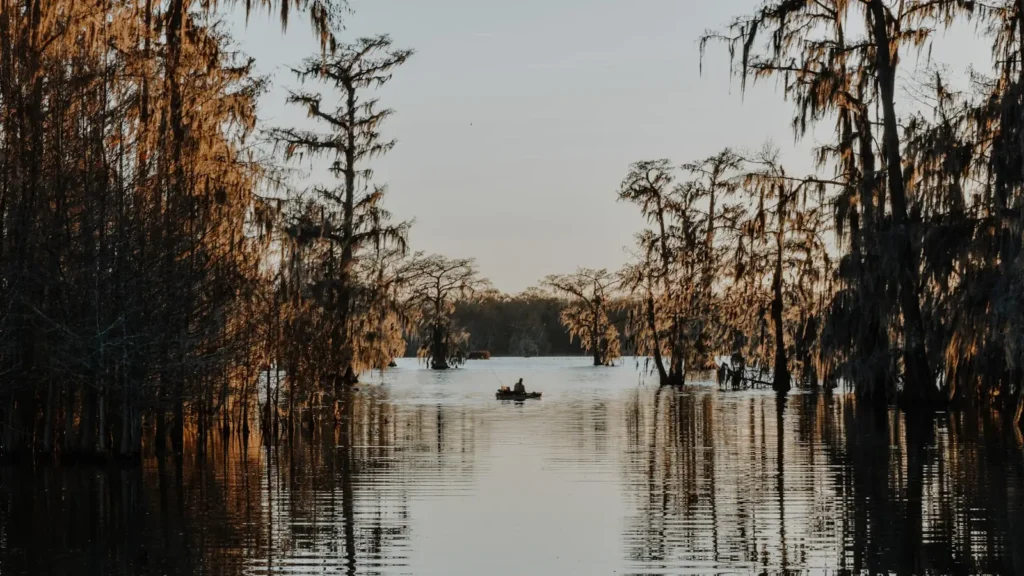
The photo at the top of this page is not Cypress Bayou.
It is a regional stand-in, honestly captioned but generic — we will not put a name to a river we cannot prove. Send us a photograph you took here and it replaces the stand-in, with your credit on it.
Add a photo of this water
Landscape, not fish — the water itself. Reviewed by hand before it appears. The first one published here earns the Pioneer badge.
Fished this water? Add a photo
Reviewed by hand before it appears. Pick the water, not the spot — we never publish exact locations.
Access
Keithville area bridge crossing on Highway 171 — nearest access to the USGS gauge, bank and kayak.
Cypress Bayou parish road crossings west of Keithville — informal small-boat and wade access to the upper reach.
Stonewall area landings — mid-corridor access with parking, popular in the spring crappie run.
Lower bayou sloughs off Highway 3276 — kayak access to backwater ponds and brush flats.
Wallace Lake area ramps — improved trailer launches on the connected impoundment downstream.
Caddo Parish public bank access at the Highway 175 crossing — walk-in fishing, no ramp.
Red River lowland landings near the confluence — trailer access to the lowest, widest water.
Seasons
Spring: the peak. Crappie move to brush and timber in March, bass spawn in the protected sloughs through April, and bream begin bedding as the water settles into the 70s in May.
Summer: fish first and last light. Shade under cypress and overhanging hardwood holds the bass; catfish take over the deep bends, and low tannic water makes long casts and light line worth the trouble.
Fall: cooling water and falling flows bring bass back to the wood through October and November, with the best topwater of the year on calm mornings.
Winter: crappie concentrate in the deepest bends and around bridge pilings, and catfish stay catchable. Bass fishing turns slow but a warm week will move fish shallow again briefly.
From the water
No logged trips yet. Be the first to put this water on your map.
Log this water
Fished it or cleaned it? Log in or create a free account to log a trip with photos and earn the waterway badge.
Questions
What is the current flow on the Cypress Bayou?
As of Oct 21, 11:00 pm, the USGS gauge Cypress Bayou near Keithville, LA reads 4 cfs. Conditions update every 15 minutes.
What species can you catch on the Cypress Bayou?
Anglers target Black Crappie, Bluegill, Bowfin, Channel Catfish, Flathead Catfish, Largemouth Bass, Longnose Gar, Redear Sunfish, Spotted Bass, White Crappie on the Cypress Bayou in Louisiana.
Where can you access the Cypress Bayou?
Keithville area bridge crossing on Highway 171 — nearest access to the USGS gauge, bank and kayak. Cypress Bayou parish road crossings west of Keithville — informal small-boat and wade access to the upper reach. Stonewall area landings — mid-corridor access with parking, popular in the spring crappie run. Lower bayou sloughs off Highway 3276 — kayak access to backwater ponds and brush flats. Wallace Lake area ramps — improved trailer launches on the connected impoundment downstream. Caddo Parish public bank access at the Highway 175 crossing — walk-in fishing, no ramp. Red River lowland landin...
When is the best time to fish the Cypress Bayou?
Spring: the peak. Crappie move to brush and timber in March, bass spawn in the protected sloughs through April, and bream begin bedding as the water settles into the 70s in May. Summer: fish first and last light. Shade under cypress and overhanging hardwood holds the bass; catfish take over the deep bends, and low tannic water makes long casts and light line worth the trouble. Fall: cooling water and falling flows bring bass back to the wood through October and November, with the best topwater of the year on calm mornings. Winter: crappie concentrate in the deepest bends and around bridge pili...
Where are the fishing regulations for the Cypress Bayou?
Regulations change by season and section. Read the current rules on the Louisiana agency site: https://www.wlf.louisiana.gov/page/recreational-freshwater-finfish-and-crawfish